Superior National Forest
Boundary Waters Canoe Area (BWCA)
Superior National Forest not only contains numerous backpacking and hiking options it also contains a unique paddling area. The Boundary water Canoe Area or BWCA is a large wilderness area that is popular with anglers and is growing in popularity with back country campers. This area contains hundreds of lakes and thousands of campsites and most of which require a paddle to access, many also require a portage or two for those looking for an even more remote wilderness experience.
Key Features:
- Seemingly limitless paddling opportunities
-Little to no boat motors permitted in BWCA
-Overnight camping requires a USFS permit, get it in advance
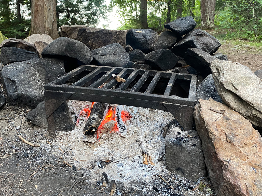
-Must stay a designated campsite with pit toilet and fire grate
-Portages are common, but usually short
-Great fishing
- Seemingly limitless paddling opportunities
-Little to no boat motors permitted in BWCA
-Overnight camping requires a USFS permit, get it in advance
-Must stay a designated campsite with pit toilet and fire grate
-Portages are common, but usually short
-Great fishing
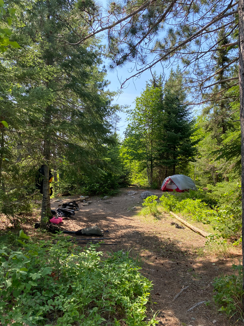
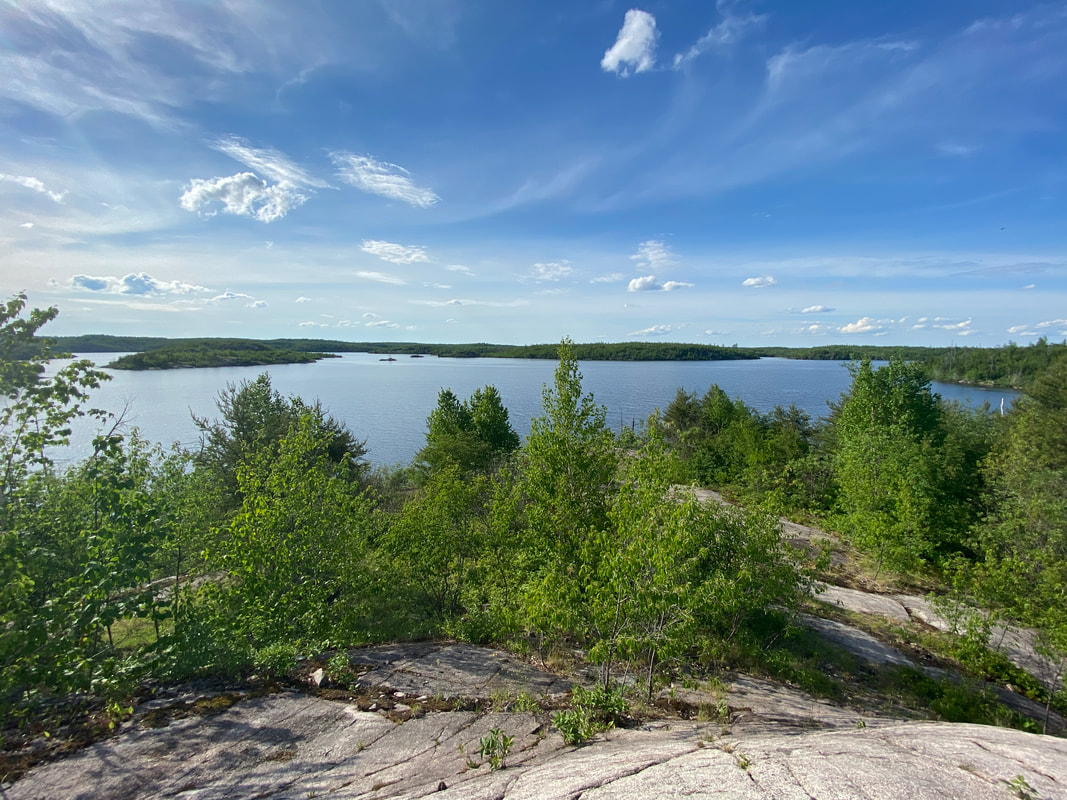
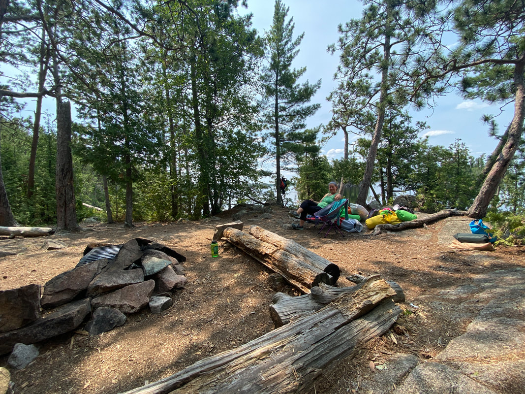
Seagull Lake
 The view from our campsite on Seagull lake, Superior National Forest
Key Features:
-A big lake that is miles in length
-Many islands and coves that can make navigation a challenge for first timers
-Wind can be a factor, plan accordingly
-Over thirty campsites on the lake
-Fires in the last 15 years have reduced the shade in some campsites
-Can be reached without a portage (entry point 54)
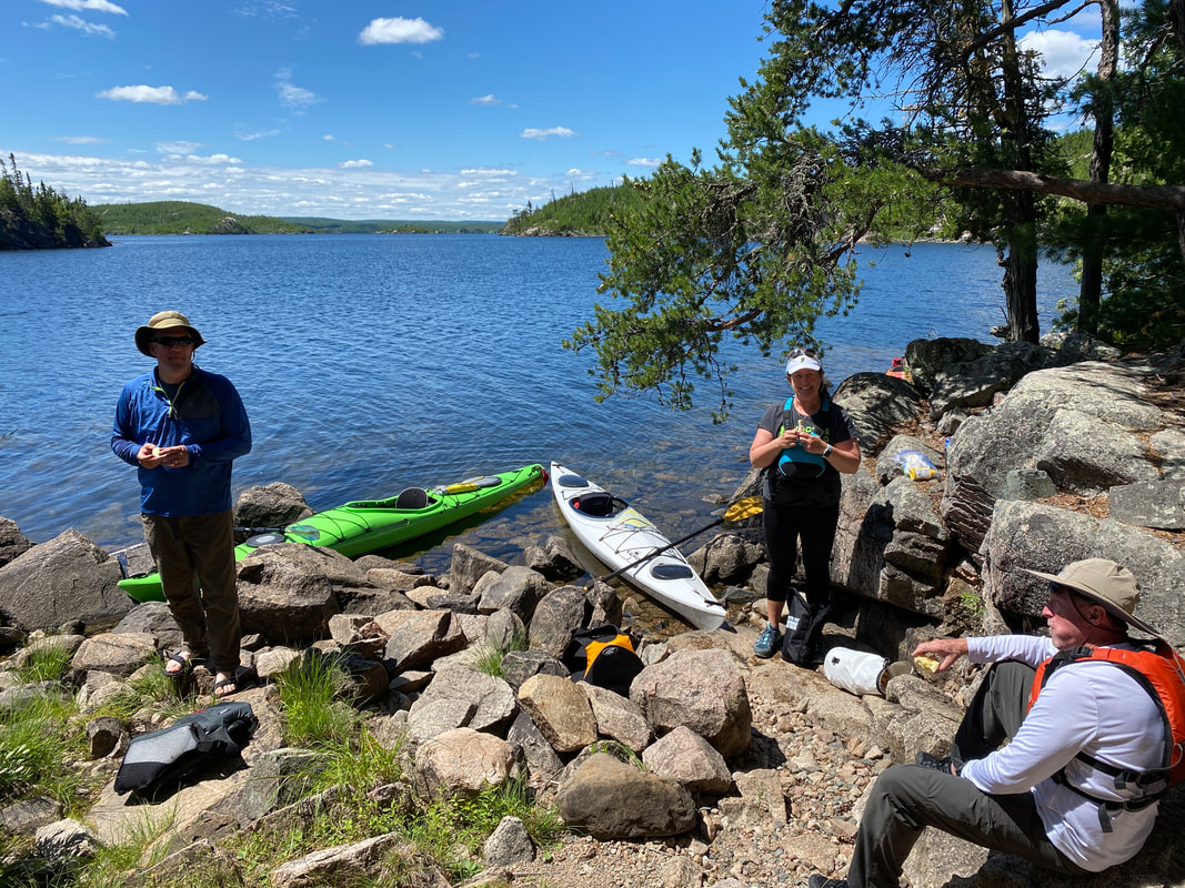
Entering the BWCA, Seagull Lake, Superior National Forest
|
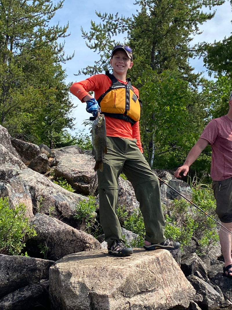
Fishing, Seagull Lake, Superior National Forest
|
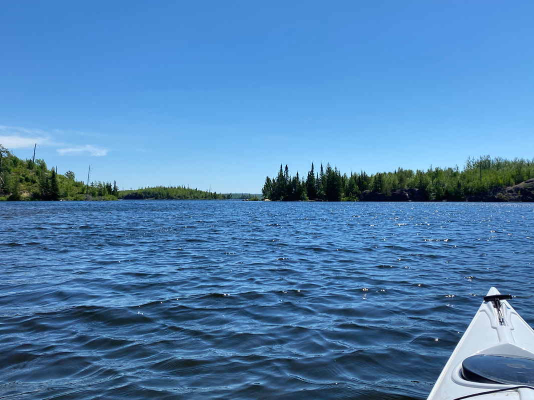
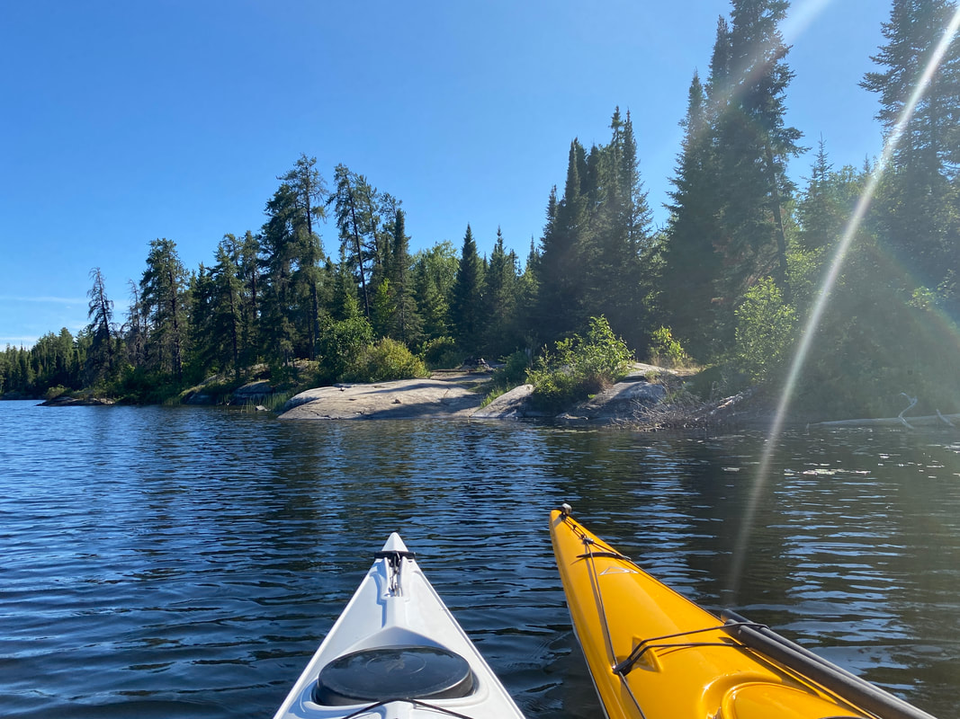
A kayak level view of Seagull Lake, Superior National Forest
|
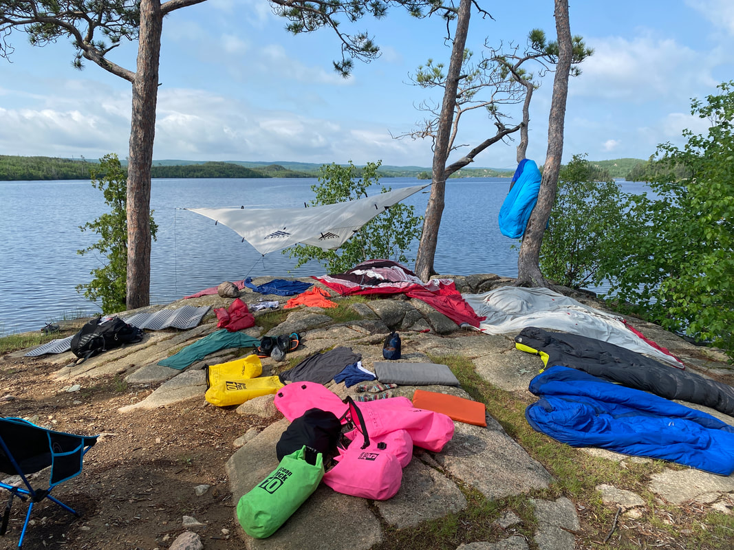
Drying gear after a huge thunderstorm, Seagull Lake, Superior National Forest
|
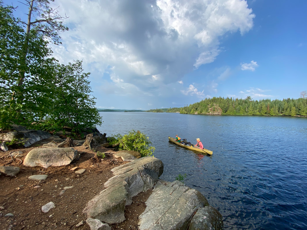
Rounding an island, Seagull Lake, Superior National Forest
|
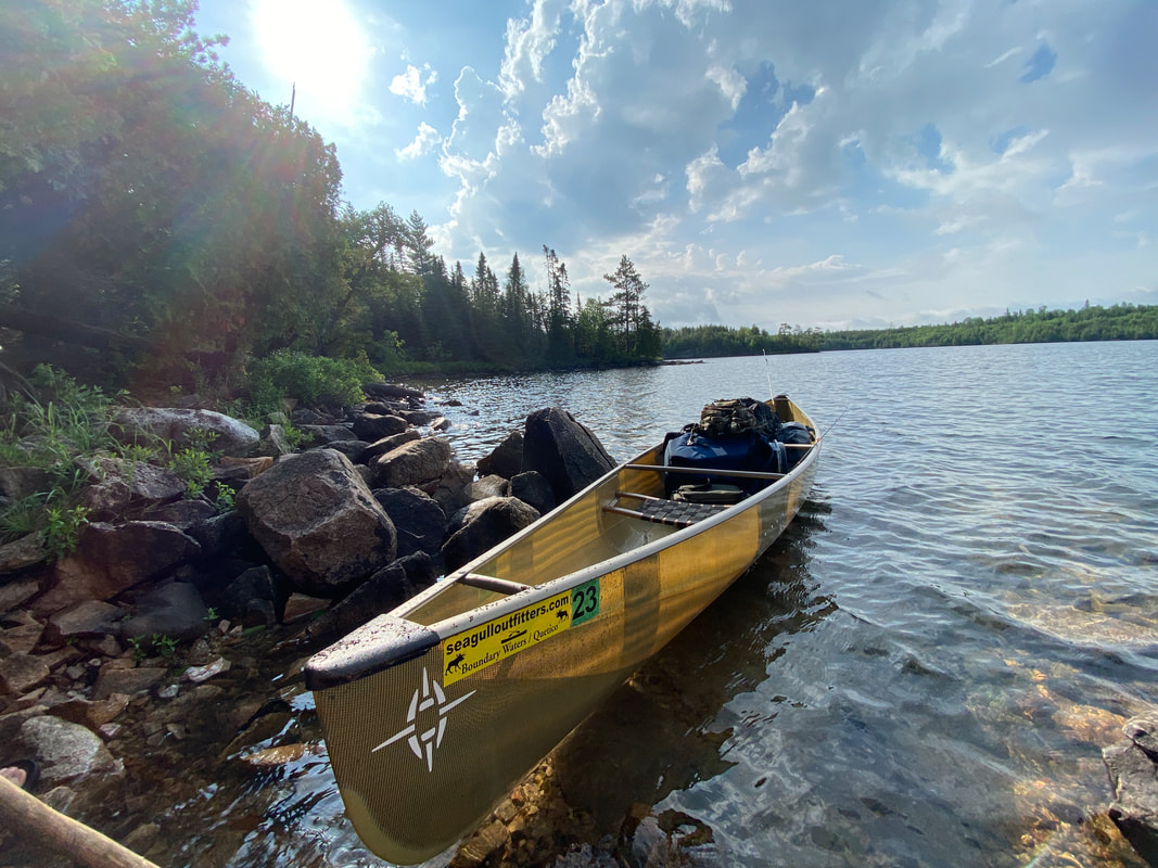
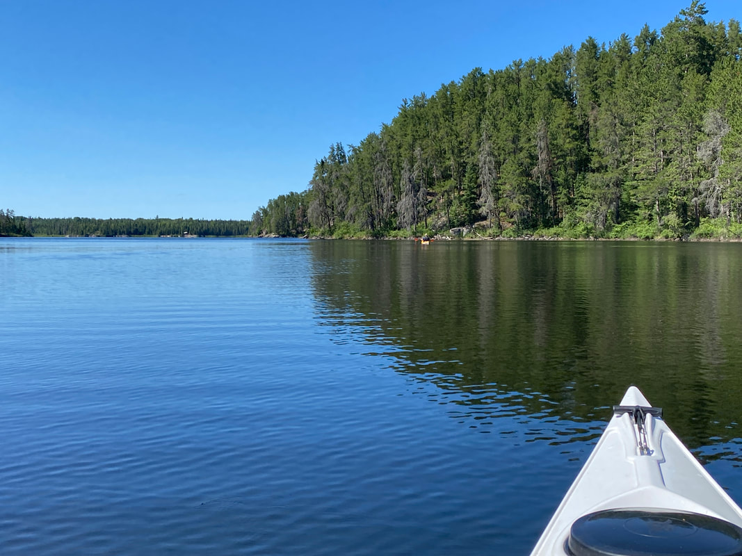
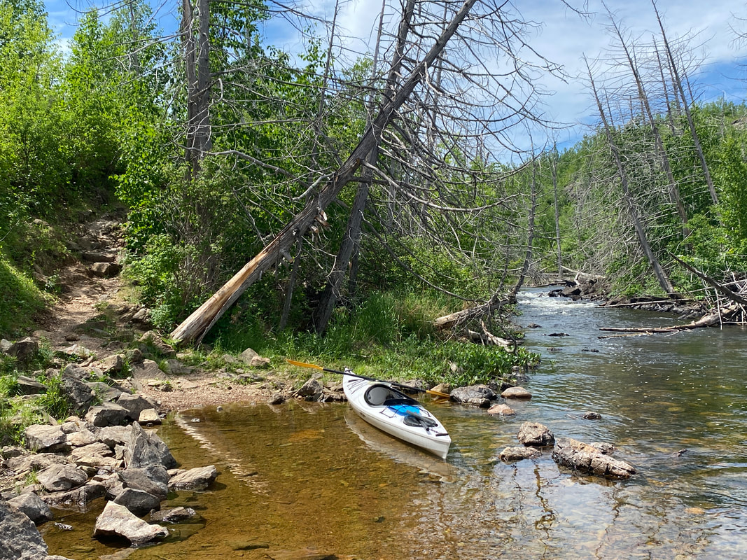
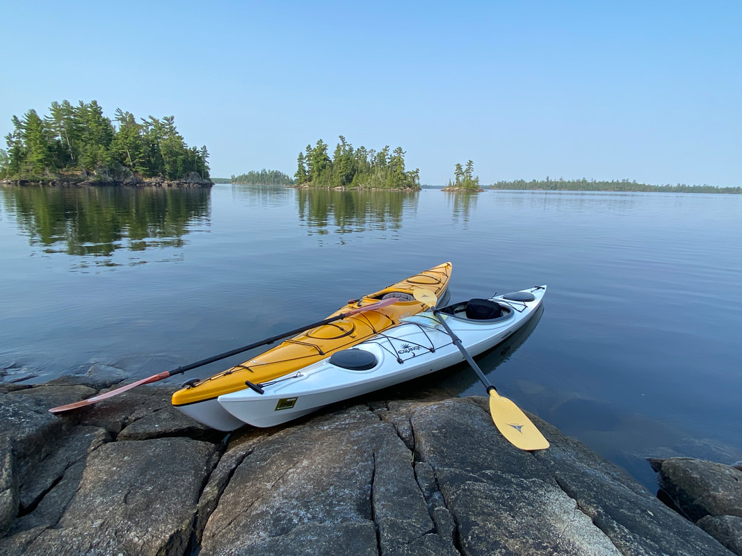
Seagull Lake entry point offers paddlers and anglers lots of options for exploration and adventure. With a moderate number of permits issues each day, it's not too hard to snag entry into this Boundary Waters area. Located at the tip of the Gunflint Trail out of Grand Marais, MN, this area will take you deep into the eastern side of the BWCA. We've heard the east side is less crowded and less commercialized than the west side near Ely, MN, but we really can't speak to the accuracy of that.
Seagull Outfitters is a pick up point for permits, whether you rent a canoe from them or not, so that is where our first of 2 trips to Seagull Lake began. You can use their services or park in nearby public boat launches and begin your trip. Paddlers may choose to stay on the big lake or portage from Seagull into numerous other small lakes. You may base camp and explore or hop from site to site. Just make sure you have Plan A, B, and C to account for crowds, site availability, weather, and fatigue. We were surprised at how hard it was to find a site, so plan to paddle over an hour more than anticipated if your planned site for the night is taken. We were denied spots we wanted numerous times and also witnesses tired paddlers exhale in despair when the paddled upon our site, taken for the night. Sharing is possible (we allowed a family to double up with us one night) but is frowned upon in the BWCA. When we were shut down by weather and asked to double up, the campers made it clear to us that was not ok.....so you never can count on that.
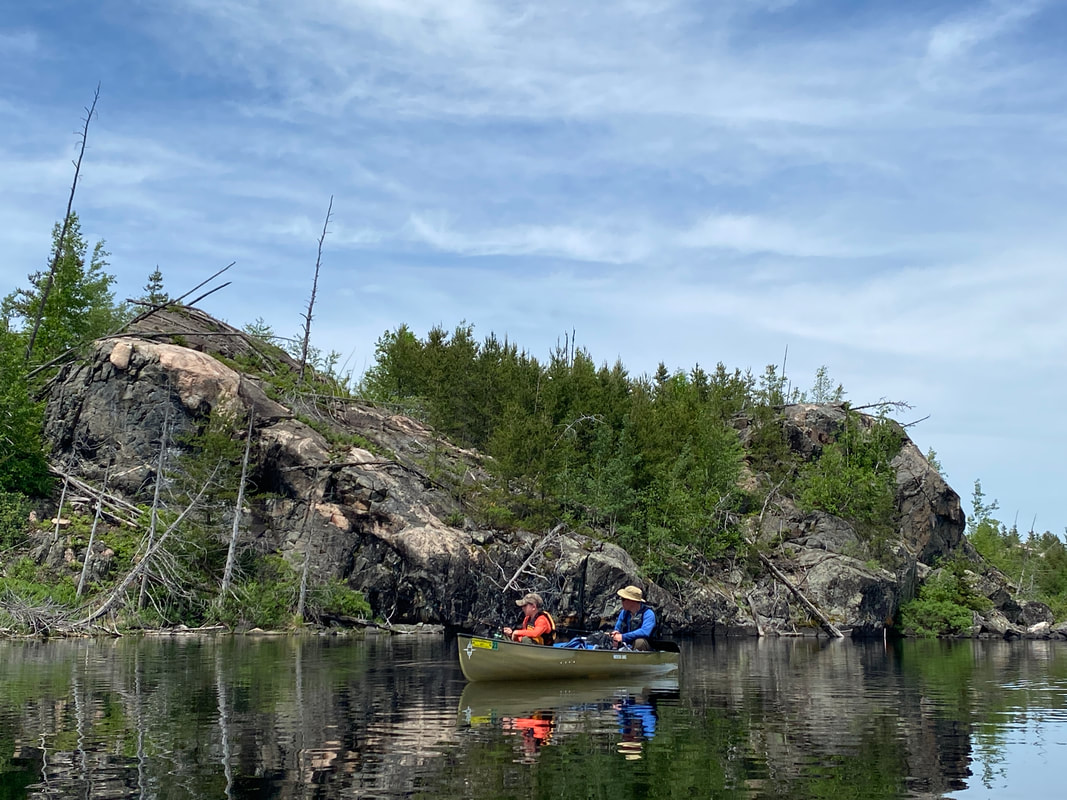
Seagull Lake is an impressive body of water edged in large rocky outcrops and pine forests and sprinkled with islands of all shapes and sized. Navigating these islands calls for close attention to detail of the map as paddlers work their way through wind protected areas and areas exposed to the big lake and the winds that can work up quite a chop, making paddling at the least difficult and at the worst unable to be paddled.
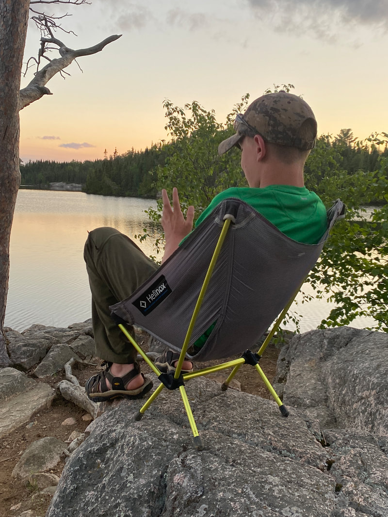
Bugs, firewood, and weather can all be challenges in this area depending on your time of year and exact location, but the fishing is solid throughout. Maybe you'll try for the "grande slam" of fish as we did: pike, bass, walleye, and lake trout. Good luck! All in all, despite some thunderstorms, leeches, black flies, and 90 degree heat, all in all this was a grand trip. The sunsets over the lake and possibility of exploration made for a wonderful first BW experience!
Seagull Outfitters is a pick up point for permits, whether you rent a canoe from them or not, so that is where our first of 2 trips to Seagull Lake began. You can use their services or park in nearby public boat launches and begin your trip. Paddlers may choose to stay on the big lake or portage from Seagull into numerous other small lakes. You may base camp and explore or hop from site to site. Just make sure you have Plan A, B, and C to account for crowds, site availability, weather, and fatigue. We were surprised at how hard it was to find a site, so plan to paddle over an hour more than anticipated if your planned site for the night is taken. We were denied spots we wanted numerous times and also witnesses tired paddlers exhale in despair when the paddled upon our site, taken for the night. Sharing is possible (we allowed a family to double up with us one night) but is frowned upon in the BWCA. When we were shut down by weather and asked to double up, the campers made it clear to us that was not ok.....so you never can count on that.
Seagull Lake is an impressive body of water edged in large rocky outcrops and pine forests and sprinkled with islands of all shapes and sized. Navigating these islands calls for close attention to detail of the map as paddlers work their way through wind protected areas and areas exposed to the big lake and the winds that can work up quite a chop, making paddling at the least difficult and at the worst unable to be paddled.
Bugs, firewood, and weather can all be challenges in this area depending on your time of year and exact location, but the fishing is solid throughout. Maybe you'll try for the "grande slam" of fish as we did: pike, bass, walleye, and lake trout. Good luck! All in all, despite some thunderstorms, leeches, black flies, and 90 degree heat, all in all this was a grand trip. The sunsets over the lake and possibility of exploration made for a wonderful first BW experience!
Rock Hopper perched on a boulder, Seagull Lake, Superior National Forest
|
One of the few shaded campsites, Seagull Lake, Superior National Forest
|
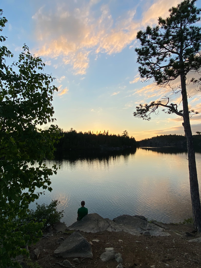
Sunset on Seagull Lake, Superior National Forest
|
A nice small mouth or smallie, Seagull Lake, Superior National Forest
|
Seagull Palisades
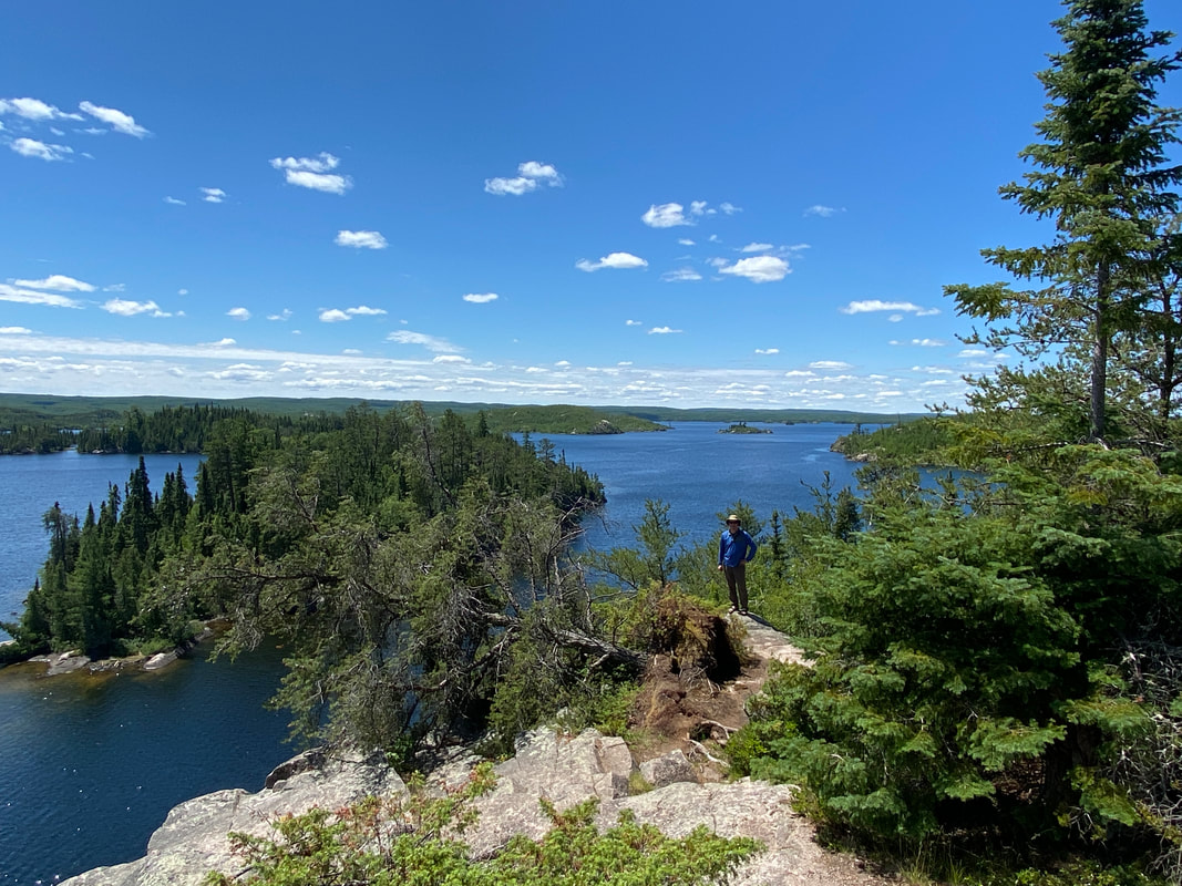
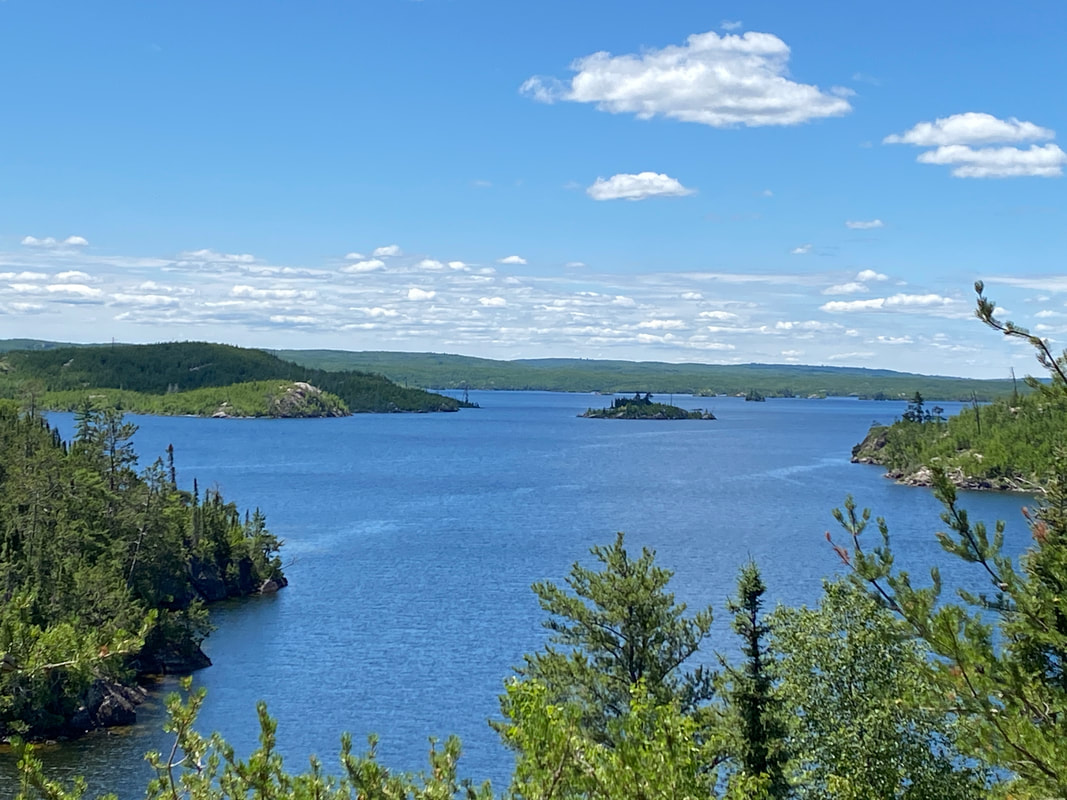
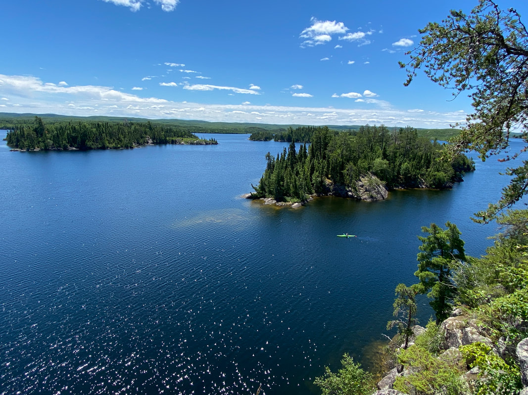
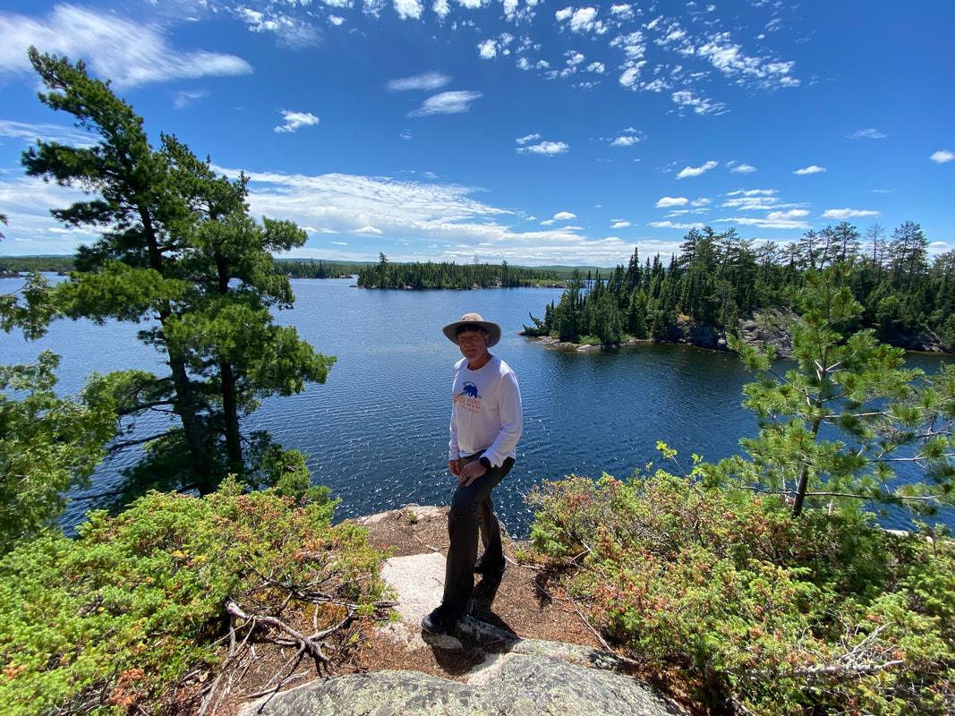
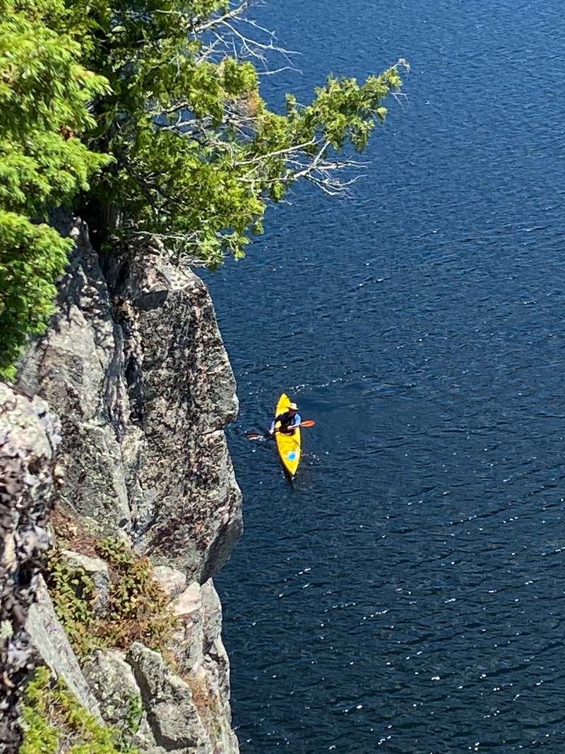
Looking down from the Seagull Palisades, Superior National Forest
Key Features:
-A short paddle from entry point 54a
- Provides great views south and west on seagull lake
- An unmarked and rocky landing
- A short and steep trail
- An unofficial trail not maintained by NFS
-A short paddle from entry point 54a
- Provides great views south and west on seagull lake
- An unmarked and rocky landing
- A short and steep trail
- An unofficial trail not maintained by NFS
The view from the lowest overlook, Seagull Palisades, Superior National Forest
|
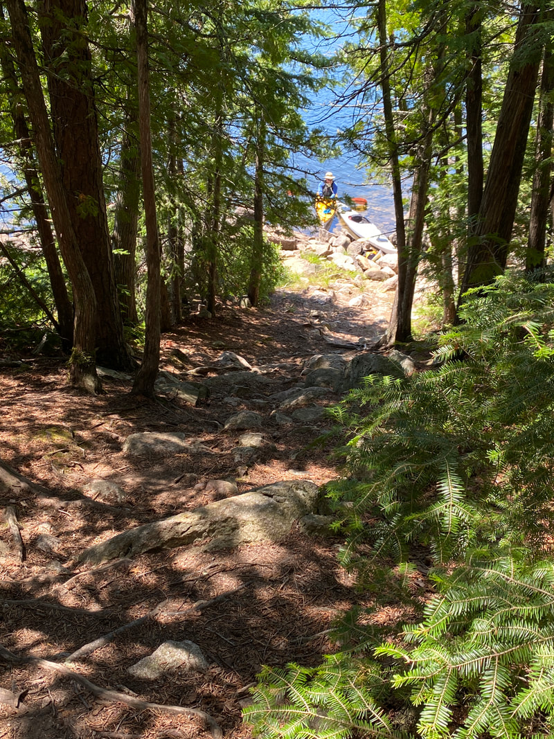
The landing for Seagull Palisades, Superior National Forest
|
Looking west from the Seagull Palisades Lake, Superior National Forest
|
Looking South from the Seagull Palisades, Superior National Forest
|
Admiring the view from the Seagull Palisades, Superior National Forest
|
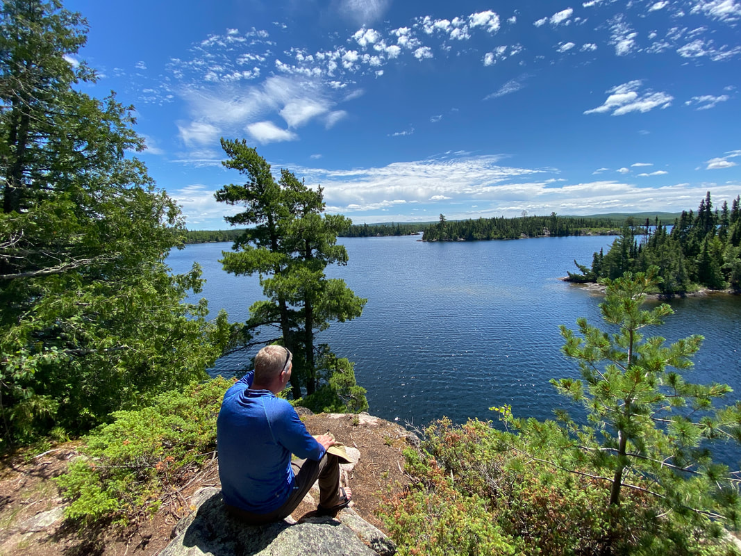
If entering Seagull Lake from Entry Point #54, you must head for the Palisades for the spectacular views offered and an eagle eye vantage point of your route. After snaking from the entry point through a route north of 3 mile island and through the first pinch point and campsite, the palisades sit midway among a group of islands before Seagull Lake opens up to its most expansive section. On the map, watch for the topographic lines indicating a island with the highest elevation. On the western tip you will be able to land your canoe in similar BWCA fashion, with a "wet foot" exit. The foot path is open and evident as a gap in the trees. It immediately ascends into a steep, rocky trail, so watch your footing as you rise to the first of 3 overlooks. Hopefully you will get a clear day which will enable you to see numerous campsites, islands, and the western sections of Seagull Lake. This is a quick hike, but worth the effort (even for eager paddlers excited to get to their campsite).
Looking down from the Seagull Palisades, Superior National Forest
|
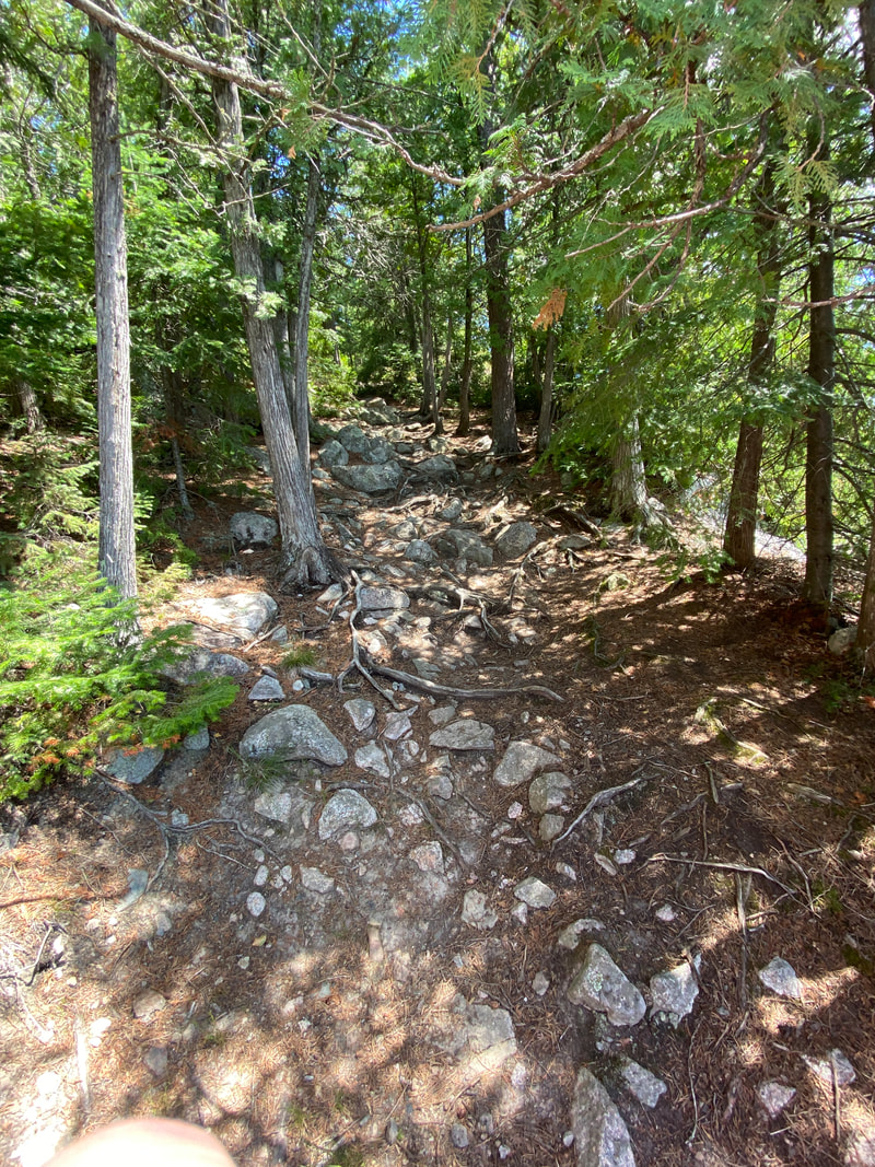
The start of the trail up to Seagull Palisades, Superior National Forest
|
Looking down to our boats on the Seagull Palisades Trail, Superior National Forest
|
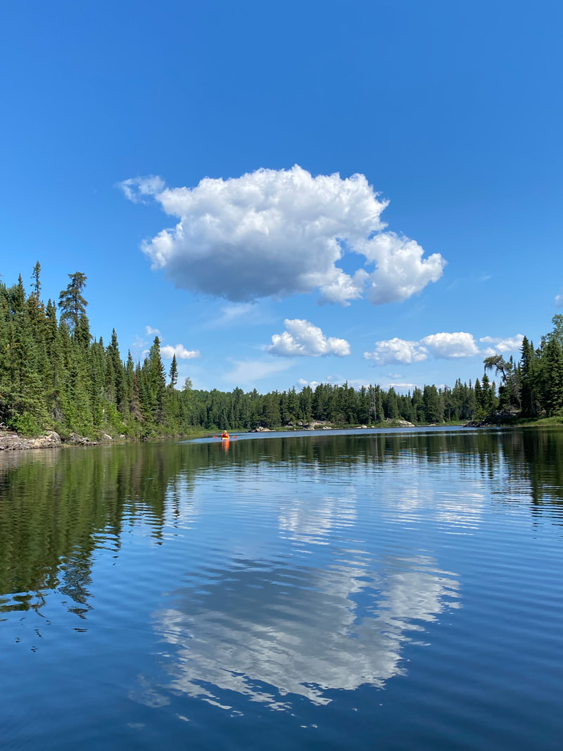
Alpine Lake
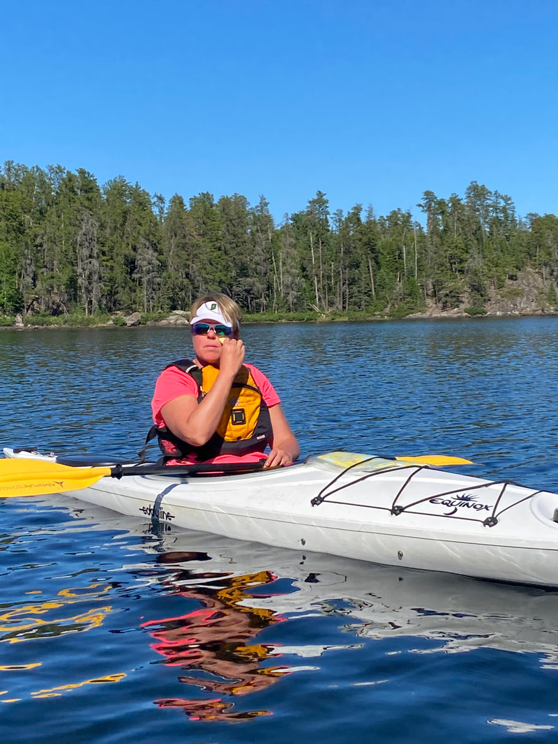
Paddling Alpine Lake, Superior National Forest
Key Features:
-A medium sized lake
-Many islands and coves that can make navigation a challenge for first timers
-Wind is usually calmer here than near by Seagull Lake
-Over 15 campsites on the lake
-Has a reasonable amount of traffic
-Fires in the last 15 years have severely reduced the shade in some campsites
-Requires a portage to access (about 0.3 miles)
Campsite with no shade, Alpine Lake, Superior National Forest
|
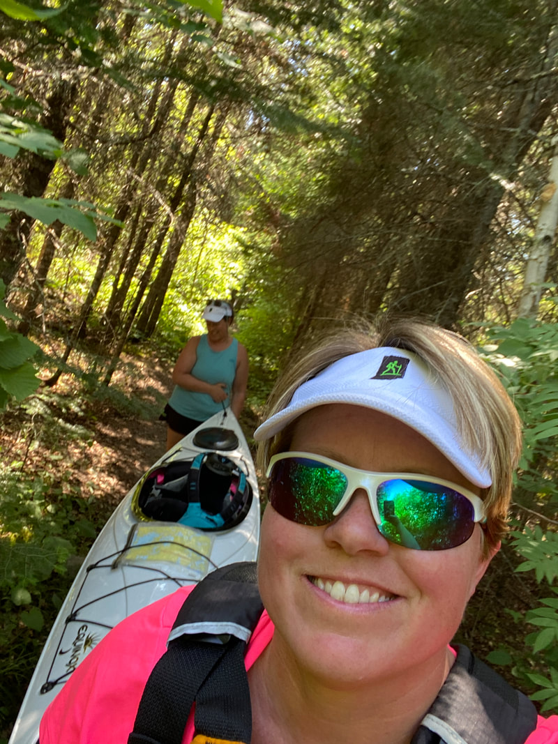
Portage from Alpine to Jasper Lake, Superior National Forest
|

Filtering water at sunset, Alpine Lake, Superior National Forest
|
Alpine Lake from above, Superior National Forest
|
Morning coffee, Alpine Lake, Superior National Forest
|
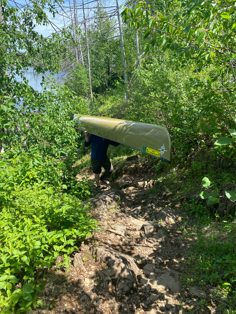
Alpine Lake, located a 100+ rod portage off of Seagull was recently hit by wildfire and so has a "Lord of the Rings" feel to it with harsh rock and burnt remnants. However, we really enjoyed the safer and protected waters that you felt like you could fully explore. Alpine Lake has numerous sites with great views and was not overly crowded when we went. The fishing was moderate and the rocky campsites and shoreline allowed for big open sites that your could stretch out and explore.
We also explored off of Alpine Lake through one of the prettiest portages we've ever done. A rushing creek fill complete with waterfall spills into Alpine from Jasper Lake and beacons you to enter. A small uphill flattens out and the crushing noise of a small waterfall intrigue you as you hike the short distance to small Jasper Lake. Most paddlers use this as a pass through, but we found it to be full of wildlife (beavers, eagles, and leeches....beware!)
On our second trip to the BWCA, we were able to explore the northwest portion of Alpine Lake where several of the nicer campsites are located. Alpine Lake is a quick paddle and not overcrowded. It certainly won "Best Sunset" pictures of all of our sites as there are numerous western faced campsites with higher elevation and rocky outcroppings for excellent views.
Portaging to Jasper from Alpine Lake, Superior National Forest
|
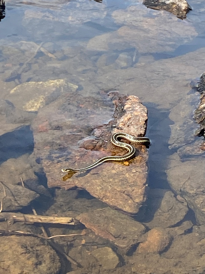
Garter snake, Alpine Lake, Superior National Forest
|
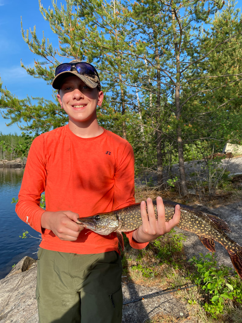
Northern Pike, Alpine Lake, Superior National Forest
|
Red Rock Lake
Watching the clouds on Red Rock Lake, Superior National Forest
Key Features:
- A less visited lake than many around it
- Great campsites
- Easy and short portage to Lake Saganaga
-Only has a few campsite compared to other lakes in the area
-Tall pines not burned in recent fires
- A less visited lake than many around it
- Great campsites
- Easy and short portage to Lake Saganaga
-Only has a few campsite compared to other lakes in the area
-Tall pines not burned in recent fires
Red Rock Lake, BWCA, Superior National Forest
|
Portaging into Red Rock Lake, BWCA, Superior National Forest
|
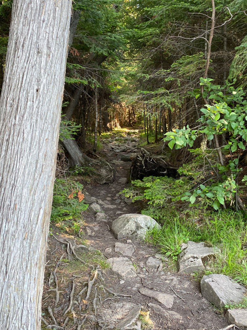
Typical portage in BWCA, Superior National Forest
|
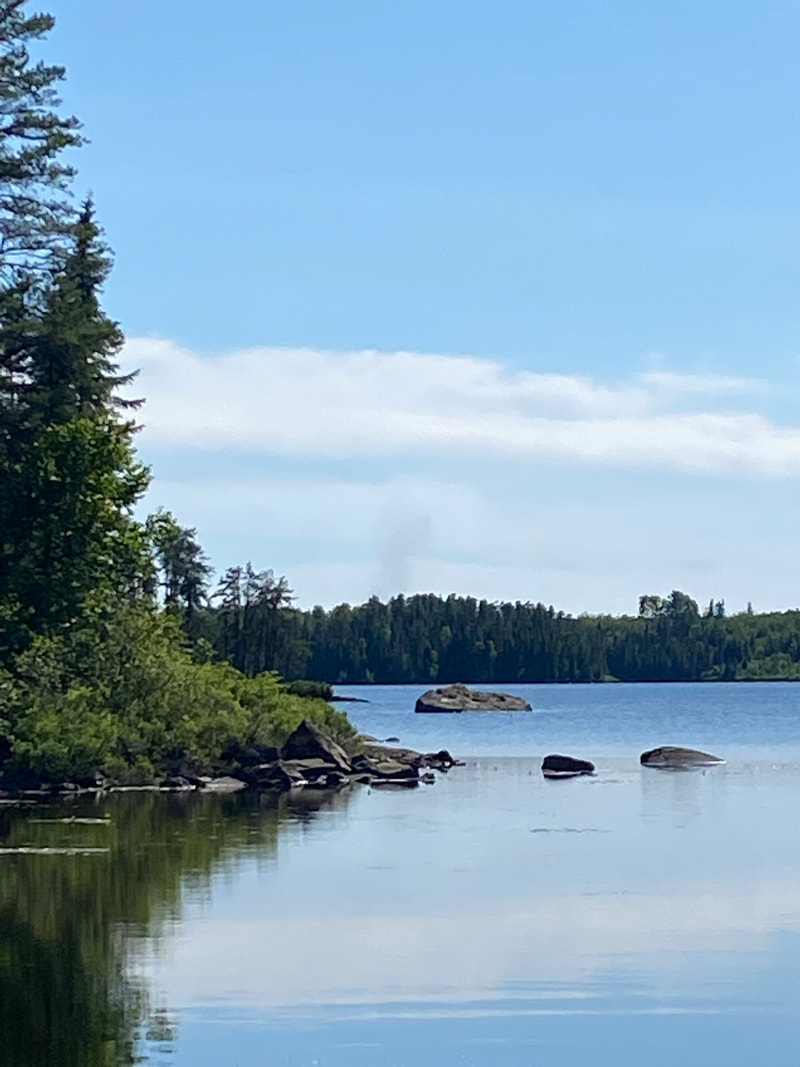
Red Rock Lake, Superior National Forest
|

Red Rock Lake after the portage, BWCA, Superior National Forest
|
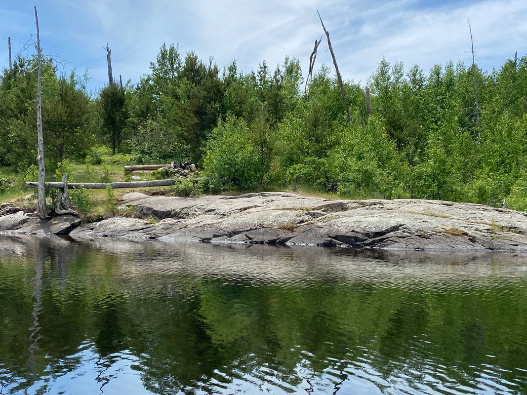
Red Rock Lake was an unexpected find on our loop from Seagull through Saganaga, and we regretted not spending a night there. However, we were able to paddle the full length of it twice (once on a day paddle, then again the following day as our plans changed to make the full loop.) Red Rock was less crowded than many other lakes in the area and offered several nice sites with much more shade than Alpine & Seagull offered. The sites were spread out at good distances and were on both sides of the lake as you make an S shape from Alpine to the larger Saganaga Bay. The portages on either side of Red Rock are moderate to short. The map lists the entry into Sag as a 10 rod, but we found we could float the boats down a short channel between the lakes, it was a tight squeeze but their was plenty of water in early July. This was a treat that allowed us to leave the kayaks fully loaded and was a time (and back) saver!
Overall, Red Rock Lake had a deep water, dark shaded feel with towering pines that shaded her borders. We will definately save Red Rock for an overnight next time!
Overall, Red Rock Lake had a deep water, dark shaded feel with towering pines that shaded her borders. We will definately save Red Rock for an overnight next time!
Outcroppings on Red Rock Lake, Superior National Forest
|
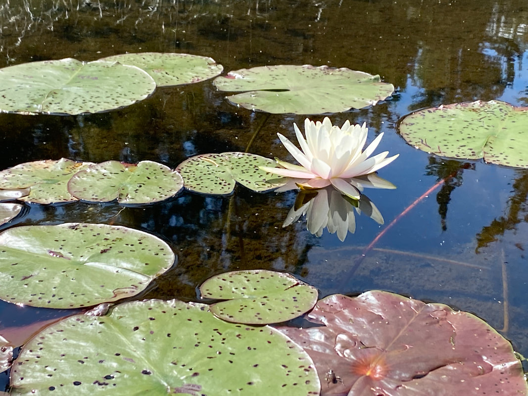
Blooming water lillies on Red Rock Lake, Superior National Forest
|
Fantastic campsites on Red Rock Lake, Superior National Forest
|
Saganaga Lake
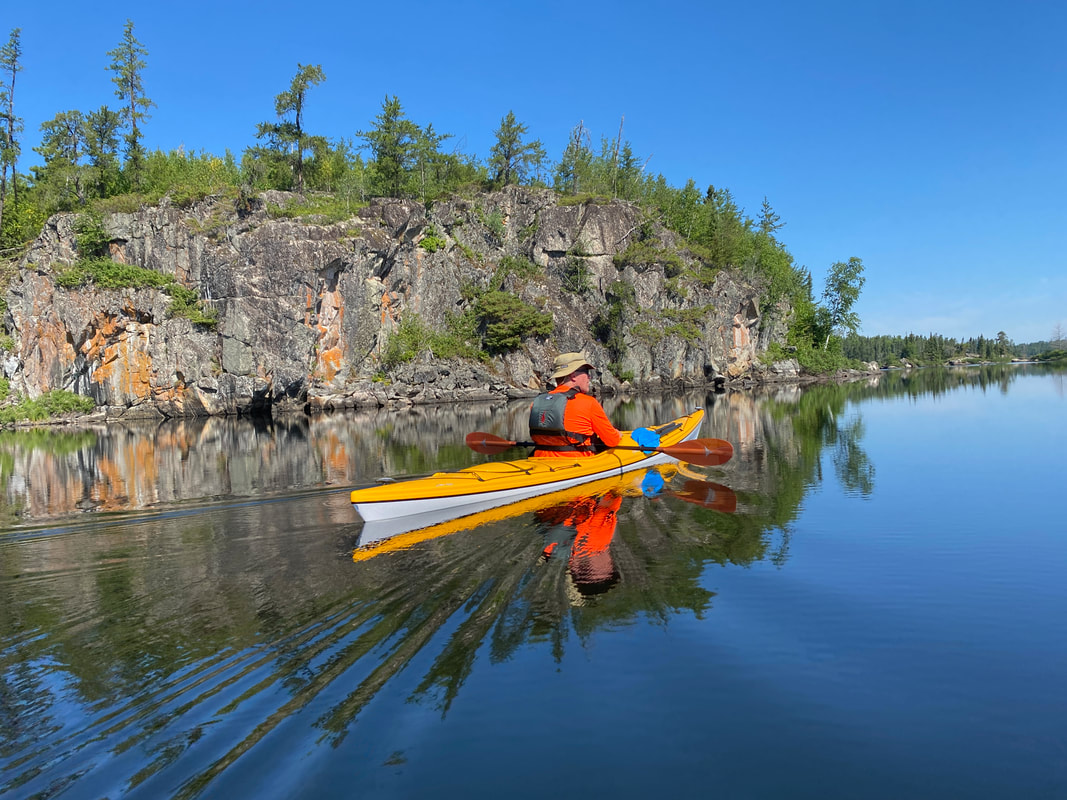
Paddling Saganaga Lake with a touch of haze from nearby wildfires, Superior National Forest
Key Features:
- The largest lake in the area
- The last lake on the Gunflint Trail
- Many islands and coves, can be difficult to navigate
- Small motors are allowed
- Part of the lake in in Canada
- The largest lake in the area
- The last lake on the Gunflint Trail
- Many islands and coves, can be difficult to navigate
- Small motors are allowed
- Part of the lake in in Canada
Island hopping on Saganaga Lake, BWCA, Superior National Forest
|
We just missed the fire ban on Saganaga Lake, BWCA, Superior National Forest
|
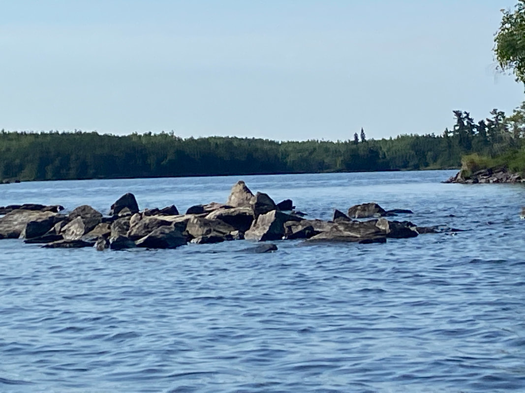
Rocky reefs, Saganaga Lake, BWCA, Superior National Forest
|
Saganaga Lake Campsite, BWCA, Superior National Forest
|
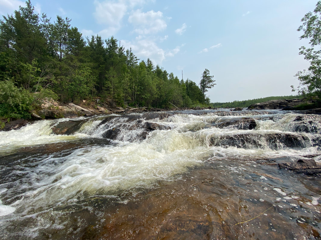
Saganaga Falls, BWCA, Superior National Forest
|
Massive Saganaga Lake can be intimidating at first glance, but with proper planning and a bit of good weather, it should not be avoided. Known as one of the few lakes that allows motors, do not expect a quiet paddle during the day and early morning peak fishing hours, but once the evening settles in, Sag can be as quiet as any other area lake. We found Sag less crowded that Seagull Lake on our paddle.
Saganaga offers quite a bit of island hopping and exploring as you travers the borders of the island "rings" while avoiding the massive parts of Sag further into Canadian waters. I feel like I can't quite give an honest review of the sights because on our trip, smoke from wildfires settled in and gave the skies a constant haze that changed the look and feel of the landscape. however, this is a reality in wilderness travel and it was interesting still to say the least.
Most people probably enter Sag through the 2 boat ramps on its southern tip, but we portaged in from Red Rock and were able to explore the islands from the west to the east from Saganaga Bay- past Loon Island- and over to Saganaga Falls. The sites closest to the boat ramps were not our favorite, so if you are planning on spending you last night close to the take out, I would recommend you just paddle further and take advantage of the nicer sites on Campers Island or further north.
The south east side of Sag has experienced recent burns, and does not have as much scenery as you might hope for. However, you can skirt the border and get a good view of Canada up close from there. Definitely take a look at the impressive Red Sucker Bay on the way to Saganaga Falls.
A side visit to Saganaga Falls should be squeezed in as well. There you will see a short waterfall that looks for like a section of rapids, but is still worth a visit. You can paddle right up to the base of the falls for some great close up pictures and a bit of adrenaline rush. Many people enter Sag from this point, we encountered several parties near this portage.
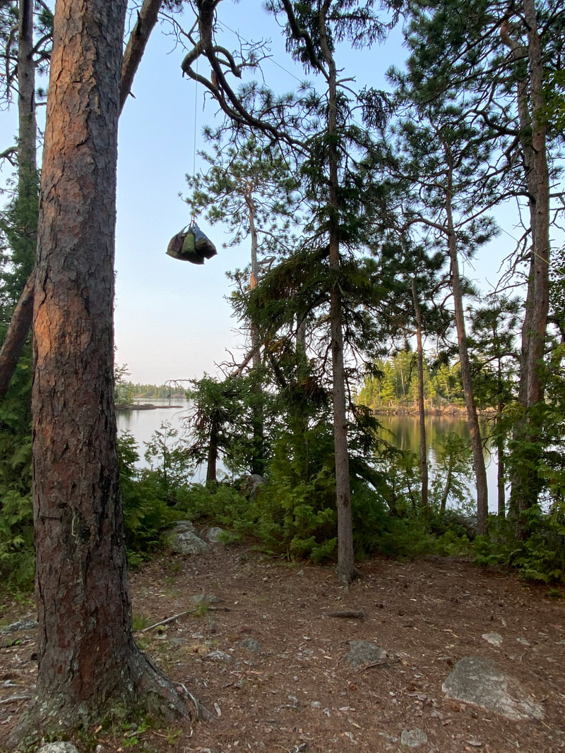
Bear hanging in the BWCA, Superior National Forest
|

Sunset on Saganaga Lake, BWCA, Superior National Forest
|
Saganaga Lake, BWCA, Superior National Forest
|