San Rafael Swell and North Wash
|
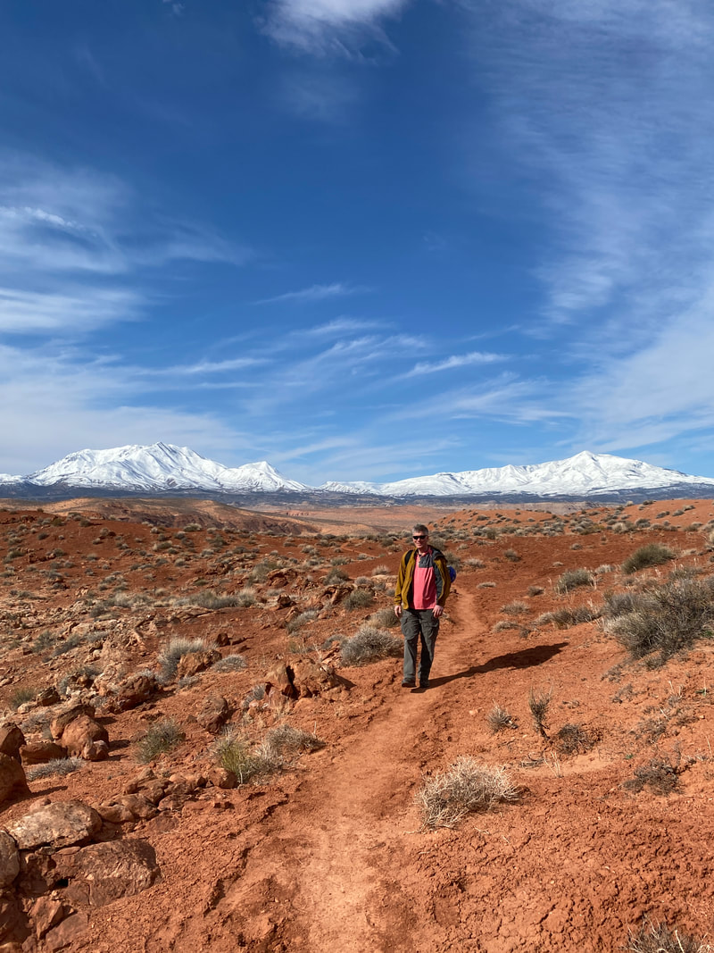
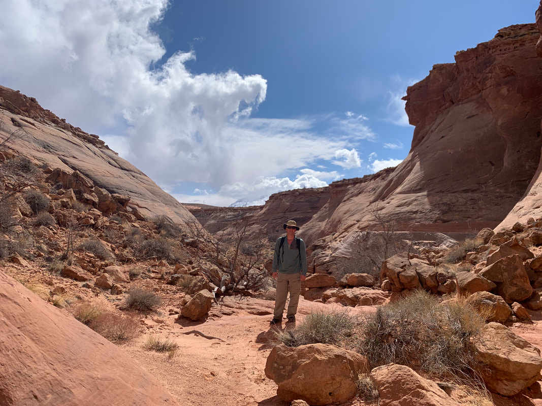
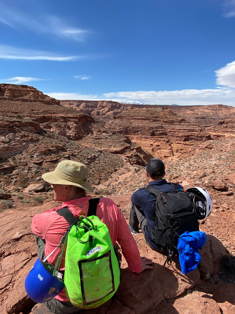
In south-central Utah there is a vast stretch of public land that is north of Lake Powell and west of Canyonlands National Park. This area has incredible desert views, rocky pinnacles to climb, challenging hikes, and countless canyons. These canyons are what the Swell and the North Wash areas are best known for. Some of these are easy walks in the desert, others are narrow slot canyons, and some are technical canyons that can add considerable spice to your adventure if you have the skills and knowledge to tackle them.
|
San Rafael Swell and North Wash
Key Features:
- Scenic drives both on pavement and dirt along both Hwy 24 and 95
- Countless cliffs, mesas, and canyons
-Don't expect solitude in the popular canyons, but the crowds are smaller than nearby parks
-Countless backcountry camping opportunities
-Wide variety of trail / canyon options for different skill levels
- Research: do not enter a canyon above your skill level
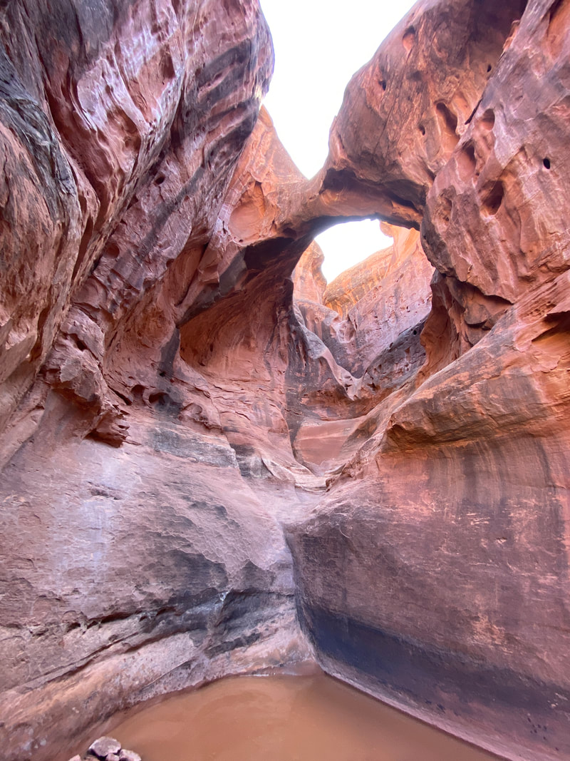
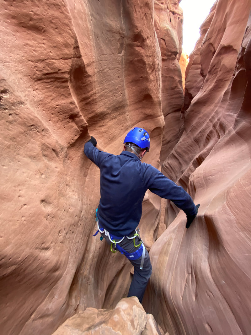
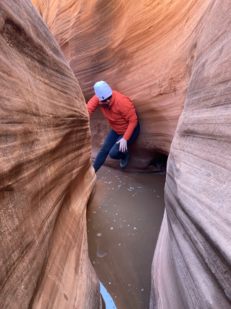
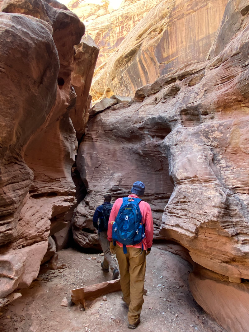
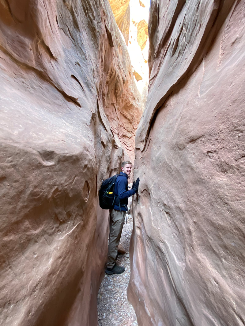
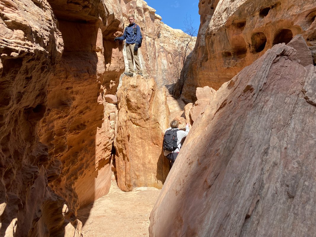
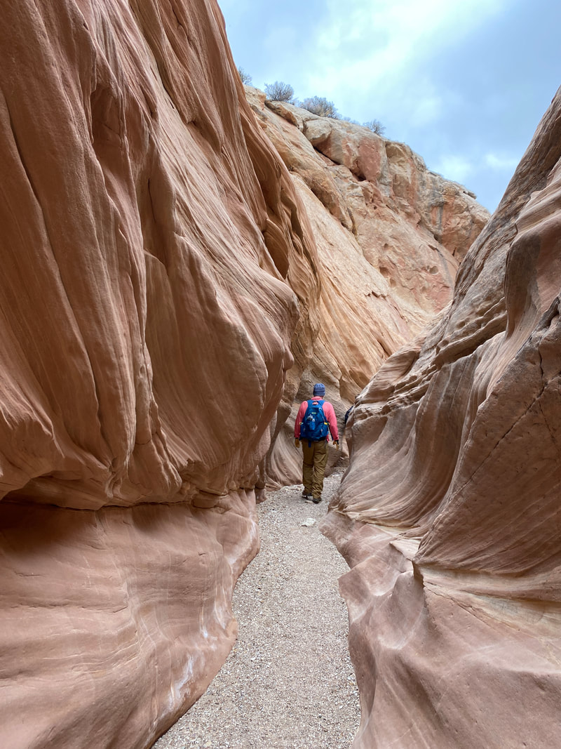
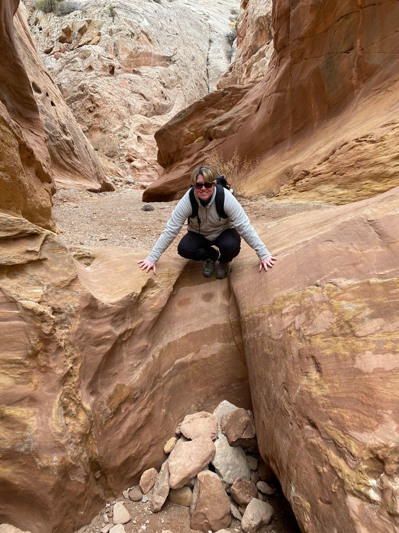
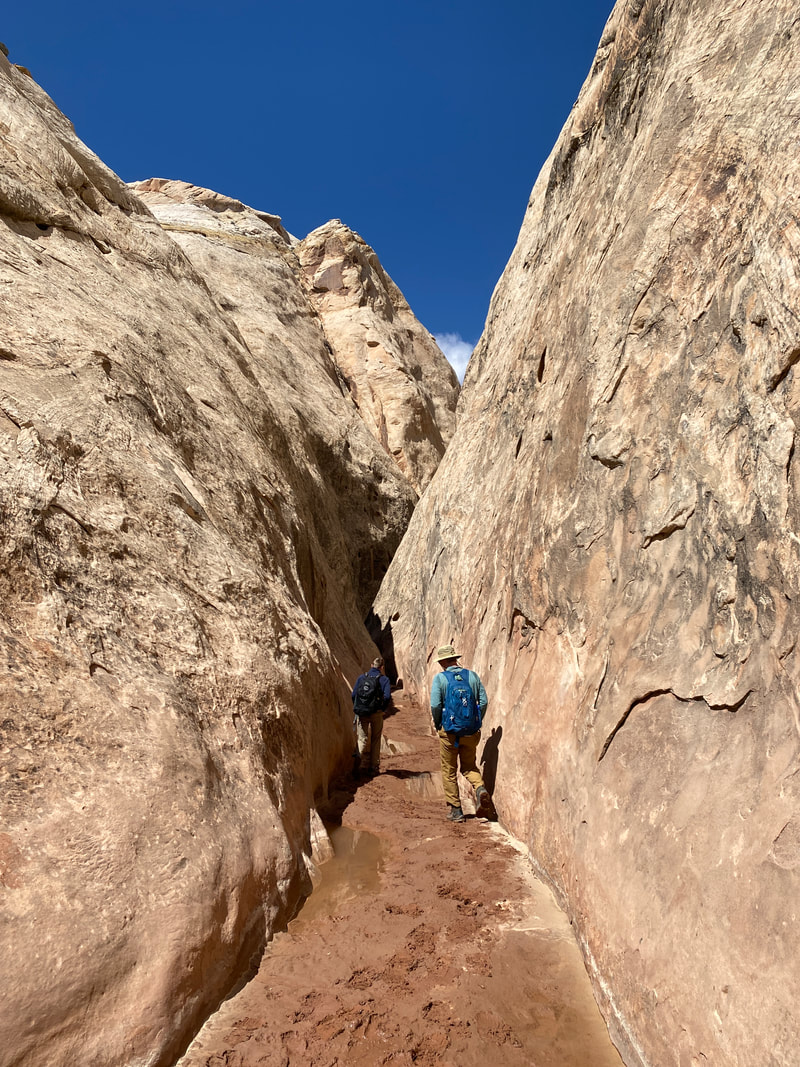
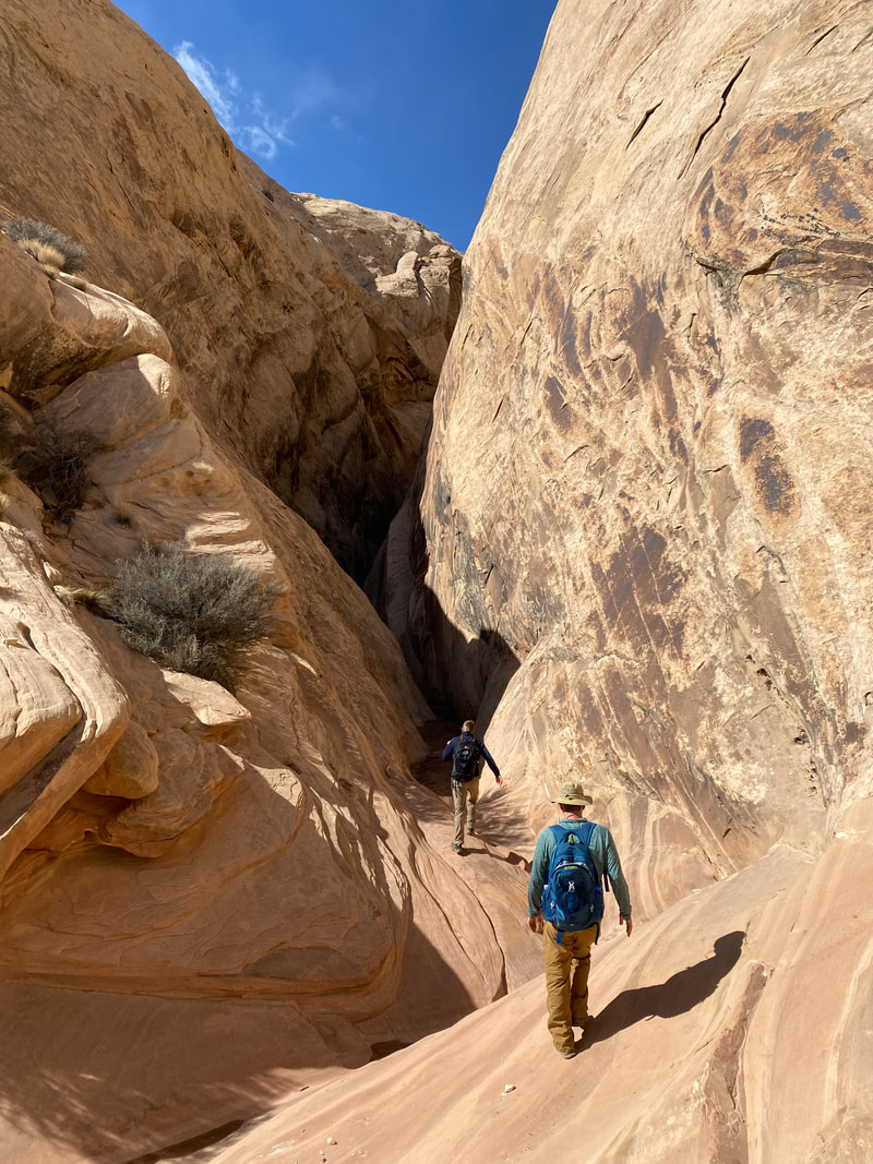
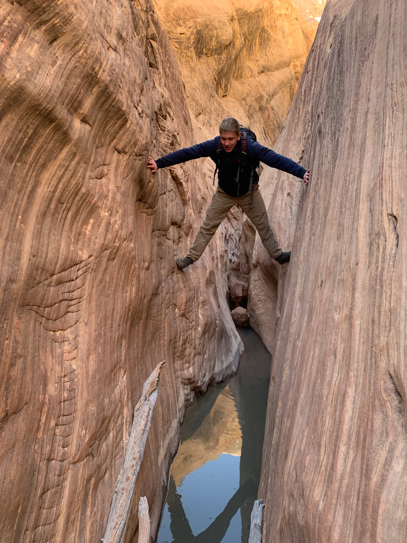
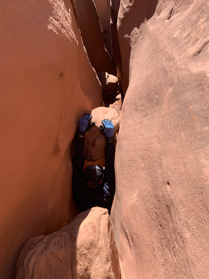
Little Wild Horse and Bell Canyons
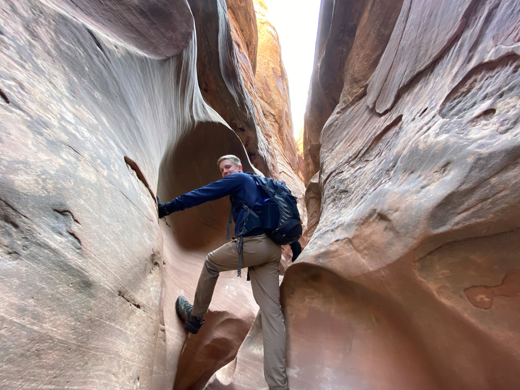
Navigating a twisting section of slot in Little Wild Horse Canyon
Little Wild Horse Canyon and Bell Canyon
Key Features:
- Access via paved road
- The most popular canyon in the Swell, don't expect solitude
- Can be an out an back or longer day hike depending on energy level
- Avoid during thunderstorms
- Mainly walking on lose gravel and rocks
- Commonly has sections with ankle deep standing water
Has a little bit of everything from bigger views to tighter slot sections
Walking up a wide section of Little Wild Horse Canyon
|
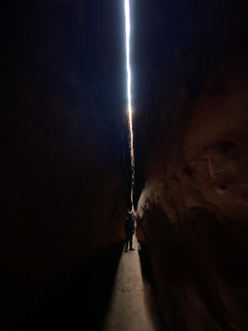
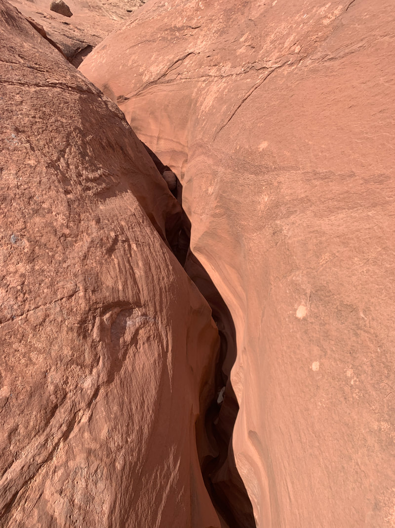
Twisting slot section in Little Wild Horse Canyon
|
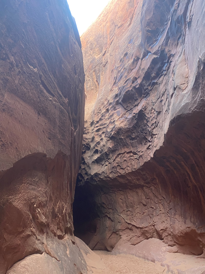
A narrow area in Little Wild Horse Canyon
|
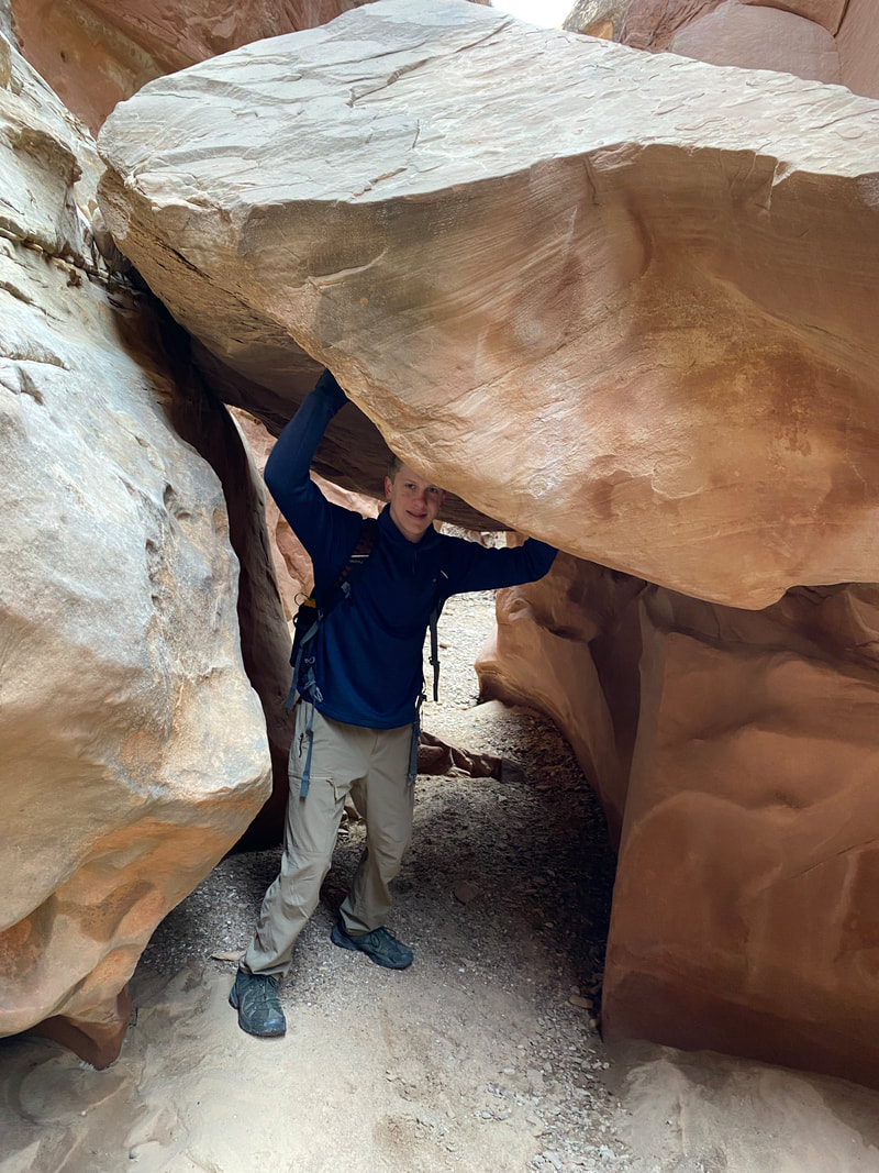
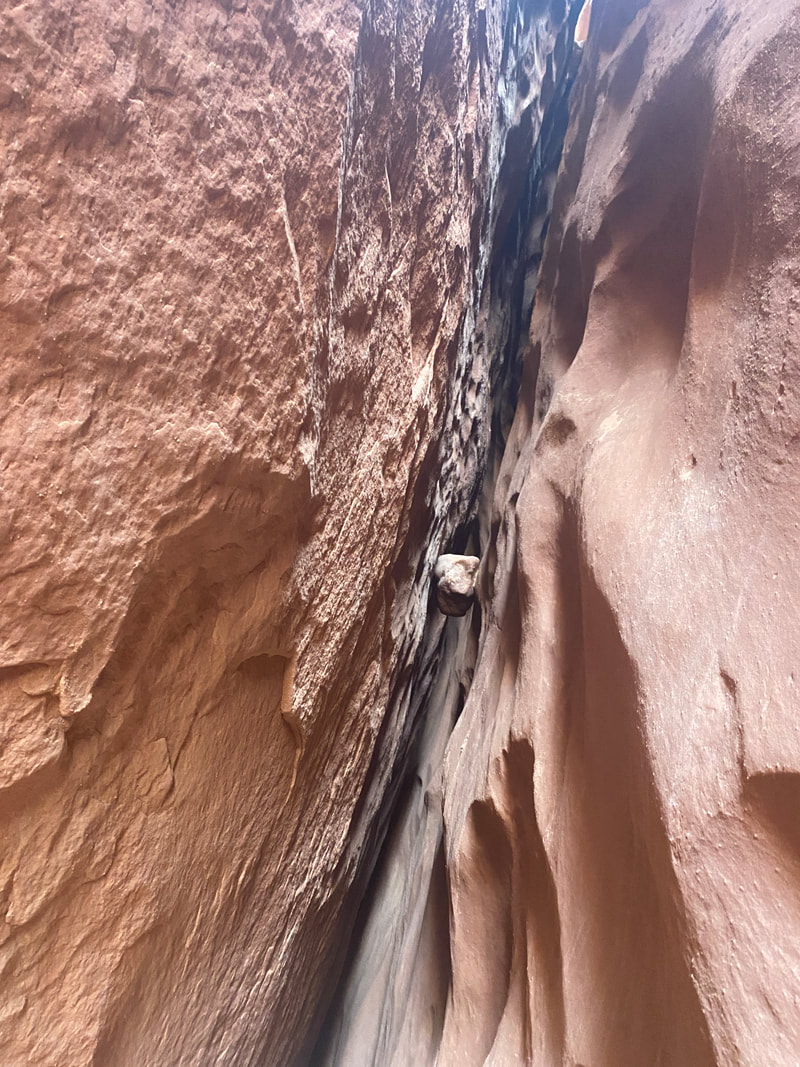
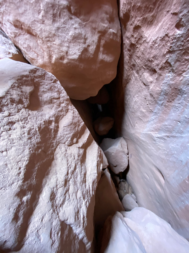
A giant choke stone in Little Wild Horse Canyon
|
The rocky rubble floor in areas of Little Wild Horse Canyon
|
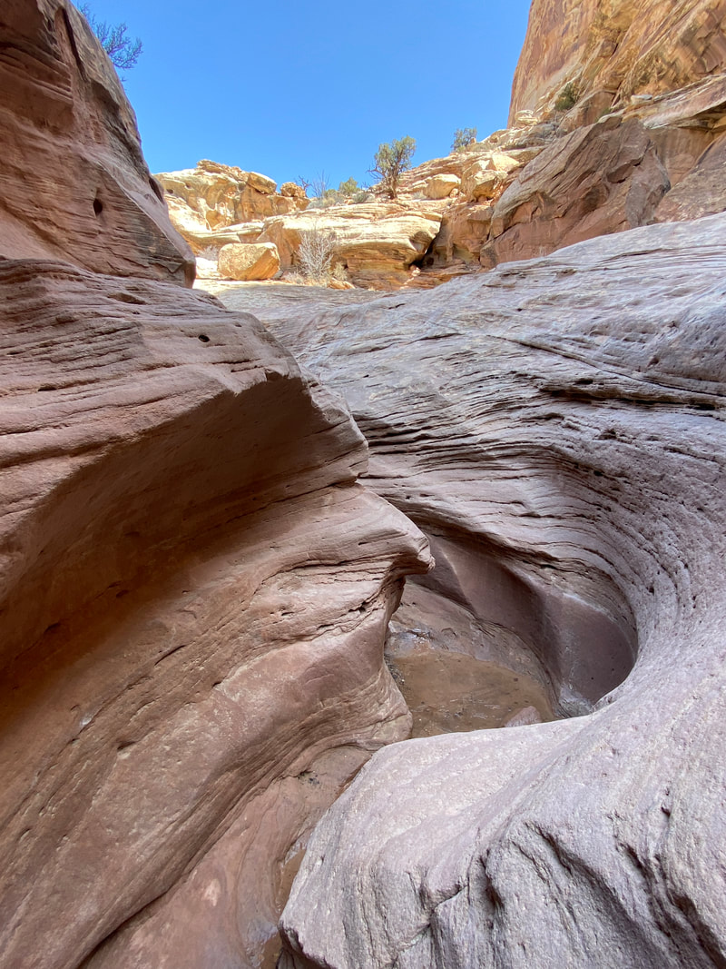
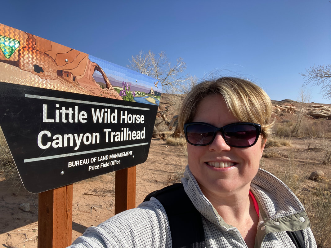
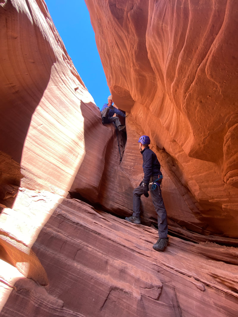
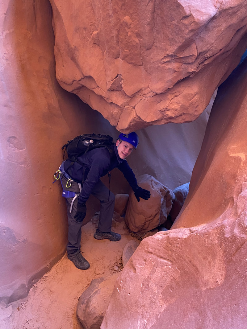
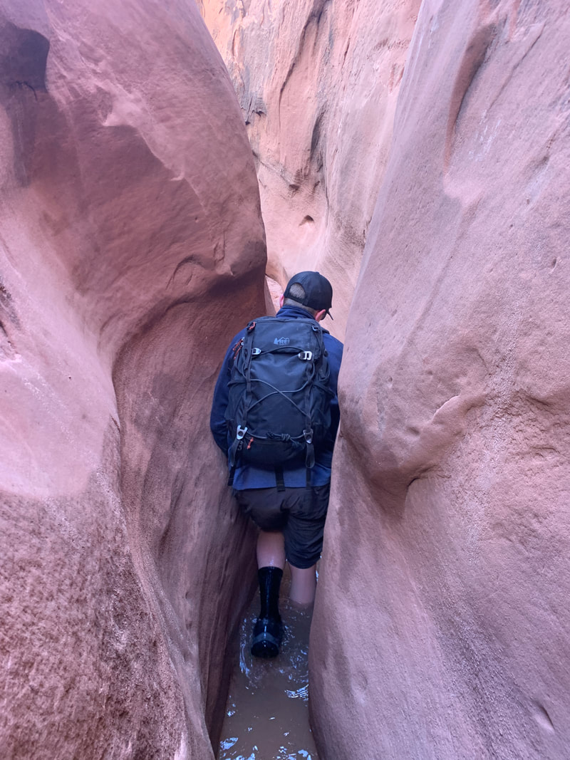
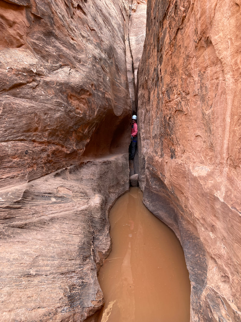
Wild Horse Canyon (4.1 miles one way)
Little Wild horse Canyon is probably the most popular hike in the southern swell, if not the whole San Rafael Swell. It is near Goblin Valley State Park and on a paved road making it accessible via a passenger car all the time, no high clearance or 4x4 vehicle needed here.
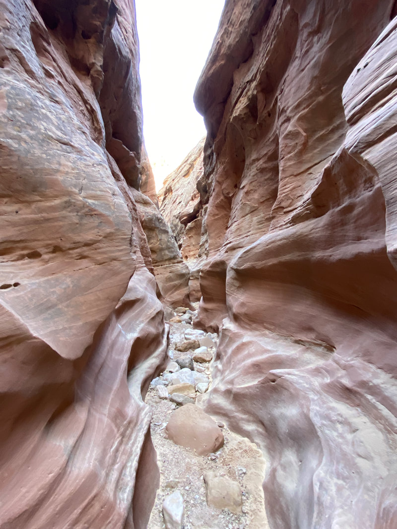
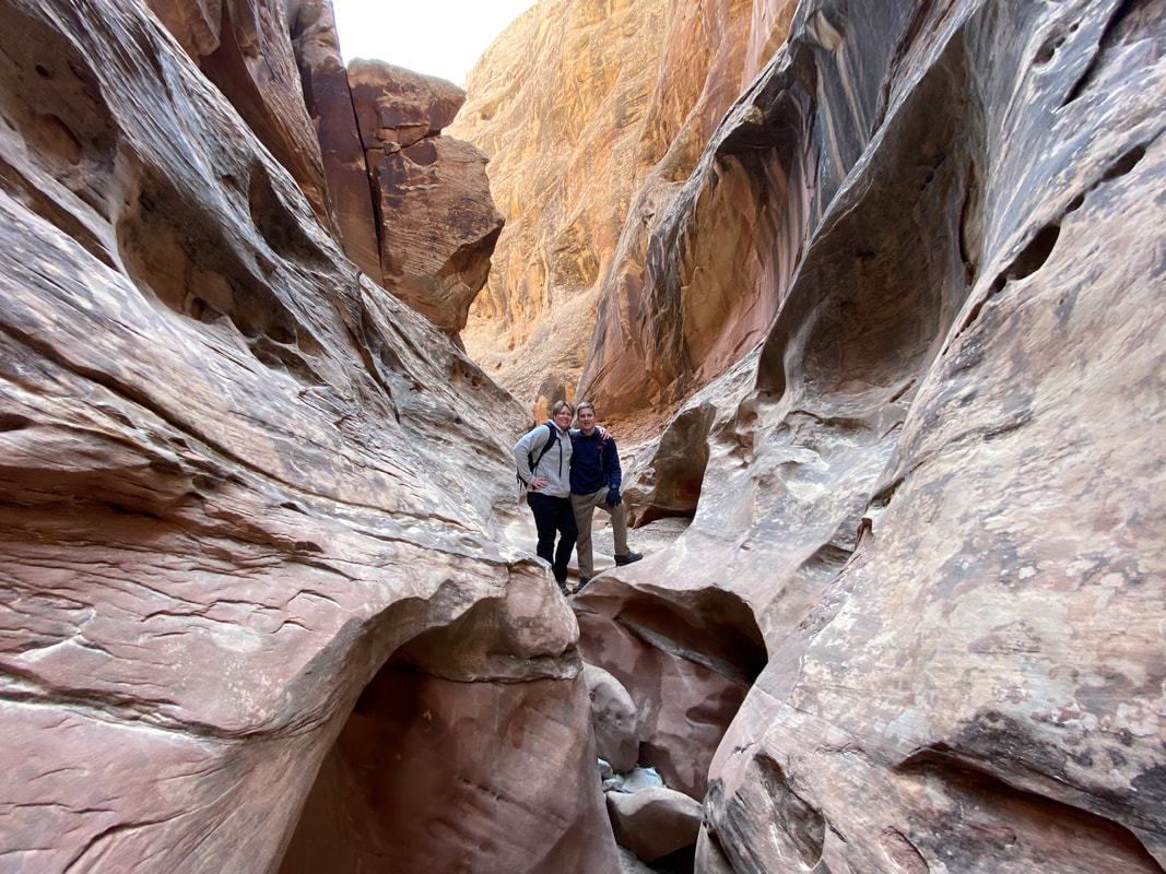
The approach to the canyon is short, maybe 20 minutes, the intersection with Bell Canyon is signed to prevent you from making a wrong turn. For the most part, the canyon can be hiked if you can scramble over some minor dry falls. The canyon, while being narrow enough to be a slot canyon, never gets tight enough that you need to turn your shoulders to fit down the canyon. However, the canyon can hold water, and during a particularly wet March we found several sections filled with ankle to knee deep water. A strong canyoner could stem over these sections, but it took significant effort and if we could do it over again, we might have just waded through the water. The canyon is long and has many slot sections, some with smooth walls, other pocketed, and some with serpentine walls that are very photogenic. Many walk the first mile or two and then turn around to return to the trailhead. The more adventurous can walk the whole canyon. A signed junction marks the connector trail / Behind the Reef Road which connects Little Wild Horse and Bell Canyons.
The approach to the canyon is short, maybe 20 minutes, the intersection with Bell Canyon is signed to prevent you from making a wrong turn. For the most part, the canyon can be hiked if you can scramble over some minor dry falls. The canyon, while being narrow enough to be a slot canyon, never gets tight enough that you need to turn your shoulders to fit down the canyon. However, the canyon can hold water, and during a particularly wet March we found several sections filled with ankle to knee deep water. A strong canyoner could stem over these sections, but it took significant effort and if we could do it over again, we might have just waded through the water. The canyon is long and has many slot sections, some with smooth walls, other pocketed, and some with serpentine walls that are very photogenic. Many walk the first mile or two and then turn around to return to the trailhead. The more adventurous can walk the whole canyon. A signed junction marks the connector trail / Behind the Reef Road which connects Little Wild Horse and Bell Canyons.
The trail head to Little Wild Horse Canyon is well marked and easily accessible
|
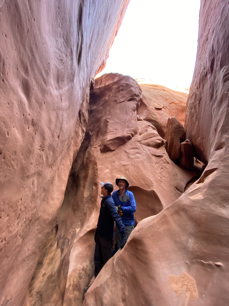
Strange rock formations in Little Wild Horse Canyon
|
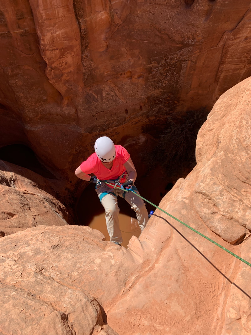
Navigating a dry fall in Little Wild Horse Canyon
|
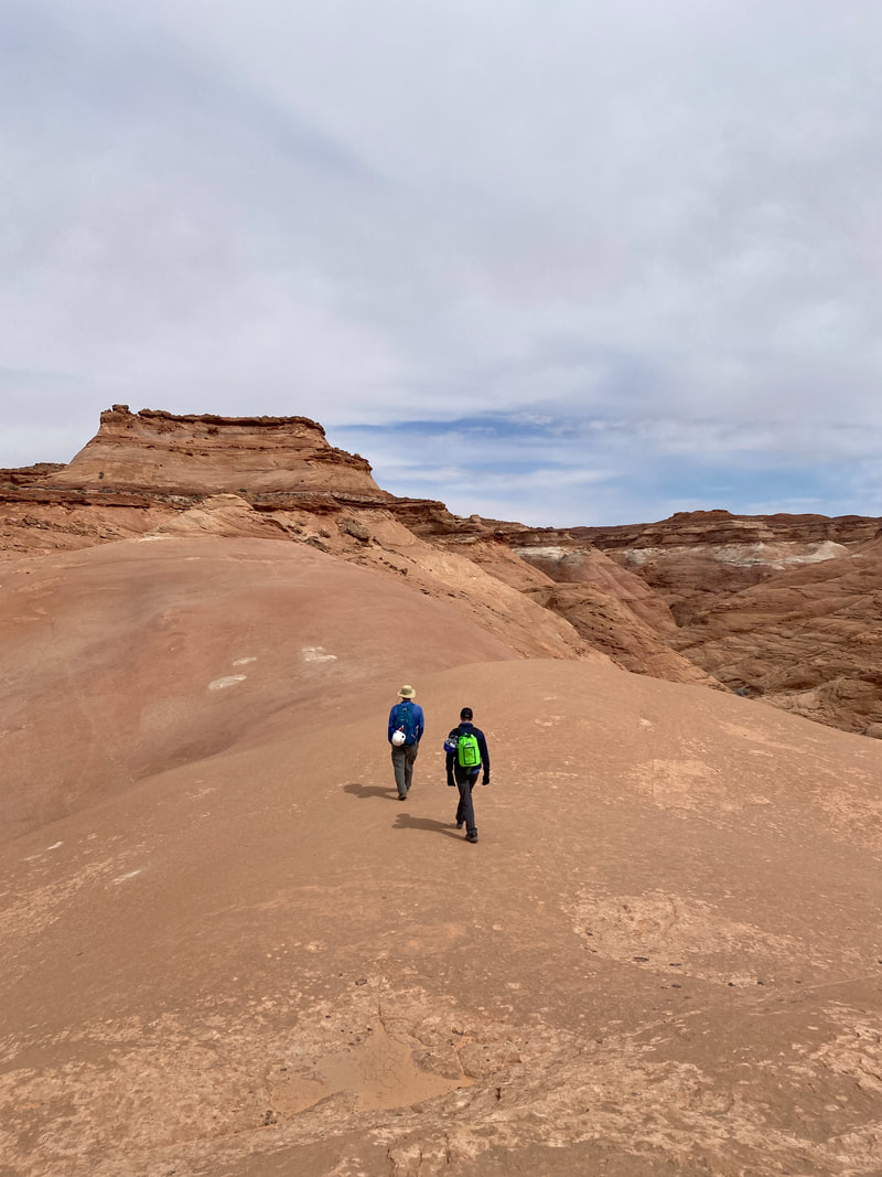
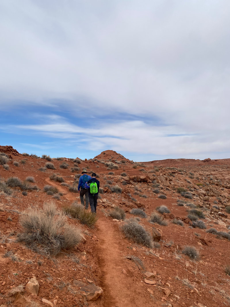
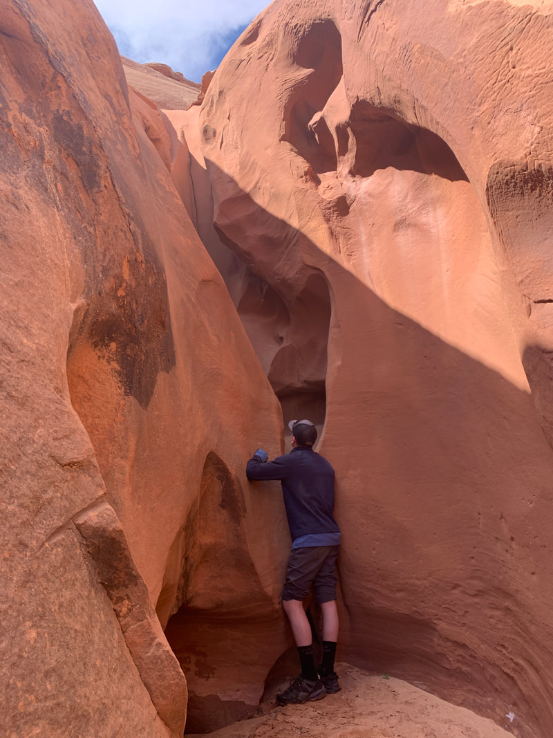
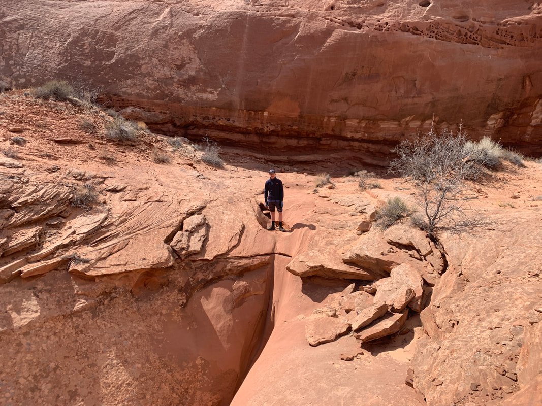
Connector Trail (1.6 miles one way)
The Connector Trail follows a section of wash and Behind the Reef Road, which is only passable by 4x4s or ATV like vehicles. We did encounter a pair riding/walking mountain bikes in this area. This section of trail is about 1.6 miles long and has some outstanding views of the reef and the swell. If you just follow the road you will encounter signs marking the way into Bell Canyon. Just past the Bell Canyon wash, is a historic cabin that many walk up and explore. It was clouding up when we visited, so we skipped this land mark to hustle through Bell Canyon. Next time, we hope to take an extra 20 minutes and visit this area.
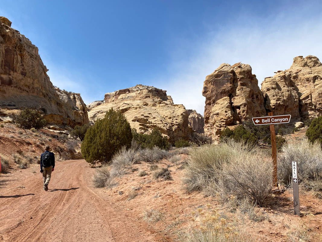
The turn off to Bell Canyon is clearly marked
|

Walking behind the reef road on our way to Bell Canyon
|
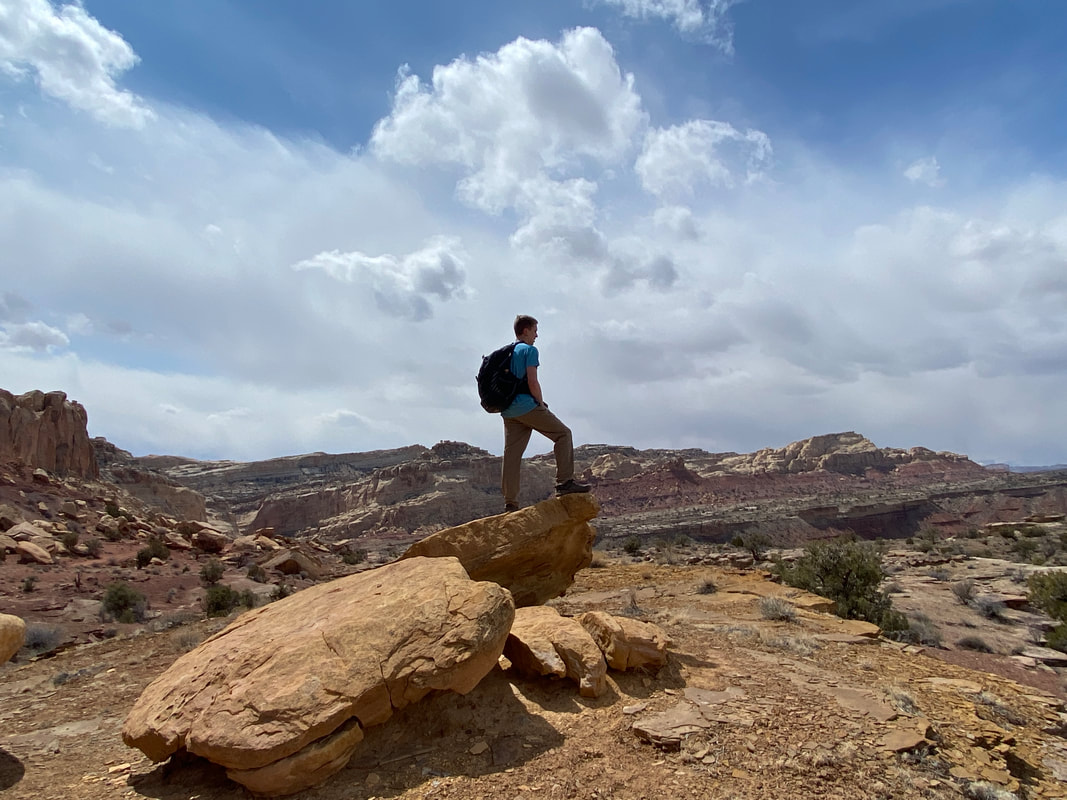
Looking out into the vast San Rafael Swell
|
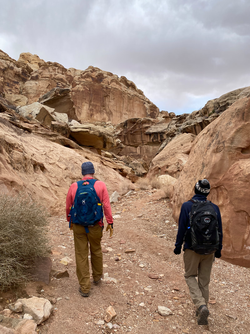
Bell Canyon (2.3 miles one way)
Bell Canyon surprised us; we did not expect it to be as nice as it was. Entering from behind the reef, the canyon quickly narrowed. There were one or two dry falls that required some scrambling. Then, the canyon narrowed to about 3-4-foot-wide and was a quick and easy walk back to the intersection and eventually the parking area. We found these sections to be surprisingly scenic and nice to walk through, even though they were not as tight or photogenic as Little Wild Horse.
The entry to Bell Canyon from the backside of the reef
|
A narrower section of Bell Canyon
|
Dropping down a dry fall in Bell Canyon
|
|
|
|
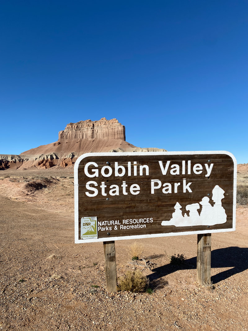
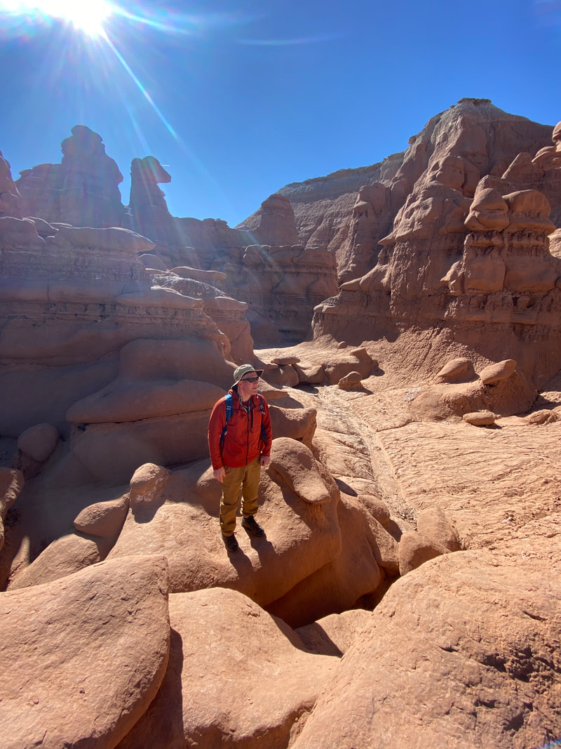
Goblin Valley State Park
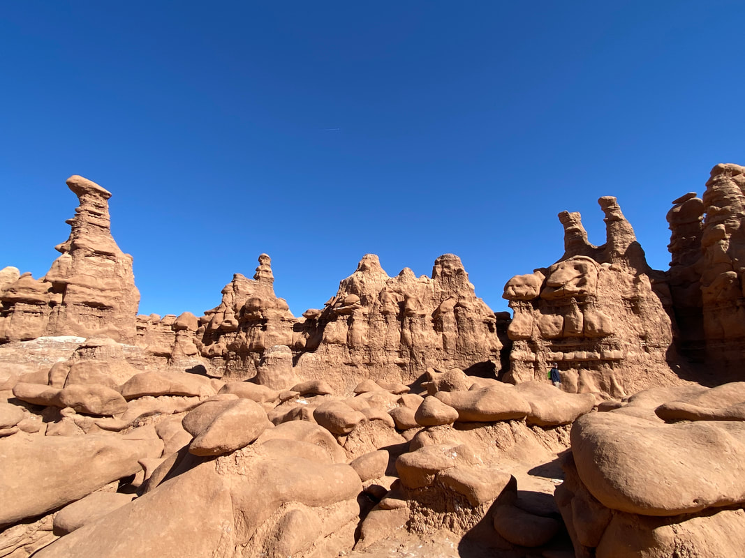
Some of the countless goblins in Goblin Valley State Park, Utah
Goblin Valley State Park
Key Features:
- Easy access from Hanksville, on paved roads
- Countless goblins or stone hoodoos to walk, climb on, and explore
- Very popular, may be crowded weekends and nice days
- Has a very popular technical canyon route called the Goblin's Lair
-
Key Features:
- Easy access from Hanksville, on paved roads
- Countless goblins or stone hoodoos to walk, climb on, and explore
- Very popular, may be crowded weekends and nice days
- Has a very popular technical canyon route called the Goblin's Lair
-
The entrance to Goblin Valley State Park
|
A maze of goblin's found in Goblin Valley State Park
|
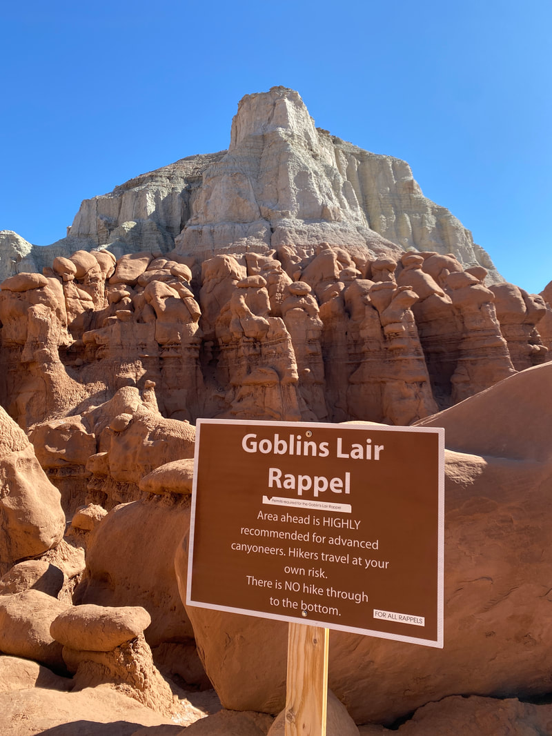
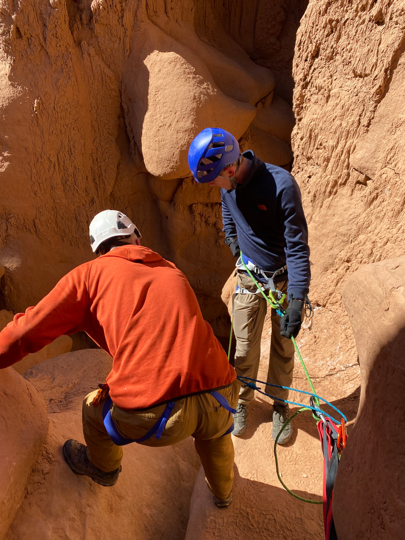
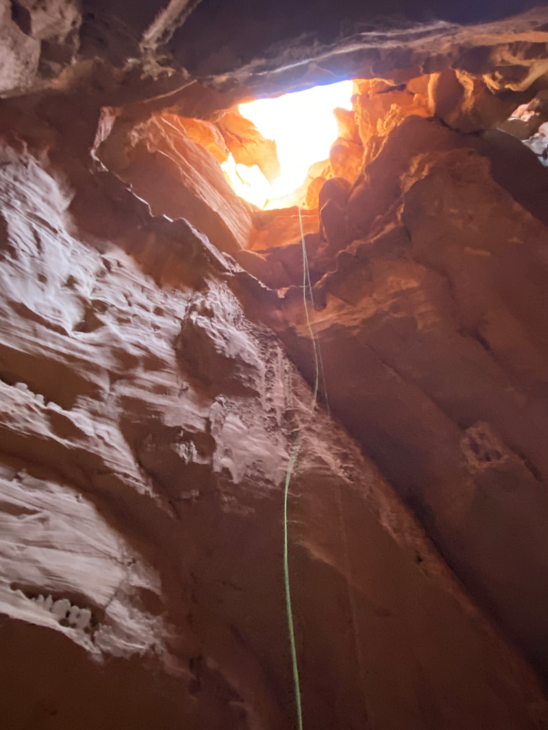
The Goblins Lair is a one way trail, requiring a rappel, Goblin Valley State Park
|
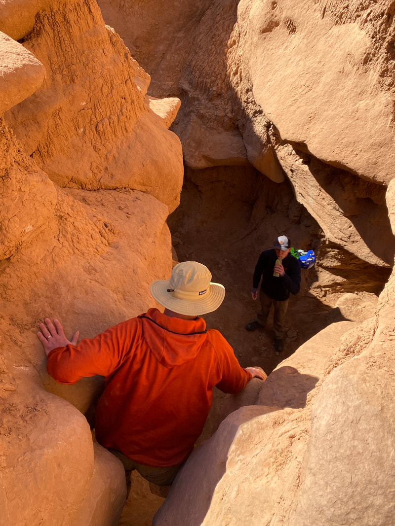
The trail down to the Goblin's Lair, Goblin Valley State Park
|
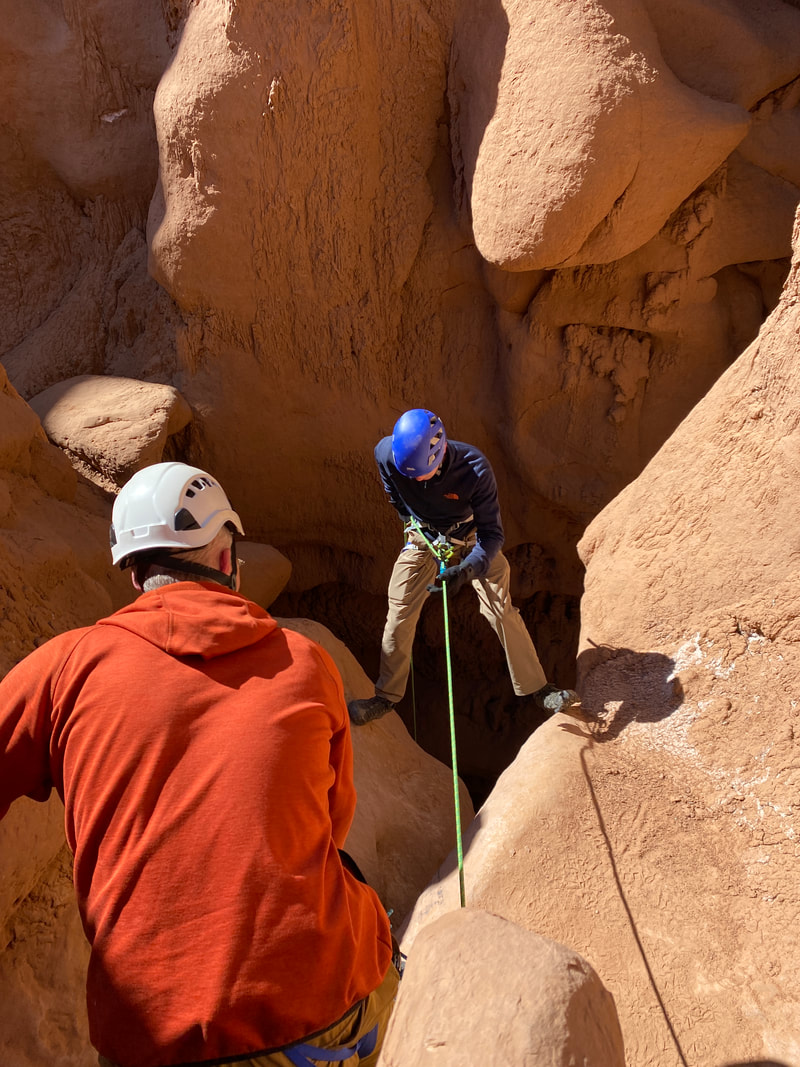
Starting the rappel into Goblins Lair, Goblin Valley State Park
|
Goblin's Lair Trail (1.5 miles one way)
As far as state parks go, Goblin Valley is very unique. It is accessed from a paved road, and is very popular even though it is relatively remote. The park has a few hiking trails, and thousands of stone hoodoos. Adventurers can walk around and climb over these hoodoos for hours, and they are the main attraction in the park, expect them to be crowed.
For those looking for a different adventure, the park has technical canyon called the Goblin’s Lair. Accessing this canyon has some unique challenges. First, you need a permit from the rangers which costs two dollars per person. The rangers also limit the number of parties in the canyon to avoid overcrowding. If a guide service has reserved the time slot, expect to wait.
From the main parking area, you will encounter the second challenge which is navigating the hoodoos. As you enter the maze of towering hoodoo, you can quickly loose your bearings and course. I am sure the locals have no problem, but for us Hoosiers it was a challenge. Simply maintain your heading and continue up into the hoodoos. The climb up was not a problem once we found the right path to scramble up.
You will know you are getting close when you start to encounter warning signs. The rappel begins as a large hole hidden among larger boulders. You will know you are at the rappel when you find the webbing which makes the rappel anchor and the 89 ft drop into the Goblin’s Lair. We found the anchor to be solid and the rappel to be an easy one. There was slight jostling with footwork in the first 5-10 feet as you descend to a flatter ledge. Once there, it begins a fun, wide-open free hang into the Lair- an enormous cave-like chamber with a flat bottom and boulder fields all around.
Once at the bottom, it was a fun scramble out to the back side of the dome the Goblin Lair is in. From here it is about a mile walk around the to the parking area through open desert and wide vistas of the Henry Mountains.
We really enjoyed this adventure and highly recommend it. If you are not up for doing it yourself, the park staff or website can direct you toward some guides who can help anyone from young children to middle age parents through this canyon.
From the bottom of the Goblin's Lair looking up, Goblin Valley State Park
|
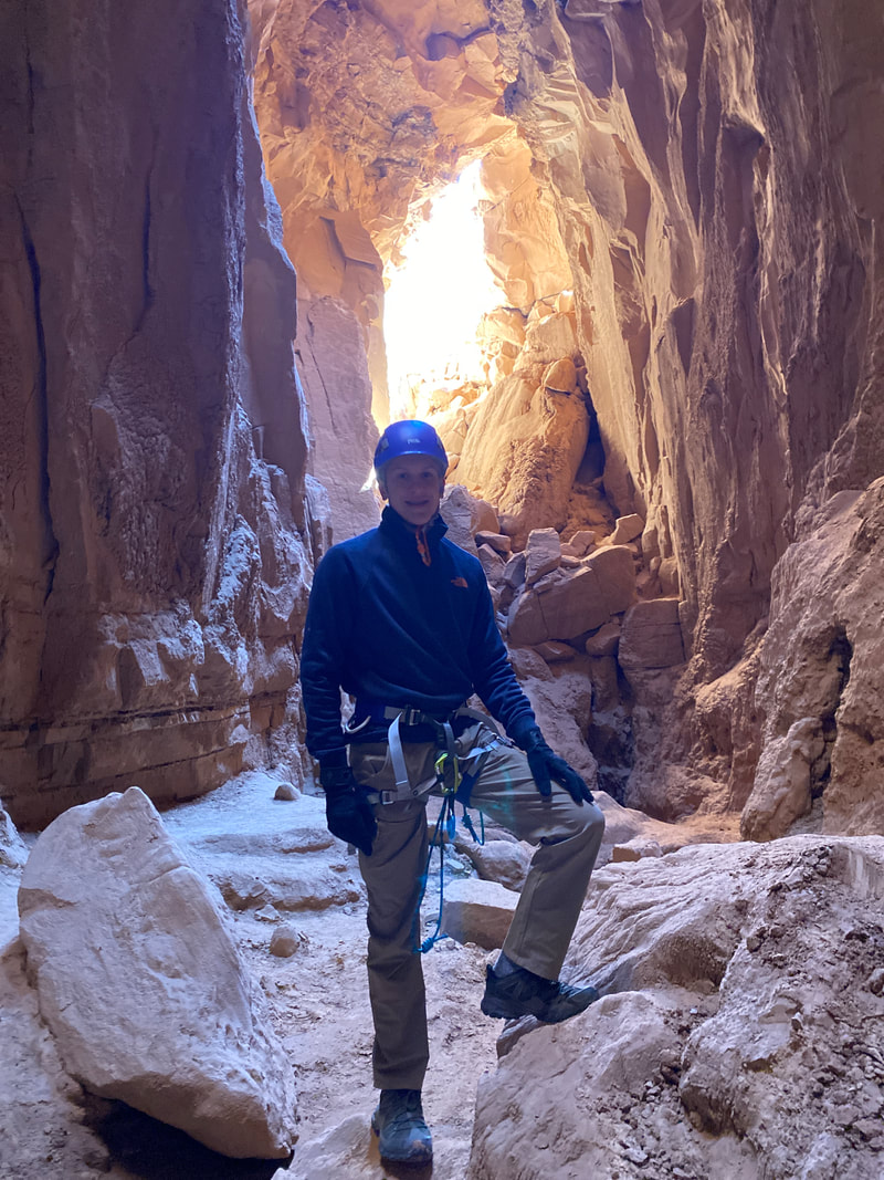
Our canyoner in the Goblin's Lair, Goblin Valley State Park
|
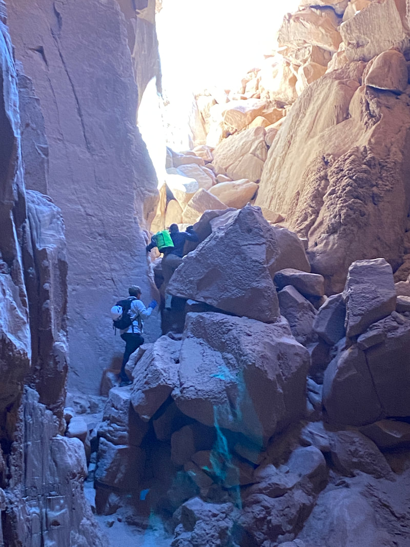
The scramble out of the Goblin's Lair, Goblin Valley State Park
|
|
|
|
Wild Horse Windows
Looking up in Wild Horse Windows, San Rafael Swell Utah
Wild Horse windows
Key Features:
- Trailhead is very close to paved road
- Relatively easy hike mostly on rock and not too steep
- Makes a nice addition to a day spent in one of the near by canyons
- Has some accessible pictographs
Key Features:
- Trailhead is very close to paved road
- Relatively easy hike mostly on rock and not too steep
- Makes a nice addition to a day spent in one of the near by canyons
- Has some accessible pictographs
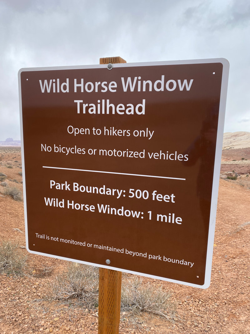
The Wild Horse Windows Trail starts in the Goblin Valley State Park
|
Walking the slick rock toward Wild Horse Windows
|
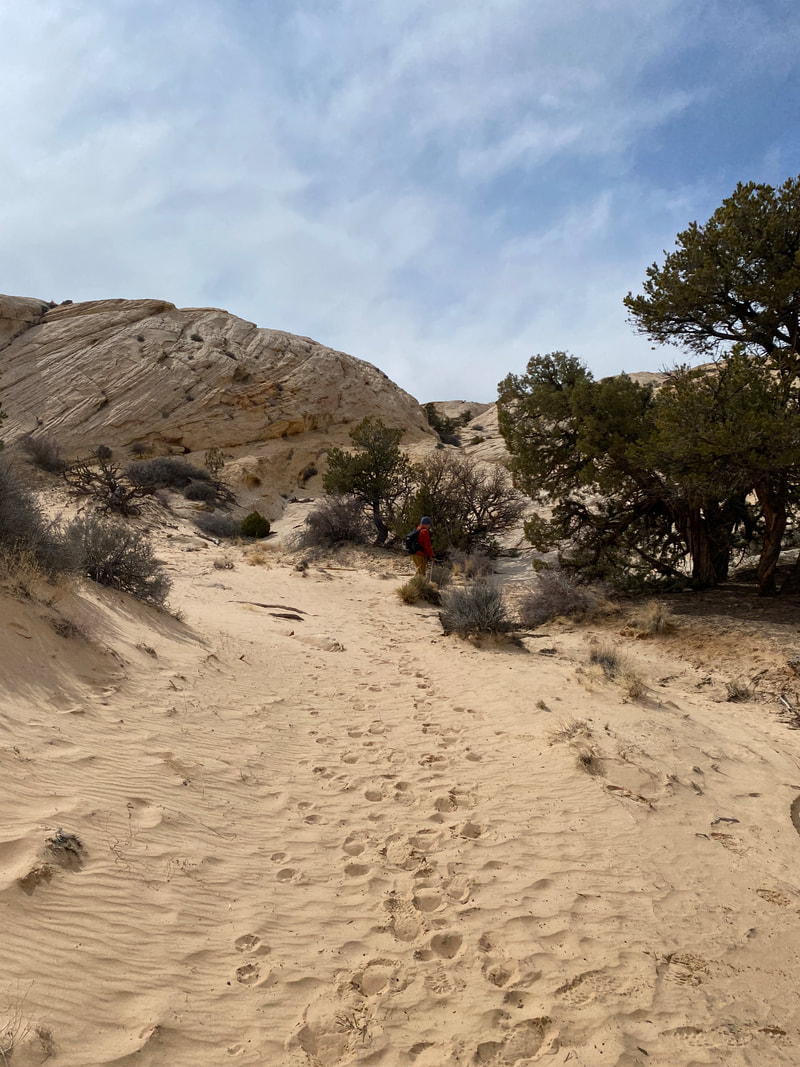
As you approach Wild Horse Windows the trail turns to sand
|
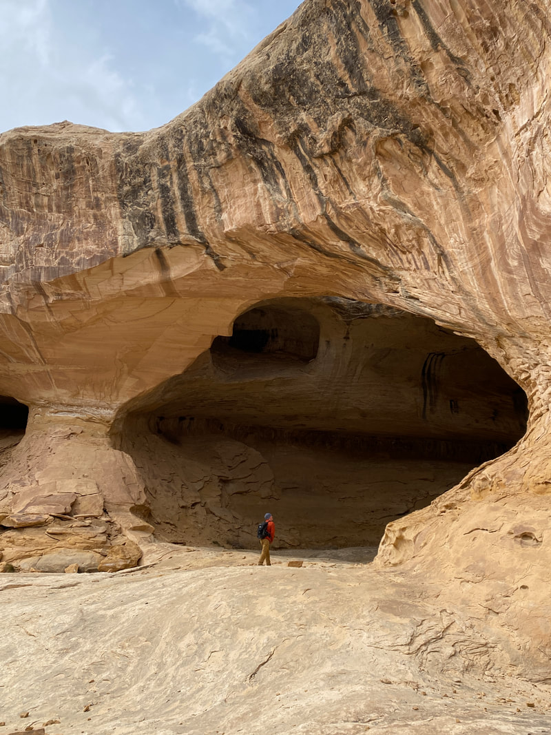
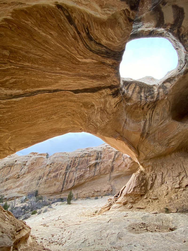
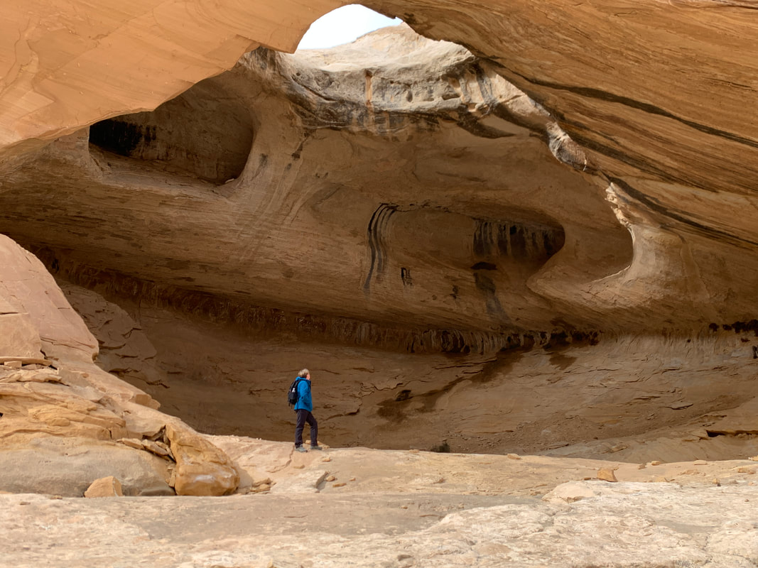
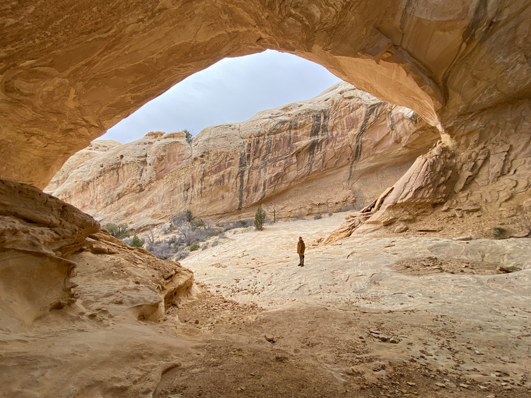
The huge alcove or arch that makes Wild Horse Windows
|
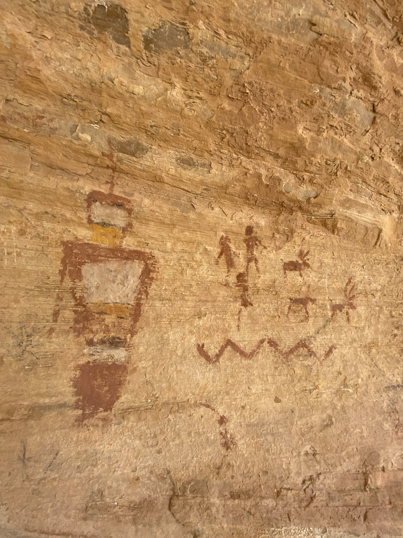
Some of the pictographs in Wild Horse Windows
|
Wild Horse Windows (1 miles)
This is a nice hike to fill an afternoon or evening after completing a longer canyon. It is very close to Goblin Valley State Park, and the trail head is just off of the paved park road which can be accessed by any vehicle in dry weather.
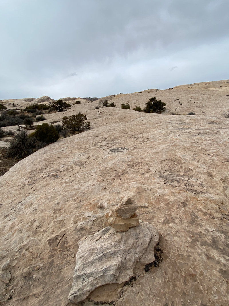
The trail head parking area is marked with a sign and the first 500 feet or so of the trail is inside the park. Follow the trail down to the wash and back up toward the swell. You will quickly find yourself working up whitish slick rock, and just trust yourself following the cairns. As you work toward the arch, you will cross a sandy area or two and if it has rained recently, you may pass a tank or two full of water. Once inside the alcove, you will notice a large hole in the roof making arch like structure. This has gone by many different names, including the Window to Heaven, Wild Horse Arch, and the Eye of Oculus. Whatever you call it, it is cool. We encourage you to check out both side of the alcove. You may also notice high on the right-hand side looking up several pictographs can be found. While you can scramble right up to these pictographs, please avoid touching these pictographs so that other can enjoy them. When you have explored the area, return to your vehicle the way you came.
The trail head parking area is marked with a sign and the first 500 feet or so of the trail is inside the park. Follow the trail down to the wash and back up toward the swell. You will quickly find yourself working up whitish slick rock, and just trust yourself following the cairns. As you work toward the arch, you will cross a sandy area or two and if it has rained recently, you may pass a tank or two full of water. Once inside the alcove, you will notice a large hole in the roof making arch like structure. This has gone by many different names, including the Window to Heaven, Wild Horse Arch, and the Eye of Oculus. Whatever you call it, it is cool. We encourage you to check out both side of the alcove. You may also notice high on the right-hand side looking up several pictographs can be found. While you can scramble right up to these pictographs, please avoid touching these pictographs so that other can enjoy them. When you have explored the area, return to your vehicle the way you came.
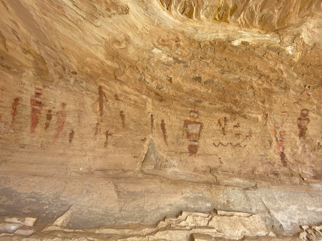
The pictograph panel in Wild Horse Windows
|
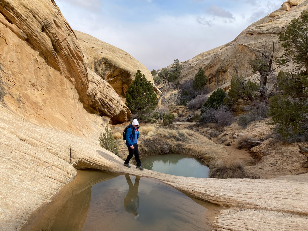
A few potholes, just below Wild Horse Windows
|
Looking out from Wild Horse Windows down the canyon
|
|
|
|
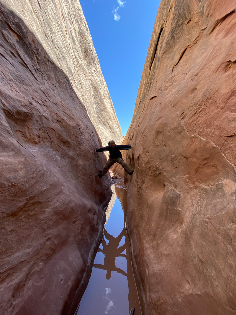
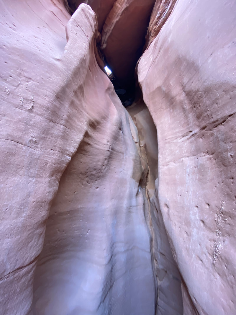
Ding and Dang Canyons
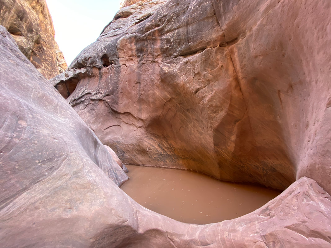
One of the many potholes full of very cold water we encounter in Ding Canyon
Ding and Dang Canyons
Key Features:
- A mile or so down the wash from Little Wild Horse Canyon
- On a dirt road that is accessible by a high clearance vehicle in good weather
- A nice canyon that is getting more popular
- Parts are more difficult that Little Wild Horse Canyon
- Water is common in Ding and Dang Canyons, expect to get wet
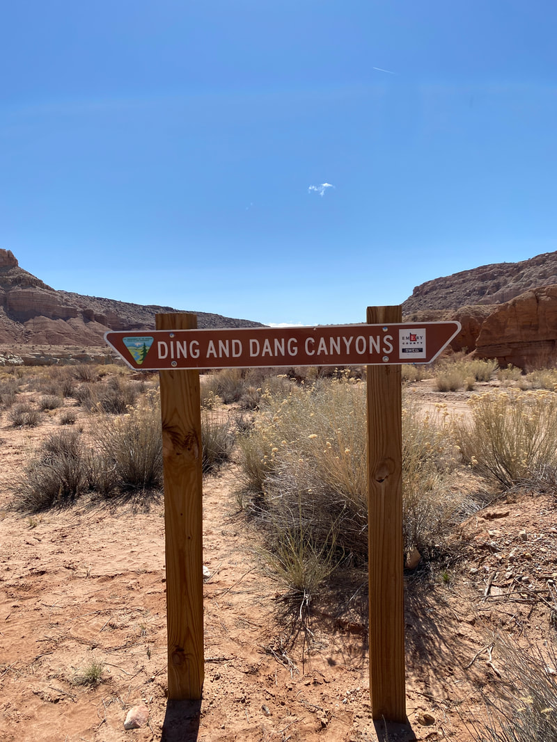
A small sign next to the wash marks the entrance to Ding and Dang canyons
|
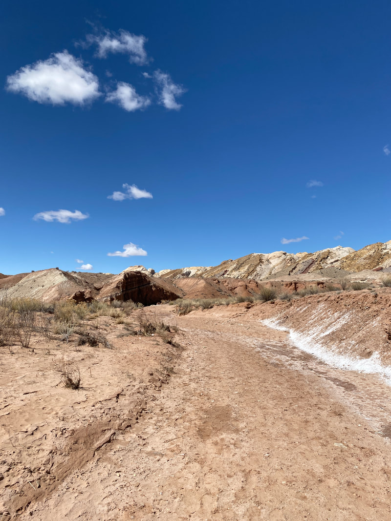
Walking the wash towards Ding and Dang canyon
|
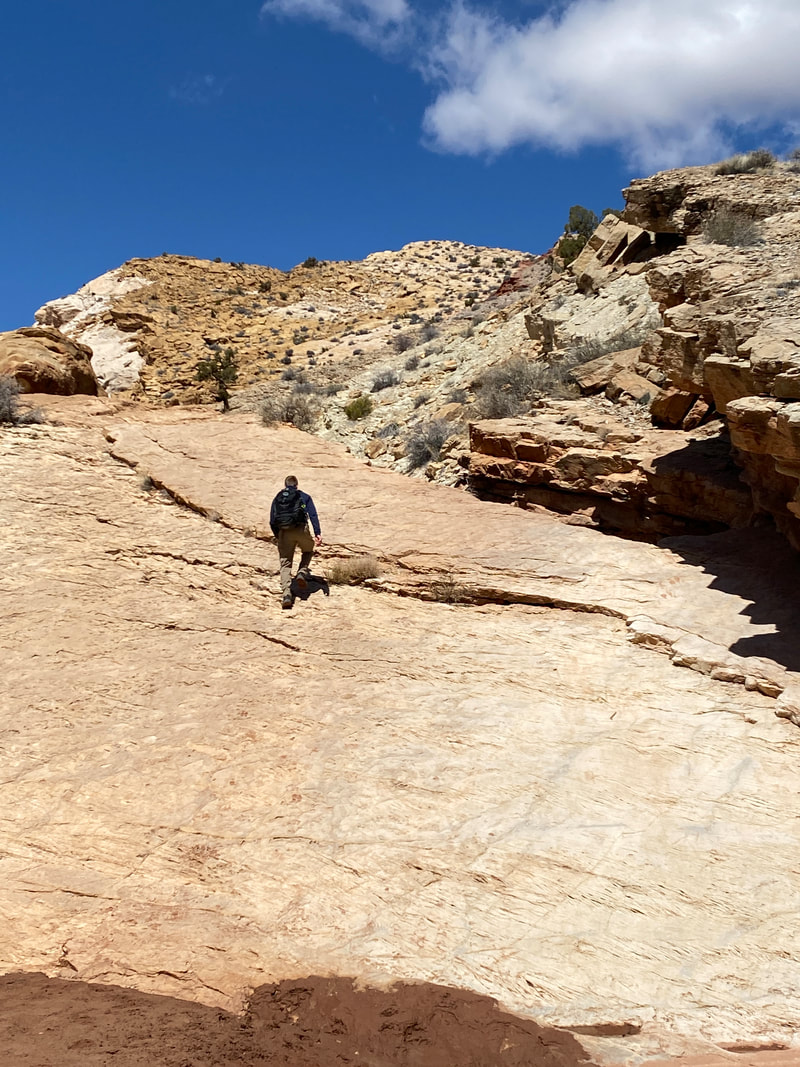
The slick rock ramp leading into Ding canyon
|
Some muddy narrows leading into the Ding Canyon slot sections
|
Trying to stem over water in Ding Canyon
|
Ding and Dang Canyon (about 7.6 miles)
Ding and Dang Canyons are both high on our list of canyons to explore in the southern swell. The trailhead is about a mile down the wash from the Little Wild Horse Canyon parking area.
We found the wash to be an easy drive in a high clearance vehicle, but be aware it is in a wash and could get very wet and muddy after a rain. From the parking area the walk up to the Ding intersection was quick and easy. If you turn to the right facing up canyon you will work through a few twists and turns before coming to a large slick rock ramp marking the entrance in to ding canyon. Once out of the wash and into the canyon, it quickly slots up. We found these slots to be full of cold water that was knee to hip deep. While you could stem over them, it was physically difficult. After this section, we encounter a series of pot holes that were even deeper. Getting cold, we turned around and decided to try out Dang Canyon. As usual, the walk down canyon was much faster than the walk up.
From the intersection of the two canyons, it is a much longer walk up to the slot section in Dang canyon. Once again, this slot was full of cold water, and after fighting through a water-filled section we decided to call it a day and return to our vehicle. Next time, we hope to have better conditions and complete the Ding Dang loop.
Entering the Dang Canyon slot section
|
Resting before stemming to the next dry spot
|
Trying to stay dry in Dang Canyon
|
|
|
|
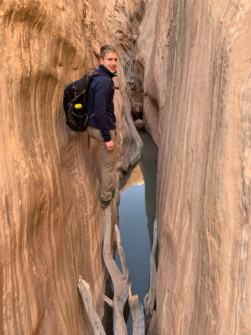
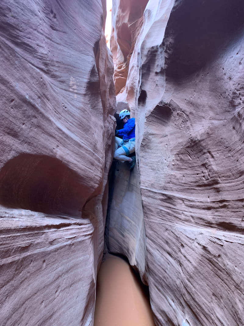
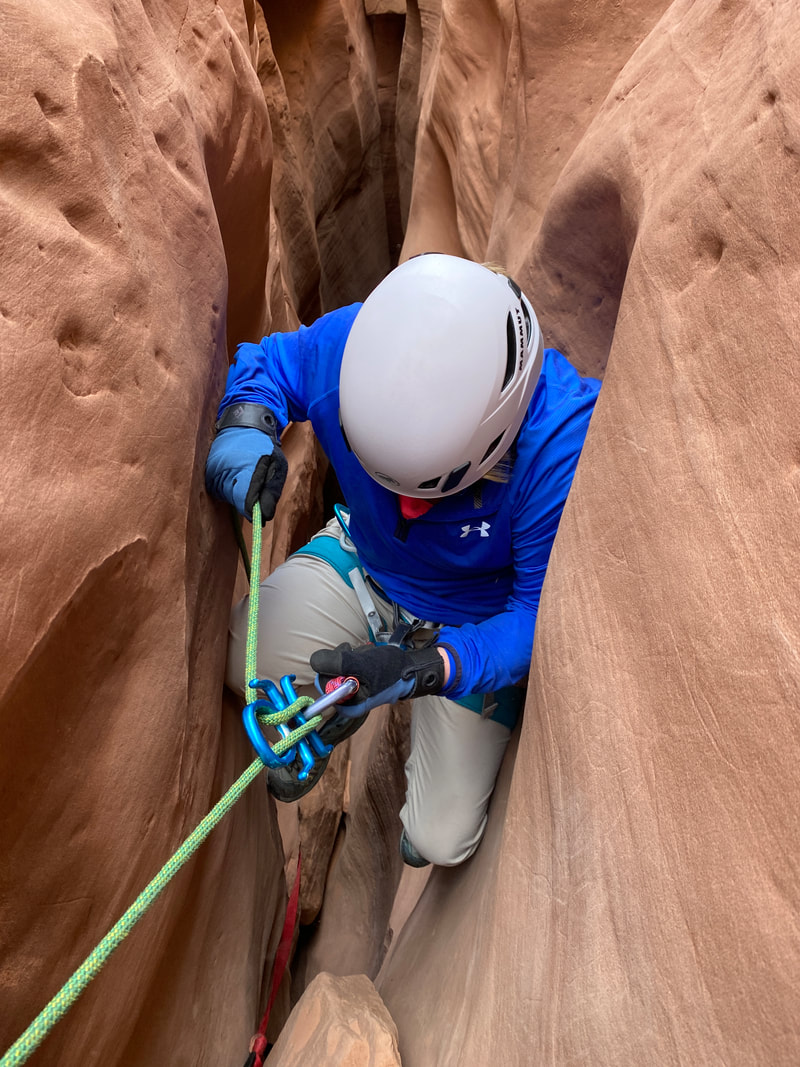
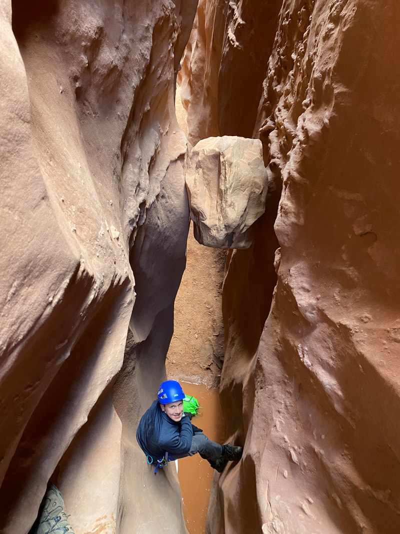
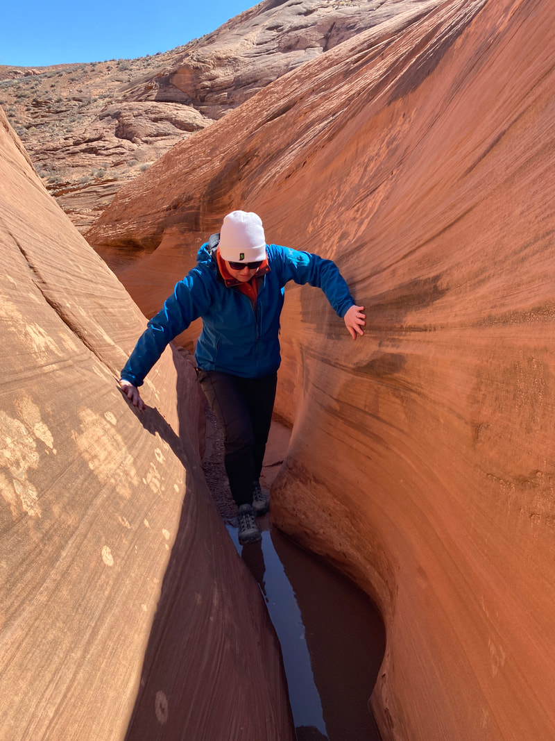
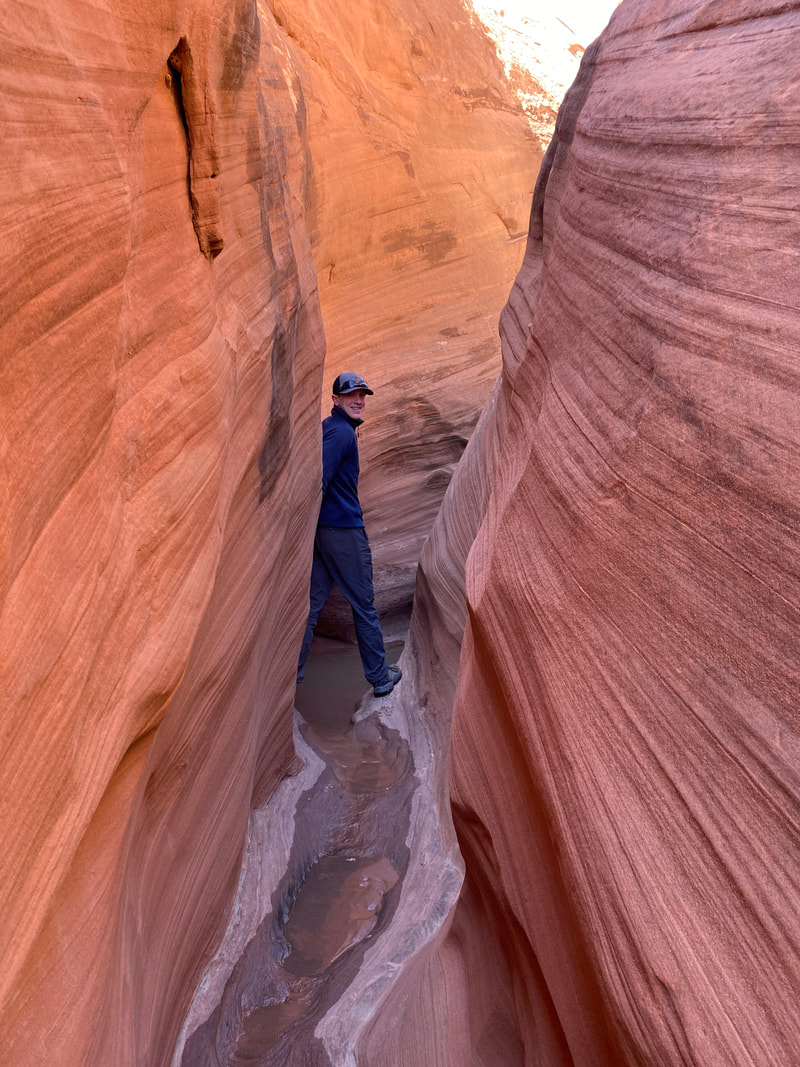
Leprechaun Canyon
A tight spot in Leprechaun Canyon, North Wash Utah
Leprechaun Canyon
Key Features:
- Easy access right off a paved road
- Very popular technical canyon
- Canyon has a reputation for several very tight area; larger canyoneers BEWARE :)
- The walk up from the bottom is an outstanding option
Key Features:
- Easy access right off a paved road
- Very popular technical canyon
- Canyon has a reputation for several very tight area; larger canyoneers BEWARE :)
- The walk up from the bottom is an outstanding option
The walk up the wash toward Leprechaun Canyon, North Wash Utah
|

The shallow canyon just before entering Leprechaun Canyon, North Wash, Utah
|
Leprechaun Canyon, North Wash, Utah
|
The entry way into the first tight section of Leprechaun Canyon, North Wash, Utah
|
The Belfast Boulevard section of Leprechaun Canyon, North Wash, Utah
|
Leprechaun Canyon (1 miles)
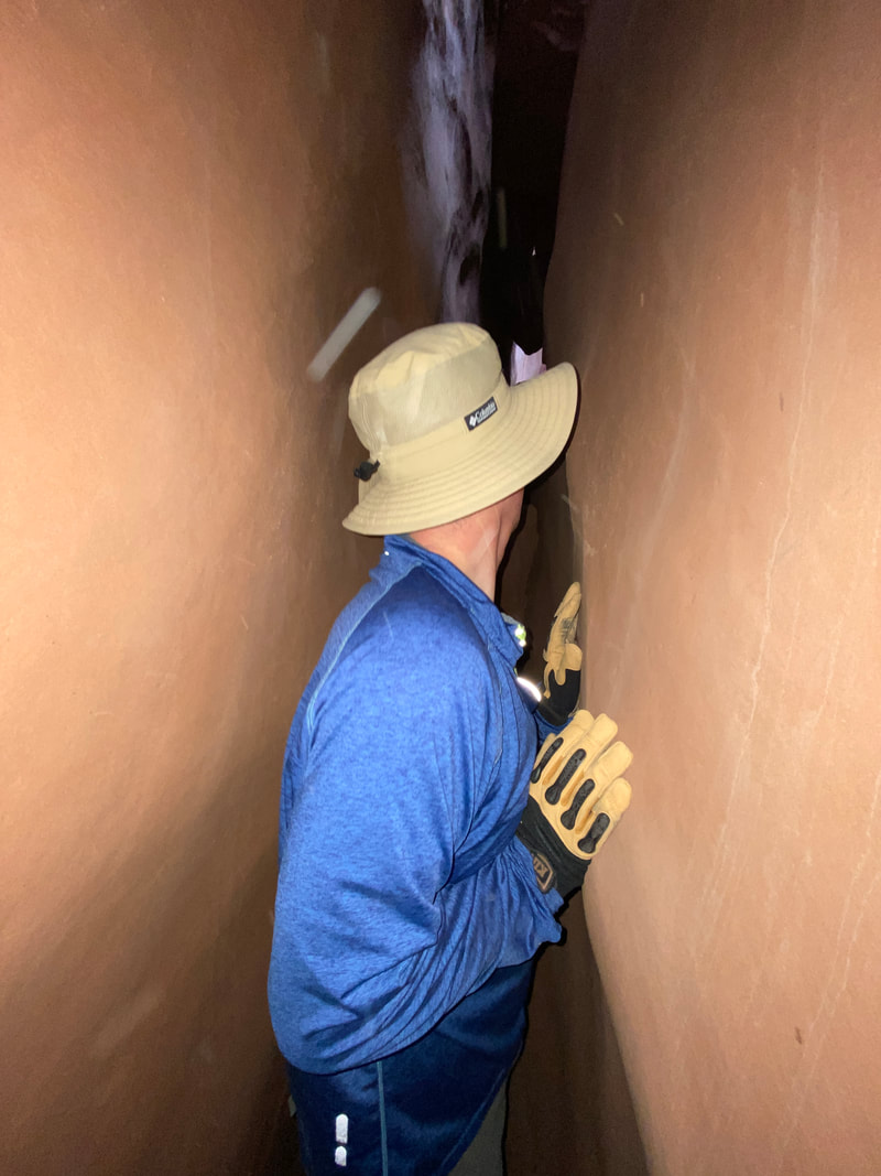
If your familiar with canyoneering or the North Wash area, you have likely heard of Leprechaun Canyon. This is a technical canyon, meaning it require ropes, rappelling, and more skill than just scrambling over rocks. Basically, you can get yourself hurt or trapped in this canyon if you don’t know what you’re doing. That said, it is very popular, both with adventures and guiding outfits. The canyon is also known for being tight, those with a waist larger than 32 inches may find spots difficult, especially within the middle fork. However, if you’re not that skilled or you’re a little bit of a larger person, you can still see some great parts of this canyon by walking the bottom up. This will allow you to avoid the technical portions and go until it gets too tight for you. This is how we hiked Leprechaun Canyon.
The parking area is just North of the Sandthrax BLM camping area, and right on Highway 95. The approach is through a reedy creek bed, which I could image being very grown up in the summer time. After a 20-minute walk to the canyon, we encountered a narrow slot section, that was only 7-8 feet deep. This section of slots is photogenic and somewhat twisted. It gets narrow too; it is a good place to see what a tight slot canyon feels like with out getting miles back in a dark canyon. If you find you aren’t up for that challenge, it can be avoided by walking the slick rock to the right of this looking up canyon.
After this section of slot, you encounter a deep wide canyon with brilliant reddish-orange wall reaching high above you. The scale is simply massive and is one of the most photogenic portions of the canyon. The canyon is wide and easy to walk in at this point.
As you continue further up canyon, it will gradually get narrower until coming to a feature call Belfast Boulevard. This is a long, dark section of slot canyon that gets narrow, but not so much you need to turn your shoulder and shuffle sideways. The footing is easy, and while it is tight, it is a simple walk. Hike to your comfort level here, if it is too tight, or you’re uncomfortable, you always have the option to reverse course. Adventurous types may walk it all the way to the intersection of the middle and left forks. Most turn around here.
Scrambling another 30 feet up the left fork, you quickly run into an impassible pour off. If you want you can continue up the middle fork, it will get much tighter and more challenging. We followed the middle fork past this intersection through a twist or two and found a section that required everyone in our family to shuffle sideways, even our 130 pound 14 year old. This area can feel extremely claustrophobic due to the awkward footwork, dark depths, and inability to see how far it continues. We continued down these another 100 feet or so and climbed under and over a couple of choke stones that required delicate maneuvering leading us to another rubble-filled opening with a drop off into another tight slot section. This is where we turned around. The slot sloped and curved upward with an extremely tight foot space and appeared to require chimneying or stemming- at height -to clear an ill placed choke stone. It would have required very tricky, tight maneuvering with no “out” if you got in a bind. One misstep would send you sliding into the bottom of the slot’s funnel, where you would be stuck without the ability to turn your shoulders for leverage.
The hike back out was just as fun as the hike in, and maybe a little easier knowing the obstacles we would have to work around. No mater what your skill level, we recommend walking up Leprechaun Canyon as far as you feel you. It is a beautiful canyon and a nice challenge.
Intersection of the middle and East Forks of Leprechaun Canyon, North Wash, Utah
|
A tight section of Middle fork of Leprechaun Canyon, North Wash, Utah
|
Chock stones in the Middle fork or Leprechaun Canyon, North Wash, Utah
|
|
|
|
Blarney Canyon
Down climbing in the West Fork of Blarney Canyon, North Wash, Utah
Blarney Canyon
Key Features:
- Easy access off a paved road
- Fun approach, walking up massive slick rock dome to trail on ridge
- Great beginner canyon
- East Fork is little easier, West Fork a little harder
-Straight forward rappels, and down climbs
Key Features:
- Easy access off a paved road
- Fun approach, walking up massive slick rock dome to trail on ridge
- Great beginner canyon
- East Fork is little easier, West Fork a little harder
-Straight forward rappels, and down climbs
First rappel in the East Fork of Blarney, North Wash, Utah
|
First down climb in the East Fork of Blarney Canyon, North Wash, Utah
|
Second rappel in East Fork of Blarney Canyon, North Wash, Utah
|
Navigating slots in the East Fork of Blarney Canyon, North Wash, Utah
|
Downclimbing in the East Fork of Blarney, North Wash, Utah
|
Blarney Canyon ( about 5 miles)
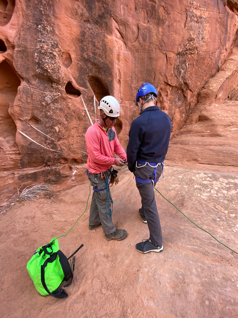
Blarney is a technical canyon, meaning it require ropes, rappelling, and more skill than just scrambling over rocks. Basically, you can get yourself hurt or trapped in this canyon if you don’t know what you’re doing. That said, it is one of the easier technical canyons and a great one for beginners. Overall, Blarney offers a lot of challenges in back to back fashion that makes it a mental and physical bang for your buck day.
Blarney can be split into an east and west fork, the east is a little easier and little less scenic, the west a little harder, a little more scenic, and for us, a little wetter. Blarney can be done as 2 half days or one long day. You will have to repeat the climb up (a 45 minute hike up the slick rock), but it would be a big day of adventuring.
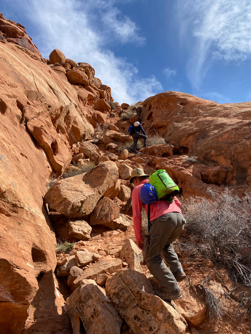
Blarney is just north of the Leprechaun parking area and is also right of Hwy 95. The approach to do the canyon is fun, too. From the parking area, you cross the wash and begin up a huge slick rock dome, the route is steep, but you never need your hand for balance or traction. There were no cairns when we hiked this area, we just keep going up to the highest point on the dome. Be sure to turn around and enjoy the views too, the Henry Mountains looked awesome in the distance.
Eventually, you will leave slick rock and come to a rocky trail; follow it a little higher still and around to the forks of Blarney. It sounds vague as a trail route, but we found this was exactly correct and intuitive to just continue to climb up the dome until it tops out.
As you top out the dome and begin a slight downhill portion, you will encounter the West Fork first. This is the slightly harder fork. There was a rappel station step up right at the top, but this was an optional rappel, as you could down climb near by if you wanted to. Once down this 15-20 ft drop, we immediately came to the main rappel, which was about 40 ft down to the canyon floor. A short walk led us to the start of the slot canyon section and a small hole to drop down to our first real down climb. We had no problem other than some anxiety about not being able to see the down climb at first, but in the big picture it was fairly easy for us. Many of the downclimbs require working over a chockstone (awkwardly), then positioning yourself to downclimb by chimneying little by little to the canyon floor. Several websites mentioned some rappel here, but it was not a bad down climb.
Once in the slot proper it was a mix of down climbing, scrambling and walking. Several areas got narrow, but nothing that would be a problem. We never had to stem over any narrow sections, and could stay on the canyon floor the whole time. We eventually encountered another rappelling anchor and a few feet further a 40-50 foot drop in the canyon. We setup a rappel from this anchor and slid into place for a rappel. It was not the easiest or most graceful rappel due to the nature of the canyon and tighter space. The rope was more of an assist while carefully downclimbing. After getting to the bottom it was clear an experienced cannoneer could probably down climb this obstacle if applying the correct pressure in tricky spots, but we think a rappel is probably the better option for most people.
On past this obstacle we encountered what we would have consider the most difficult section of the canyon. This was a series of 6-10 foot down climbs, some of which had a little overhang to them due to choke stones, and they all ended into a brown pool of water. After negotiating several of these down climbs, the canyon became an easy walk to the intersection of the East and West fork. A short walk from here lead to one more nice section of easy slot and the walk in the wash back to the parking area.
Blarney can be split into an east and west fork, the east is a little easier and little less scenic, the west a little harder, a little more scenic, and for us, a little wetter. Blarney can be done as 2 half days or one long day. You will have to repeat the climb up (a 45 minute hike up the slick rock), but it would be a big day of adventuring.
Blarney is just north of the Leprechaun parking area and is also right of Hwy 95. The approach to do the canyon is fun, too. From the parking area, you cross the wash and begin up a huge slick rock dome, the route is steep, but you never need your hand for balance or traction. There were no cairns when we hiked this area, we just keep going up to the highest point on the dome. Be sure to turn around and enjoy the views too, the Henry Mountains looked awesome in the distance.
Eventually, you will leave slick rock and come to a rocky trail; follow it a little higher still and around to the forks of Blarney. It sounds vague as a trail route, but we found this was exactly correct and intuitive to just continue to climb up the dome until it tops out.
As you top out the dome and begin a slight downhill portion, you will encounter the West Fork first. This is the slightly harder fork. There was a rappel station step up right at the top, but this was an optional rappel, as you could down climb near by if you wanted to. Once down this 15-20 ft drop, we immediately came to the main rappel, which was about 40 ft down to the canyon floor. A short walk led us to the start of the slot canyon section and a small hole to drop down to our first real down climb. We had no problem other than some anxiety about not being able to see the down climb at first, but in the big picture it was fairly easy for us. Many of the downclimbs require working over a chockstone (awkwardly), then positioning yourself to downclimb by chimneying little by little to the canyon floor. Several websites mentioned some rappel here, but it was not a bad down climb.
Once in the slot proper it was a mix of down climbing, scrambling and walking. Several areas got narrow, but nothing that would be a problem. We never had to stem over any narrow sections, and could stay on the canyon floor the whole time. We eventually encountered another rappelling anchor and a few feet further a 40-50 foot drop in the canyon. We setup a rappel from this anchor and slid into place for a rappel. It was not the easiest or most graceful rappel due to the nature of the canyon and tighter space. The rope was more of an assist while carefully downclimbing. After getting to the bottom it was clear an experienced cannoneer could probably down climb this obstacle if applying the correct pressure in tricky spots, but we think a rappel is probably the better option for most people.
On past this obstacle we encountered what we would have consider the most difficult section of the canyon. This was a series of 6-10 foot down climbs, some of which had a little overhang to them due to choke stones, and they all ended into a brown pool of water. After negotiating several of these down climbs, the canyon became an easy walk to the intersection of the East and West fork. A short walk from here lead to one more nice section of easy slot and the walk in the wash back to the parking area.
The drop into the West Fork of Blarney Canyon, North Wash, Utah
|

Down climbing in the West Fork of Blarney Canyon, North Wash, Utah
|
Scrambling down an obstacle in the West Fork of Blarney Canyon, North Wash, Utah
|
Crawling under a huge choke stone, West Fork of Blarney Canyon, North Wash, Utah
|
If you walk around the head of the West Fork, about 10 minutes further, you will come to the East Fork of Blarney. This is the easier of the two forks. The rappel down was the nicest and easiest of the whole trip. A short walk leads to an easier down climb or slide on the sculped canyon floor. The canyon was scenic and slots and down climbs were a fun challenge- enough excitement, but nothing overwhelming. We encounter a little water at the start of the canyon, but were able to stay dry the whole time.
When we reached the second rappel we were feeling confident and everyone elected to down climb and we had no problem. We continued to scramble scoot and slide through the rest of the canyon with not problems, but did wear holes in our backpacking pants in the process. (Tip: Don’t wear your best clothes in the tight slots of the North Wash.)
When we reached the second rappel we were feeling confident and everyone elected to down climb and we had no problem. We continued to scramble scoot and slide through the rest of the canyon with not problems, but did wear holes in our backpacking pants in the process. (Tip: Don’t wear your best clothes in the tight slots of the North Wash.)
Walking the slick rock up the start of Blarney Canyon, North Wash, Utah
|
Walking the trail toward the head of Blarney Canyon, North Wash, Utah
|
Great views of the Henry Mountains on the approach to Blarney Canyon, North Wash, Utah
|
|
|
|
Lucky Charms Canyon
Encountering wet slots in Lucky Charms Canyon, North Wash
Lucky Charm Canyon
Key Features:
- Accessed from Hwy 95
- Short canyon with an quick approach
- Good way to fill and afternoon or evening
- Some tighter sections and a little climbing at the end
- Canyon had a surprising amount ankle to knee deep water in it
Key Features:
- Accessed from Hwy 95
- Short canyon with an quick approach
- Good way to fill and afternoon or evening
- Some tighter sections and a little climbing at the end
- Canyon had a surprising amount ankle to knee deep water in it
Wading up Lucky Charms Canyon, North Wash, Utah
|
An interesting rock bottom section of Luck Charms Canyon, North Wash, Utah
|
Sliding under a choke stone in Luck Charms Canyon, North Wash, Utah
|
Luck Charms, slot section from above, North Wash, Utah
|
Looking up a pour off in Luck Charms Canyon, North Wash, Utah
|
Lucky Charms Canyon (about 1 mile)
Lucky Charms Canyon was not on our radar when we started exploring the North Wash area, but after moving through the canyons we planned on visiting faster than we anticipated, we found ourselves with an afternoon to explore another canyon. Lucky Charms was that canyon.
This canyon is accessed by pulling right off of Hwy 95 just past the Bullfrog intersection (276). From the pull off we walked up a sandy wash and around the bend and found a baby slot canyon, it was not very deep and had a rather large “V” shape, but as we followed it up it began to get deeper until it finally became a slot. We ended up wading through ankle to knee deep water in the canyon because it was too much effort to stem long sections of the canyon, (maybe our technique is not that great, or maybe the walls were a little too vertical for our wet shoes.) Either way, we got wet in this canyon. Luckily the water was cool and not cold. We really enjoyed a short section in which the canyon walls and floor was one solid rock, this area was easy going. As far a being a tight canyon, it had a few tight spots, and one particular choke stone near a short drop with water in it that was particularly tight, but overall not too bad. After a section of decent slots, the canyon widens in to a “V” shape again with a narrow bottom that rapidly widens. After walking this section for a few minutes, we came to a large pour off. It would be a challenge to climb up this, but it might be doable for an expert. If you back track about a minute, you will encounter some slick rock. On the right looking up canyon, you can walk up and get around the pour off. After studying this pour off from the top and bottom, it looked like a fun down climb. When we visit next we will bring a rope and harness just in case and try climbing down this obstacle. From the pour off the canyon widens and for a minute or two then narrows to 5-8 feet wide as you scramble over rocks to a climb out of the canyon. We are not climbers at all, but it looked like once you got past the first 4-6 feet of climbing it would be easy the rest of the way up. This is where we turned around. As usual, the hike out seemed much quicker than the hike in and we were back to our vehicle in no time and off to Hanksville for dinner.
This canyon is accessed by pulling right off of Hwy 95 just past the Bullfrog intersection (276). From the pull off we walked up a sandy wash and around the bend and found a baby slot canyon, it was not very deep and had a rather large “V” shape, but as we followed it up it began to get deeper until it finally became a slot. We ended up wading through ankle to knee deep water in the canyon because it was too much effort to stem long sections of the canyon, (maybe our technique is not that great, or maybe the walls were a little too vertical for our wet shoes.) Either way, we got wet in this canyon. Luckily the water was cool and not cold. We really enjoyed a short section in which the canyon walls and floor was one solid rock, this area was easy going. As far a being a tight canyon, it had a few tight spots, and one particular choke stone near a short drop with water in it that was particularly tight, but overall not too bad. After a section of decent slots, the canyon widens in to a “V” shape again with a narrow bottom that rapidly widens. After walking this section for a few minutes, we came to a large pour off. It would be a challenge to climb up this, but it might be doable for an expert. If you back track about a minute, you will encounter some slick rock. On the right looking up canyon, you can walk up and get around the pour off. After studying this pour off from the top and bottom, it looked like a fun down climb. When we visit next we will bring a rope and harness just in case and try climbing down this obstacle. From the pour off the canyon widens and for a minute or two then narrows to 5-8 feet wide as you scramble over rocks to a climb out of the canyon. We are not climbers at all, but it looked like once you got past the first 4-6 feet of climbing it would be easy the rest of the way up. This is where we turned around. As usual, the hike out seemed much quicker than the hike in and we were back to our vehicle in no time and off to Hanksville for dinner.
Looking down the pour off in Luck Charms Canyon, North Wash, Utah
|

The climb up to the ridge, above Luck Charms Canyon, North Wash, Utah
|
Looking out Lucky Charms Canyon, North Wash, Utah
|
|
|
|
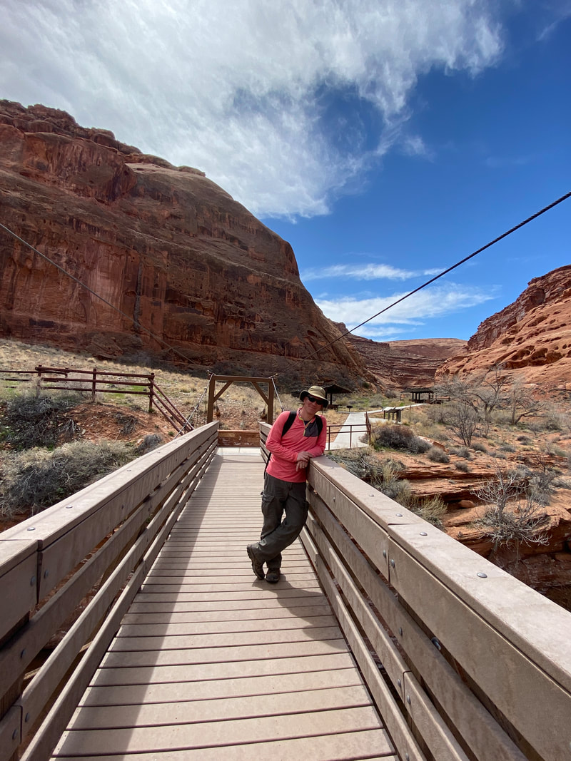
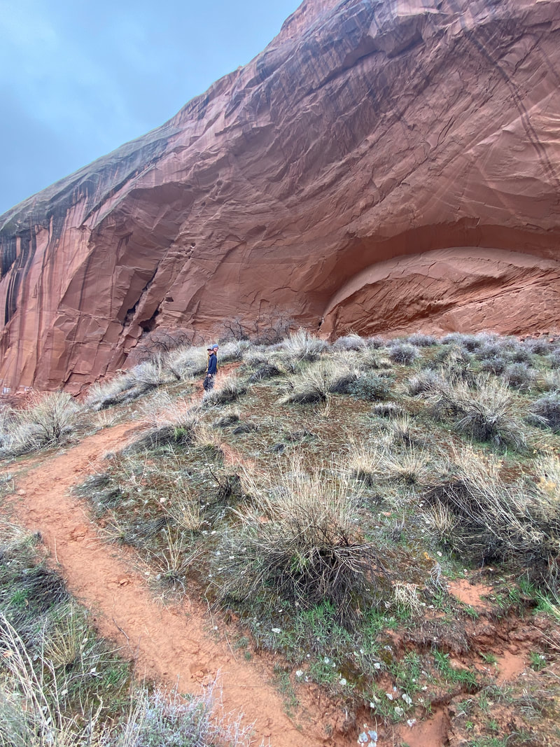
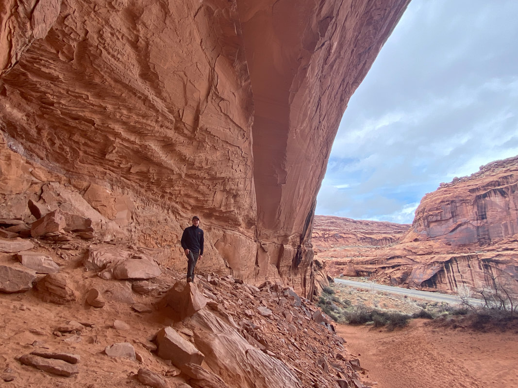
Hog Springs Rest Area
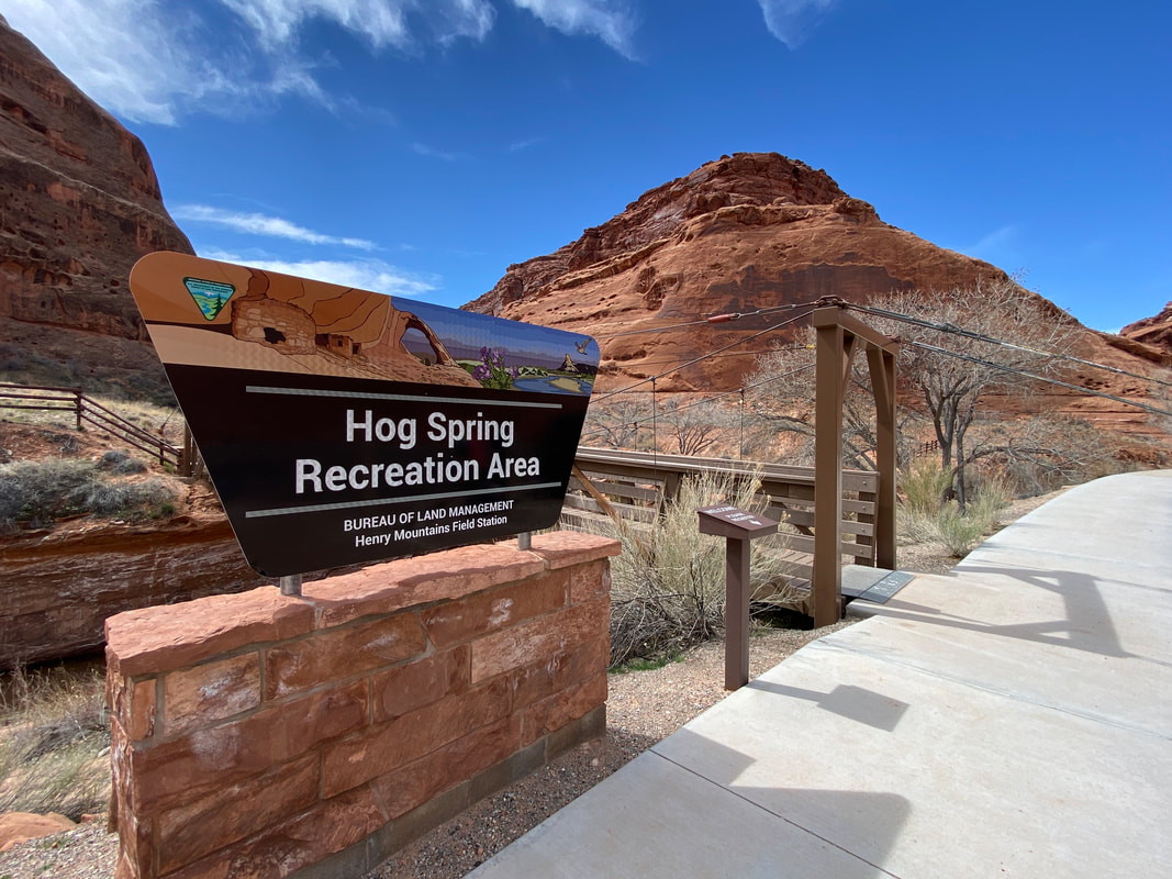
Hog Spring Recreation Area, North Wash, Utah
Hog Springs Rest Area
Key Features:
- Right off Hwy 95, easy access
- Nice picnic area, and hick up the creek toward Hog Springs
- Petroglyphs are hidden across the Hwy
- The famous Moqui Queen pictograph is in an alcove just a short walk from the parking area
- Had the cleanest and nicest pit toilets ever
Key Features:
- Right off Hwy 95, easy access
- Nice picnic area, and hick up the creek toward Hog Springs
- Petroglyphs are hidden across the Hwy
- The famous Moqui Queen pictograph is in an alcove just a short walk from the parking area
- Had the cleanest and nicest pit toilets ever
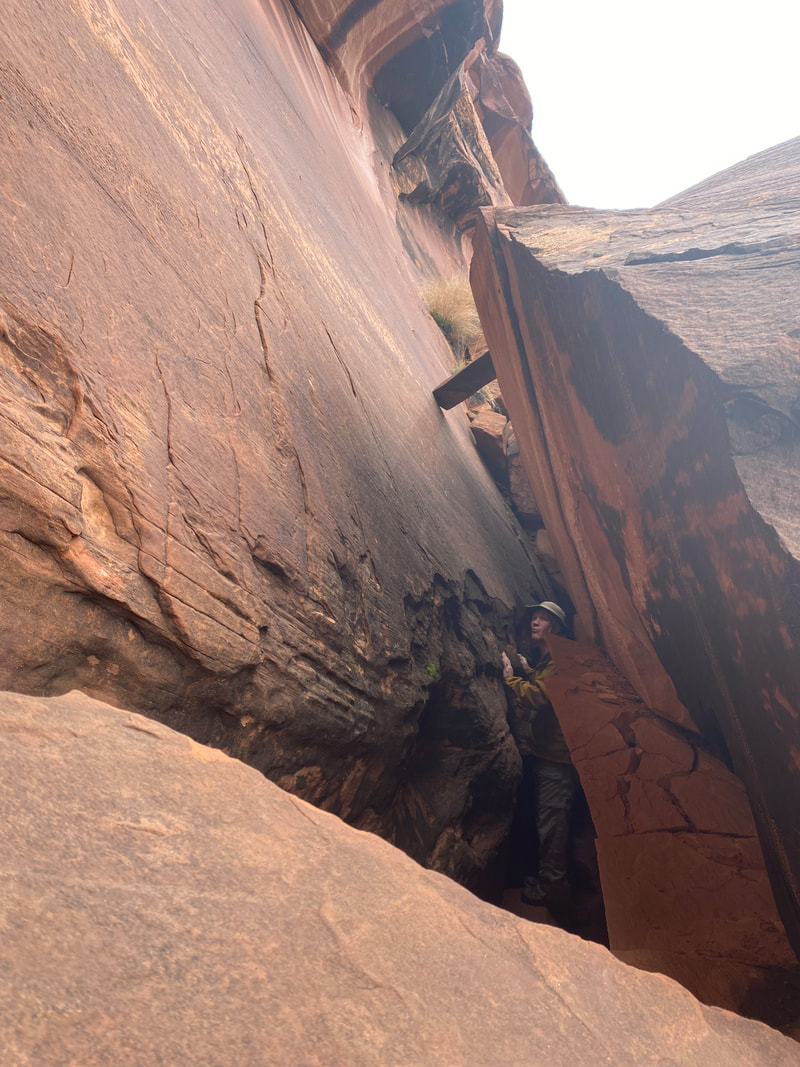
Checking out the hidden petroglyphs across Hwy 95, Hog Springs, North Wash, Utah
|
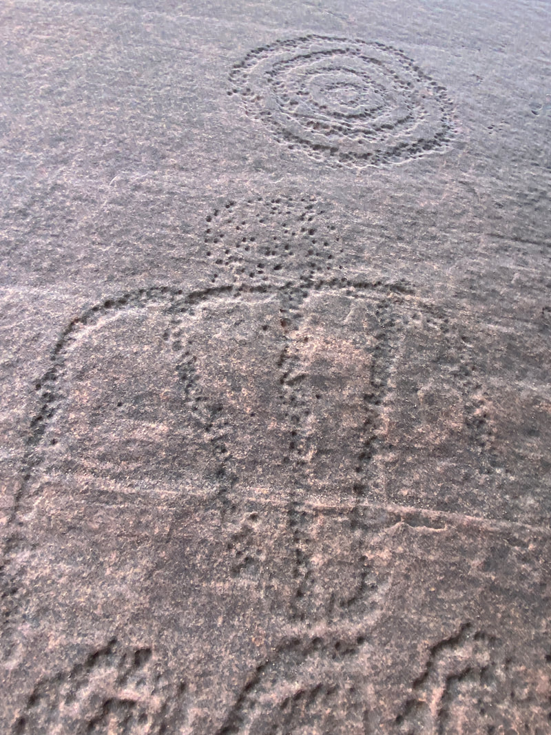
Interesting petroglyphs at Hog Spring Recreation Area, North Wash, Utah
|
The trail to the petroglyphs is easily marked, Hog Spring Recreation Area, North Wash, Utah
|
The Moqui Queen, Hog Spring Recreation Area, North Wash, Utah
|
The canyon creek at Hog Spring Recreation Area, North Wash, Utah
|
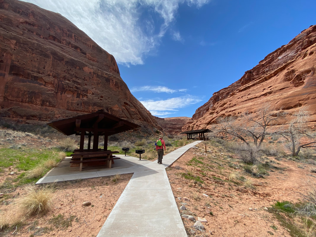
Hog Springs Rest Area (1 mile)
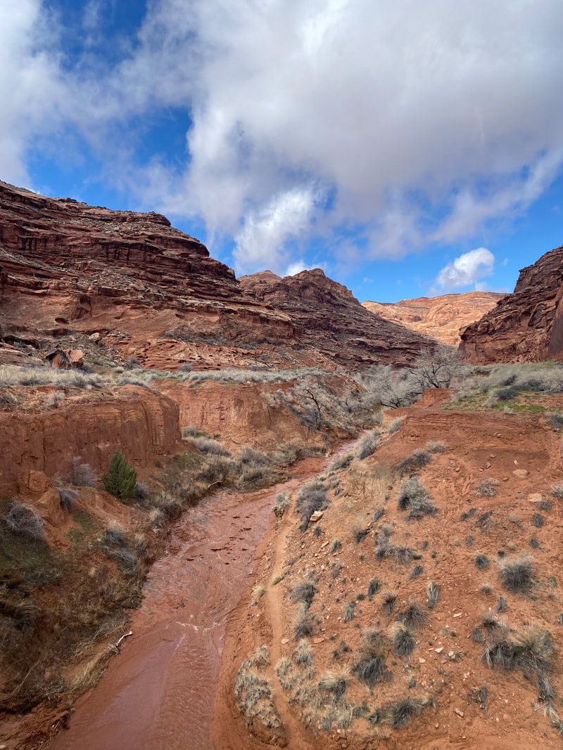
With a chance of rain in the forecast and some clouds on the horizon we elected to stay out of slot canyons this morning, so we stopped by the Hog Spring Rest Area to walk the creek up to the spring.
We found the rest area and picnic area to be really nice and clean. In fact, it had the nicest, cleanest pit toilet we had ever seen. The bridge over the creek was fun, too. We attempted the hike up to the spring keeping a close eye on the sky. Even though it was not a slot canyon, we did not want to be in the wash during a heavy rain. We followed the social tail in and out of the creek bed for about 30 minutes making progress toward the springs. The trail was a little muddy and the creek had about 4 inches of water in it. The flowers and plants along the creek had swollen buds and looking like leaves might burst out in the next week or less. I can imagine in the summer, this a cooler, green oasis in the North Wash. With the sky getting darker and with no way to progress further upstream without getting our boots wet, we turned around to head back to the picnic area. Once we returned to the first creek crossing by the picnic area, we found the rocks we used as stepping stones to cross the creek were now under water. In our 45 minute walk the creek had doubled in depth. It was time to get out of the wash.
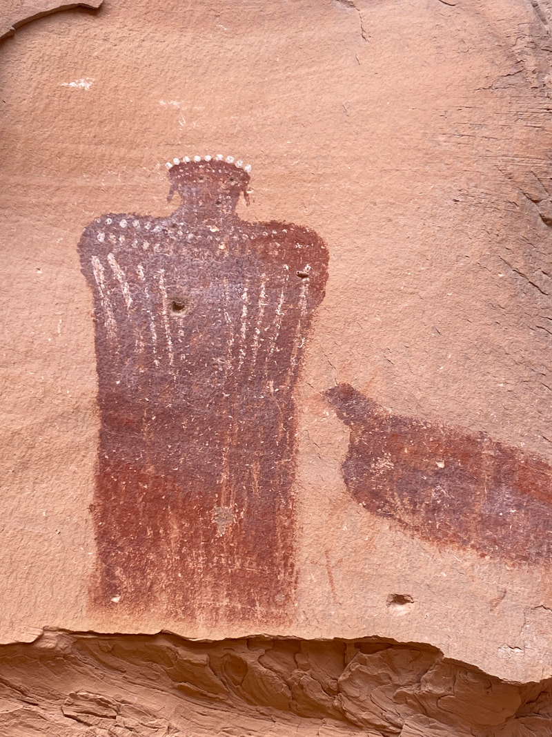
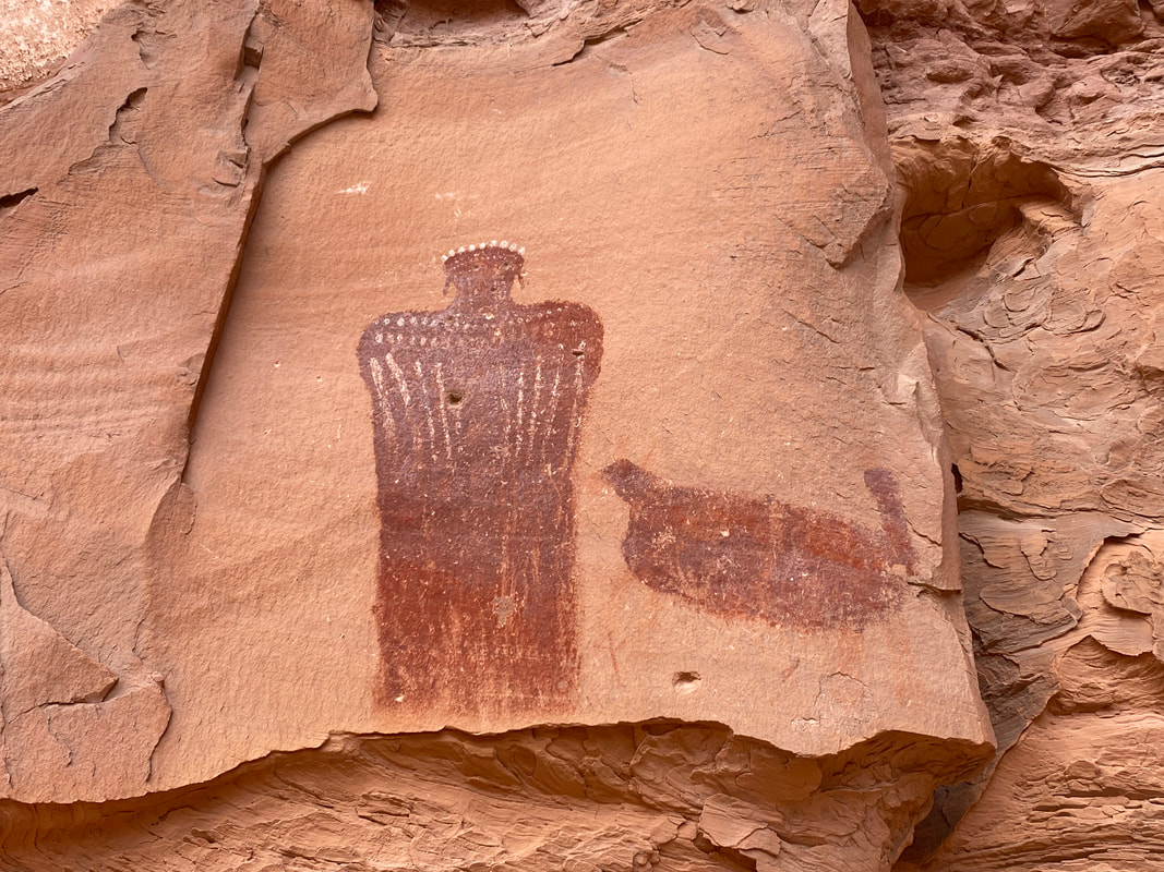
Across the street from the rest rooms we found a few petroglyphs about 7 feet up on a rock wall behind a large leaning boulder. It took a few minutes to find them; be sure to look up and don’t be afraid to walk behind the boulder.
Just a few tenths of a mile south down Hwy 95 is an even more popular pictograph called the Moqui Queen, if you have good vision and a little luck you might even be able to barely spot this from the highway. Many people walk south from the parking area, find a creek crossing, and follow the trail up into the large alcove. From here the Moqui Queen is hard to miss. If you want you can even walk up the rubble to stand just underneath this large pictograph. If you are in the area, it is worth the ten minutes to check out, but I would not make a trip just to see the rock art, but then again, we are more into the physical challenge of the canyons than the historical artifacts.
Large alcove with petroglyphs Hog Spring Recreational Area, North Wash, Utah
|
The Moqui Queen, Hog Spring Recreational Area, North Wash, Utah
|
Very well maintained rest area and picnic area Hog Spring Recreational Area, North Wash, Utah
|
|
|
|
Hogwarts Canyon
The last rappel in Hogwarts Canyon, North Wash, Utah
Hogwarts Canyon
Key Features:
- On paved section of Notom Road
- Many campsite to choose from
- Popular and fill up quickly
- You may have to work to find a secluded site
- Can backpack in or camp from the back of your vehicle
Key Features:
- On paved section of Notom Road
- Many campsite to choose from
- Popular and fill up quickly
- You may have to work to find a secluded site
- Can backpack in or camp from the back of your vehicle
Earning the rappels by first climbing up Hogwarts Canyon, North Wash, Utah
|
A panoramic view of the North Wash at the top of the canyon Hogwarts Canyon, North Wash, Utah
|
Rappelling in, trying to avoid water at the bottom Hogwarts Canyon, North Wash, Utah
|
Rappelling into the natural bridge area of Hogwarts Canyon, North Wash, Utah
|
Some chimneying to avoid a pothole in Hogwarts Canyon, North Wash, Utah
|
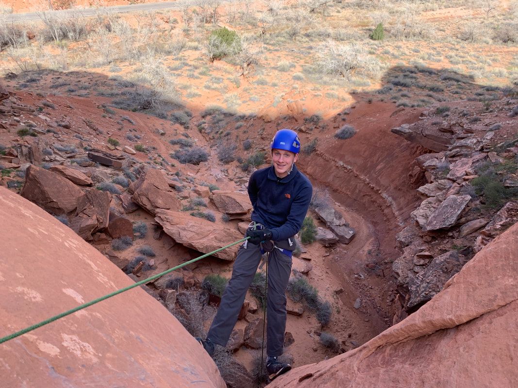
Hogwarts Canyon (about 2.5 miles)
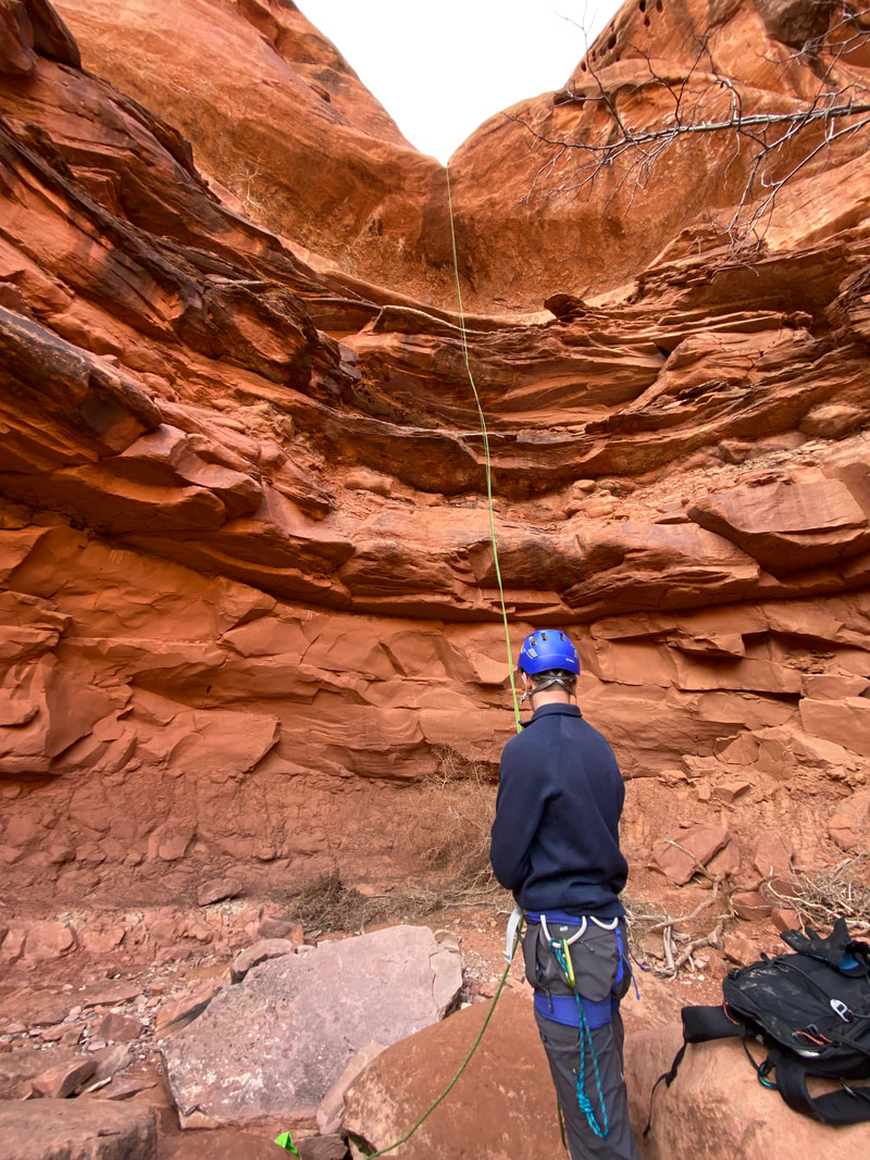
Hogwarts is a technical canyon, meaning it requires ropes, rappelling, and more skill than just scrambling over rocks. Basically, you can get yourself hurt or trapped in this canyon if you don’t know what you’re doing. Hogwarts Canyon was a different experience for us. This canyon, while having a pot hole and one narrow spot, was not a slot canyon. We heard of it while in the North Wash, and upon research, realized it was a canyon for rappelling- exactly what we had trained for. After climbing straight up the side canyon, four massive rappels would take you into a hidden spot with a massive natural bridge and then drop you back down on the road near your starting point. It’s not a slot canyon, but rather a rappelling adventure, which makes it much less traveled than much of the North Wash.
Hogwarts is easy to access, just park at the Hog Springs rest area right off Hwy 95. Cross the bridge to the other side of the creek, walk toward the picnic area, follow the trail up the creek for just a minute or so, then cross the creek again and work up the canyon to your left, but stay out of the canyon proper and stay on the left side. The scramble up was not marked, but if you just stay to the left (once again learning to simple head to the top) you should be fine. Did we mention the scramble up was long, hot, and exposed to the full sun? Even on our 60-degree day, the scramble up was a soaker.
The views from the top are outstanding. You would be wise take a few minutes and take in the 360 views of canyons and desert. Once at the top, we immediately had to give up some of that hard-earned elevation. After about 10 minutes of walking down the next wash over, we came to an anchor, but noticed that it would not be to hard to walk around this drop. After another 3 minutes, we came to a drop we could not walk around, our first rappel in Hogwarts Canyon. This rappel had a very tricky starting point. The anchor hung over a large boulder with the intent to hook in while standing on a small ledge that required an exposed walk of about 3-4 feet straight down the cliff face. After figuring we could pull the anchor up over the boulder and safely hook in before carefully downclimbing, we felt a little safer with it. This rappel ended right next to large pool of water, filled from recent spring rains. The rappel went fine and every one was able to avoid the water not problem.
Walking another few minutes brought us to the second rappel, which was down a sculpted pour off, under a large arch that bridged the canyon. This is the prized area of Hogwarts Canyon and where all the challenges of a typical canyon lie. After this rappel, we had to slide (yes slide) down a slick rock ramp around the pool of water near the bottom of the pour off, roughly 12-14 feet. The next challenge in this area was large pothole which we carefully stemmed over, followed by the one short tight section of this canyon. These were not a problem compared to the canyons we had already done, but if we had not already practiced and honed in our skills, these would have been unnerving. The pothole was full of water and the rock along the edges was extremely slick and sandy. The vantage point going around the pothole made is hard to assess what you were getting in to. It was a very physical spot that some people might have been unable to complete.
It was a five-minute walk to the next rappel, which was anchored on two solution pockets. This was a really nice place to get setup because we had a large flat area away from the cliff edge to setup. This third rappel was down a steep slickrock ramp to a ledge, then a 40 or so foot rappel. At this point, we started getting confident and did not repack the rope and decided to carry it to the next drop.
The last drop was a 90 foot rappel that was mostly free-hanging. The start of this rappel was on the edge of the final water trap (which was full). Scrambling around to avoid the water and then ending right on the edge of the huge drop was thrilling. These anchor bolts were the only anchor bolts we encountered in the North Wash. This rappel was a little awkward as much of the drop was blind and the bottom landed you amidst a snaggle of a small tree. The rappel went smoothly until the last person attempted to throw the last of the rope over to rappel double-stranded. The rope not being in a rope bag resulted in a huge tangled mess that took 10 minutes to correct. Once corrected, it was a smooth trip to the canyon floor and a quick walk along the edge of the highway back to our vehicle.
This was a great little canyon with a big climb followed by 4 quick drops. The only drawback was it lacked the tight slot sections found in some of the other canyons. Much of this canyon was shaded in the afternoon and evening, and with the water traps could potentially leave canyoners cold.
Squeezing through the only tight spot in Hogwarts Canyon, North Wash, Utah
|
Setting up for Rappel 3 in Hogwarts Canyon, North Wash, Utah
|
On the ground after the last rappel in Hogwarts Canyon, North Wash, Utah
|
|
|
|