Capitol Reef National Park
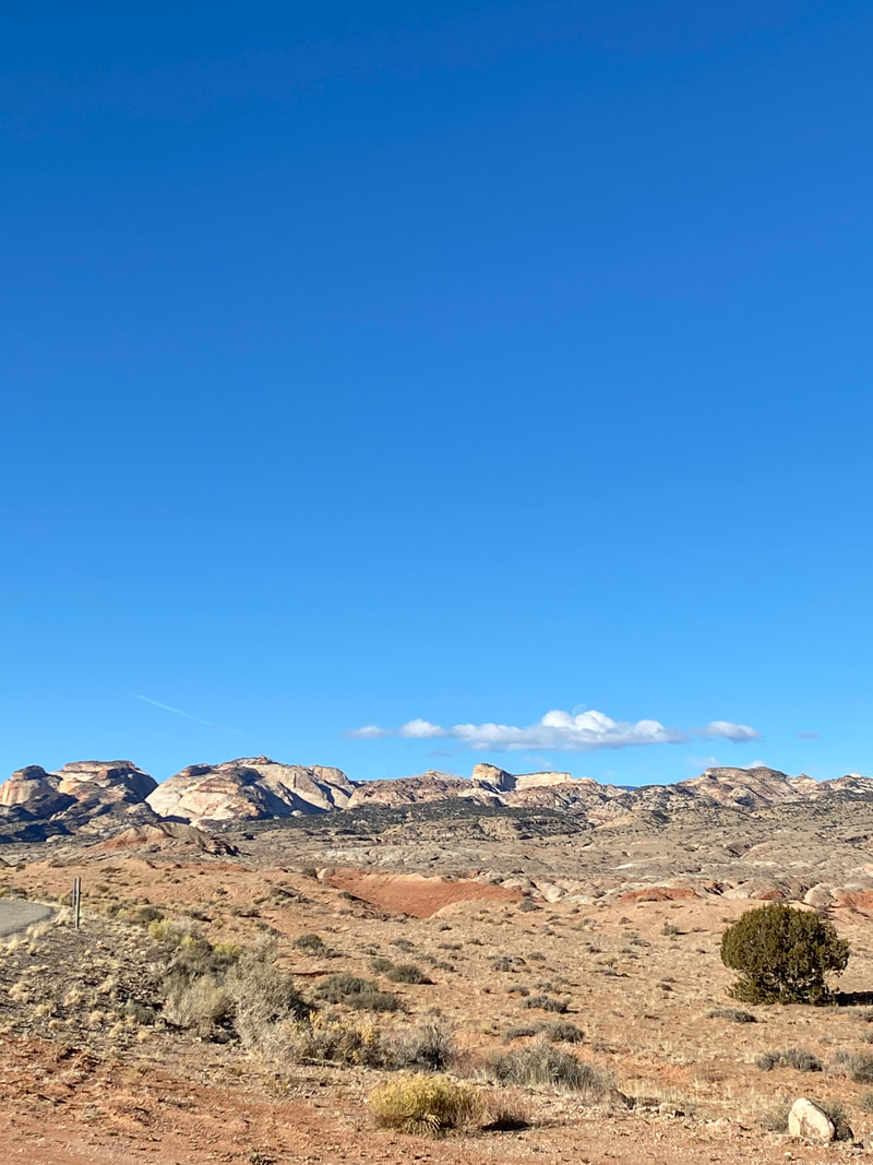
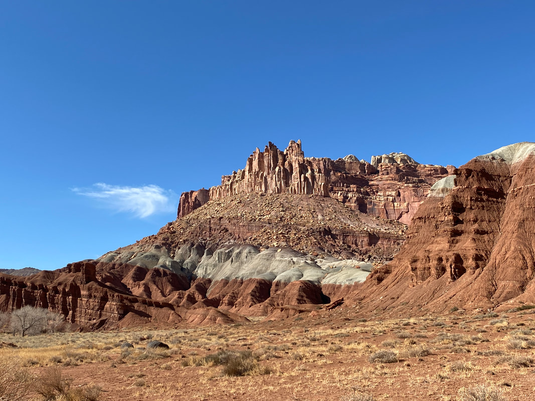
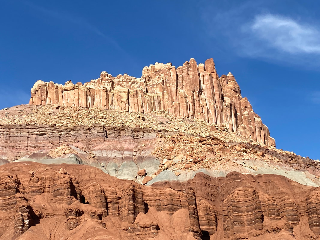
Capitol Reef National Park is the least visited of the five national parks in Utah and encompasses a hundred mile plus stretch of the Water Pocket Fold, one of the largest monoclines in the world. In this park you will find massive red rock cliffs, white sand stone domes, arches, cultural artifacts, narrows, and slot canyons all in one national park.
Capitol Reef National Park
Key Features:
- Scenic drives both on pavement and dirt
- Massive cliffs, and narrows
-Some areas are very high traffic others receive very little use
-Back country camping opportunities
-Wide variety of trail options
- Adjoins BLM land for a variety of camping options
Key Features:
- Scenic drives both on pavement and dirt
- Massive cliffs, and narrows
-Some areas are very high traffic others receive very little use
-Back country camping opportunities
-Wide variety of trail options
- Adjoins BLM land for a variety of camping options
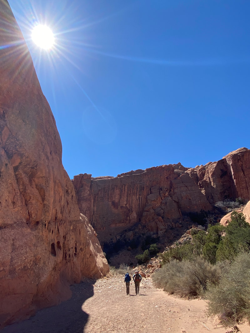
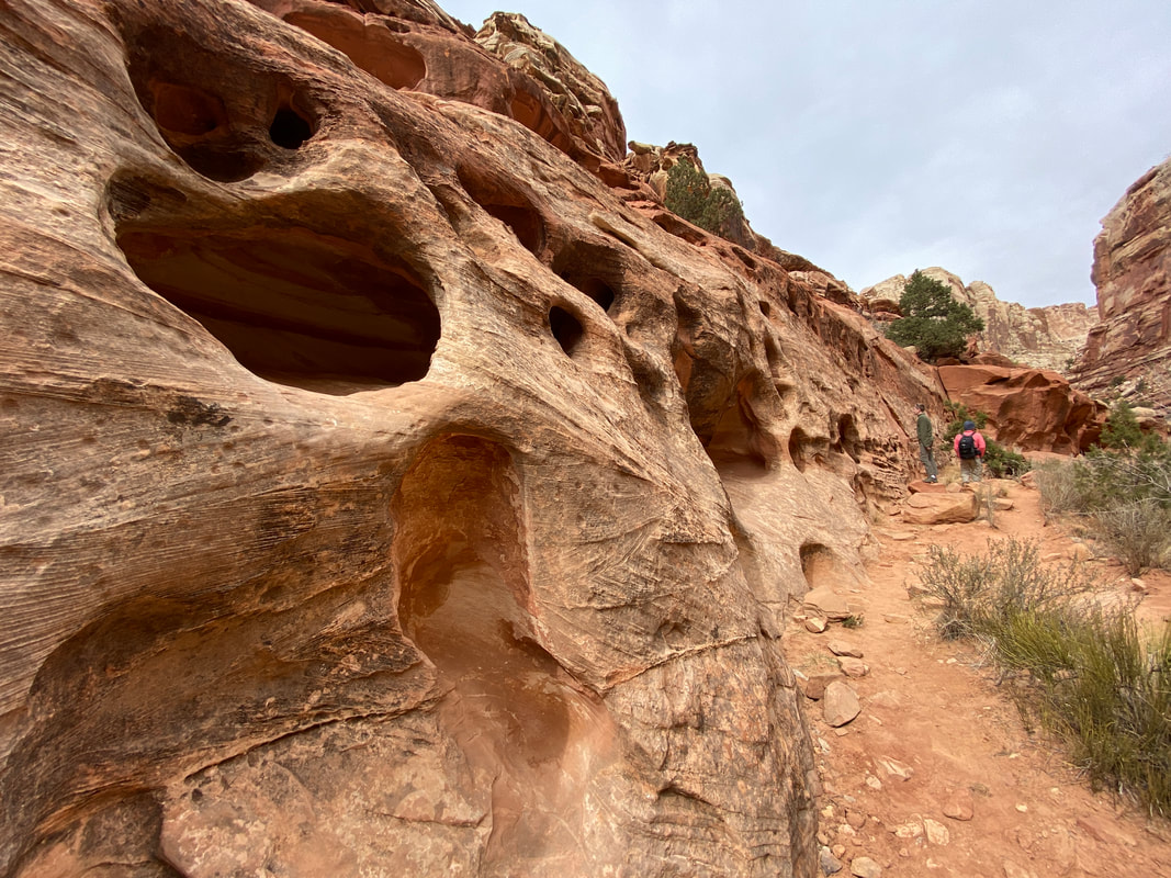
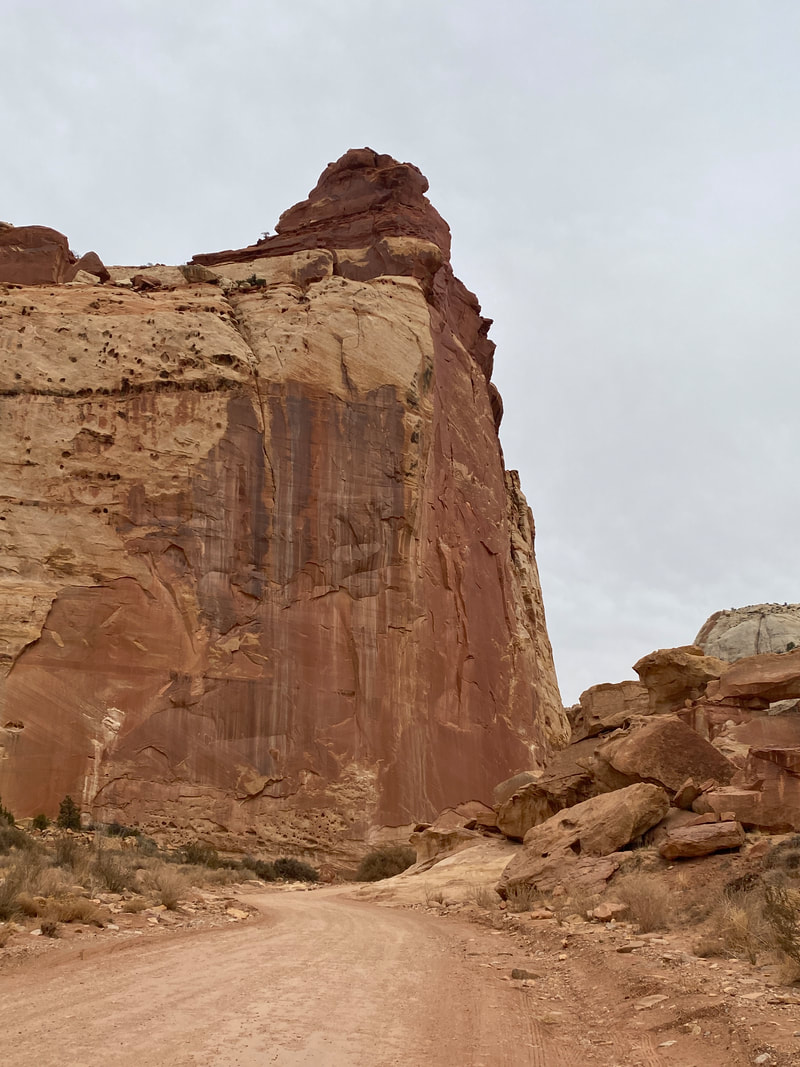
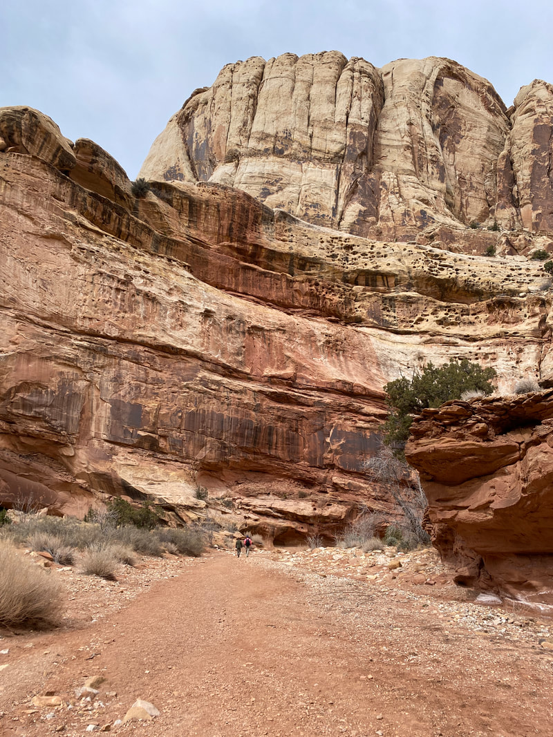
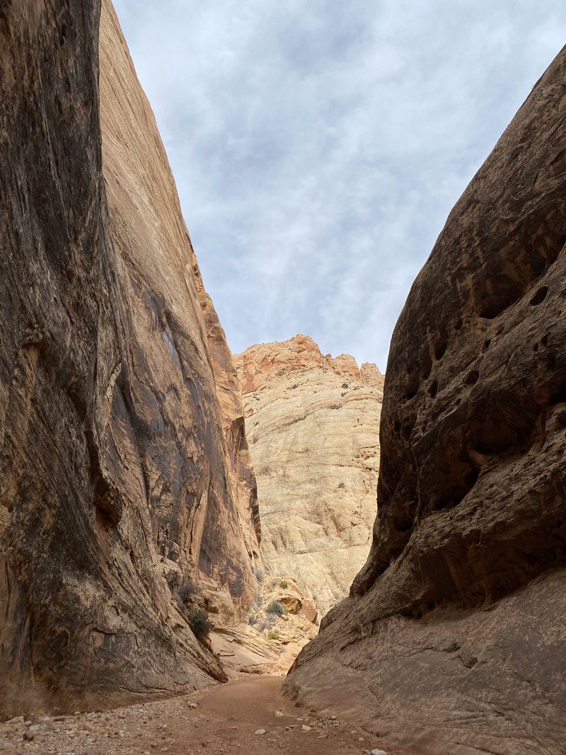
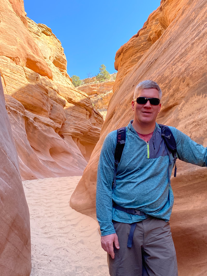
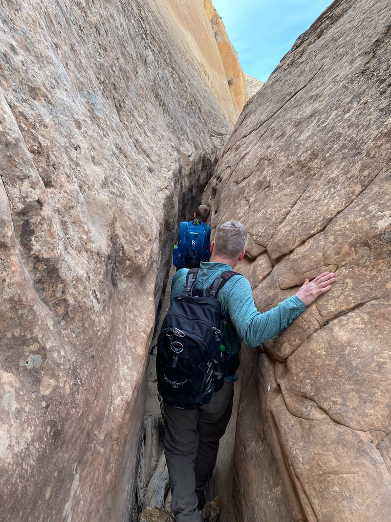
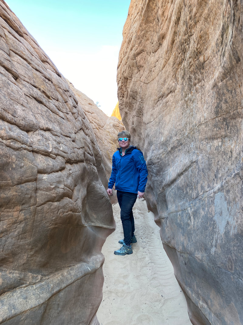
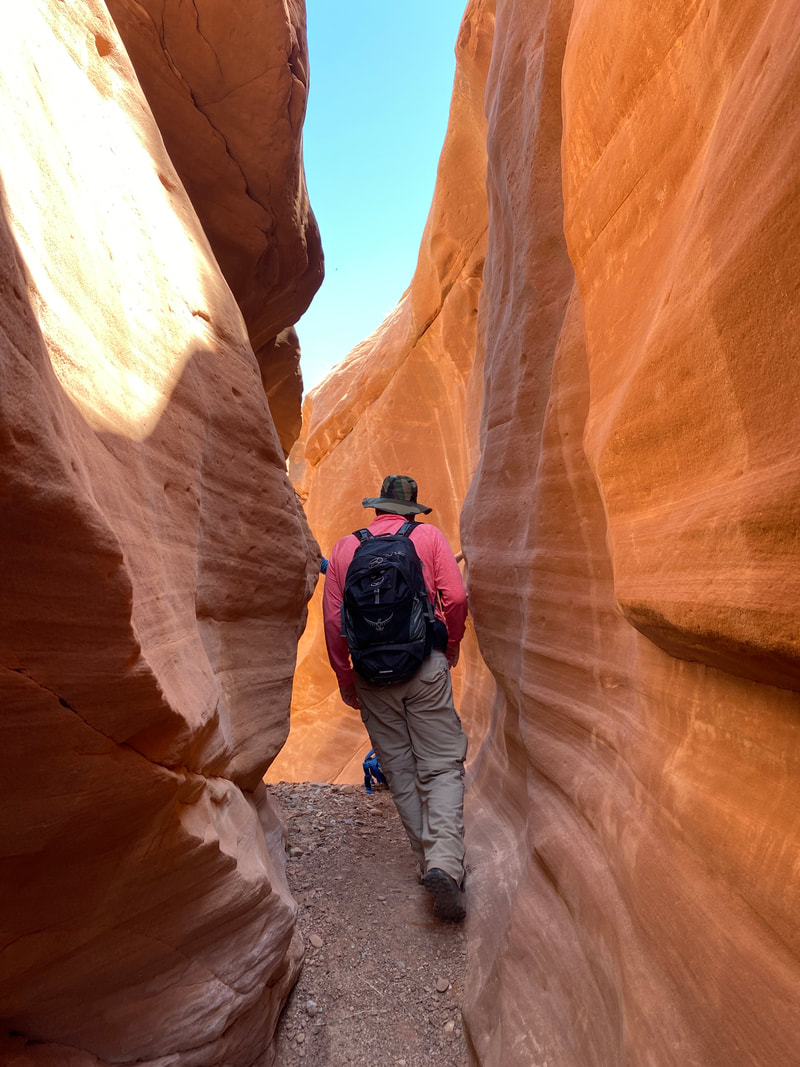
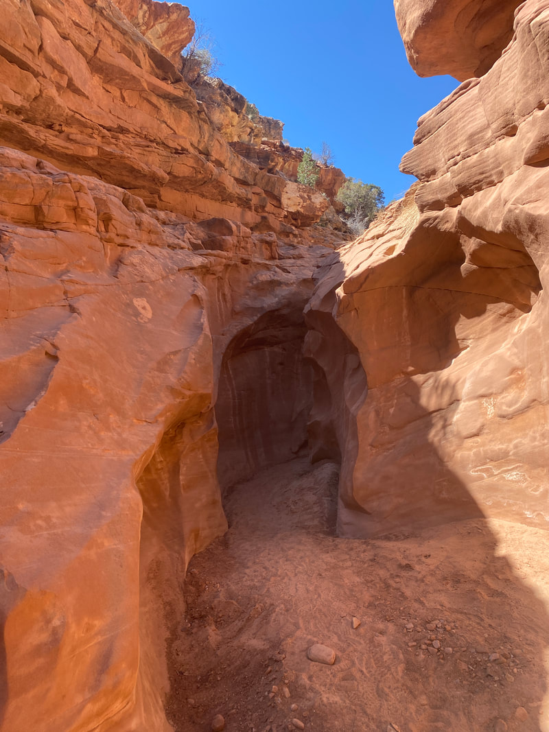
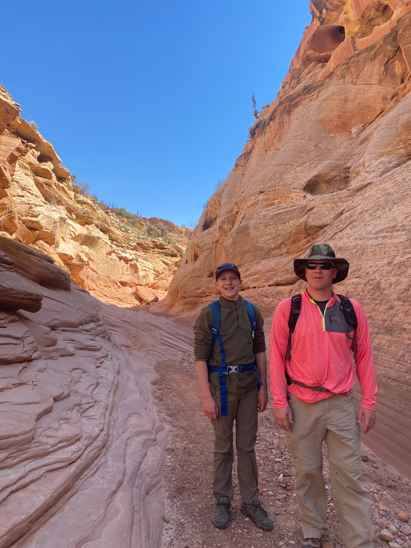
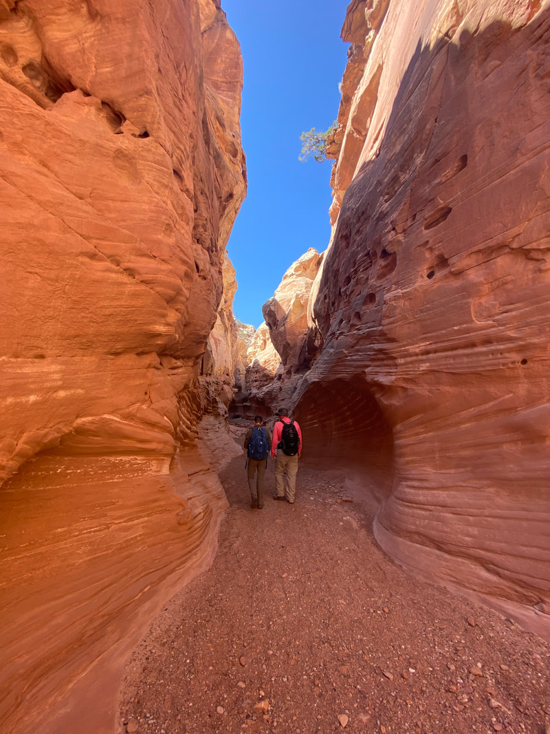
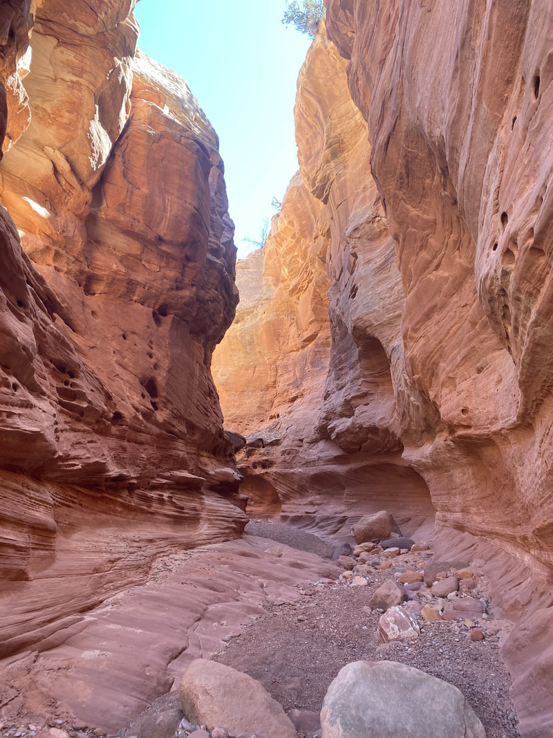
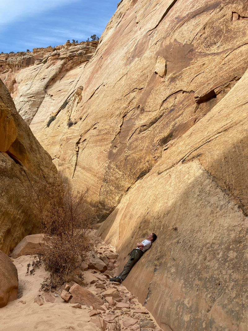
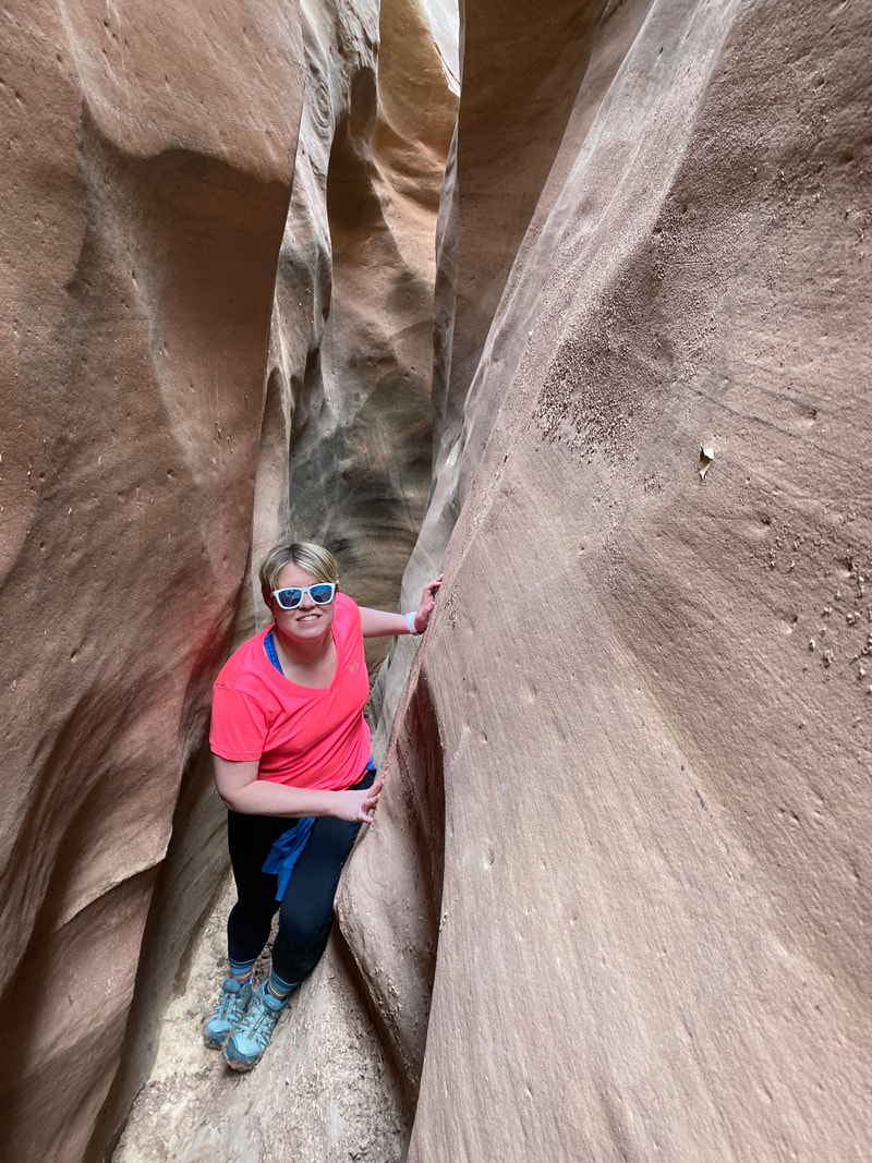
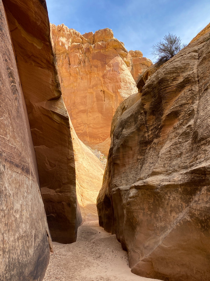
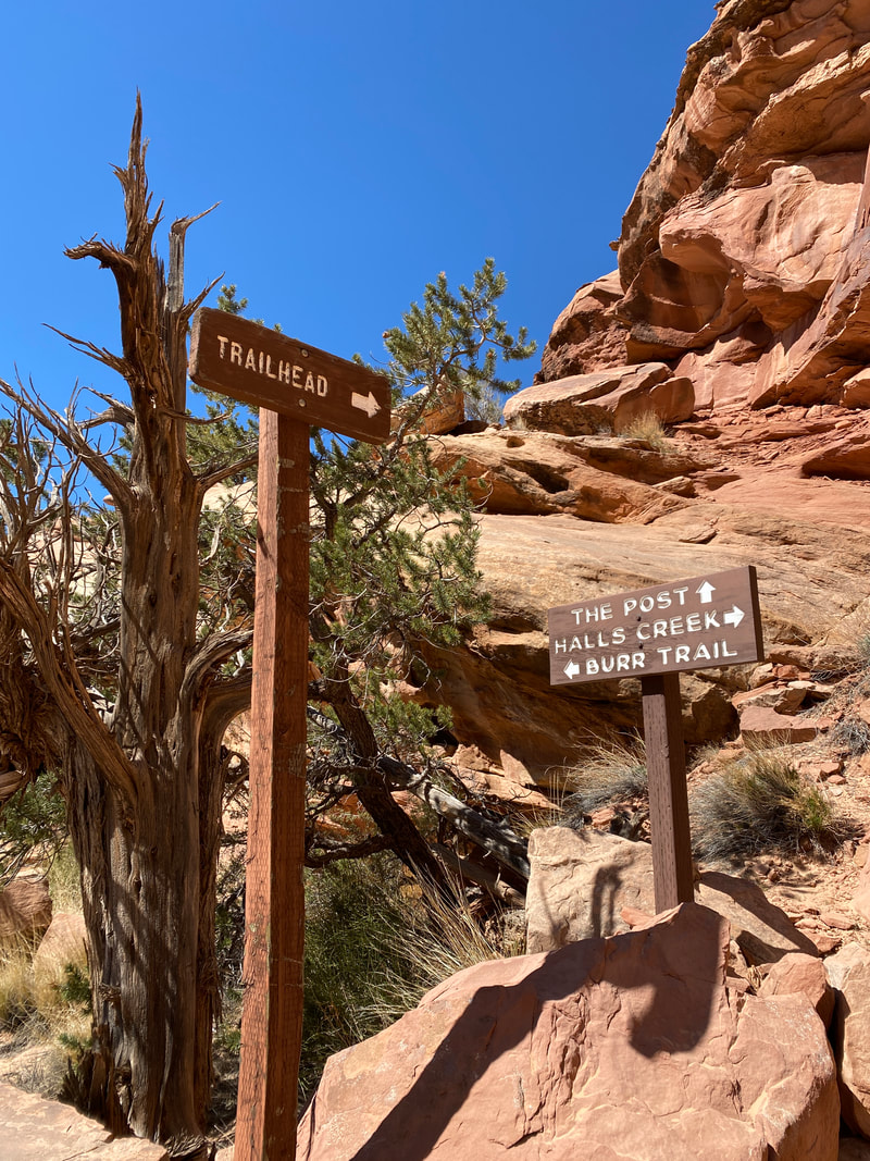
The Grand Wash
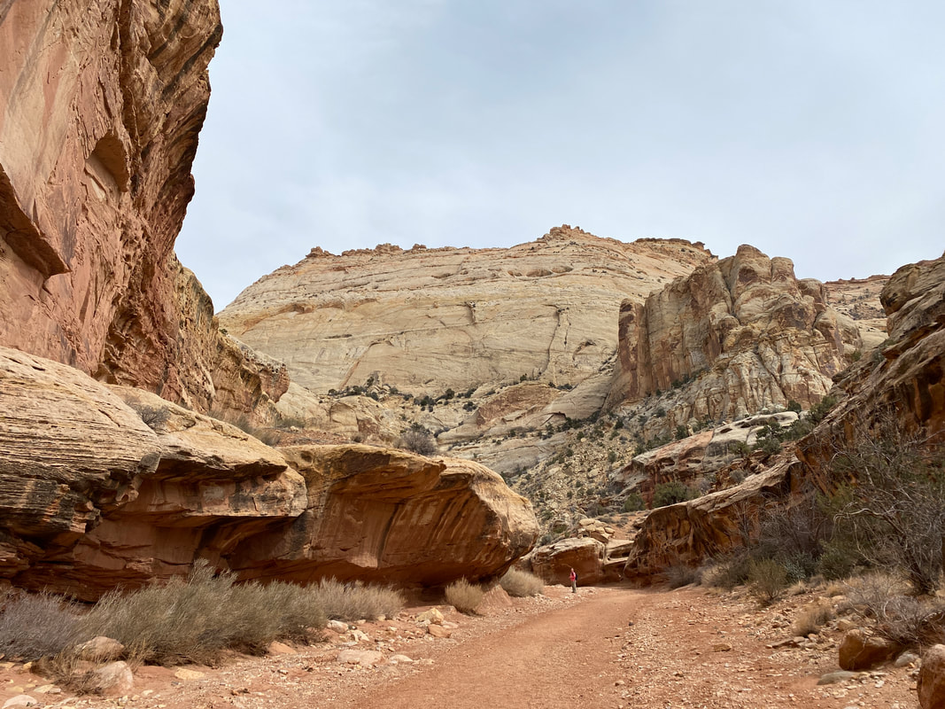
The Grand Wash Trail, Capitol Reef National Park
Grand Wash
Key Features:
- High cliffs and impressive narrows
- Dirt road to parking area off scenic drive is passable to passenger cars
- Very popular trail - expect to see a lot of people
- Avoid during thunderstorms
- Mainly walking on lose sand / gravel
Key Features:
- High cliffs and impressive narrows
- Dirt road to parking area off scenic drive is passable to passenger cars
- Very popular trail - expect to see a lot of people
- Avoid during thunderstorms
- Mainly walking on lose sand / gravel
The Grand Wash Trail, Capitol Reef National Park
|
Trail, Capitol Reef National Park
|
The Grand Wash Trail, Capitol Reef National Park
|
The Grand Wash Trail, Capitol Reef National Park
|
The Grand Wash Trail, Capitol Reef National Park
|
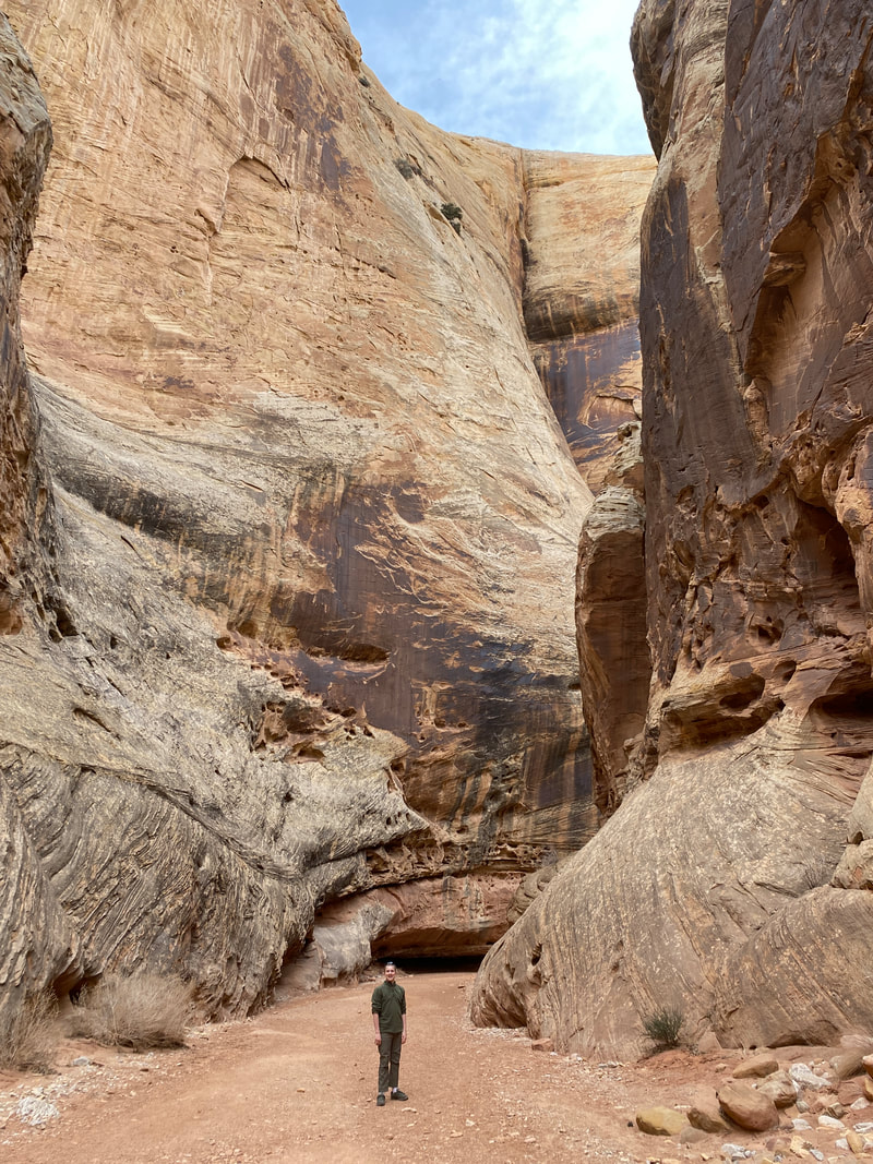
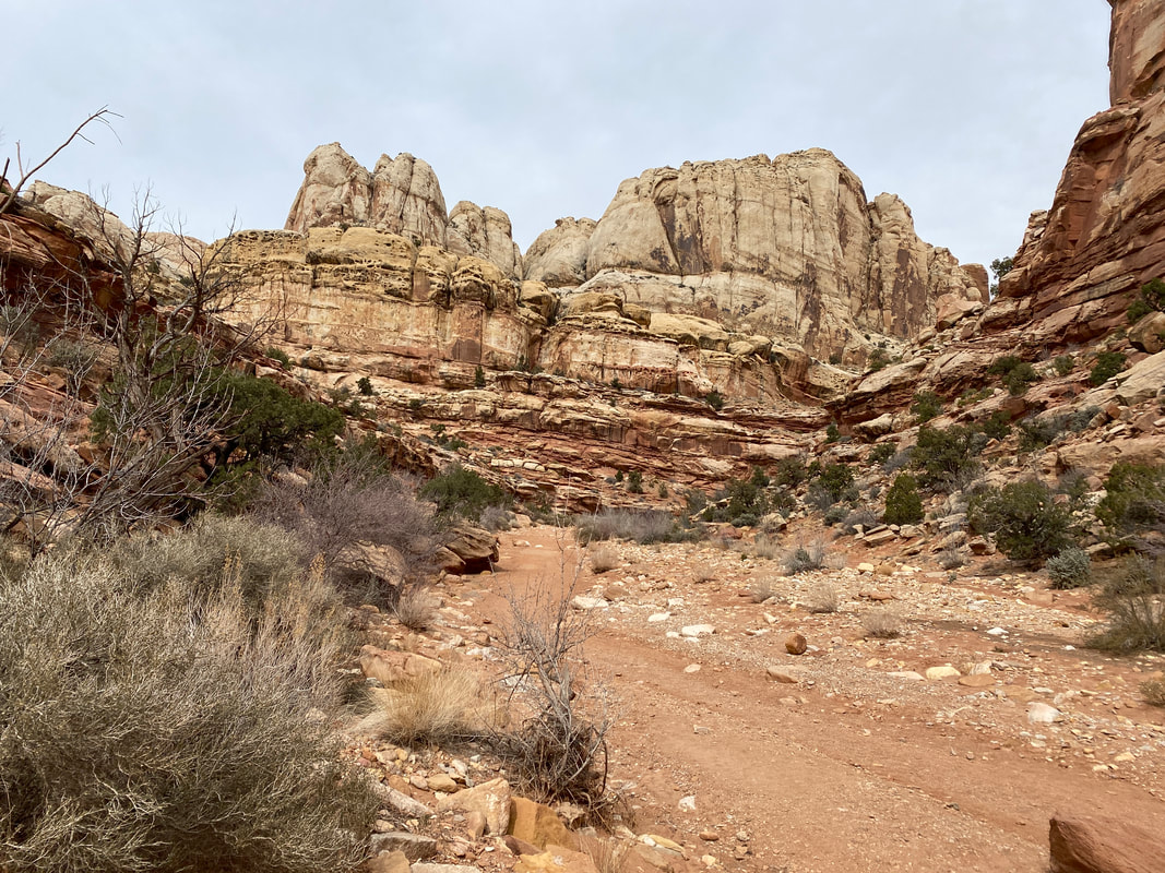
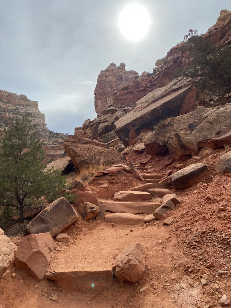
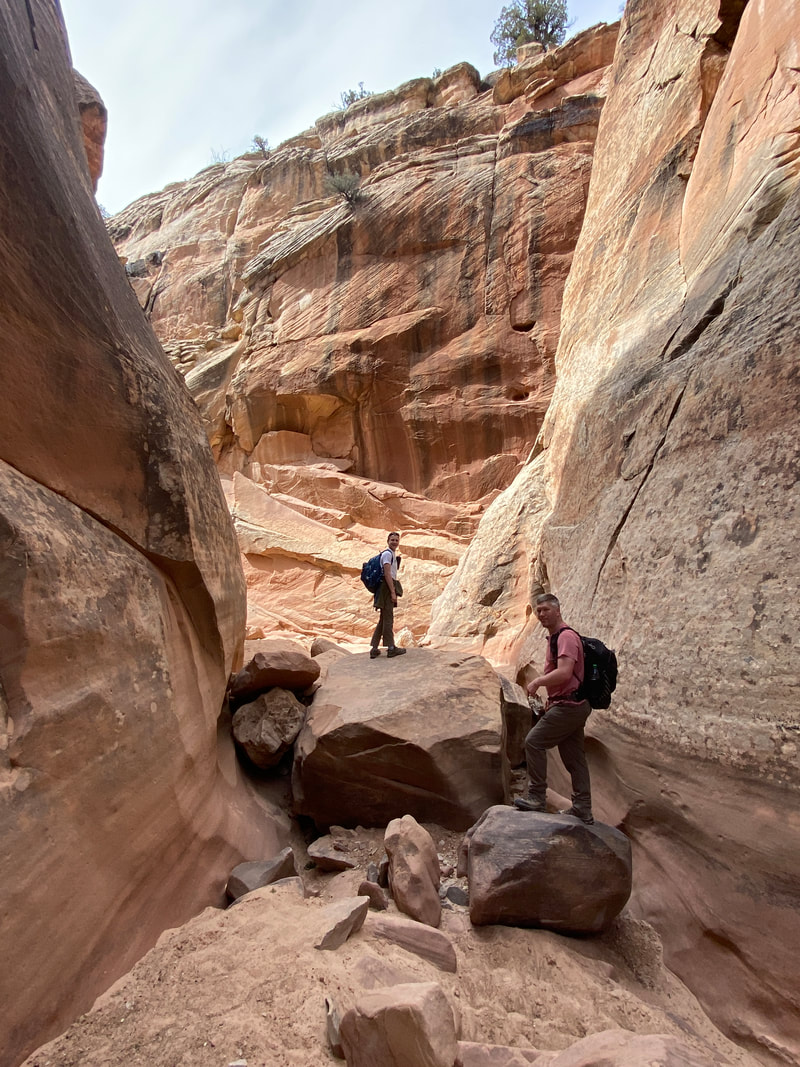
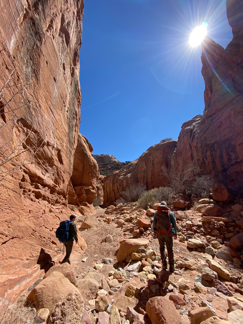
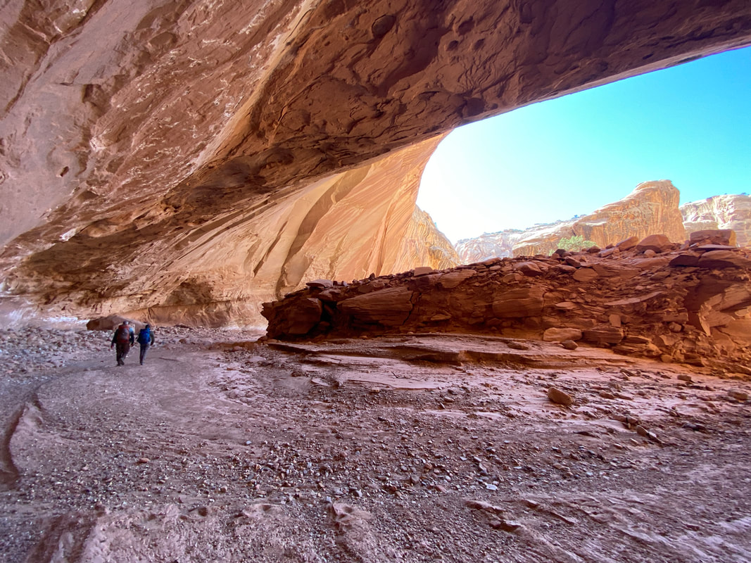
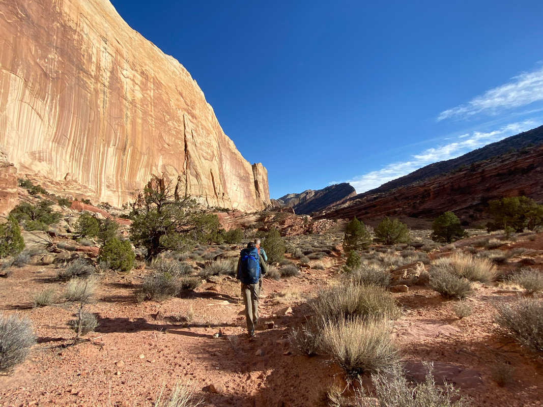
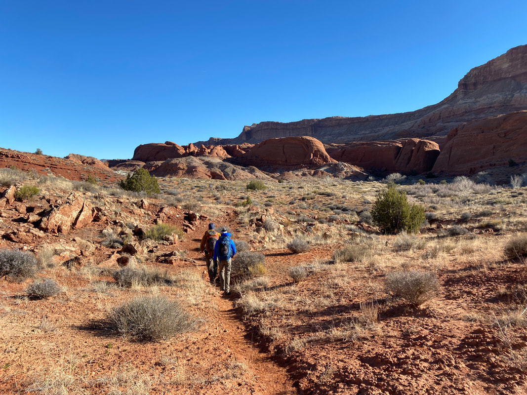
Grand Wash (4.4 miles round trip)
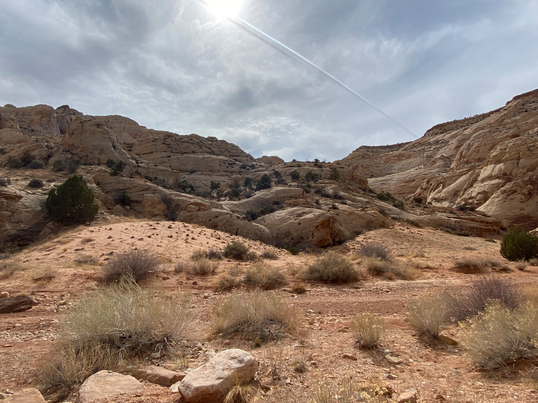
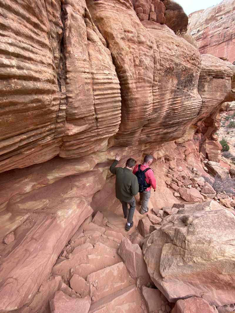
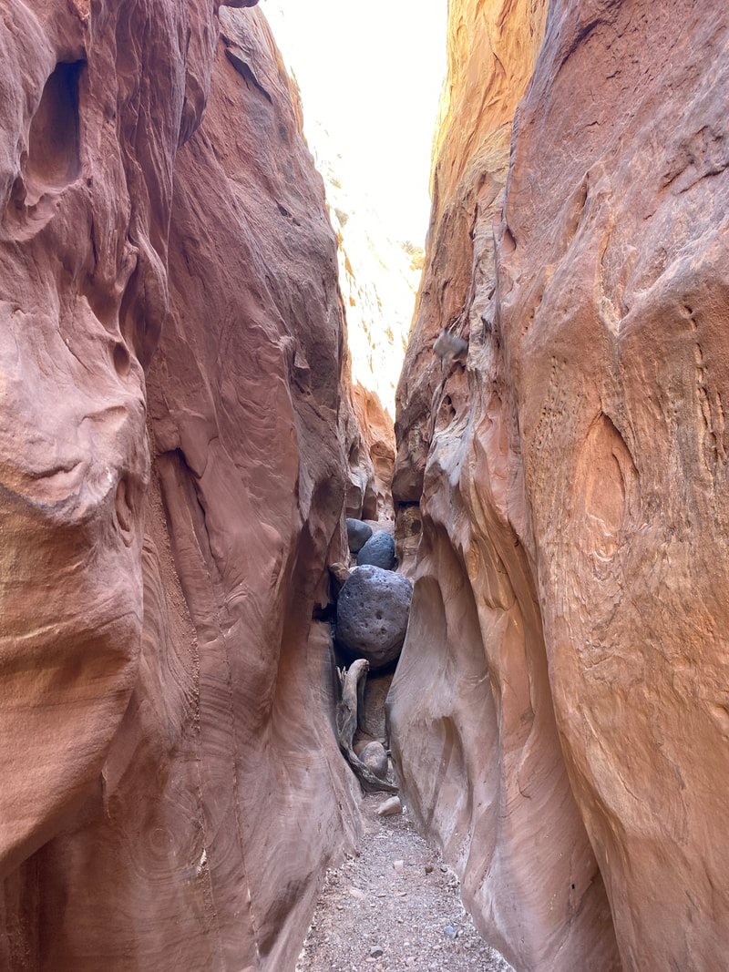
The Grand Wash is a great way to start any adventure in Capitol Reef, where you can experience a canyon and narrows with quick access and ease of ability. Since Torrey, Utah sits at elevation, it is also a great way to acclimatize to the change in elevation. It is just a short drive from the visitor center on a paved scenic drive. The short section of dirt road that leads up to the trail head was passable by regular passenger vehicles. Expect the parking area to be full as this might be the most popular hike in the park. Don’t expect to have the trail to yourself. The trail follows the wash the whole time, and while I am sure it has some elevation change, it seemed to be a level walk with little elevation change. The wash has massive sand stone cliffs on either side of the wash that rise up 100’s of feet. Most of the hike you will be hiking in a combination of sand and gravel, and at times you have the ability to bypass the wash curve and; make a direct beeline over firmer land.
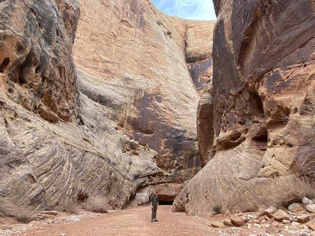
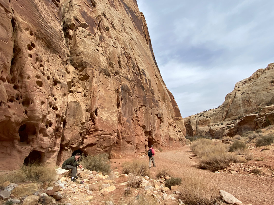
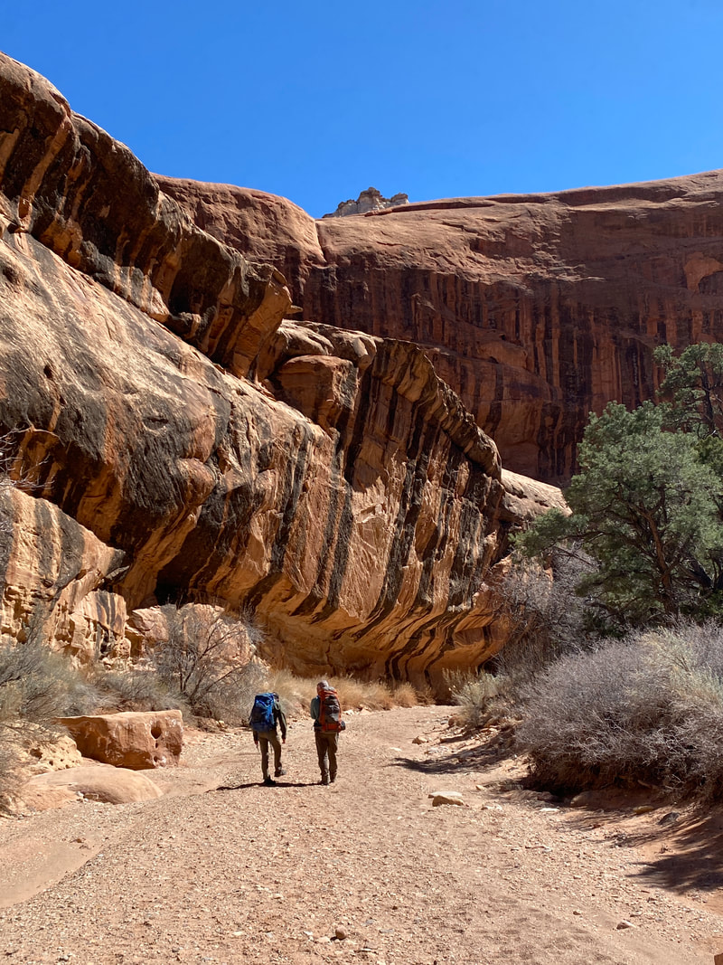
You hike roughly a mile in before the narrows begin, where you will then begin the best portion of the hike where enormous cliff walls pinch in and rise above you giving you a sense of grandeur. The variety of colors and rocks make every turn interesting with things to admire. The wash is also full of interesting plants, sage brushes, and cacti.
It is so different from the Midwest, that I found myself never tiring of the walk. The trail system is very popular, although most people probably cut off and hike the Cassidy Arch Trail. We estimate we passed people every 5-10 minutes and probably shared the trail with 40 people.
The Grand Wash Trail, Capitol Reef National Park
|
The Grand Wash Trail, Capitol Reef National Park
|
The Grand Wash Trail, Capitol Reef National Park
|
|
|
|
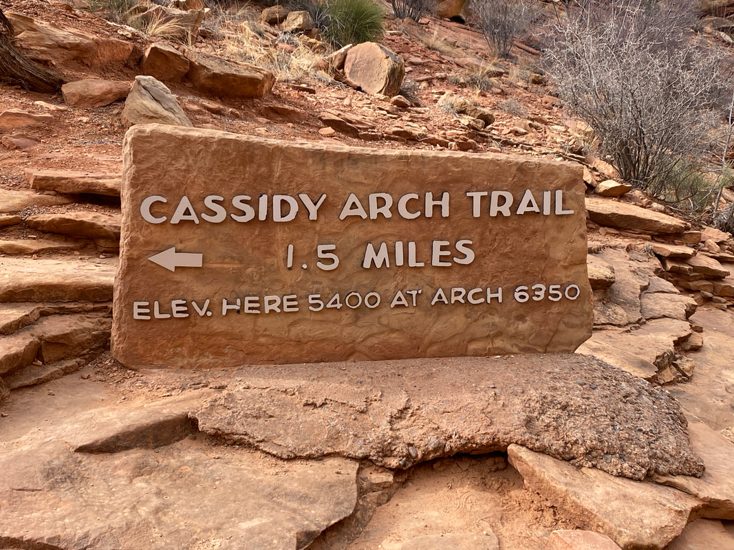
The Cassidy Arch Trail
The Cassidy Arch Trail, Capitol Reef National Park
Cassidy Arch Trail
Key Features:
- A lot of stair climbing and walking on slick rock
- Epic views of the valley you climb
- Very popular trail - expect to see a lot of people
- Red rock cliffs and arch views
- Steep with narrow cliff-edge hiking
Key Features:
- A lot of stair climbing and walking on slick rock
- Epic views of the valley you climb
- Very popular trail - expect to see a lot of people
- Red rock cliffs and arch views
- Steep with narrow cliff-edge hiking
The Cassidy Arch Trail, Capitol Reef National Park
|
The Cassidy Arch Trail, Capitol Reef National Park
|
The Cassidy Arch Trail, Capitol Reef National Park
|
The Cassidy Arch Trail, Capitol Reef National Park
|
The Cassidy Arch Trail, Capitol Reef National Park
|
Cassidy Arch Trail (3.2 miles round trip)
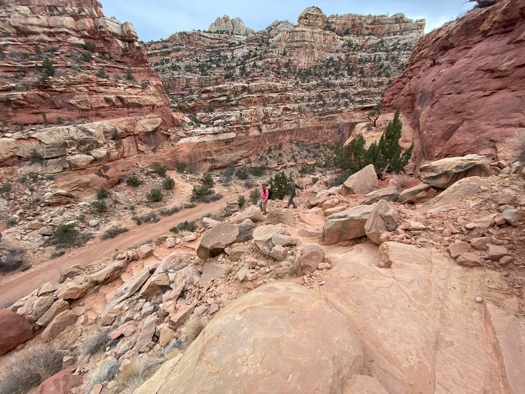
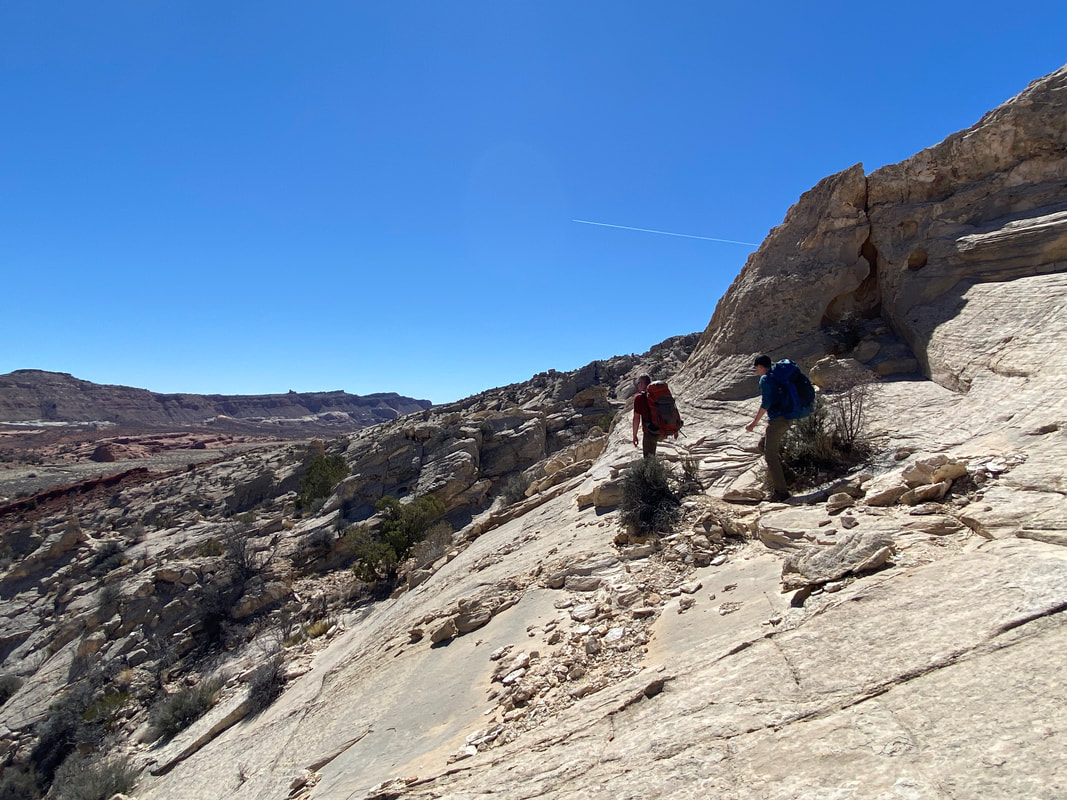
Cassidy Arch trail starts slightly up trail of the Grand Wash Trail and quickly rising using a series of stone steps that cling to the side of the cliff face. They wind and switchback quickly, curving around the valley until you are right above the parking area and can get an amazing sense of scale for the entire valley. The deep reds, oranges, and pale tans contrast against eh blue sky and green foliage and your eyes simply can’t process or take in enough of it. While the trail is exposed and overlooks the massive valley, we never felt unsafe during the climb and overlooks. At about a mile up, the Cassidy Arch comes into view across the valley, and hikers can be seen cutting across the final walkway to the arch.
This trail system was very crowded as one of the most popular hikes, so expect to share the trail. The parking area was full and I would estimate we shared the trail with about 50 people.
This trail system was very crowded as one of the most popular hikes, so expect to share the trail. The parking area was full and I would estimate we shared the trail with about 50 people.
The Cassidy Arch Trail, Capitol Reef National Park
|
The Cassidy Arch Trail, Capitol Reef National Park
|
The Cassidy Arch Trail, Capitol Reef National Park
|
|
|
|
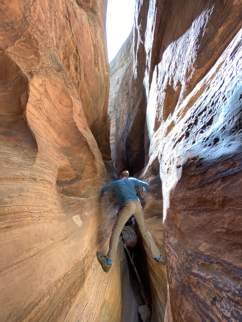
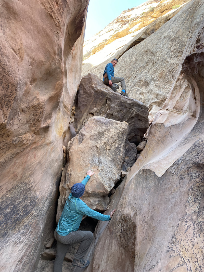
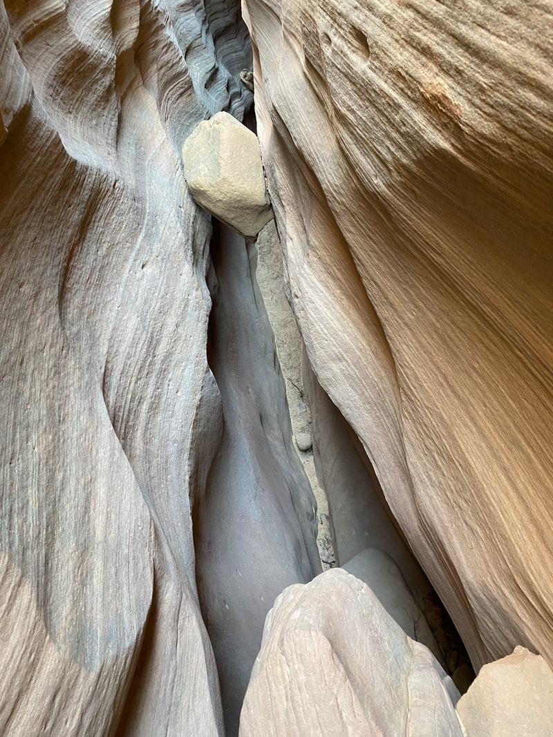
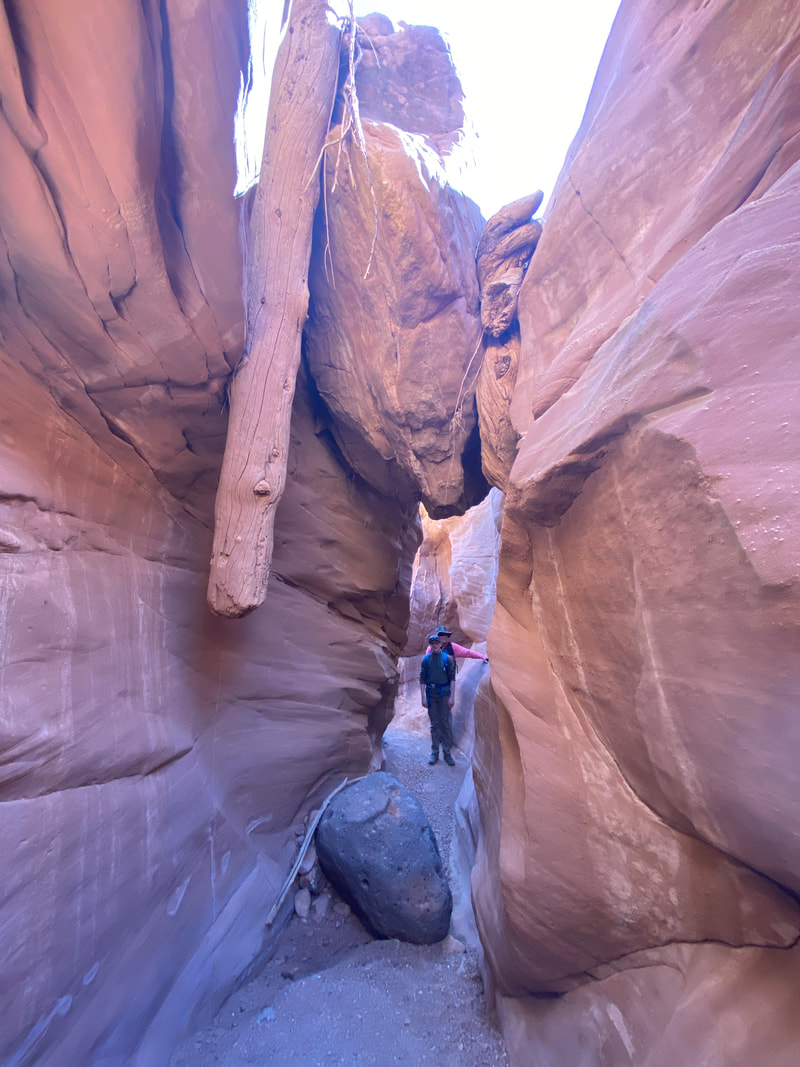
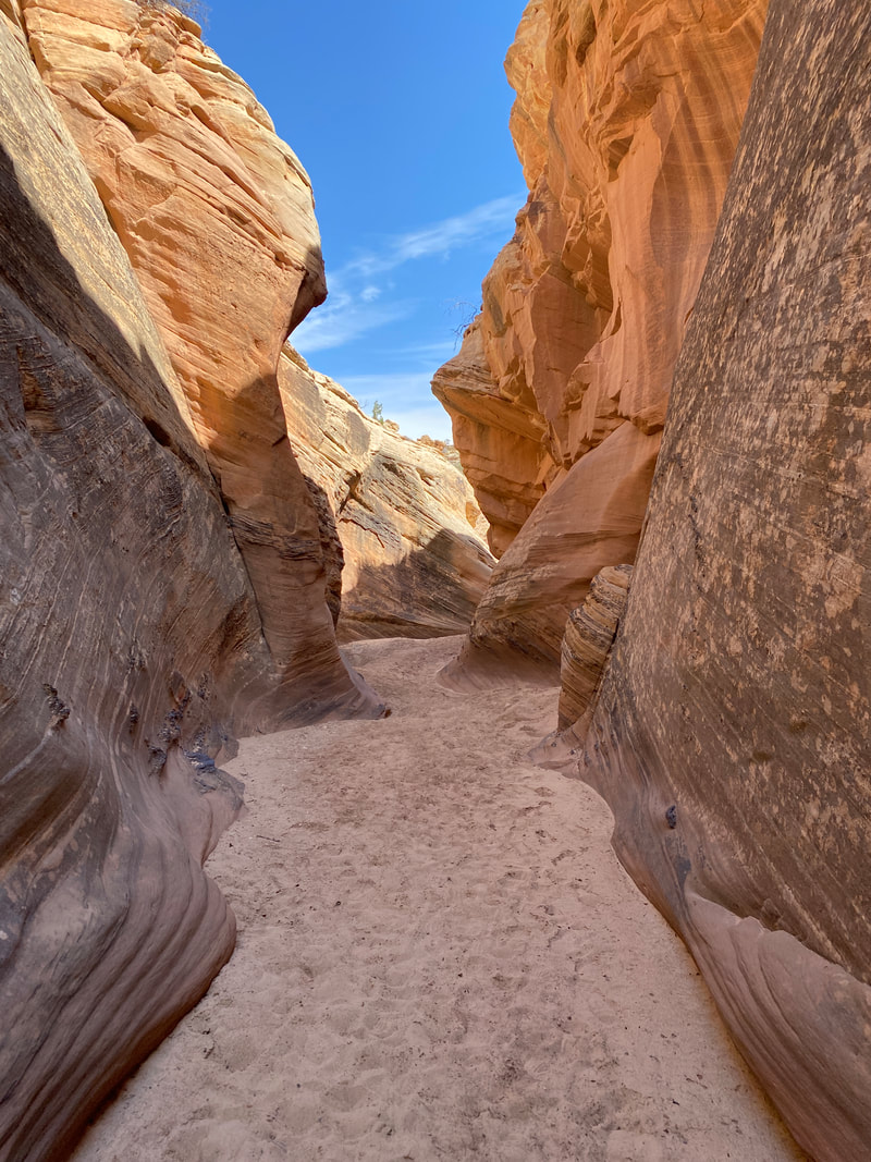
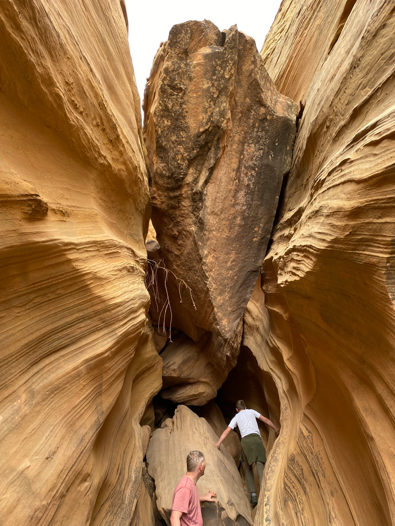
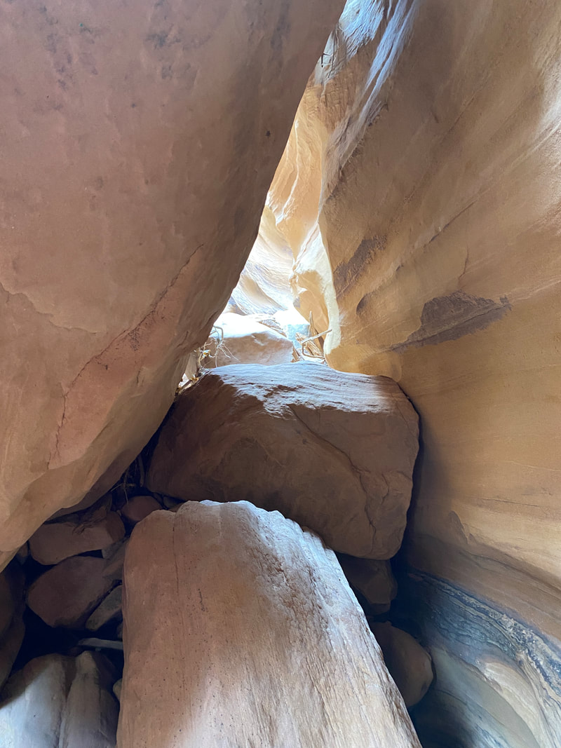
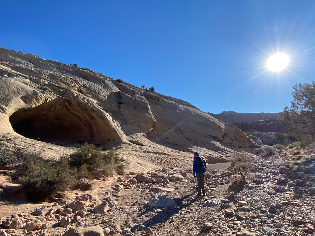
Burro Wash
The sandy narrows before the first choke stone in Burro wash, Capitol Reef National Park
Burro Wash
Key Features:
- On Paved section of Notom Road
- Had the most slot sections of the slot canyons in the area
- requires some scrambling and minor climbing over obstacles
- commonly has some water in it
- Our favorite slot canyon so far
Key Features:
- On Paved section of Notom Road
- Had the most slot sections of the slot canyons in the area
- requires some scrambling and minor climbing over obstacles
- commonly has some water in it
- Our favorite slot canyon so far
Walking the wash up to Burro Wash, Capitol Reef National Park
|

The pour off at the end of Burro Wash, Capitol Reef National Park
|
Getting above a narrow spot in Burro Wash, Capitol Reef National Park
|
Climbing up a large choke stone, Burro Wash, Capitol Reef National Park
|
Entering a narrow slot section, Burro Wash, Capitol Reef National Park
|
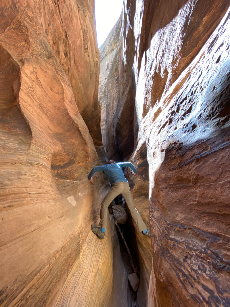
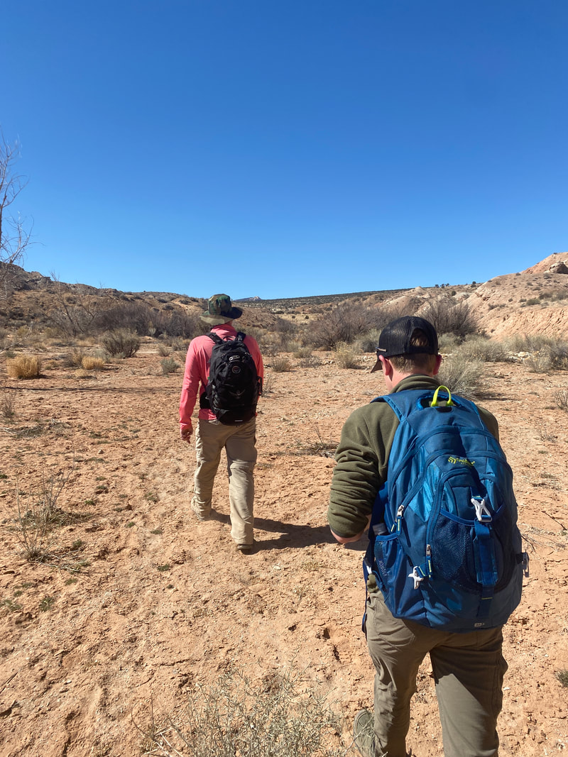
Burro Wash (7.5 miles)
On a cold 27 degree morning, we took off through the park toward Burro Wash in the southern part of the park. Forecasts were for clear skies warming up to 49 degrees in the afternoon. The park rangers had outdated canyon information, so we journeyed into the unknown, hoping for a fun day, but expecting to be stopped by water or ice. However, we were soon to have one of our greatest days of hiking ever, fully completing the challenges of Burro’s slots and making it all the way to the pour off chamber.
The wash travels through a flat and big sky desert. Behind us was the snow capped Henry Mountains and before us were the twists and turns of the wash, sage brush tumblers, and pillars of rock jutting up from the desert floor. The wind across the flat was intense and we kept our layers on despite the full sun. A two mile hike through the sand and gravelly wash took us to the entrance of the official Burro Wash and Capital Reef border.
It was a short distance of boulder fields and water channels before the slot sections begin. That was a nice set up in in our opinion, because you hike fast for 2 miles then get right into the adventure. Most of the hike is devoted to navigating the slot and choke stones.
The actual slots did not disappoint! There were numerous sections of slots of all varieties. Some were wide with sandy bottoms, some were tight with soaring walls, some were narrow with tricky slippery foot and hand holds, some were creepy tight squeezes. The challenges seemed to increase in difficulty, which left us increasing our skills as we went. It was picture perfect as far as slots go.
Some interesting things we noted were the changing temperatures and conditions within the canyon. Some spots were quite windy as the wind channeled up through the he canyon. Some spots were sunbaked and warm while others were deep and damp holding the cold of the morning. There were also a variety of conditions of rock with which to hold on to. At times the rock was gritty and grippy and maneuvering was done with ease, while other spots were blockaded with extremely challenging choke stones, while other spots were like walking on a sandy beach.
This was a very epic hike and I’m pleased we were all able to navigate the challenges and make it to the final chamber. The last chamber opens up after a very tight, high walled squeeze in the shadows. The final chamber was a sandy bottomed circular room maybe 25 foot in diameter. It felt huge after the slots. About thirty feet up the smooth sandstone wall you could see the pour off where the slot canyon above
dumped the water Into this chamber. This was not way to continue with out so every technical canyoneering or climbing skills. Then we got to enjoy the whole hike again on the way back.
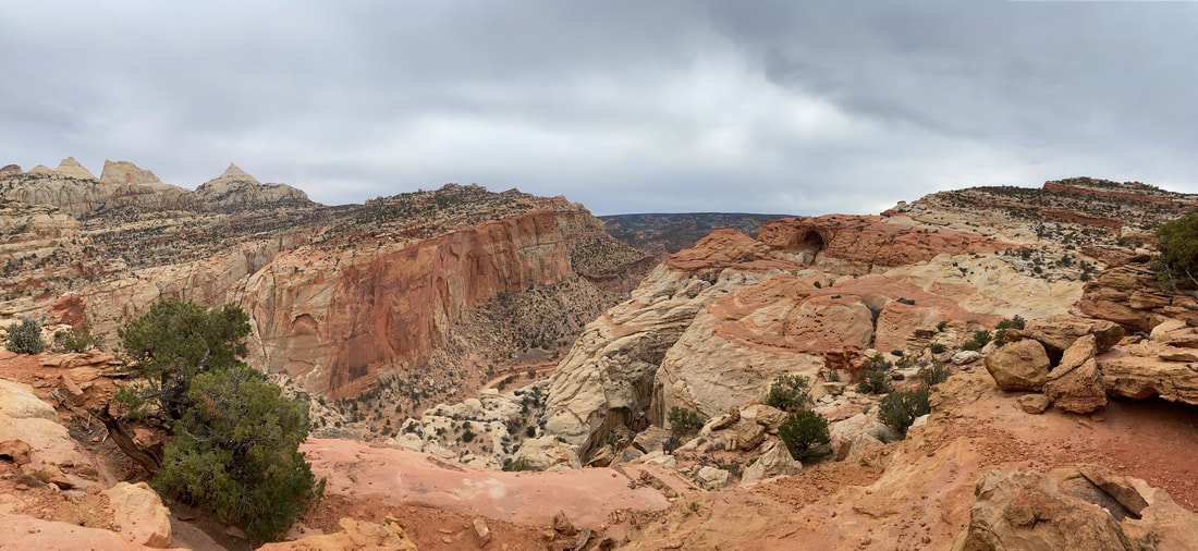
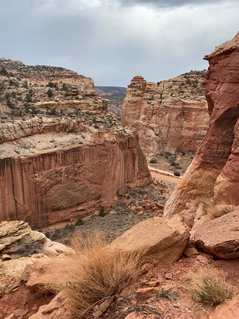
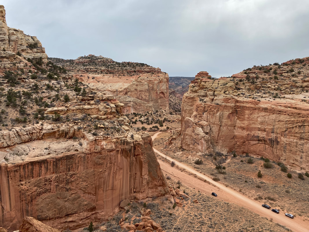
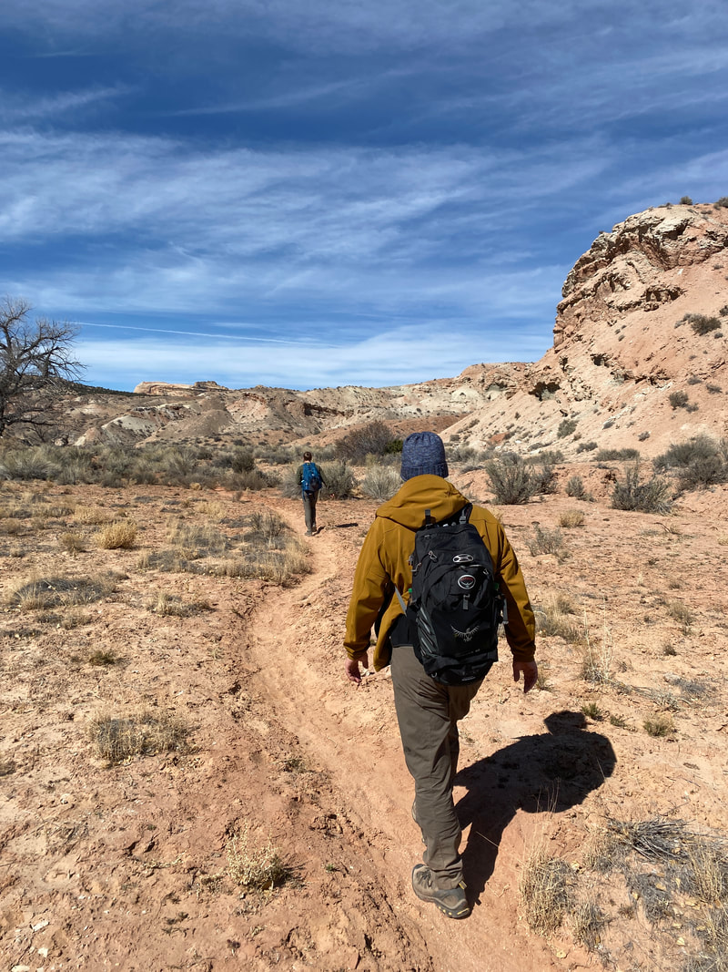
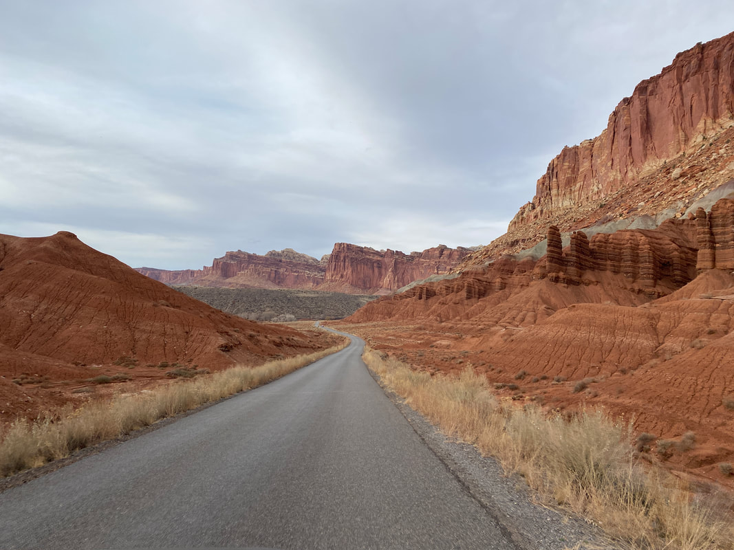
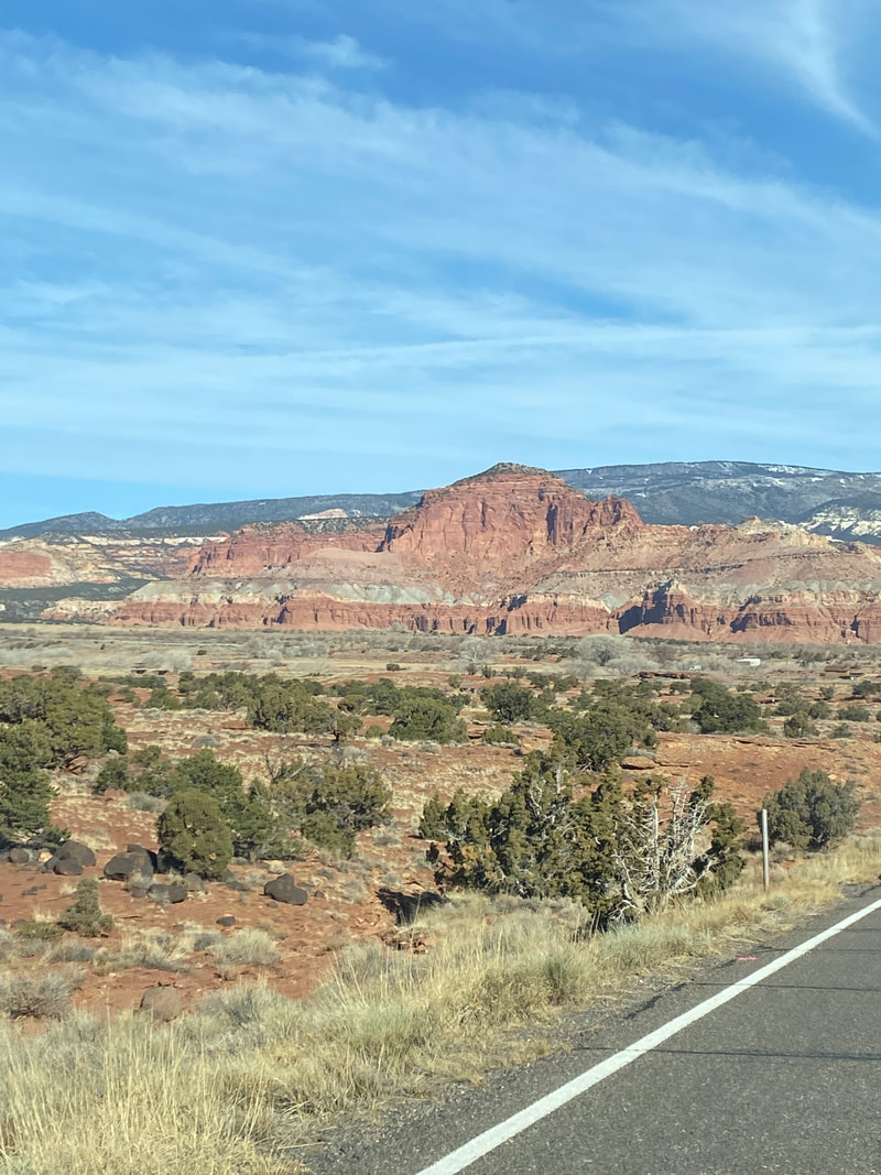
Driving Capitol Reef
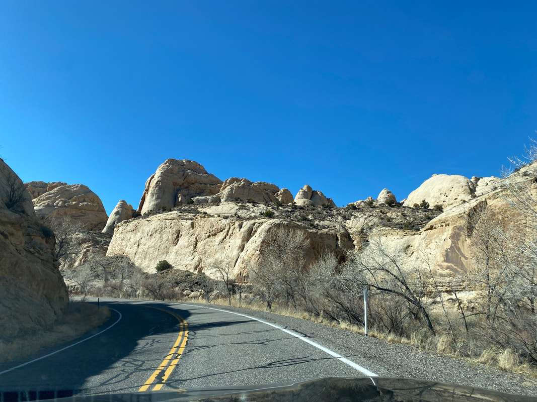
If driving Capitol Reef is the only thing you have time for, it would be sad, but would not disappoint you. Most of the drive through the main area of the park follows State Highway 24. It is paved with pull offs for panoramic vistas and rock formation highlights. With a clear day, you’ll have nice contrast with the rock layers and the colors will pop off your blue sky backdrop, but even on a cloudy day the views are amazing and impressive.
The town of Torrey is quite small with only 300 full time residents. The town clearly caters to food, fuel, and lodging of park visitors, but is small and quaint. You’ll immediately encounter the massive red rock walls of Capitol Reef, and drive along side them for miles before dropping into the Fruita District and Park Visitor Center. It is a tiny center, staffed with only 2 park rangers for trail information and offers very few displays and information as to the Geology and history of the area. Our experience was that the park rangers were not incredibly familiar with the trails firsthand, indicating most visitors stick to the short front-country hikes and were not entering the backcountry canyons, BLM lands, or dirt road sections off Notom Road.
After passing the visitor center, you journey can branch off numerous directions. You can proceed brought the Freemont River valley and see mule deer, orchards, petroglyphs, and head for the Notom Road. Or, you can turn into the Fruita historic town and camping areas and journey on out through the scenic drive of the park.
Most of our adventures were off the Notom Road in what is called the east side of the park and down further into the backcountry routes of the Water Pocket Fold. This impressive area has some ranches and offers incredible views of the Henry Mountains and some interesting rock formations, pillars, and landscapes. Several slot canyon trailheads are found here and we noted maybe 10 parties parked in this area all week, indicating it is the true backcountry adventure and solitude you are probably seeking. BLM lands offer numerous backcountry camping options, and our 2 favorite nights of camping were off the Notom Road on some secluded spots.
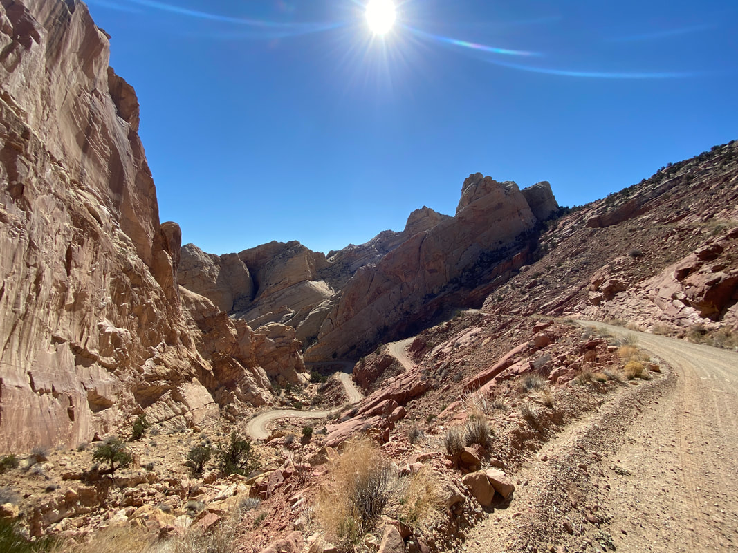
Eventually, Notom Road turns to dirt after about 20 miles (5 miles past Sheets Gulch) and is impassable in the rain, but worth the drive to access some of the best parts of the park. Many of the park maps were not up to date on the status of this road, so keep that in mind and as long as you feel comfortable with your weather and vehicle capabilities, don’t be intimidated to drive it.
The wash travels through a flat and big sky desert. Behind us was the snow capped Henry Mountains and before us were the twists and turns of the wash, sage brush tumblers, and pillars of rock jutting up from the desert floor. The wind across the flat was intense and we kept our layers on despite the full sun. A two mile hike through the sand and gravelly wash took us to the entrance of the official Burro Wash and Capital Reef border.
It was a short distance of boulder fields and water channels before the slot sections begin. That was a nice set up in in our opinion, because you hike fast for 2 miles then get right into the adventure. Most of the hike is devoted to navigating the slot and choke stones.
The actual slots did not disappoint! There were numerous sections of slots of all varieties. Some were wide with sandy bottoms, some were tight with soaring walls, some were narrow with tricky slippery foot and hand holds, some were creepy tight squeezes. The challenges seemed to increase in difficulty, which left us increasing our skills as we went. It was picture perfect as far as slots go.
Some interesting things we noted were the changing temperatures and conditions within the canyon. Some spots were quite windy as the wind channeled up through the he canyon. Some spots were sunbaked and warm while others were deep and damp holding the cold of the morning. There were also a variety of conditions of rock with which to hold on to. At times the rock was gritty and grippy and maneuvering was done with ease, while other spots were blockaded with extremely challenging choke stones, while other spots were like walking on a sandy beach.
This was a very epic hike and I’m pleased we were all able to navigate the challenges and make it to the final chamber. The last chamber opens up after a very tight, high walled squeeze in the shadows. The final chamber was a sandy bottomed circular room maybe 25 foot in diameter. It felt huge after the slots. About thirty feet up the smooth sandstone wall you could see the pour off where the slot canyon above
dumped the water Into this chamber. This was not way to continue with out so every technical canyoneering or climbing skills. Then we got to enjoy the whole hike again on the way back.
Driving Capitol Reef
If driving Capitol Reef is the only thing you have time for, it would be sad, but would not disappoint you. Most of the drive through the main area of the park follows State Highway 24. It is paved with pull offs for panoramic vistas and rock formation highlights. With a clear day, you’ll have nice contrast with the rock layers and the colors will pop off your blue sky backdrop, but even on a cloudy day the views are amazing and impressive.
The town of Torrey is quite small with only 300 full time residents. The town clearly caters to food, fuel, and lodging of park visitors, but is small and quaint. You’ll immediately encounter the massive red rock walls of Capitol Reef, and drive along side them for miles before dropping into the Fruita District and Park Visitor Center. It is a tiny center, staffed with only 2 park rangers for trail information and offers very few displays and information as to the Geology and history of the area. Our experience was that the park rangers were not incredibly familiar with the trails firsthand, indicating most visitors stick to the short front-country hikes and were not entering the backcountry canyons, BLM lands, or dirt road sections off Notom Road.
After passing the visitor center, you journey can branch off numerous directions. You can proceed brought the Freemont River valley and see mule deer, orchards, petroglyphs, and head for the Notom Road. Or, you can turn into the Fruita historic town and camping areas and journey on out through the scenic drive of the park.
Most of our adventures were off the Notom Road in what is called the east side of the park and down further into the backcountry routes of the Water Pocket Fold. This impressive area has some ranches and offers incredible views of the Henry Mountains and some interesting rock formations, pillars, and landscapes. Several slot canyon trailheads are found here and we noted maybe 10 parties parked in this area all week, indicating it is the true backcountry adventure and solitude you are probably seeking. BLM lands offer numerous backcountry camping options, and our 2 favorite nights of camping were off the Notom Road on some secluded spots.
Eventually, Notom Road turns to dirt after about 20 miles (5 miles past Sheets Gulch) and is impassable in the rain, but worth the drive to access some of the best parts of the park. Many of the park maps were not up to date on the status of this road, so keep that in mind and as long as you feel comfortable with your weather and vehicle capabilities, don’t be intimidated to drive it.
Burro Wash, Capitol Reef National Park
|
Choke stone and narrow slot in Burro Wash, Capitol Reef National Park
|
The first choke stone in Burro Wash, Capitol Reef National Park
|
|
|
|
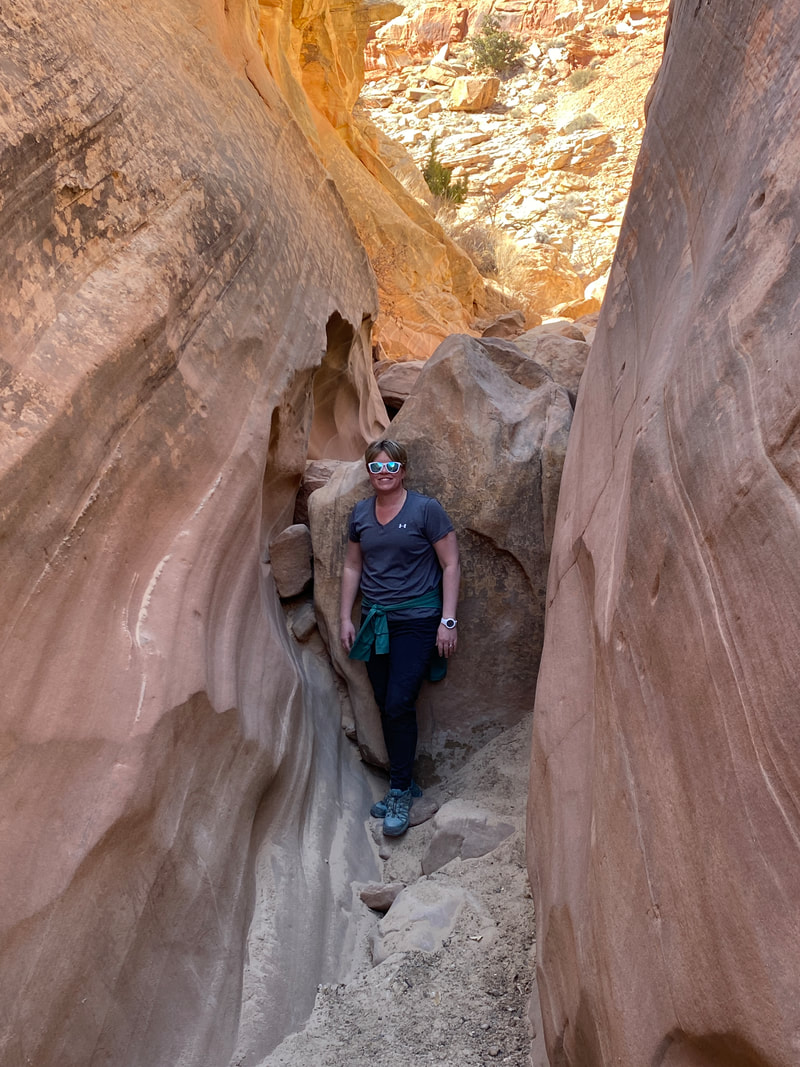
Sheets Gulch
An easy slot in Sheets Gulch, Capitol Reef National Park
Sheets Gulch
Key Features:
- On the paved portion on Notom Road
- Good beginner slot canyon
- Nice narrow sections
- Goes on for more than 13 miles
- Unlikely to see too many other hikers
Key Features:
- On the paved portion on Notom Road
- Good beginner slot canyon
- Nice narrow sections
- Goes on for more than 13 miles
- Unlikely to see too many other hikers
Choke stones in Sheets Gulch, Capitol Reef National Park
|
Climbing over a choke stone, Sheets Gulch, Capitol Reef National Park
|
Walking the wash into Sheets Gulch, Capitol Reef National Park
|
entering a slot section, Sheets Gulch, Capitol Reef National Park
|
Walking some narrows in Sheets Gulch, Capitol Reef National Park
|
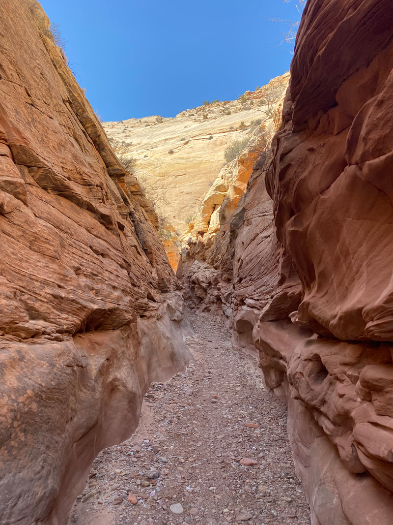
Sheets Gulch (1-13 miles)
Sheets Gulch is a very accessible, photogenic canyon that would expose hikers to some simple slot canyons as a beginner hike for maneuver slots and finding your comfort zone in the canyons. It begins as all washes do with hiking through the desert wash, although this one crosses more sandy hills before dropping into the wash. The hike is typical sandy/slippery going in and out of curvy turns which can be shortened by finding and following cut through through the low vegetation. It then squeezes in and has a very short slick rock/boulder area before you are dropped immediately in to the first narrows and slot section. The tight walls and sandy bottoms are exciting, but much simpler that the other canyons in this area, which would make it a good first slot hike. The slot sections is very short and the next mile follows suit with rocks wash meandering and finding your footholds with your head down. It is a slightly wider channel, so the sun is a factor in you planning as there aren’t as many high walls to provide shade. Coming upon the second section Not done not done
Narrows in Sheets Gulch, Capitol Reef National Park
|
Narrows in Sheets Gulch, Capitol Reef National Park
|
Slot section with choke stones, Sheets Gulch, Capitol Reef National Park
|
|
|
|
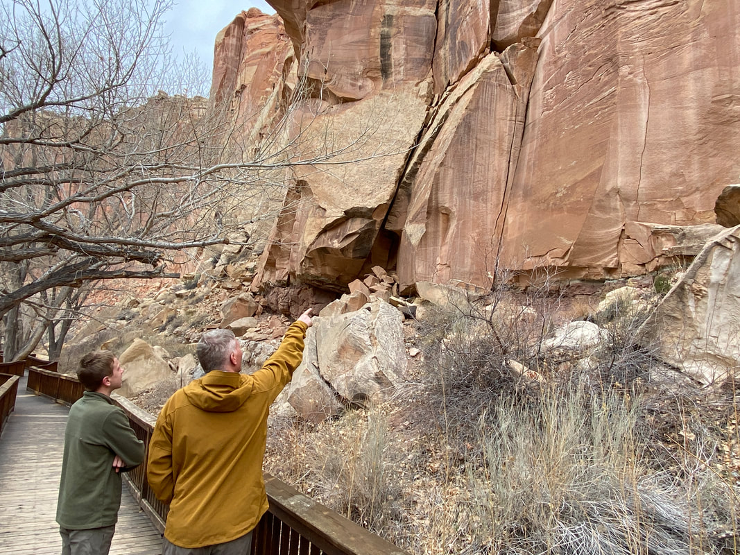
Petroglyphs
Capitol Reef National Park
Petroglyphs
Key Features:
- On Hwy 24 with ample parking even for big RVs
- It takes a good eye to spot some of them
- On elevated walk way
- Very short walk
Key Features:
- On Hwy 24 with ample parking even for big RVs
- It takes a good eye to spot some of them
- On elevated walk way
- Very short walk

The pull off is right on hwy 24, Capitol Reef National Park
|
Viewing area for largest petroglyphs, Capitol Reef National Park
|
Getting a close up look, Capitol Reef National Park
|

A decked boardwalk makes this trail easy for all, Capitol Reef National Park
|
Petroglyphs (.3 miles)
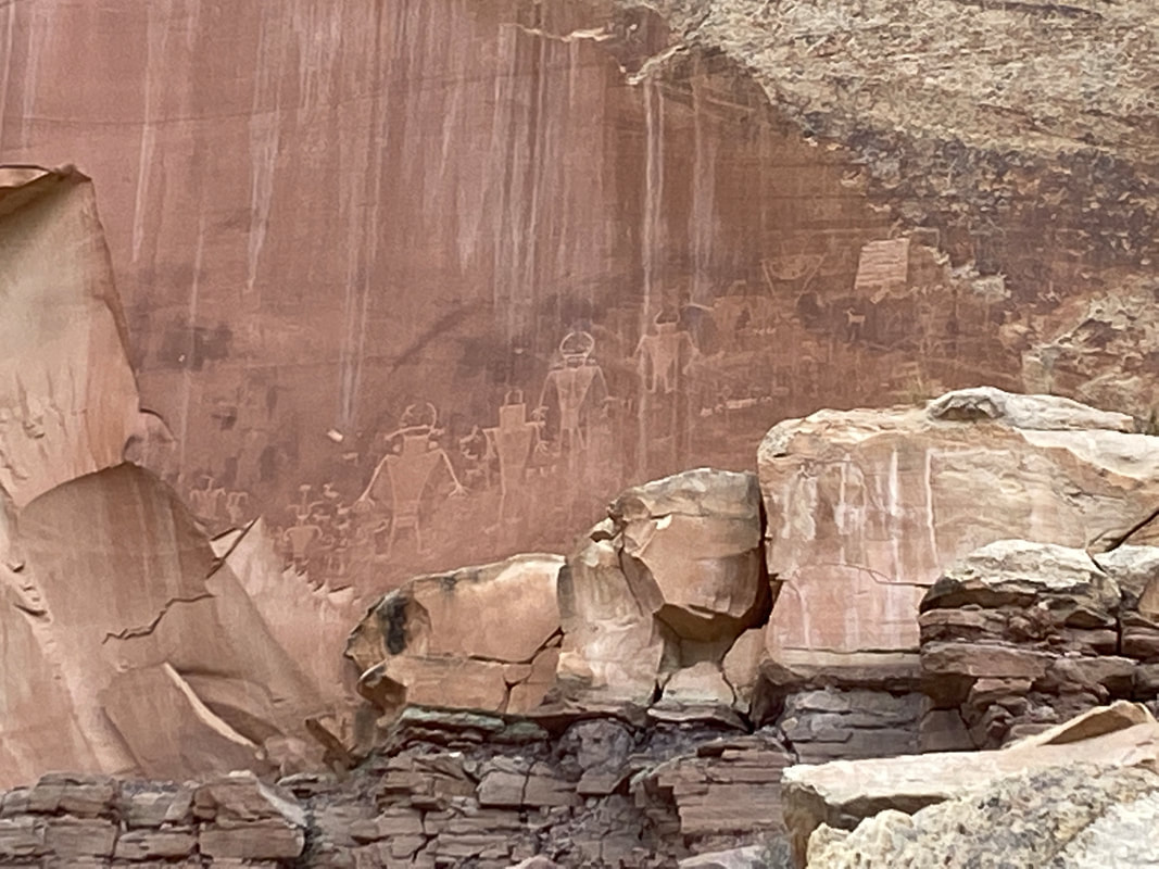
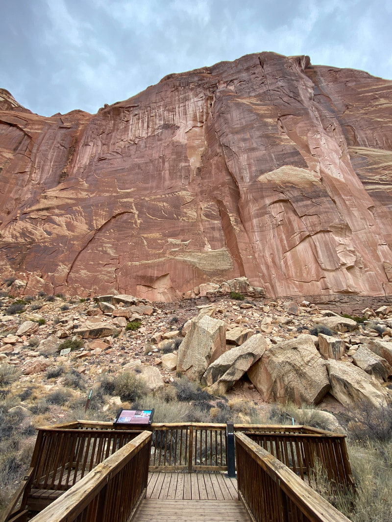
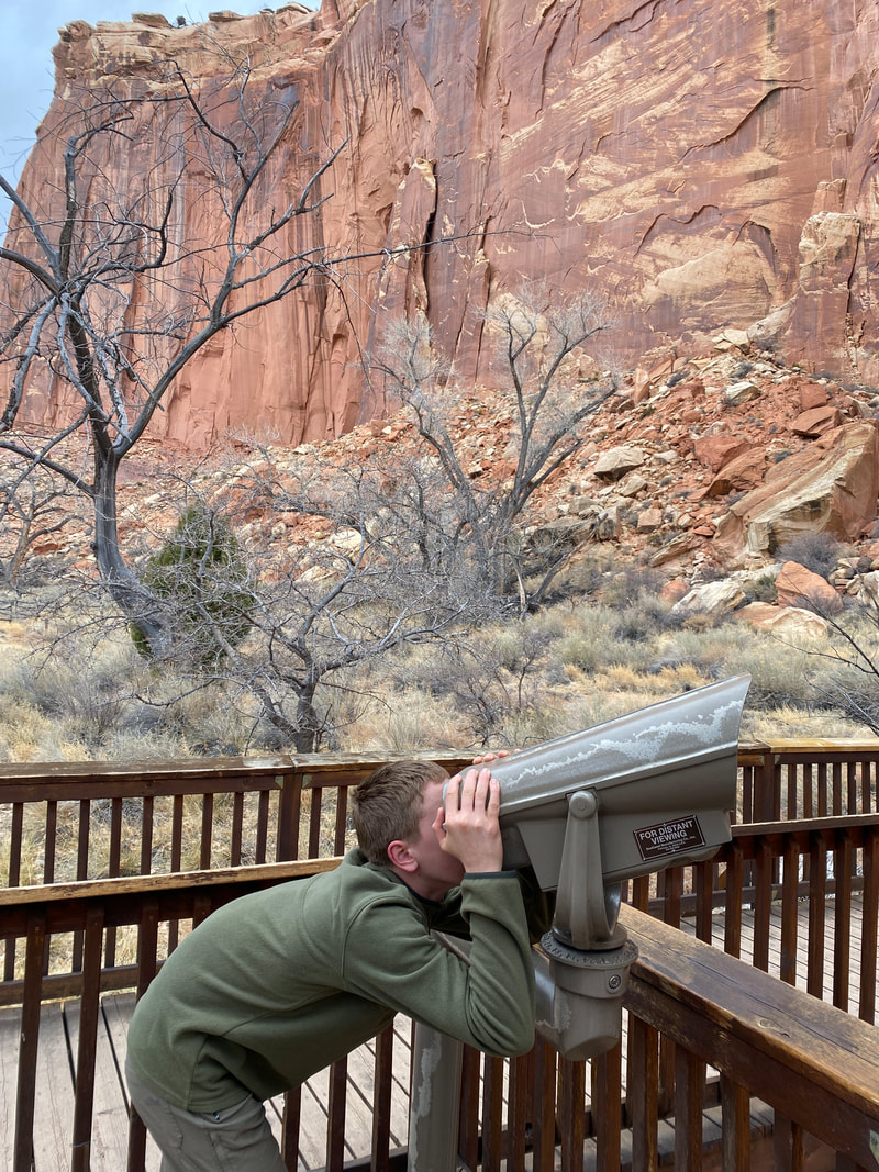
The park is fortunate to have a rich Native American history and cultural elements are found throughout the park and in the city of Torrey. The main attraction off the main road through the park is a boardwalk built along the rising cliff face of deep red Sandstone cliffs. Winding through the Freemont River valley, lined with cottonwood trees, grasses, and orchards, you come to a nice parking area and an immediate start to the boardwalks. At first, it might be hard to find and identify, but visitors will quickly hone in on the faint etchings that were carved into the cliff face years ago. The shapes are primitive depictions of people, mostly with triangular bodies and stick limbs, rudimentary animal shapes, and curving plantlike shapes. Some of the petroglyphs etchings have been lost over time to erosion of the freezing and thawing and rockfalls known in this area. You can see where the rock face sheered right off and the etchings were lost to a pile of rubble. This makes witnessing them even more of a treat, knowing that over time, they will be lost forever. There are probably a series of 10-12 etchings to view and the walk is about a football field in length at most. We saved this side trip for a 20 minute time span when a storm was threatening and we were deciding what appropriate actions would be for the evening.
Trying to find those petroglyphs, Capitol Reef National Park
|
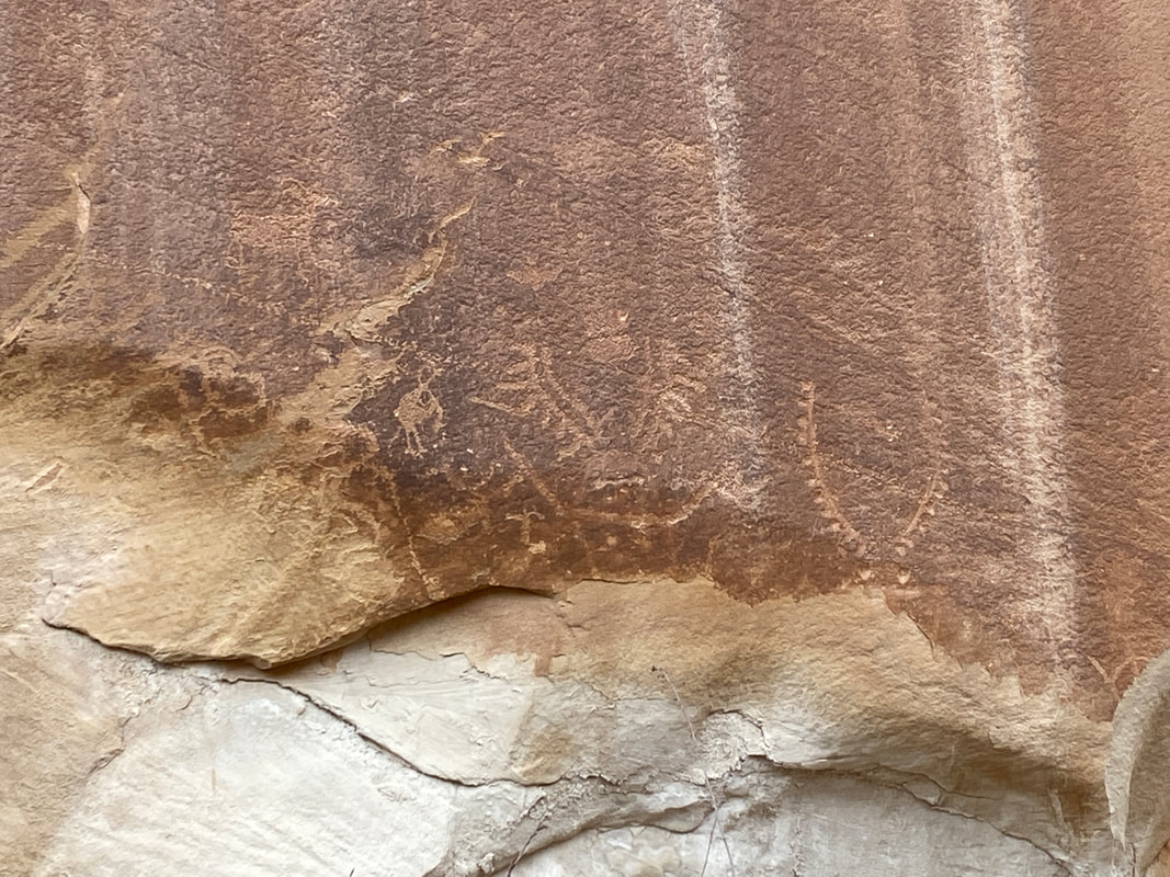
Petroglyphs, Capitol Reef National Park
|
|
|
|
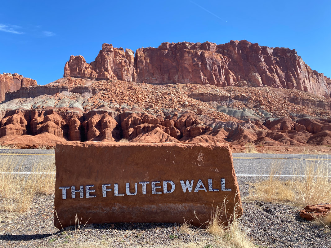
Driving Highway 24 & Notom Rd.
The scenic drive, past the campground, in Capitol Reef National Park
Driving Capitol Reef
Key Features:
- Smooth, well-maintained roads
- Epic views of the red rocks and formations
- Gets you close to some of the best features
- Plenty of pull offs for picture taking
-Not bumper to bumper
Key Features:
- Smooth, well-maintained roads
- Epic views of the red rocks and formations
- Gets you close to some of the best features
- Plenty of pull offs for picture taking
-Not bumper to bumper
One of the many scenic pullouts, Highway 24, Capitol Reef National Park
|
Views from Highway 24, Capitol Reef National Park
|
Views from Highway 24, Capitol Reef National Park
|
Highway 24, Capitol Reef National Park
|
The Burr Switch backs, Capitol Reef National Park
|
Driving Capitol Reef
If driving Capitol Reef is the only thing you have time for, it would be sad, but would not disappoint you. Most of the drive through the main area of the park follows State Highway 24. It is paved with pull offs for panoramic vistas and rock formation highlights. With a clear day, you’ll have nice contrast with the rock layers and the colors will pop off your blue sky backdrop, but even on a cloudy day the views are amazing and impressive.
The town of Torrey is quite small with only 300 full time residents. The town clearly caters to food, fuel, and lodging of park visitors, but is small and quaint. You’ll immediately encounter the massive red rock walls of Capitol Reef, and drive alongside them for miles before dropping into the Fruita District and Park Visitor Center. It is a tiny center, staffed with only 2 park rangers for trail information and offers very few displays and information as to the Geology and history of the area. Our experience was that the park rangers were not incredibly familiar with the trails firsthand, indicating most visitors stick to the short front-country hikes and were not entering the backcountry canyons, BLM lands, or dirt road sections off Notom Road.
After passing the visitor center, you journey can branch off numerous directions. You can proceed brought the Freemont River valley and see mule deer, orchards, petroglyphs, and head for the Notom Road. Or, you can turn into the Fruita historic town and camping areas and journey on out through the scenic drive of the park.
Most of our adventures were off the Notom Road in what is called the east side of the park and down further into the backcountry routes of the Water Pocket Fold. This impressive area has some ranches and offers incredible views of the Henry Mountains and some interesting rock formations, pillars, and landscapes. Several slot canyon trailheads are found here and we noted maybe 10 parties parked in this area all week, indicating it is the true backcountry adventure and solitude you are probably seeking. BLM lands offer numerous backcountry camping options, and our 2 favorite nights of camping were off the Notom Road on some secluded spots.
Eventually, Notom Road turns to dirt after about 20 miles (5 miles past Sheets Gulch) and is impassable in the rain, but worth the drive to access some of the best parts of the park. Many of the park maps were not up to date on the status of this road, so keep that in mind and as long as you feel comfortable with your weather and vehicle capabilities, don’t be intimidated to drive it.

The Burr Switch Backs, Utah Capitol Reef National Park
|
The paved section of Notom Road, Capitol Reef National Park
|
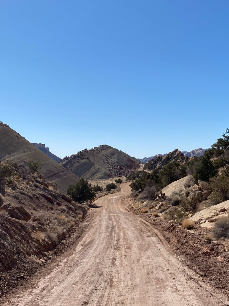
The unpaved section of Notom Road, Capitol Reef National Park
|
|
|
|
Cotton Wood Wash
Capitol Reef National Park
Cotton Wood Wash
Key Features:
- On paved section of Notom road
- About a 1.5 mile walk in before it gets interesting
- Has a large pool that is usually full before the end
- in our opinion it is a harder hike than Sheets Gulch
- Popular BLM camping areas near trail head
Key Features:
- On paved section of Notom road
- About a 1.5 mile walk in before it gets interesting
- Has a large pool that is usually full before the end
- in our opinion it is a harder hike than Sheets Gulch
- Popular BLM camping areas near trail head
Walking the sandy wash into Cotton Wood Wash, Capitol Reef National Park
|
Scrambling over boulders as we move up Cotton Wood Wash, Capitol Reef National Park
|

Climbing over choke stones, Cotton Wood Wash, Capitol Reef National Park
|
The arrow head choke stone, in Cotton Wood Wash Capitol Reef National Park
|
The passage under the arrow head choke stone, Cotton Wood Wash, Capitol Reef National Park
|
Cotton Wood Wash
Cottonwood Wash starts about nine miles down Notom Road, still on the paved portion accessible to passenger vehicles no matter the weather. Do not hike this route if any weather is looming or threatening as the narrows, slots, and wash will flood.
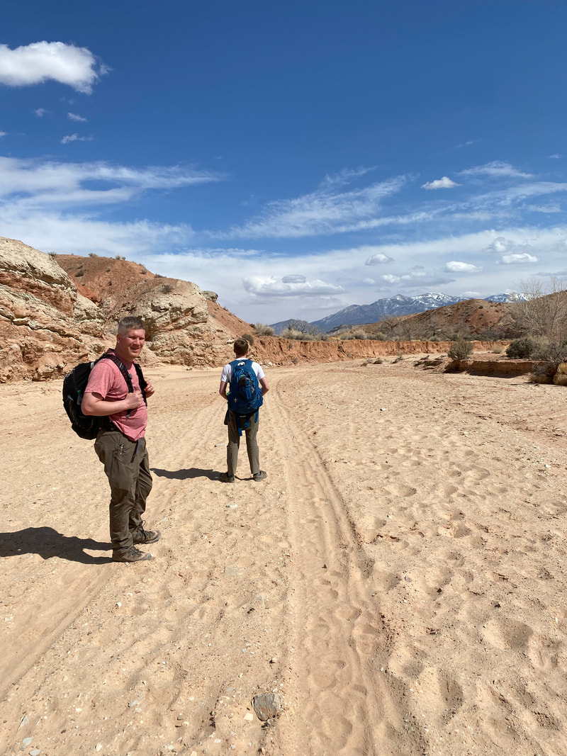
This hike begins in a long wide open wash that meanders around a curvy valley, and is loose and sandy, which can make for frustratingly slow going to begin your day. Look for the side trails that cut the corners of the wash and speed up the hike. While still sandy, and full of undergrowth and brush, these do shave off some time and wandering on your hike.
Along the first mile, the Mountain View’s behind you are really amazing, so don’t forget to look back and look forward to a very nice exit hike. There are several campsites along the way in before the park begins and it is BLM land. Horseback riders like this area as a camp ground, so be mindful that you might share the trail or need to keep your eyes peeled for droppings. There was a little bit of water in the first portion of this hike if you are overnighting to get an early start, you should be able to filter a little water early on.
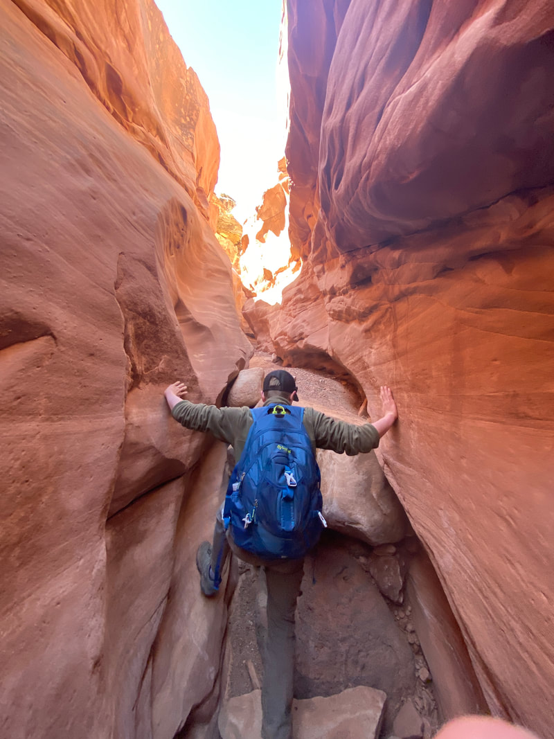
Once you leave the wide wash, you start heading into the narrows, which I found to be the most interesting and challenging path finding of the hike. Large boulders, wide slickrock outcropping, and chutes make this an ever changing portion of the hike. THere are numerous ways to navigate this portion of the hike, and we had fun scouting out the best most adventurous route. At times we charged through the deep channels and climbed the rock features, and at other times we snaked our way around the pile of boulders tossed in the charging water coming out of the narrows. Imagining it full of fresh rain water, powering through the narrows was awe inspiring, and while I wouldn’t want to be there, I was very curious what it might look like in full fury. This made it evident how dangerous it could be after fresh rain.
If the weather is right, the final section of the out and back trail is the actual slots. Depending on how the conditions are, you might be stopped early on by water, or you might luck out as we did and find it dry and navigable. This is where the real slot canyon skills began and we found ourselves trying new methods of navigating the features, whether is be stemming, bridging, and chimneying. These were a combination of hand-feet, leg-back, and arm-leg combinations providing various types of friction against the rough rock to allow you to pull yourself up and over obstacles. Most of these felt very natural and it was simply a process of getting creative with what the situation required to get up and over the area.
This portion of the hike had enormous walls and deep shadowy slots. It winded and twisted through the rock and you had an absolute solitude and isolation feeling. I surprisingly never felt unsafe as I anticipated. Each challenge just felt like you either could or could not make it up and over, thus each obstacles would either be surpassed or be the end of your journey and your turnaround point. I was nervous on the way in that the way out would be even more challenging, but somehow this slot felt equal in direction. Each area just made you pause, think through your options, try some hand holds, and then give it a try. Having 3 of us hiking allowed one person to lead climb, someone to follow up, and the weakest person be supported in the middle. I think hiking with 3 or more would maintain a safer experience.
This was a truly memorable day, and gave us everything we had hoped for coming out to Utah. The scenes were constantly changing, the terrain was giving new challenges at every turn, and we never tired of the same scenes all day. We made it about 2.5 of the 3 miles before hitting our turnaround time before weather and when our skills set was not enough to continue through the muddy, tight slot that required a sustained over sinuous slot with 2 choke stones over a 10 foot drop.
We only saw 2 hiking groups on this hike, so it gave us the solitude we were hoping for.
This hike begins in a long wide open wash that meanders around a curvy valley, and is loose and sandy, which can make for frustratingly slow going to begin your day. Look for the side trails that cut the corners of the wash and speed up the hike. While still sandy, and full of undergrowth and brush, these do shave off some time and wandering on your hike.
Along the first mile, the Mountain View’s behind you are really amazing, so don’t forget to look back and look forward to a very nice exit hike. There are several campsites along the way in before the park begins and it is BLM land. Horseback riders like this area as a camp ground, so be mindful that you might share the trail or need to keep your eyes peeled for droppings. There was a little bit of water in the first portion of this hike if you are overnighting to get an early start, you should be able to filter a little water early on.
Once you leave the wide wash, you start heading into the narrows, which I found to be the most interesting and challenging path finding of the hike. Large boulders, wide slickrock outcropping, and chutes make this an ever changing portion of the hike. THere are numerous ways to navigate this portion of the hike, and we had fun scouting out the best most adventurous route. At times we charged through the deep channels and climbed the rock features, and at other times we snaked our way around the pile of boulders tossed in the charging water coming out of the narrows. Imagining it full of fresh rain water, powering through the narrows was awe inspiring, and while I wouldn’t want to be there, I was very curious what it might look like in full fury. This made it evident how dangerous it could be after fresh rain.
If the weather is right, the final section of the out and back trail is the actual slots. Depending on how the conditions are, you might be stopped early on by water, or you might luck out as we did and find it dry and navigable. This is where the real slot canyon skills began and we found ourselves trying new methods of navigating the features, whether is be stemming, bridging, and chimneying. These were a combination of hand-feet, leg-back, and arm-leg combinations providing various types of friction against the rough rock to allow you to pull yourself up and over obstacles. Most of these felt very natural and it was simply a process of getting creative with what the situation required to get up and over the area.
This portion of the hike had enormous walls and deep shadowy slots. It winded and twisted through the rock and you had an absolute solitude and isolation feeling. I surprisingly never felt unsafe as I anticipated. Each challenge just felt like you either could or could not make it up and over, thus each obstacles would either be surpassed or be the end of your journey and your turnaround point. I was nervous on the way in that the way out would be even more challenging, but somehow this slot felt equal in direction. Each area just made you pause, think through your options, try some hand holds, and then give it a try. Having 3 of us hiking allowed one person to lead climb, someone to follow up, and the weakest person be supported in the middle. I think hiking with 3 or more would maintain a safer experience.
This was a truly memorable day, and gave us everything we had hoped for coming out to Utah. The scenes were constantly changing, the terrain was giving new challenges at every turn, and we never tired of the same scenes all day. We made it about 2.5 of the 3 miles before hitting our turnaround time before weather and when our skills set was not enough to continue through the muddy, tight slot that required a sustained over sinuous slot with 2 choke stones over a 10 foot drop.
We only saw 2 hiking groups on this hike, so it gave us the solitude we were hoping for.
Rock hopper resting, Cotton Wood Wash, Capitol Reef National Park
|
After the large pool, the slot canyon tightens, Cotton Wood Wash, Capitol Reef National Park
|
Cotton Wood Wash, Capitol Reef National Park
|
|
|
|
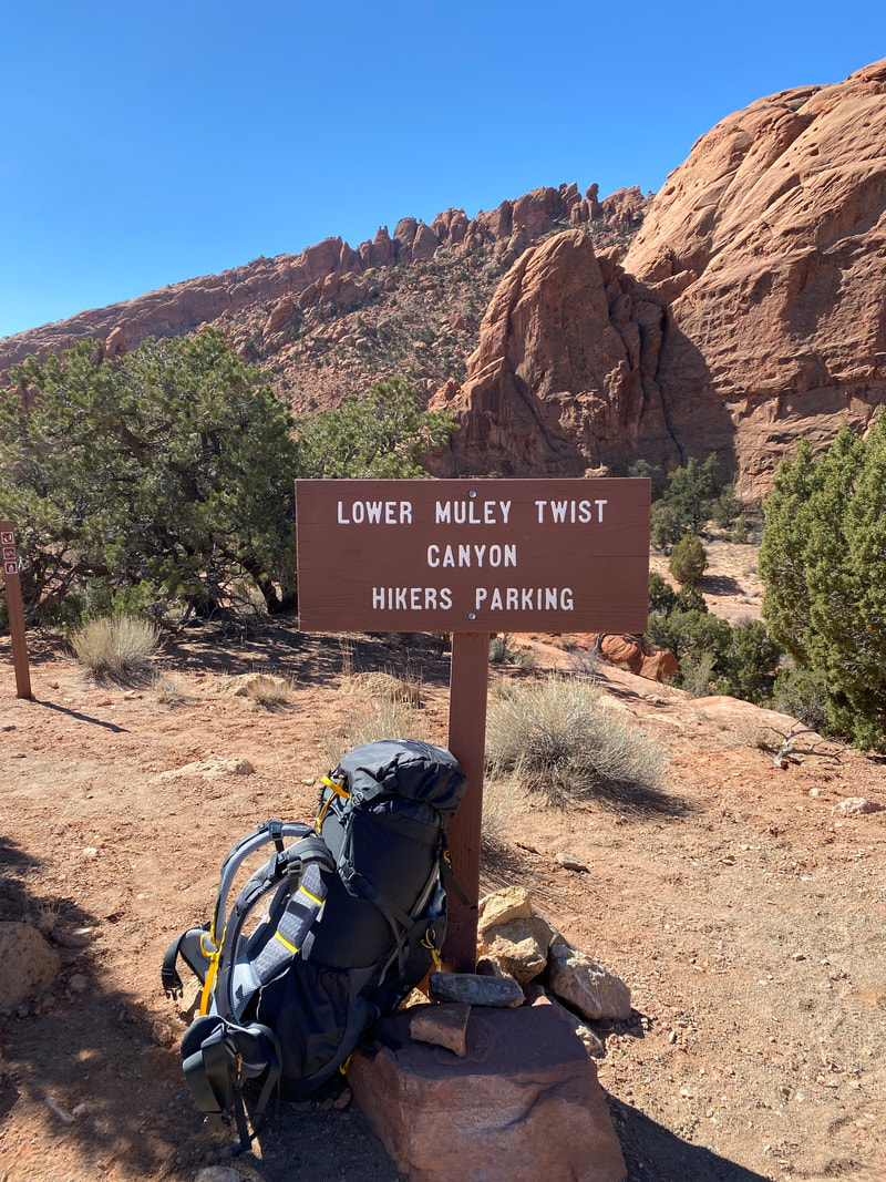
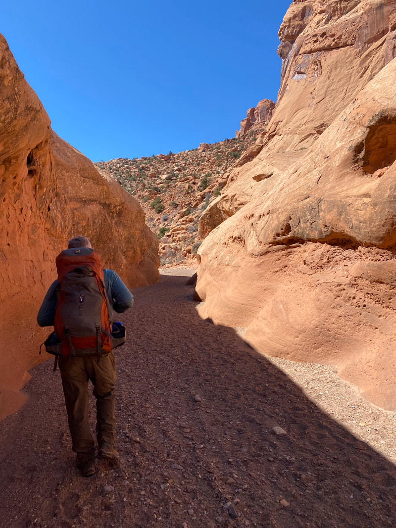
Lower Muley Twist

Capitol Reef National Park
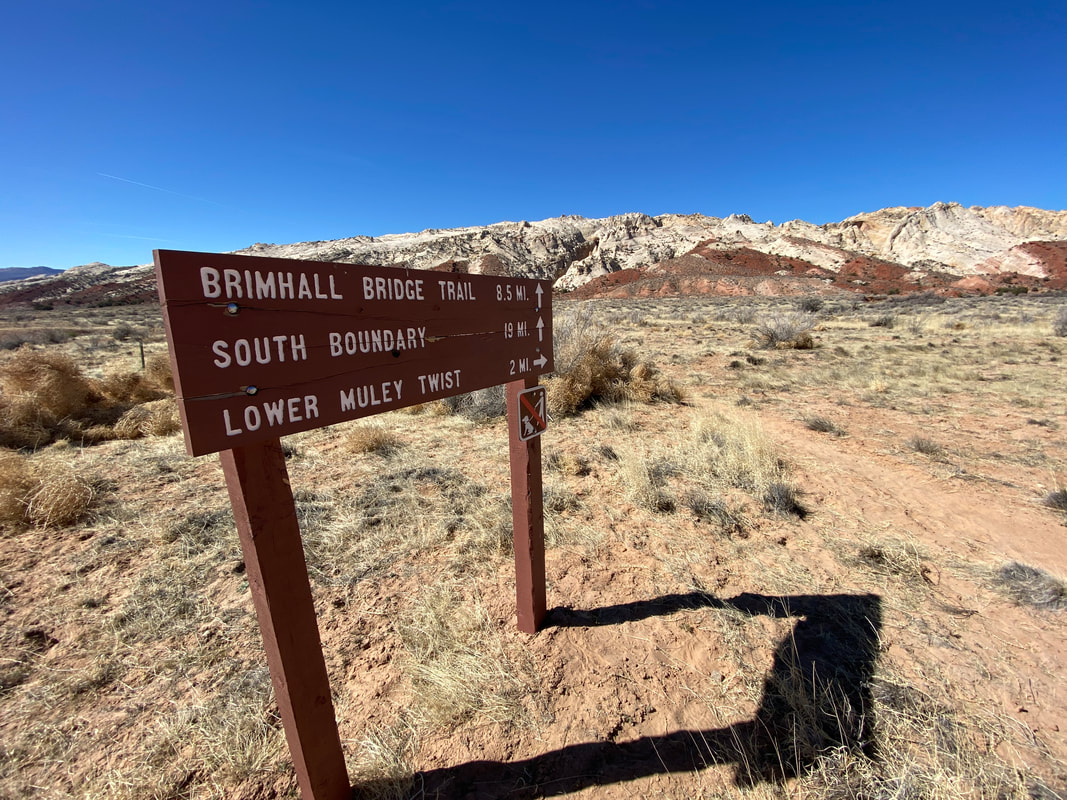
Lower Muley Twist
Key Features:
- Multiple ways to reach the trail
- Will require driving on a dirt road, that is usually passable to passenger cars
- The cutoff route has some steep sections on slick rock
- Do not expect to find any water along the trail
- Nice narrow sections on the Burr road section of trail
- Massive alcoves on the main section of trail
- Historic graffiti can be found in the cowboy cave (alcove)
- a loop hike will require a 5 mile walk in the desert
Burr Road Trail head for the Lower Muley Twsit, Capitol Reef National Park
|
Scenic narrows along the Lower Muley Twist, Capitol Reef National Park
|
Expect boulders in the wash, Lower Muley Twist, Capitol Reef National Park
|
Desert Varnish along the Lower Muley Twist, Capitol Reef National Park
|
Notom Road, Capitol Reef National Park
|
Lower Muley Twist (23 miles)
Burr switchbacks trail head to the cut off (4 miles)
Part of the fun of this hike is the getting there. The long drive down Notom road adds to the sense of isolation and grandeur. Miles of dust, washboard bumps, and tumbleweed get your mind right for the challenges that lie ahead. Along the route, you’ll pass private ranches and you’ll get a great sense of the monocline of the Water Pocket Fold that juts up awkwardly from the earth. The multicolored streaks and layers are awe inspiring. The final adventure of the drive to the Lower Muley Twist Trailhead is ascending the Burr Switchbacks in your car. The hairpin turns and gravelly washouts keep the driver alert and his passengers tightening their seatbelts. This is a certainly not a crowded area due to its isolation, but we did encounter other vehicles on both of our drives up and down the switchbacks, so be mindful that this is also a point of interest for a lot of visitors, even if they are not starting a hike from here. There are approximately 5 switchbacks and the views and enjoyment of driving it are really worth a visit.
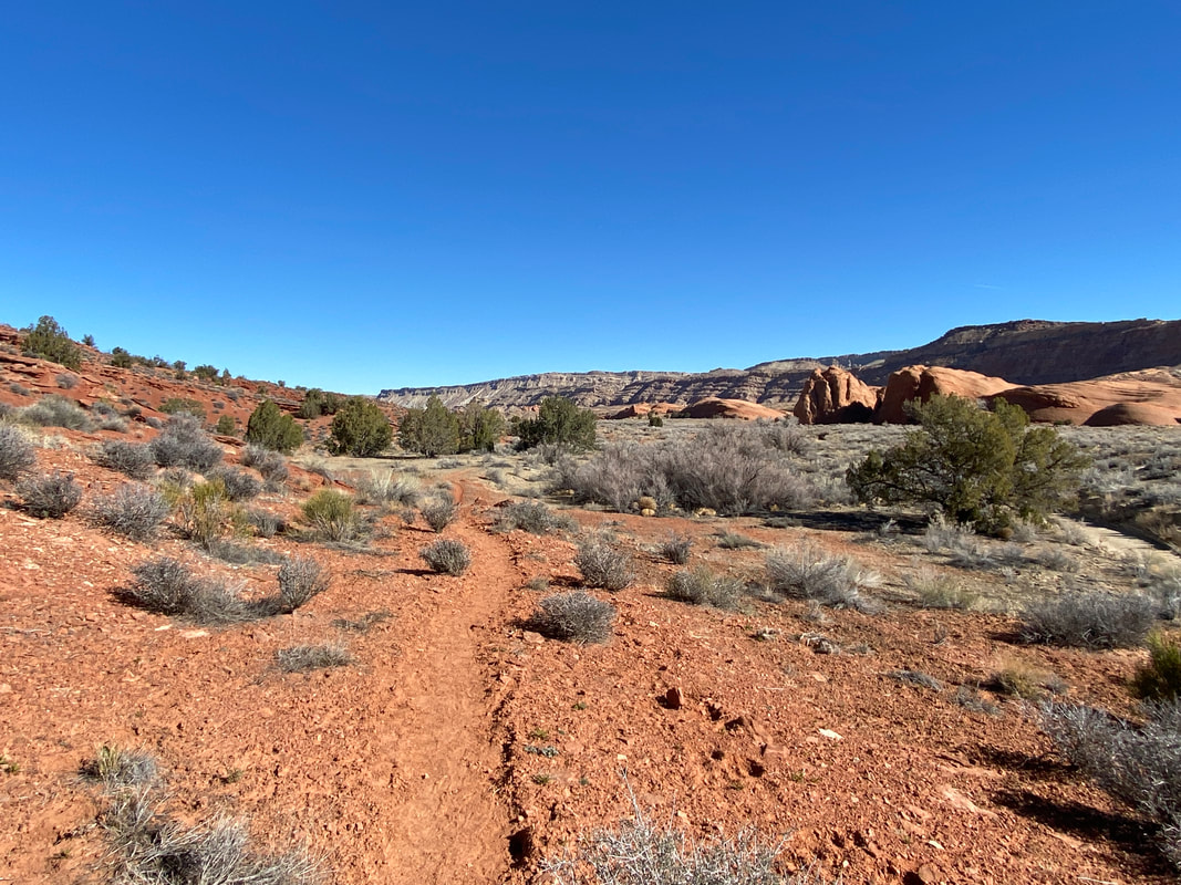
Once finishing the Burr Switchbacks, you will immediately be at the trailhead. This is the less common entry point for the lower Muley Twist Trail. The parking area will only accommodate 3-4 vehicles. After a short walk with just a touch of slick rock you will cross the the creek bed and walk around a 100 yard through the scrub until dropping into the wash for the next 4 miles. This wash was one of the most photogenic sections of Water Pocket Fold. The striking colorations, narrow high walls, and twisting kept the camera out and the jaws dropped. This was probably my favorite section of wash. While the footing was typical of washes, with the loose gravel and sand, it was not as complicated or deep as some washes, so the hike was enjoyable. There was some scrambling and small boulder navigating, but for the most part, it was a pleasant section. This section lacked the massive alcoves you find further down stream, but had some sections of narrows. None were super long, but they were very scenic. This continues for about 4 miles to the intersection with the Cut Off trail.
Part of the fun of this hike is the getting there. The long drive down Notom road adds to the sense of isolation and grandeur. Miles of dust, washboard bumps, and tumbleweed get your mind right for the challenges that lie ahead. Along the route, you’ll pass private ranches and you’ll get a great sense of the monocline of the Water Pocket Fold that juts up awkwardly from the earth. The multicolored streaks and layers are awe inspiring. The final adventure of the drive to the Lower Muley Twist Trailhead is ascending the Burr Switchbacks in your car. The hairpin turns and gravelly washouts keep the driver alert and his passengers tightening their seatbelts. This is a certainly not a crowded area due to its isolation, but we did encounter other vehicles on both of our drives up and down the switchbacks, so be mindful that this is also a point of interest for a lot of visitors, even if they are not starting a hike from here. There are approximately 5 switchbacks and the views and enjoyment of driving it are really worth a visit.
Once finishing the Burr Switchbacks, you will immediately be at the trailhead. This is the less common entry point for the lower Muley Twist Trail. The parking area will only accommodate 3-4 vehicles. After a short walk with just a touch of slick rock you will cross the the creek bed and walk around a 100 yard through the scrub until dropping into the wash for the next 4 miles. This wash was one of the most photogenic sections of Water Pocket Fold. The striking colorations, narrow high walls, and twisting kept the camera out and the jaws dropped. This was probably my favorite section of wash. While the footing was typical of washes, with the loose gravel and sand, it was not as complicated or deep as some washes, so the hike was enjoyable. There was some scrambling and small boulder navigating, but for the most part, it was a pleasant section. This section lacked the massive alcoves you find further down stream, but had some sections of narrows. None were super long, but they were very scenic. This continues for about 4 miles to the intersection with the Cut Off trail.
|
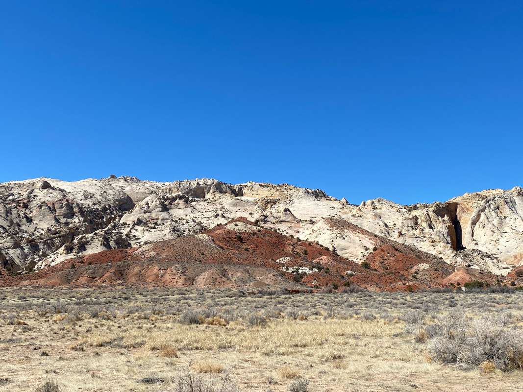
Lower Muley Twist to the desert Halls Creek exit (8 miles) After the cut off trail, the Muley Twist continues down stream and the walls rise to towering heights. This section of the trail was mostly shaded and offered reprieve from the desert sun. As you twisted through the valley, you popped in and out of the sun and shade, at times taking off a layer, and at times adding a layer. The most interesting feature of this section are the massive alcoves and undercuts, proof of the power of water and erosion over time. The wash meanders or twist back and forth, slightly less “twisty,” but just as interesting. Cottonwoods are the clear indication of possible water prescience, and in March we were able to find one deeper pool of water to filter from that seemed clear of any signs of cattle. After scrambling rocks for upwards of 10 miles, hikers maybe antsy to find the final Cowboy Cave, the final massive alcove and marker that you are nearing the exit of the canyon, and most hikers end point for day one. The hundred year old grafitti will be the tell tale sign that you’ve arrived, and you will note the massive alcove that dwarfs anything that came before. This area must clearly have been a favorite spot for cowboys as both sides of the canyon maintain large areas of shade and breeze at both morning and night. Another 20 or so minutes will have you turning the final corner and headed toward the desert. While there are several camping options, finding one level and free of wind may be a challenge. Picking a sandy flat spot that suites your tired feet and committing for the night are a struggle with so many options around the next curve. To exit the canyon fully, there is a cairned cut off to save walking down to intersection with Halls Creek. This section was extremely photogenic as the massive high walls peeked into the desert mountains ahead, beaconing hikers onward. This section is roughly the last one mile of the 8 in this section, but hikes very quickly and easily with light gravel under foot. |
Following the wash through a huge alcove, Lower Muley Twist, Capitol Reef National Park
Towering cliffs along the Lower Muley Twist, Capitol Reef National Park
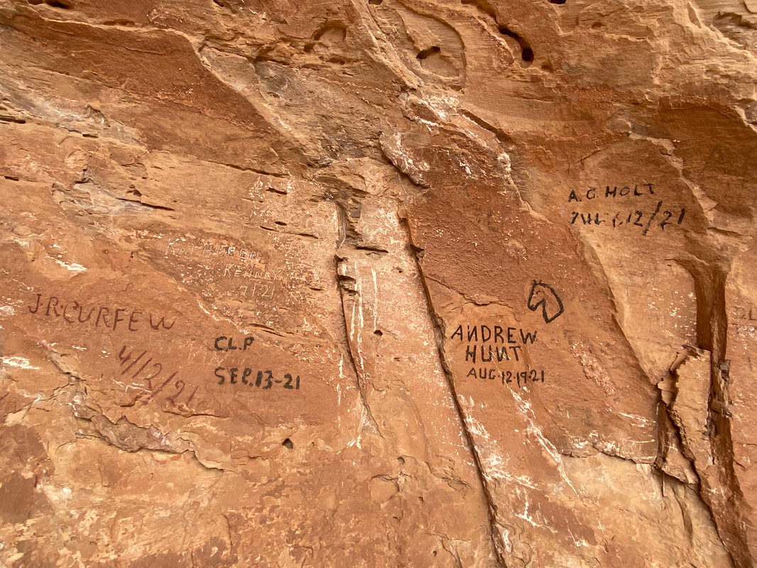
Graffiti in Cow Boy Cave, Lower Muley Twist, Capitol Reef National Park
|
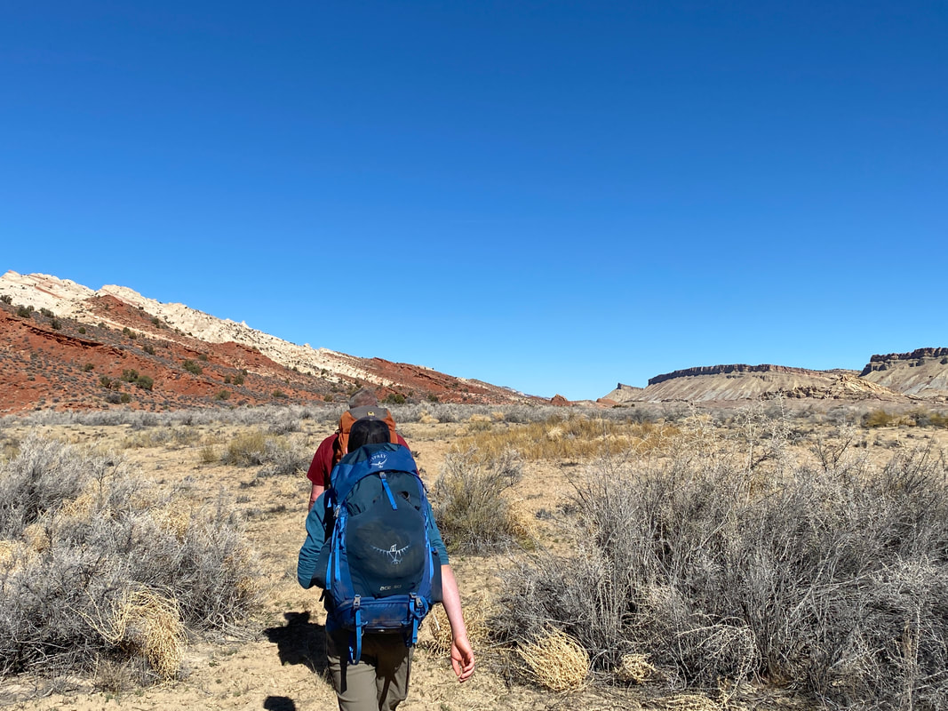
Walking the Halls Creek drainage back to The Post (5 miles)
Hikers need to be ready for desert hiking as they exit the canyon and the terrain, views, and climate conditions change dramatically. We anticipated a cold 27 degree morning with possible wind and were pleased to find the wind had mostly abated, however, the morning chill was still present for the first hour of the hike and we remained in our jackets, slowly stripping layers as we hiked. The important thing to remember on this section is that you will be in FULL sun, and despite any cold weather, there will be no break from the desert sun. Sun screen, hats with brims and/or neck protection are a must as we learned the hard way anticipating cold weather gear and absent-mindedly forgetting the sun screen. These miles seems to absolutely fly by compared to the canyon miles. The trail is flat, sandy and well-marked and we made they 5 miles at a 3 mile an hour + pace. The views on this section of the hike were the highlight of the adventure for me. Watching the desert animal footprints and seeing the desert flora and fauna up close kept my hiker mind busy. The sense of distance and scale was also a new hiking challenge. The valley markers looked far away, but we quickly found ourselves upon them and the scene changing unexpectedly as we hiked.
The Post (trailhead for some, pit toilet and break spot for others)
The Post is named after the ranchers’ cattle holding area and you’ll break right next to old fence posts. Hiking up the cut off and looking back will give you a much better impression of the size and purpose of this area historically. Looking up at the cut off trail from this area, you can just slightly make out the ascent up the red rock band and over the hard Navajo sandstone slick rock. Looking up at the route is slightly intimidating for less than fresh hikers as you are essentially going to go “up and over” the entire Water Pocket Fold.
Lower Muley Twist near the exit to Halls Creek and the walk back to the Post, Capitol Reef National Park
|
Returning to the Post, across the desert, Capitol Reef National Park
|
A worn desert trail, Capitol Reef National Park
|
Great views of the Water Pocket Fold on the way back to the Post, Capital Reef National Park
|
Cut off route (2 miles)
We were nervous about this route as numerous guidebook resources and online material called this a challenging hike with extreme exposure in some areas. Being from the Midwest, it was hard to judge what exactly exposure risks were considered. We always try to err on the side of caution in new areas and don’t want to assume our hiking skills always apply in new areas and conditions. Hopefully, this philosophy will continue to keep us humble and safe. So we asked each of the 3 parties we saw along the route what their opinion was as to the cut off’s difficulty. They all called it enjoyable with epic views and simply said to be cautious and follow the cairns. They were all day hikers with fresh legs and light packs, so we were still slightly trepidations. So with that in mind, and with the nervous minds of parents taking their child into danger, we proceeded up the route...
Immediately the steepness slapped us in the face and our packs seemed to pull us backwards. With one foot in front of the other we trudged upward and onward, quickly climbing and gaining elevation. Despite the vertical challenge, hikers are rewarded with immediate and epic views of the Water Pocket Fold and desert valley that you’ve just hiked all morning. The Henry Mountains, the Water Pocket Fold, the Post... all open up before you in epic style. Following the red rock band that juts out in hard angular strips leads you up the first section of many over the fold.
The next section of hiking is what could be considered exposure. The hike transitions to white Navajo Sandstone and harsh angles of slick rock. With packs on you back, you’ll carefully place each step on your way straight up, over and around, and switch backing up and down this section. Following cairns will possibly give you an easier route, but all directions seem to provide equal challenge as the full sun beats down, upping the ante of this section. Once you reach the actual top, the fold slightly flattens out and the red rocks of the Lower Muley Twist come into view. There is a small arch located in clear view right before you drop back into the valley. I would estimate about 2/3 of this cut off is actual up climbing, with a sandy meandering downhill on the other side. Only when you are perched directly over the canyon do you really return to a descend, and it is quick and steep, but does not feel dangerous in the slightest compared to what you have just climbed. Once again, sun protection and water are key factors to your success of this traverse.
The final section of the lollipop loop will be through the 4 mile twisty canyon section mentioned earlier that leads back to the Burr Road trail head for a total of 23 miles on this hike. However this hike could easily be started and finished at the Post to make it 8 miles shorter or done as an out and back from either trail head.
2 miles over the Water Pocket Fold or 5 miles around to reach Lower Muley Twist, Capitol Reef National Park
|
You will hike over the Water Pocket fold on the Cut Off trail, Capital Reef National Park
|
Crossing some slick rock on the Cut Off route, Capitol Reef National Park
|

Notom Road, Capitol Reef National Park
|
|
|
|
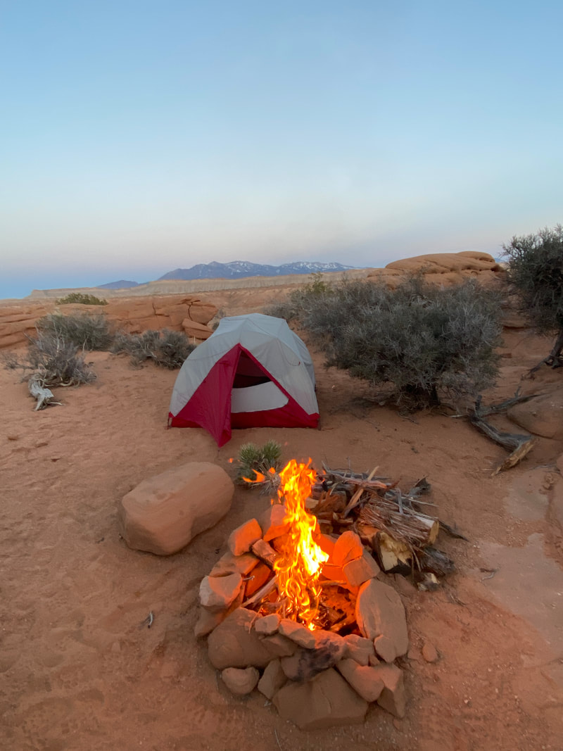
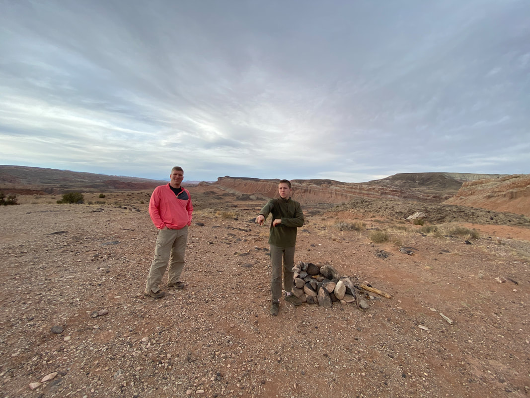
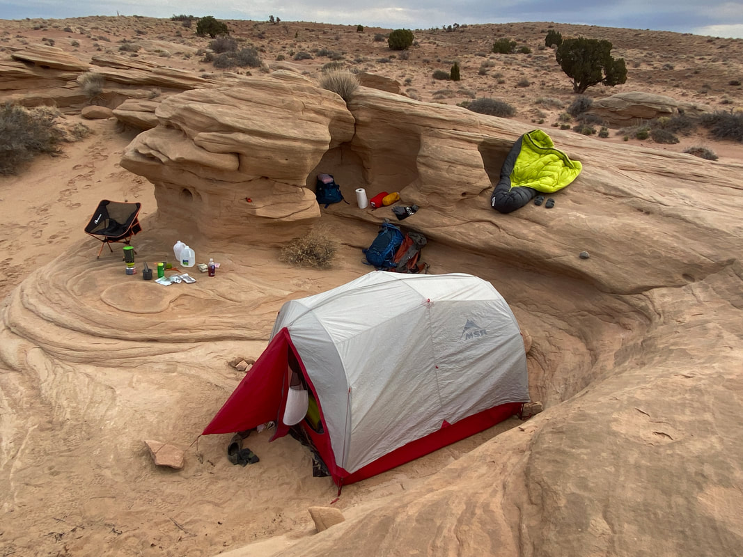
BLM Camping
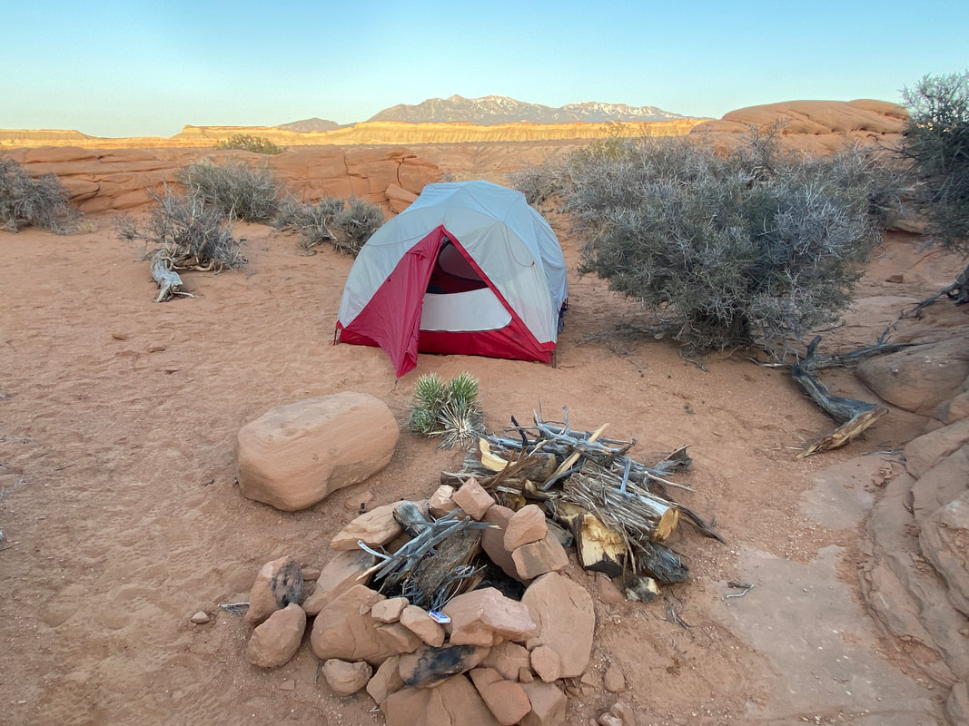
Camping on BLM property just outside Capitol Reef National Park
BLM Camping
Key Features:
- On paved section of Notom Road
- Many campsite to choose from
- Popular and fill up quickly
- You may have to work to find a secluded site
- Can backpack in or camp from the back of your vehicle
Key Features:
- On paved section of Notom Road
- Many campsite to choose from
- Popular and fill up quickly
- You may have to work to find a secluded site
- Can backpack in or camp from the back of your vehicle
Looking out at the Henrys, BLM property of Notom road
|
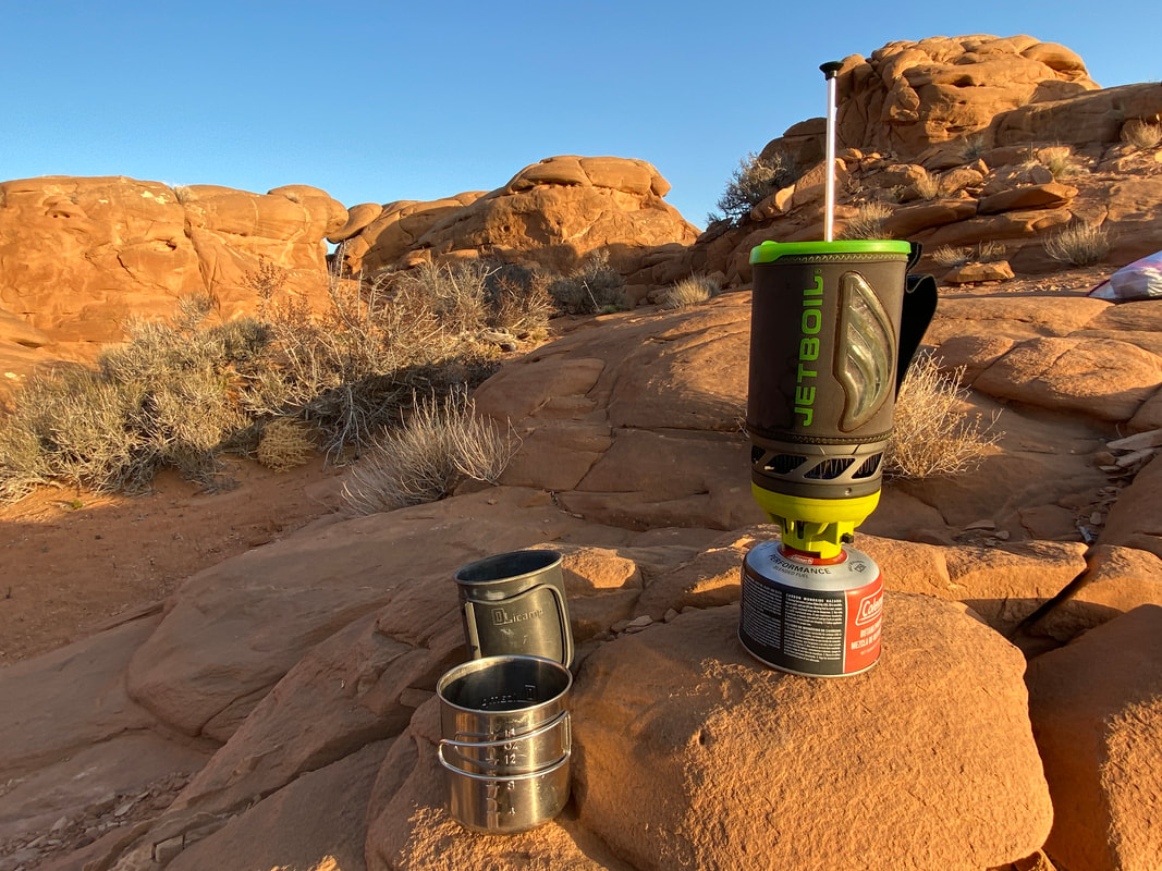
Making coffee, BLM property of Notom road
|
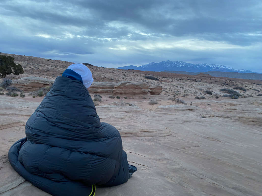
Waiting for the sunrise over the Henrys, BLM property of Notom road
|
The first campsite we found, BLM property of Notom road
|
Finding shelter from the wind, BLM property of Notom road
|
BLM Camping
Under construction
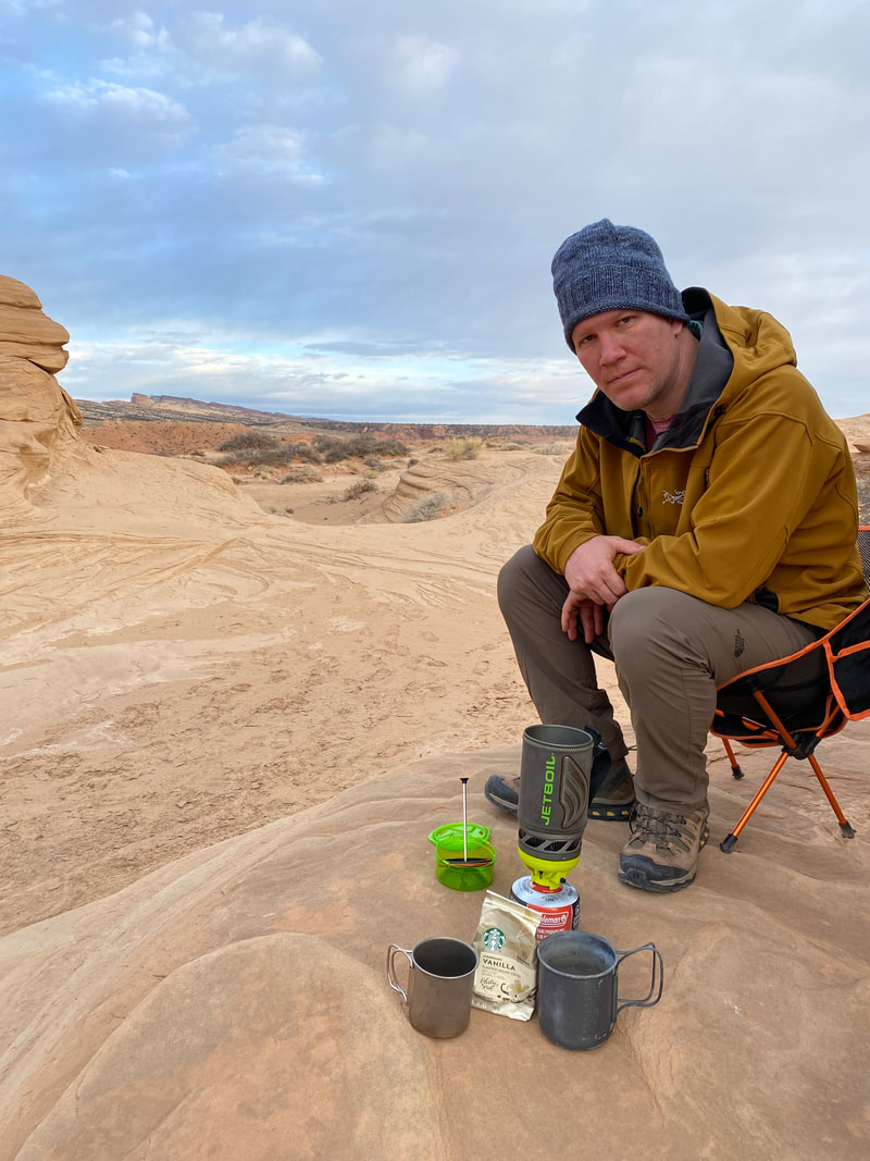
Making coffee, BLM property of Notom road
|

Looking for a campsite, on BLM property of Notom road
|
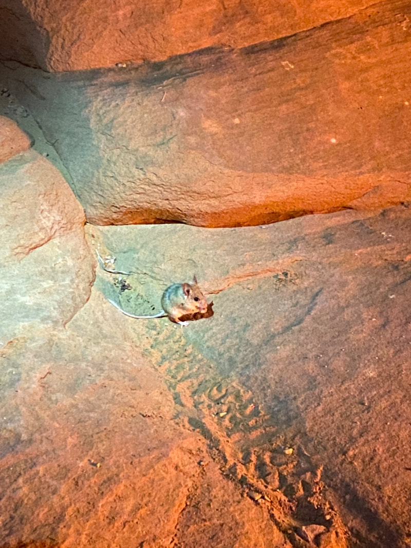
The desert animals came out at night, BLM property off Notom road
|
|
|
|