Shawnee National Forest
Shawnee National Forest encompasses nearly 300,000 acres of valley, ridges, and oak hickory forests in the southern tip of Illinois. The forest system has many trails and recreation opportunities which we have yet to explore.
Shawnee National Forest
Key Features:
- Cliffs and rock formations
- Wildflowers in the spring
-Some areas are very high traffic others receive very little use
-Back country camping opportunities
-Wide variety of trail options
- Many areas are multi-use
Key Features:
- Cliffs and rock formations
- Wildflowers in the spring
-Some areas are very high traffic others receive very little use
-Back country camping opportunities
-Wide variety of trail options
- Many areas are multi-use
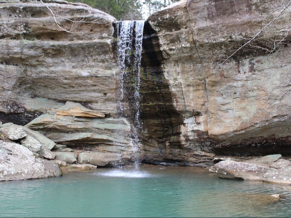
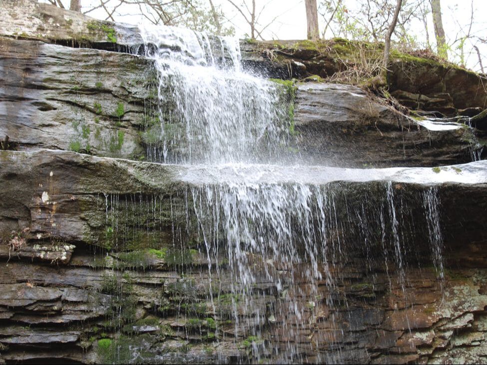
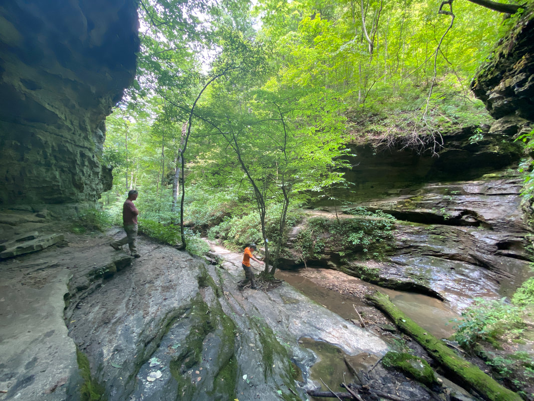
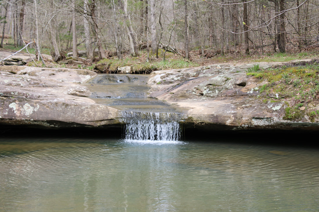
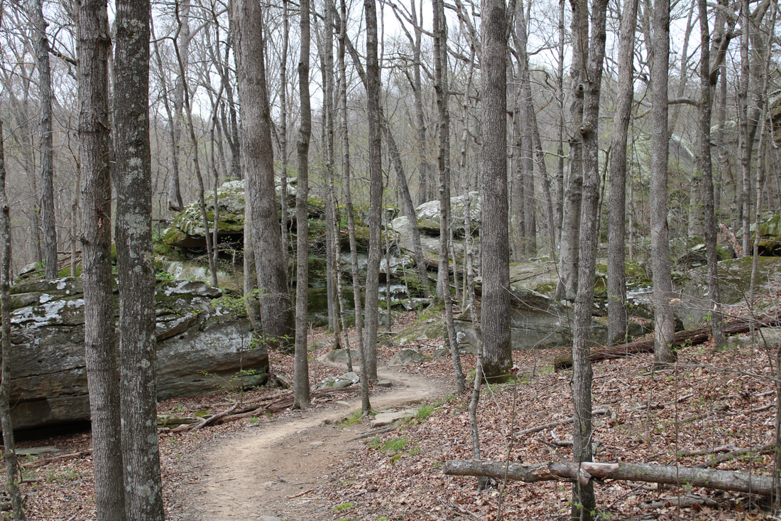
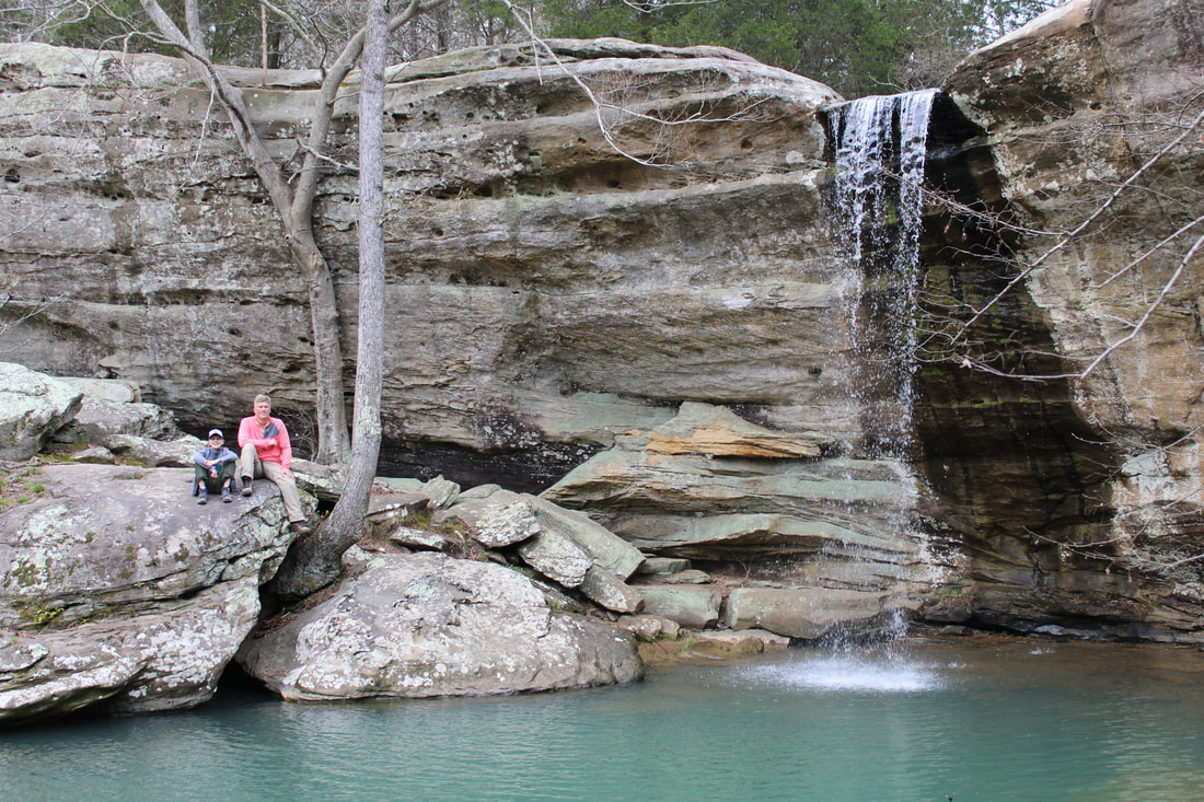
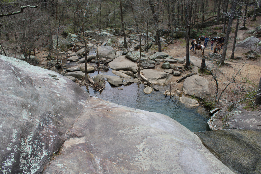
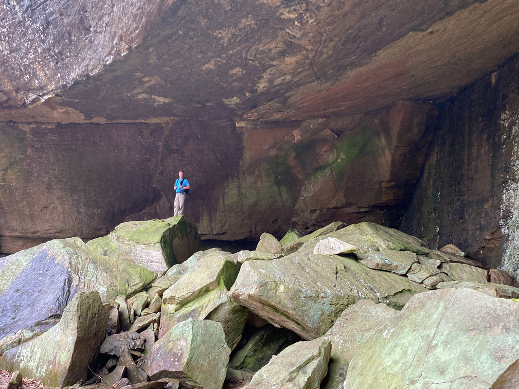
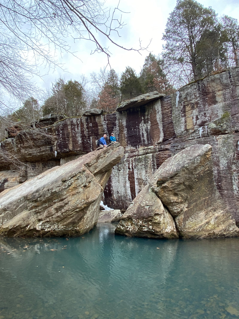
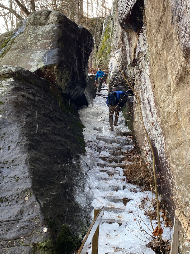
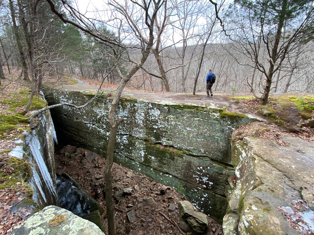
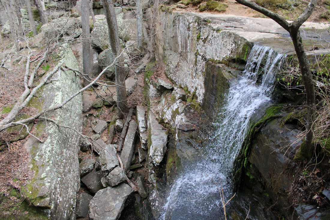
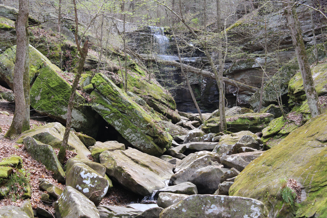
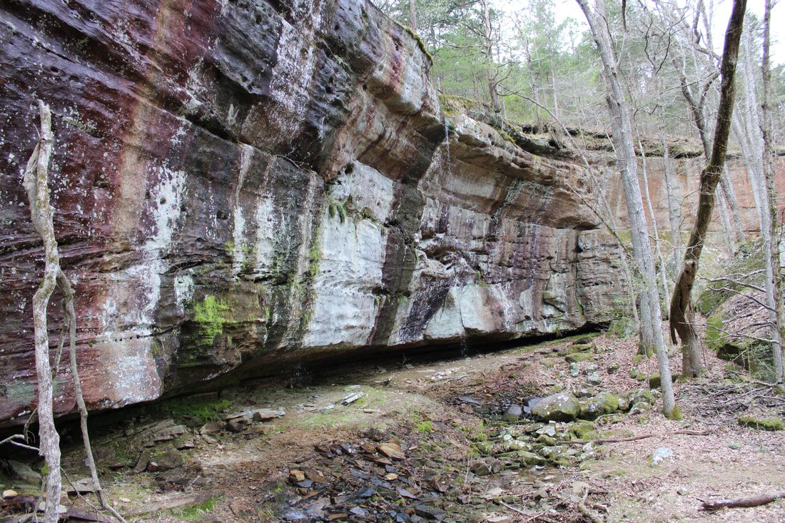
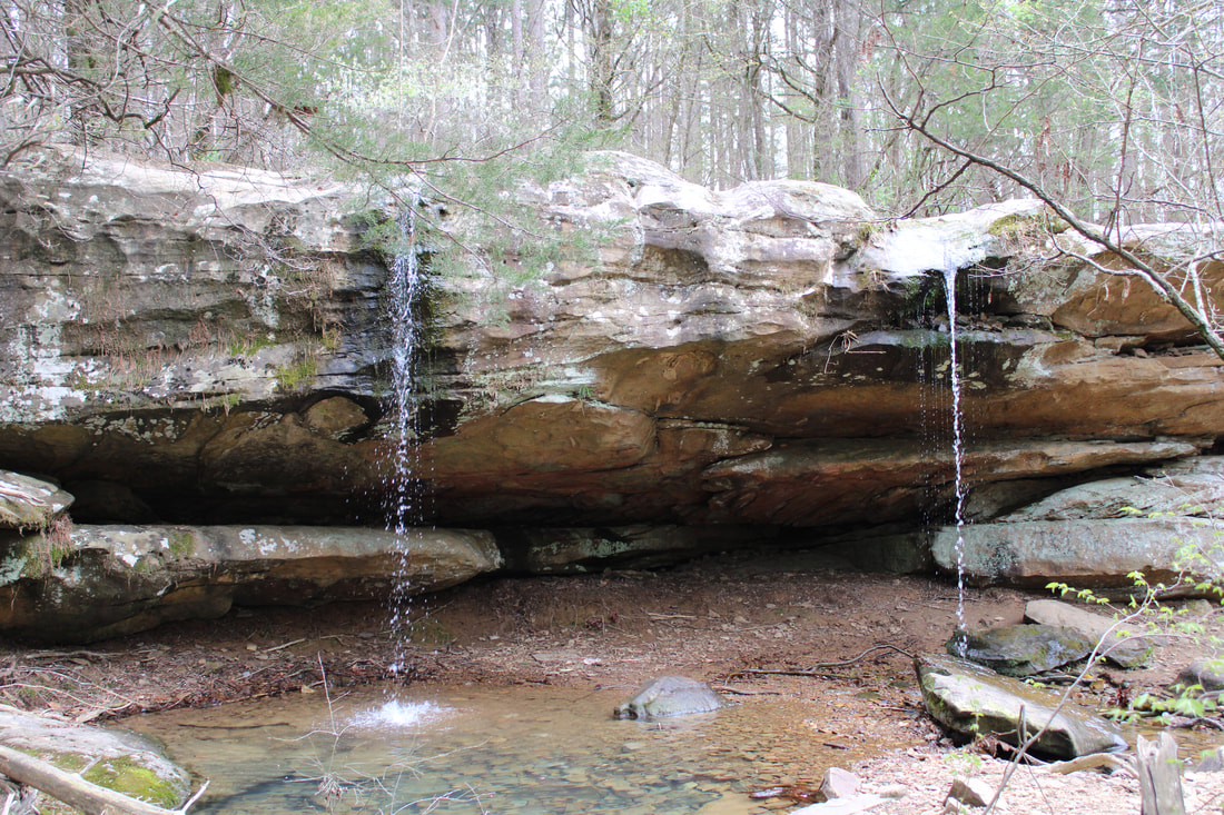
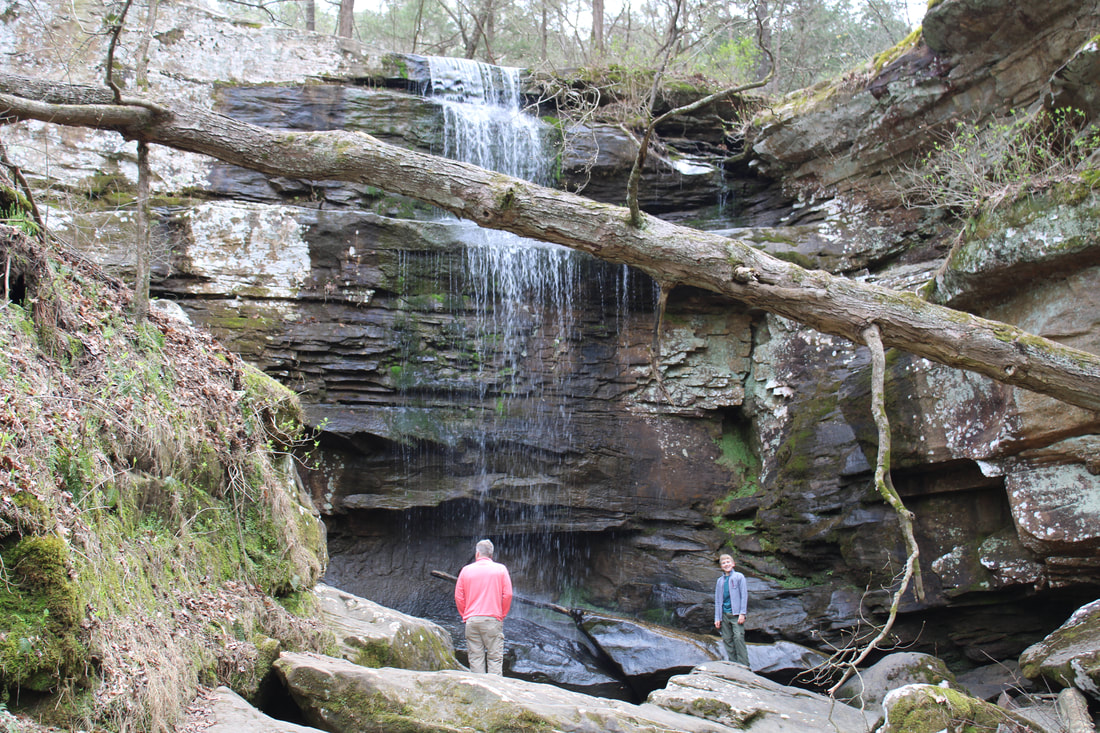
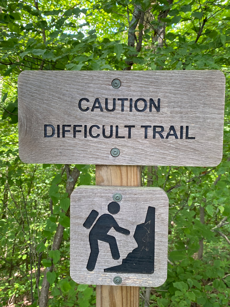
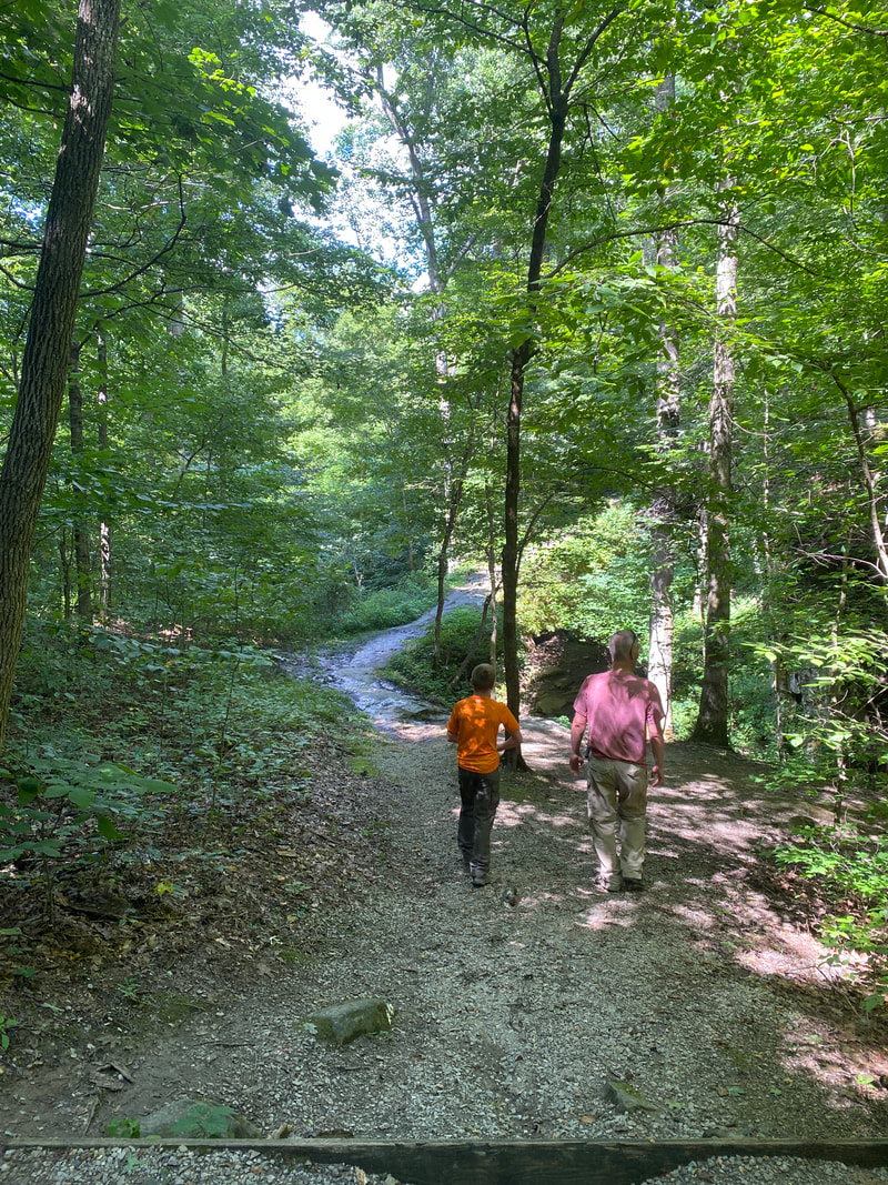
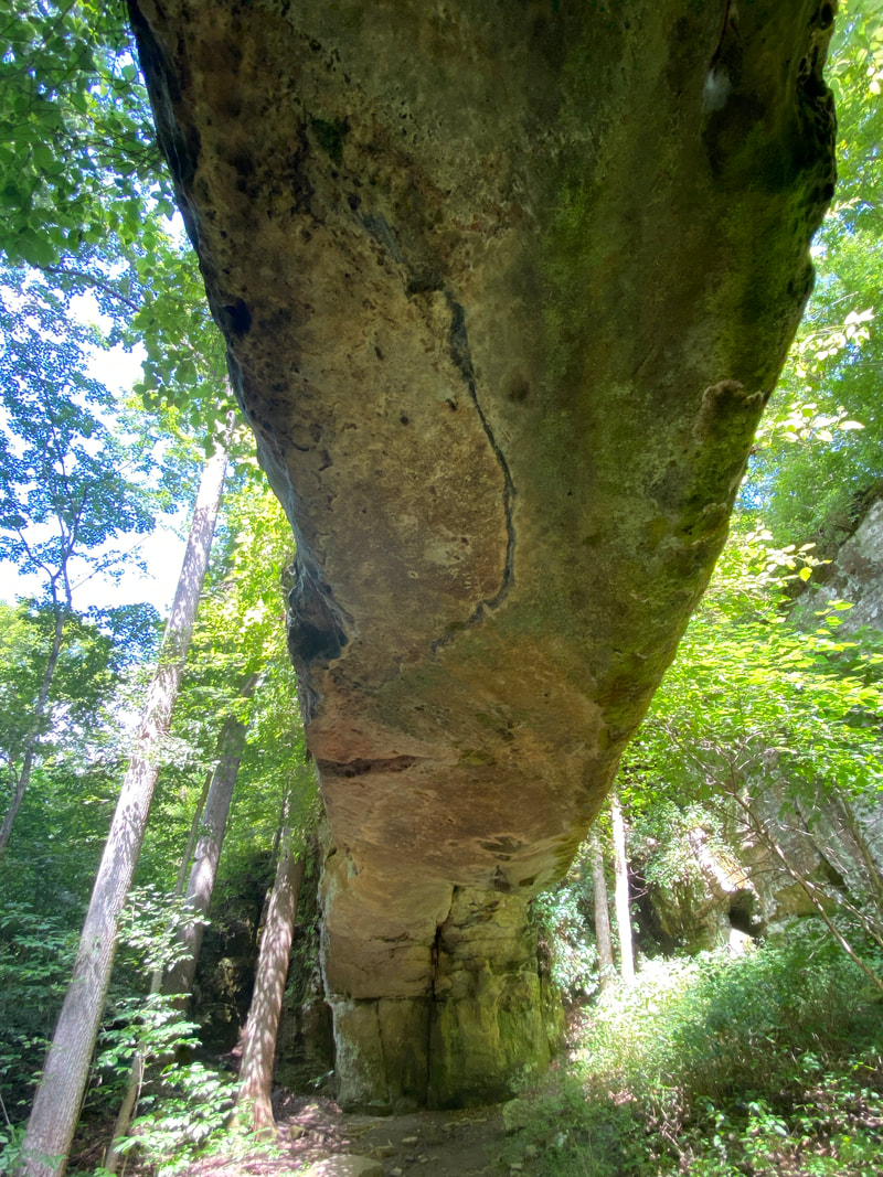
Jackson Falls

Jackson Falls, Shawnee National Forest
Jackson Falls
Key Features:
- High cliffs and scenic water falls
- The base of the falls is a popular swimming location
- Climbers frequent the rock faces
- Horses regularly use the lower trails
- A rock scramble is required to reach the valley floor
Key Features:
- High cliffs and scenic water falls
- The base of the falls is a popular swimming location
- Climbers frequent the rock faces
- Horses regularly use the lower trails
- A rock scramble is required to reach the valley floor
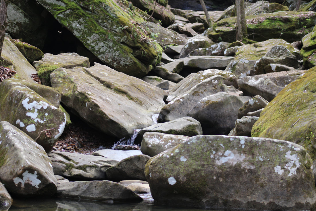
The creek above Jackson falls, Shawnee National Forest
|
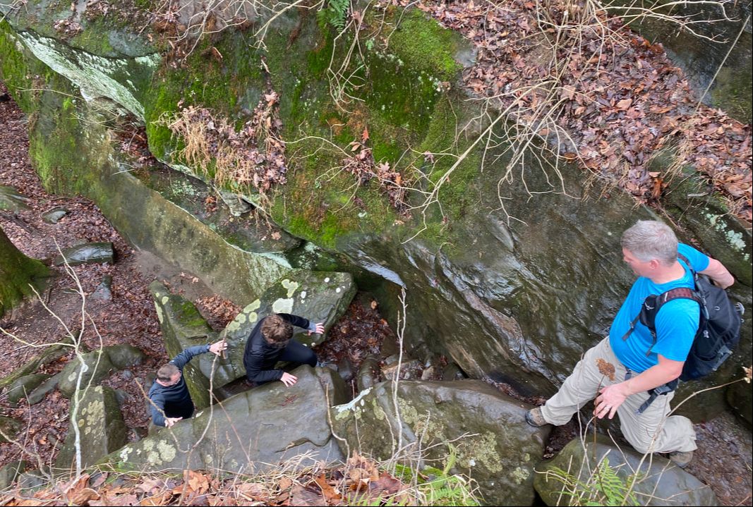
Rock scramble to the valley floor, Jackson Falls, Shawnee National Forest
|
Jackson Falls, valley floor trail, Shawnee National Forest
|
Jackson Falls, Shawnee National Forest
|
Jackson Falls, from above, Shawnee National Forest
|
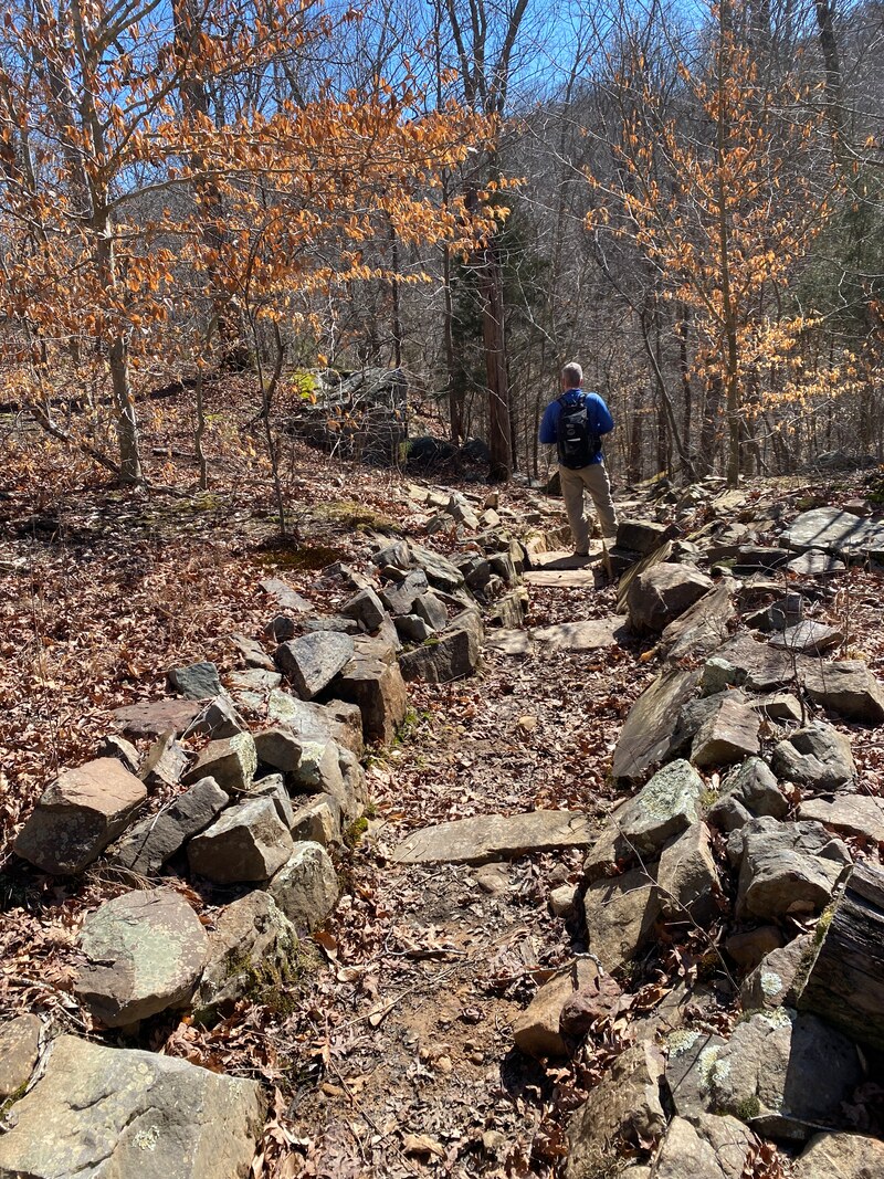
Jackson Falls (2 miles)
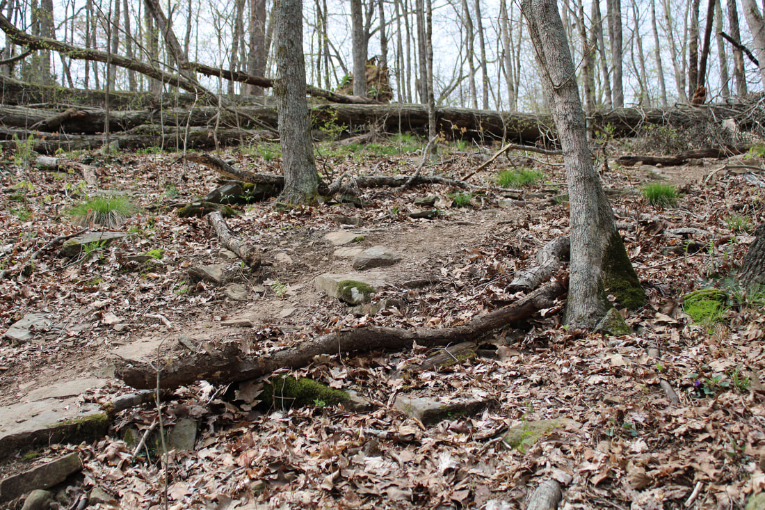
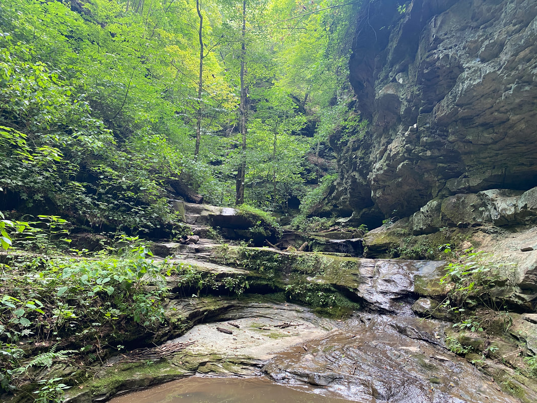
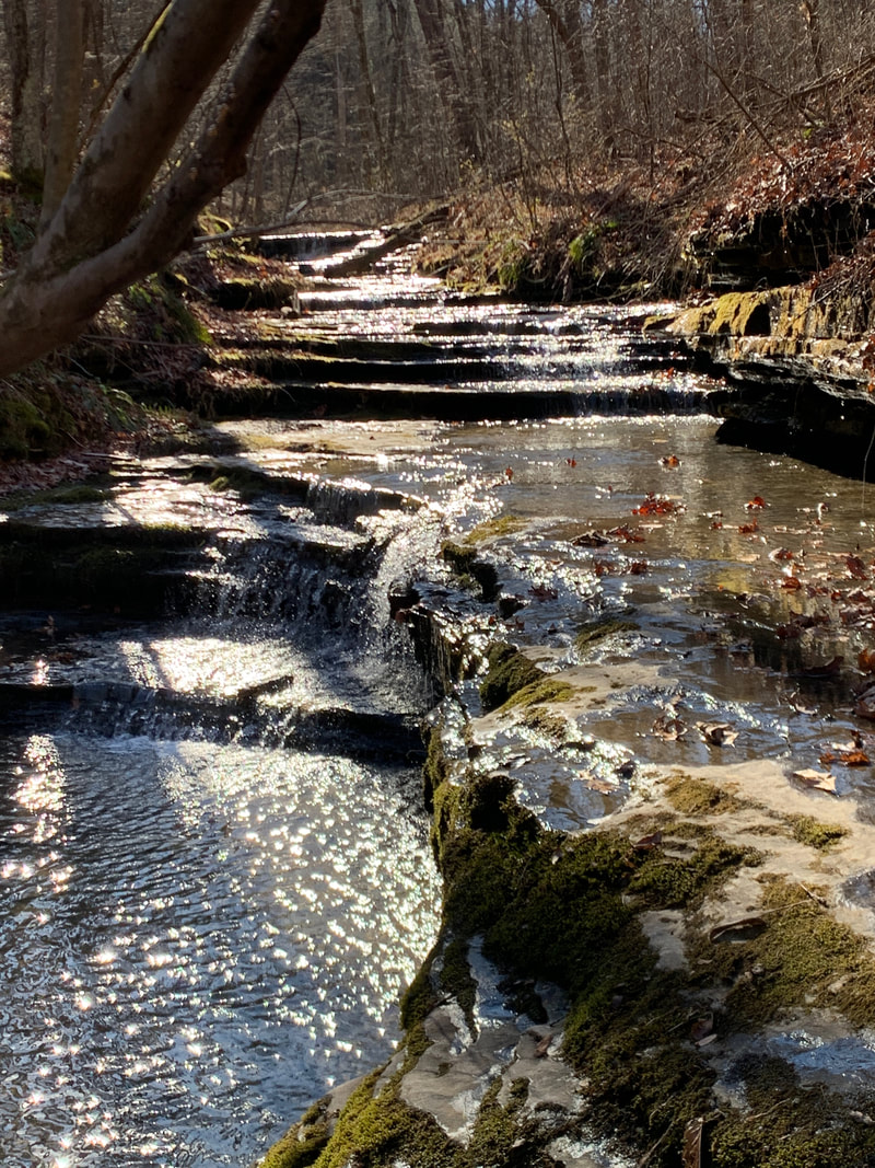
Jackson Falls has been on our hiking list for quite a while, and today proved worthy of a return visit. Close to Camp Ondessonk, but well off the paved roads, this area takes a little white-knuckled driving traversing the washouts and potholes, but rewards hikers with a quite popular destination with many activities. Immediately off the parking area, you'll find campsite after campsite that clearly indicate this as a hot spot in peak season.
The beginning portion of the hike takes you along a small stream with rocky features, small waterfalls, and cool swimming holes. Be careful as you reach the top of the falls as the trail and creek take hikers right up to the top of the falls and the enormous drop to the turquoise pool below. This bright color is a real treat for the Midwest and gives Jackson Falls an almost tropical feel. From the top, hikers will continue on down the trail along a high rocky rim line with sweeping views over the valley floor below. Large high walled rock features make this area a climbers paradise and several areas are rigged for climbing and rappelling. It is clearly frequented and well-used by climbers.
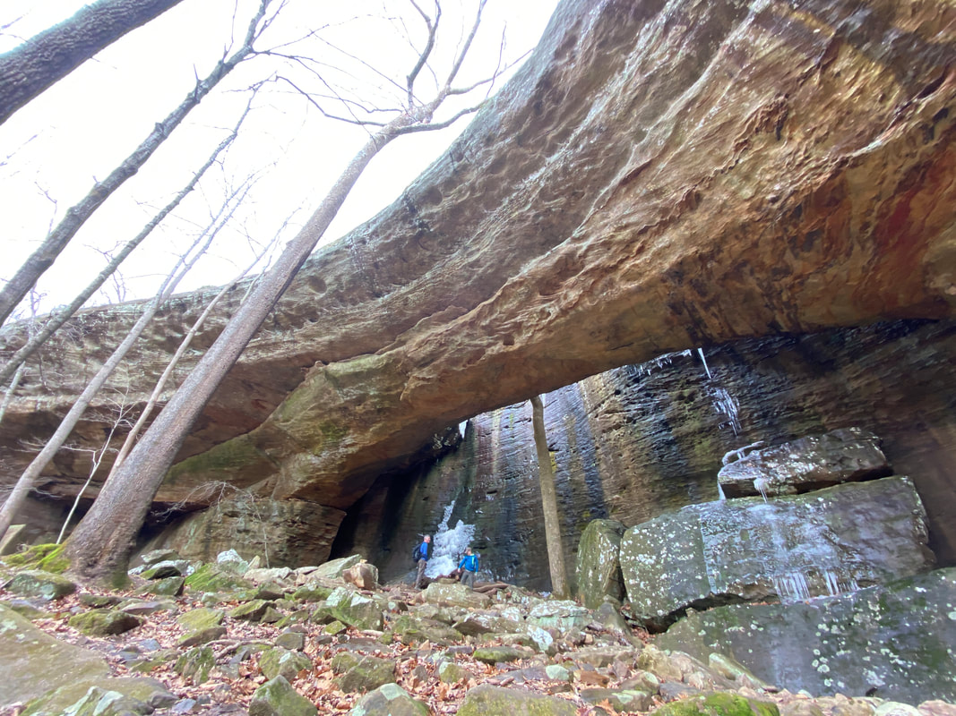
The descent to the valley floor is a bit treacherous and may not be suitable for the young, old, or injured. There is a series of boulder scrambles that acts as a makeshift rock ladder to reach the bottom of the trail. Dogs or small children may not be able to safely be assisted through this area. Continuing on, hikers will be treated to some maze-like passages and squeezes very common in the Shawnee National Forest areas. Hikers will essentially "double-back" along the valley floor to the falls an equal distance. There hikers will revel in a picturesque waterfall with turquoise pool to spend some time enjoying. Swimming would be appropriate in warmer weather, thus making this a popular site for campers. We happened upon 5 horseback riders at the falls, so this is clearly a popular destination for all avid outdoor enthusiasts.
There are two other smaller falls in the area to visit to add on to your base hike: Dog Trot Falls and North Side Falls. Dog Trot is the small (often dry) falls near the scramble to the bottom. It is easily marked with a bridge spanning the upper crossing. North Side Falls is on down the valley from Jackson Falls and is highly accessible and surrounded by interesting, deep cliff faces. You can get right up underneath the falls without wading. Definitely tag on these two destinations on your next trip to Jackson Falls.
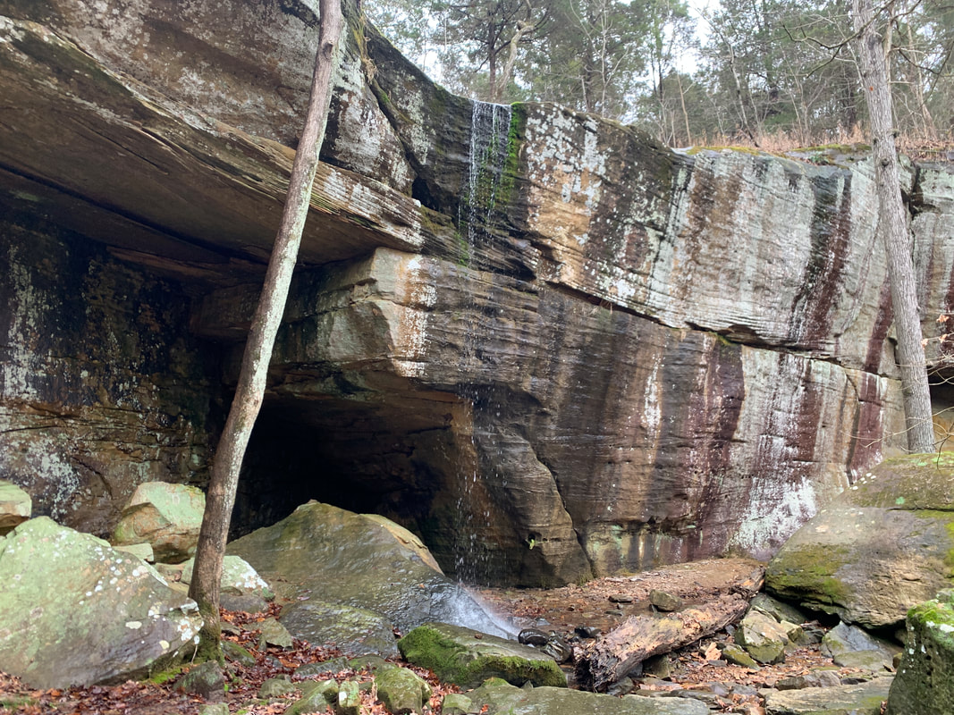
North Side Falls near Jackson Falls, Shawnee National Forest
|
Some of the interesting rock houses and formations near, Jackson Falls, Shawnee National Forest
|
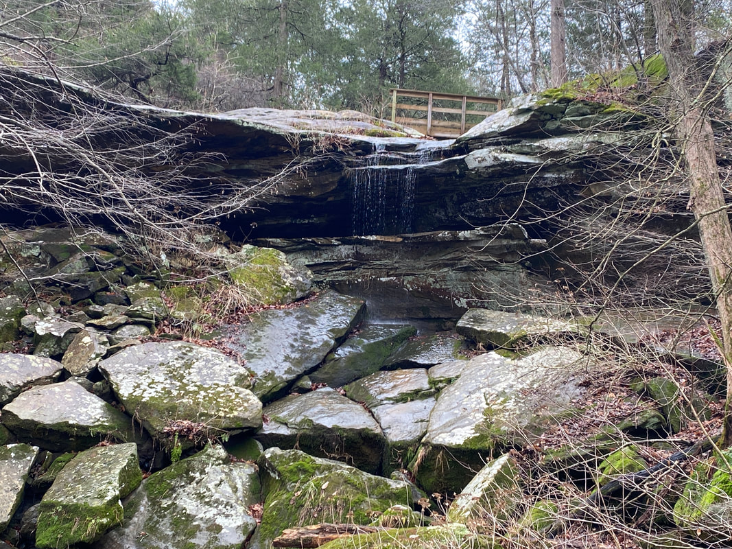
Dog Trot Falls also drains into Jackson Hollow, Shawnee National Forest
|
|
|
|
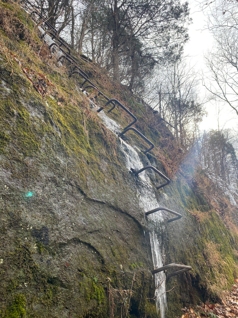
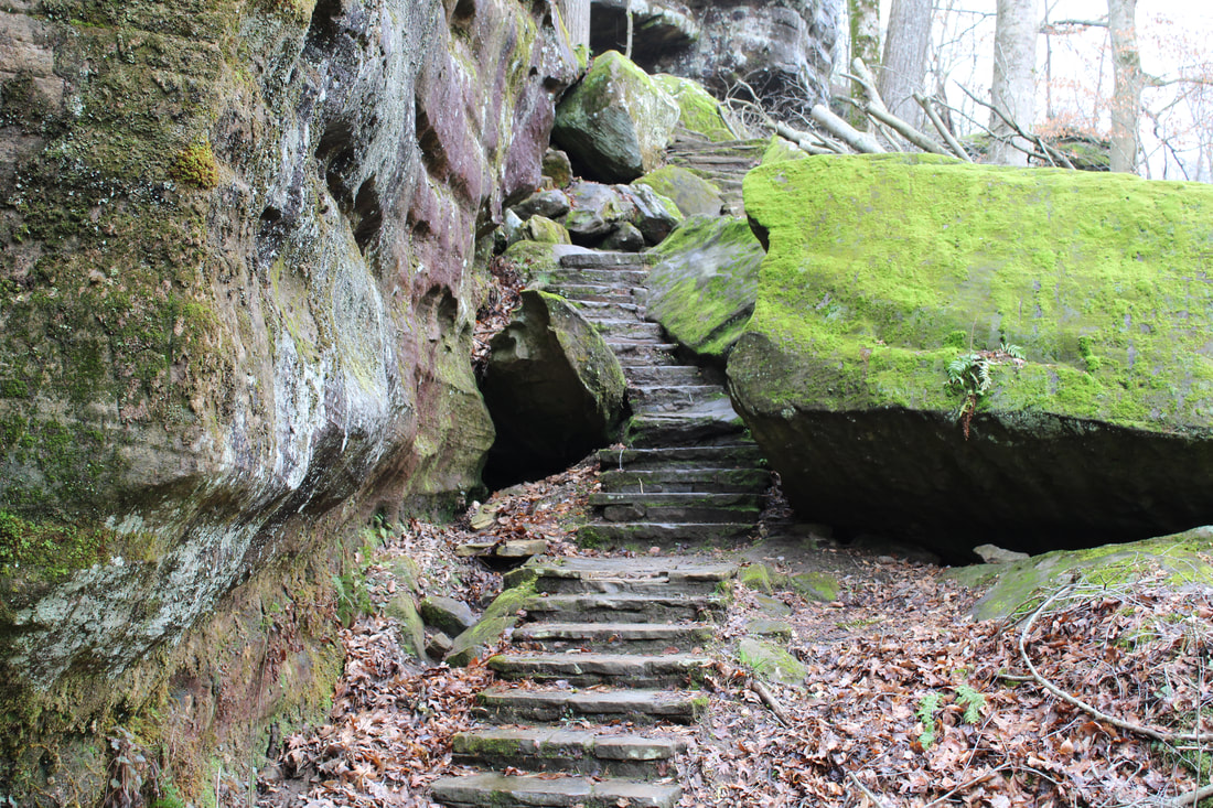
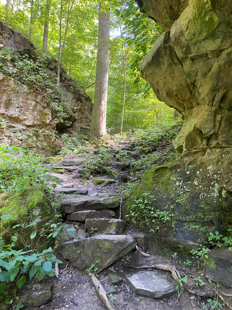
Bell Smith Springs
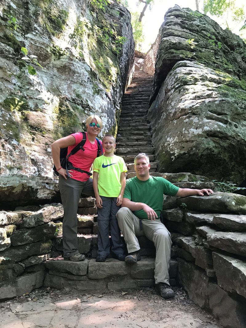
Bell Smith Springs Stone Stairways, Shawnee National Forest
Bell Smith Springs
Key Features:
-Deep valleys and high cliffs
-Illinois' largest natural bridge
-Popular swimming area for locals
-Somewhat remote area
- Many trails in the area and Red Bud Campground
Key Features:
-Deep valleys and high cliffs
-Illinois' largest natural bridge
-Popular swimming area for locals
-Somewhat remote area
- Many trails in the area and Red Bud Campground
Bell Smith Springs, Hill Branch Trail
|
The Devil's Backbone, Bell Smith Springs
|
The steel ladder iced over, Bell Smith Springs
|
Bell Smith Springs, Hill Branch trail
|
Bell Smith Springs Area
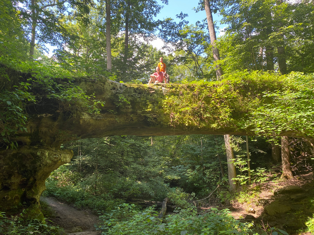
)Bell Smith Springs is really an unusual area for the Midwest and our favorite thus far in the Shawnee National Forest. With rock features, natural bridges, streams, swimming holes, and barren slick rock, hikers might think they are out west in the Arches area of Utah. This hike was not as rigorous or challenging in distance or difficulty, yet offered some interesting challenges for those that might be afraid of heights. Our favorite feature was the steel ladder bolted into the rock face that takes you to the natural bridge. It was a little dicey and unnerving, but got the adrenaline pumping in a fun and exciting way. Iced over in the winter, it adds an extra level of adventure. The natural bridge can be explored from top and bottom, giving you unparalleled access, so those with animals or children need to be very cautious on this hike as there is no room for error.
The Hill Branch Trail offers a wildly different landscape, the most unusual I've hiked in the Midwest. The trail takes you through large fields of barren rock that reminded me of volcanic lava fields or slick rock creek beds. I wish we had saved more time to fully explore more of this unusual terrain. Our son loved running up and down the dry rock beds. (Update: our recent winter hike allowed us to witness this same area flowing with water and icicles. It offered a completely different experience and we recommend a winter visit for sure!)
A hike west takes you to the Devil's Backbone, a rock feature that juts up out of the water and offers those seeking a bit of adrenaline rush a nice climb to the top. In the heat of summer, this area is also utilized as a swimming spot for locals, so be sure to bring your swimming suits.
Climbing out of the valley to the ridge top, natural bridge trail, Bell Smith Springs
|
The Natural Bridge at Bell Smith Springs, Hill Branch Trail
|
Natural bridge at Bell Smith Springs
|
|
|
|
Rim Rock Area
Stairs and stone passages to lower Rim Rock Trail, Shawnee, National Forest
Rim Rock Area
Key Features:
-High cliffs and overlooks
-Flag stone upper trail
- Short loop but can be extended with lower trail
-Connects to back country trails and areas
- No overnight parking at trail head
Key Features:
-High cliffs and overlooks
-Flag stone upper trail
- Short loop but can be extended with lower trail
-Connects to back country trails and areas
- No overnight parking at trail head
The Upper Rim Rock Trail is covered with flagstone
|
Last set of stairs to lower trail, Rim Rock Area, Shawnee National Forest
|
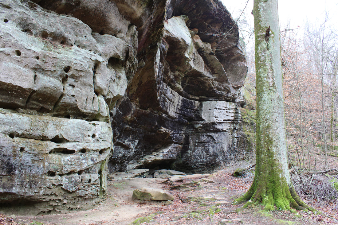
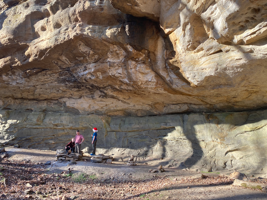
Ox Lot Cave, Rim Rock Area, Shawnee National Forest
|
Hiking friends at Lower trail Rim Rock Area, Shawnee National Forest
|
Rim Rock Trail
(1.5+)miles
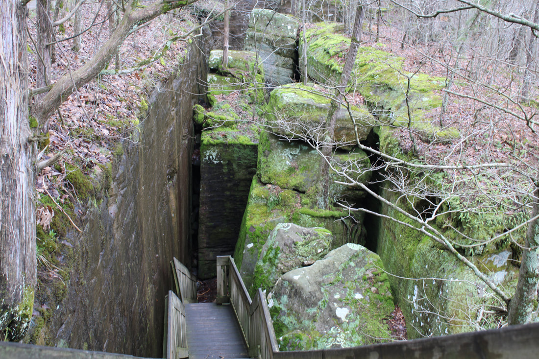
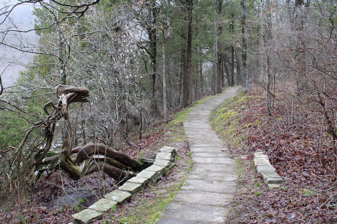
Rim Rock is a short little day hike with big opportunity for exploration and picture taking. If you start the hike on the left (or upper) portion of the rim, you are greeting with sweeping views of the tree tops over the valley. Fall would be an excellent time of year to capture the change of seasons and color of the Midwest. This portion of the trail is actually paved in stone which was a bit of a random feature. The path quickly takes you to a series of wooden stairs descending into a labyrinth of rock squeezes and high walled mazes. Kids (and kids at heart) will love exploring and navigating the rock stairs that take you to the valley floor.
The next area of the trail is Ox-Lot "Cave" where animals used to be kept cool. It is really more of an overhang than cave, but definitely stands out as a feature. The valley floor gives way to a gentle stream which can be followed all the way to -- lake and the swimming area when the season opens. Numerous foot bridges, spring wildflowers, and bird watching make this a worthy extra hike. Returning back from the spur takes you to the second series of large rock features as you hike up and out a gorgeous valley.
The hike distance is labeled as:
Length: Rim Rock Trail = 0.8 miles Lower Trail section = 0.7 miles Lake Trail section = 0.6 miles
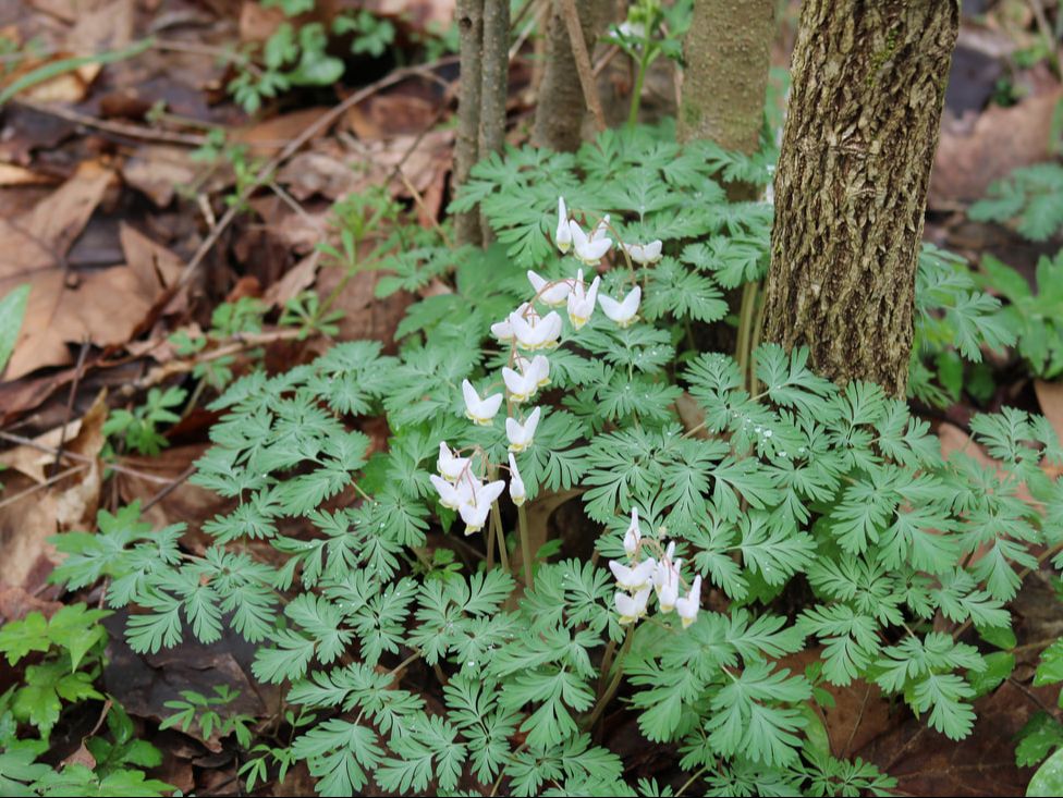
Duchman's Breeches, Rim Rock Area, Shawnee National Forest
|

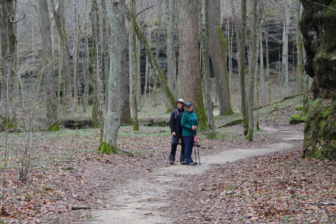
Maggie and Momma Bear at Rim Rock, Shawnee National Forest
|
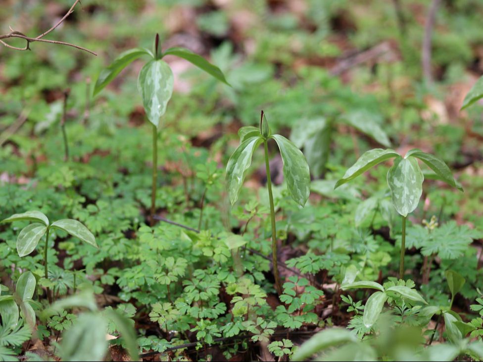
Trillium ready to bloom, Rim Rock Area, Shawnee National Forest
|
|
|
|
Burden Falls
The rocks below Burden Falls, Shawnee National Forest
Burden Falls
Key Features:
-Deep valleys and high cliffs
-Some rock scrambling
- Clear easy to follow trails but not official NFS trails
- Parking area is only 100 feet from top of falls
Key Features:
-Deep valleys and high cliffs
-Some rock scrambling
- Clear easy to follow trails but not official NFS trails
- Parking area is only 100 feet from top of falls
Looking down at Burden Falls, Shawnee National Forest
|
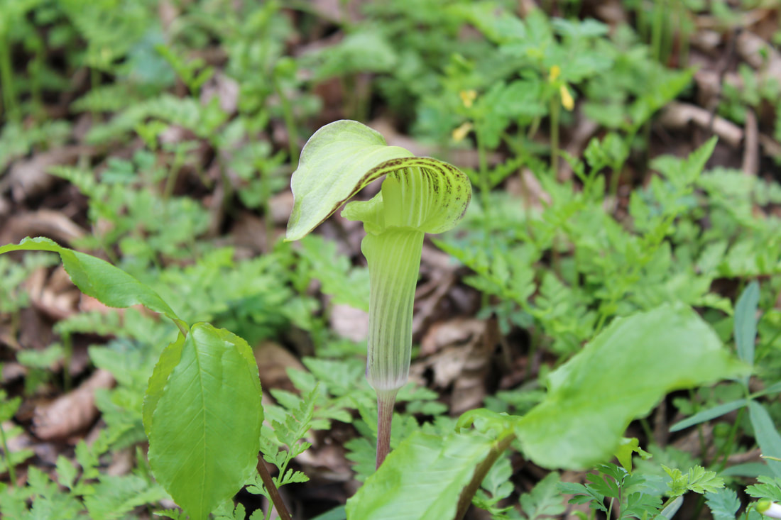
Jack in the pulpit, Burden Falls, Shawnee National Forest
|
The valley looking up to Burden Falls, Shawnee, National Forest
|
Valley walls near Burden Falls, Shawnee National Forest
|
Burden Falls
(.8 mile)
Burden Falls coupled with Jackson Falls makes for a great double day hike in Shawnee National Forrest. The upper portion of Burden Falls is easily accessible from the parking lot, and if one is cautious, this can be a great family hike. The area is scattered with boulders, rocky outcroppings, and overhangs that make this unassuming .8 mile hike a fun hour or two of exploration.
The trail is well worn and hikers have scattered side trails all over the area. Wildflowers abound in the spring and if you keep your eyes peeled, you may find trillium, Jack-in-the-Pulpits, Dutchman's Britches, Cut Leaved Tooth-wort and more. After winding through the forest, you'll descend to the valley floor and follow the branching creek bed upstream to the main attraction- Burden Falls. Hikers have full access to the main falls for some great pictures from all sorts of unique angels. Kids will enjoy rock hopping and following the fish in the shallow creek. With plenty of activities to engage people of all ages, Burden Falls is a real treat.
The trail is well worn and hikers have scattered side trails all over the area. Wildflowers abound in the spring and if you keep your eyes peeled, you may find trillium, Jack-in-the-Pulpits, Dutchman's Britches, Cut Leaved Tooth-wort and more. After winding through the forest, you'll descend to the valley floor and follow the branching creek bed upstream to the main attraction- Burden Falls. Hikers have full access to the main falls for some great pictures from all sorts of unique angels. Kids will enjoy rock hopping and following the fish in the shallow creek. With plenty of activities to engage people of all ages, Burden Falls is a real treat.
Smaller falls above the main falls, Burden Falls, Shawnee National Forest
|
Looking up at Burden Falls, Shawnee National forest
|
Steep trail to bottom of valley, Burden Falls, Shawnee National Forest
|
|
|
|
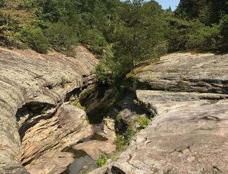
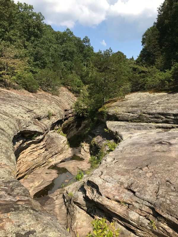
Little Grand Canyon
Little Grand Canyon, Shawnee National Forest
The valley floor at the Little Grand Canyon, Shawnee National Forest
Little Grand Canyon
Key Features:
-high ridge top views & valley floor hiking
-interesting rock features common to Southern Illinois
-waterfalls, smooth slides, and rock steps
-high canyon walls to explore
-can be tricky footing for some ages
Key Features:
-high ridge top views & valley floor hiking
-interesting rock features common to Southern Illinois
-waterfalls, smooth slides, and rock steps
-high canyon walls to explore
-can be tricky footing for some ages
Smooth, wide trail to start the Little Grand Canyon, Shawnee National Forest
|
Warning at the Little Grand Canyon, Shawnee National Forest
|
A few roots at Little Grand Canyon, Shawnee National Forest
|
Natural stone stairs at the Little Grand Canyon, Shawnee National Forest
|
Steep draw in the Little Grand Canyon, Shawnee National Forest
|
Little Grand Canyon
(3 miles)
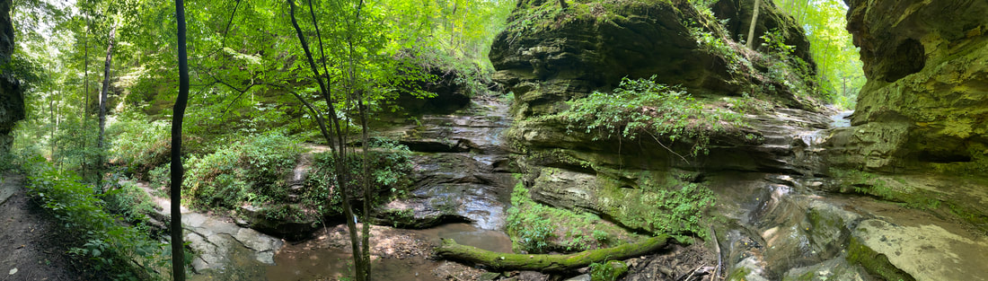
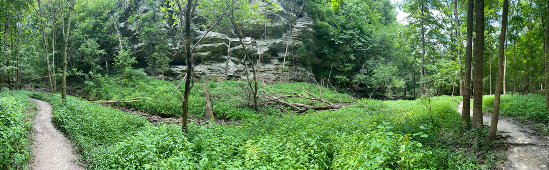
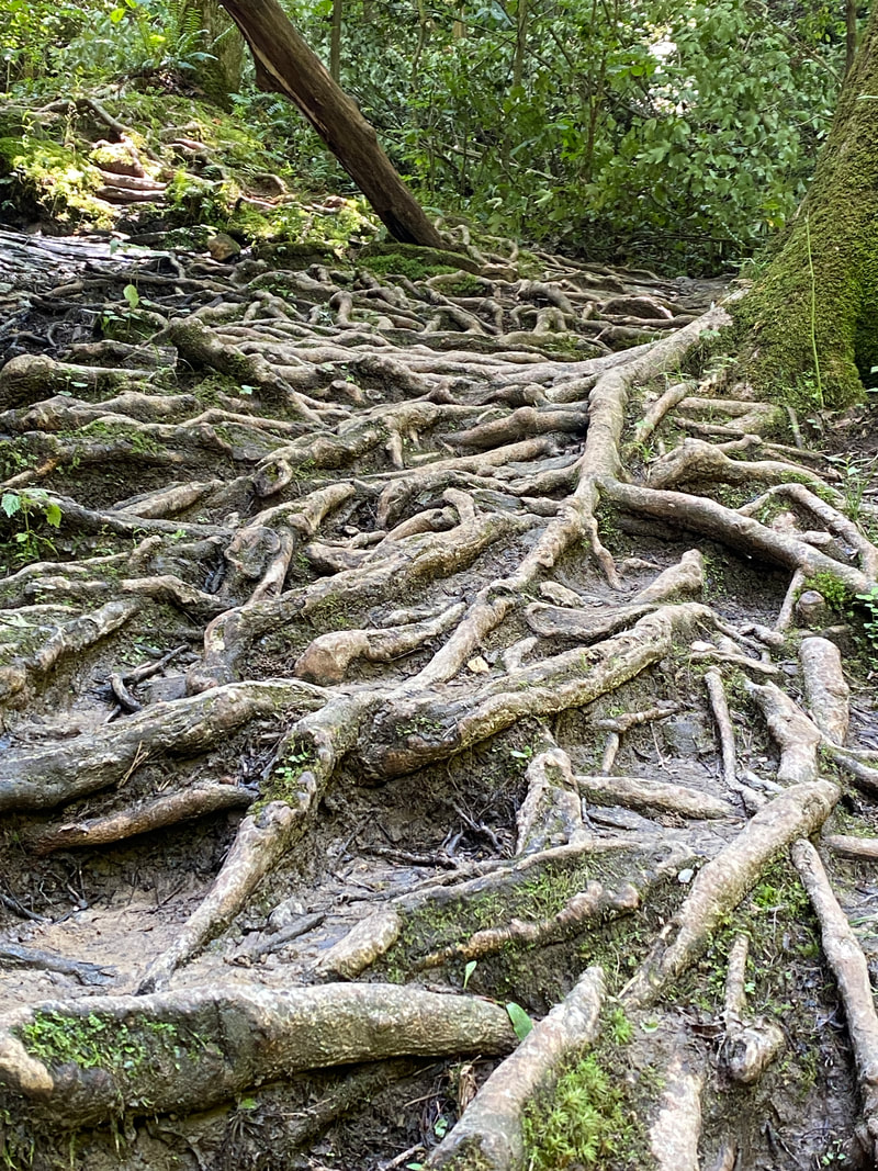
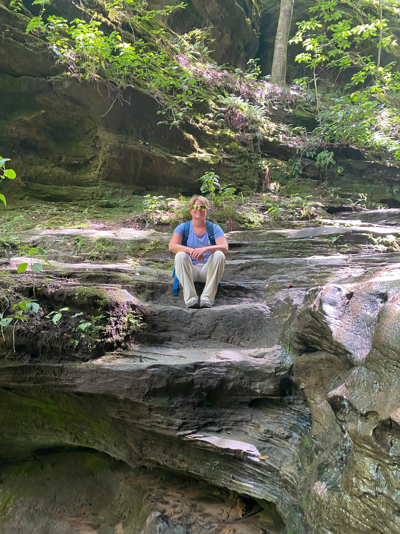
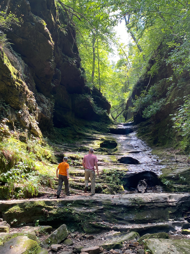
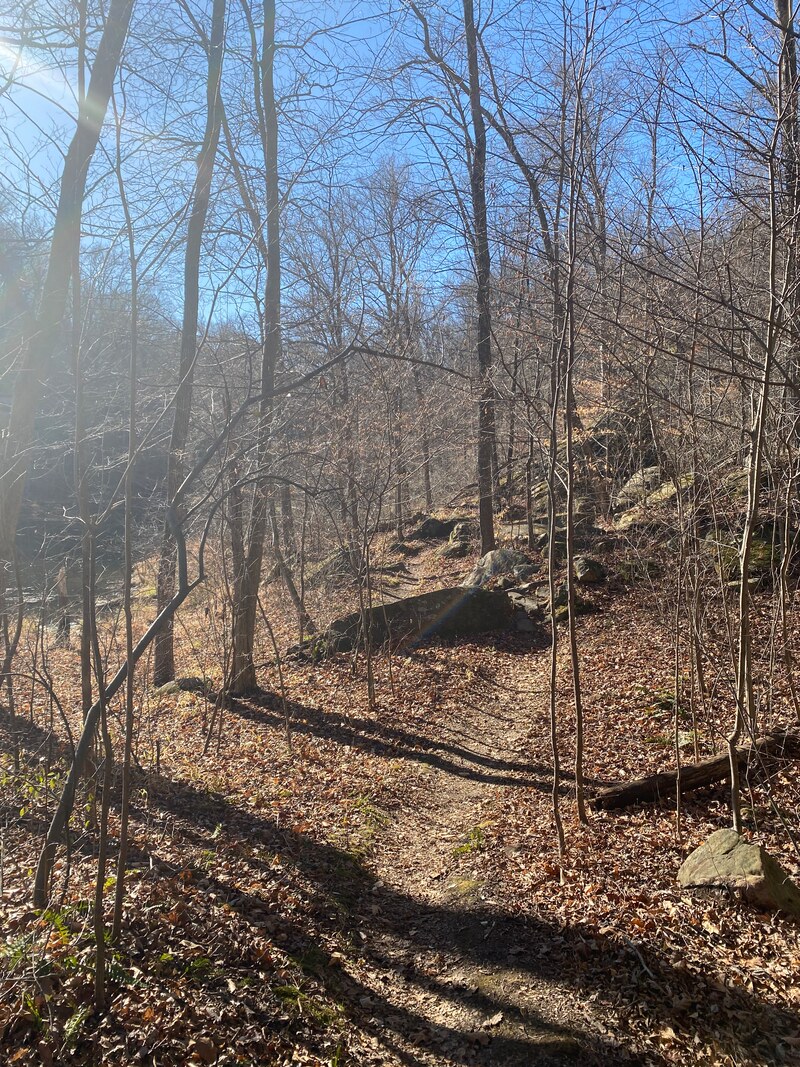
We started the trail near the pit toilets in the upper parking area, which allowed us to view the impressive overview of the Mud River valley and do many of the more interesting rock features toward the beginning of our hike. The trail at this section is quite easy with a few up and down flows. The trail is then marked "dangerous" which is mostly due to the rock scrambling on slick surfaces with a variety of heights to traverse on your way to the canyon. I would not call them dangerous or difficult for most people, they just require careful footing and the ability to take large steps up and down uneven and wet terrain. The trail follows the creek bed and could possibly flash flood or have much more water or ice on it. The day we went, it had rained hard the day before and it was wet and slightly muddy, but did not require any special precautions, just a careful step. This environment is classic Southern Illinois terrain with interesting rock wall features with unusual potholes and crevices. The main portion of this trail follows the cool creek valley with ferns and medium growth tulip trees. This trail was heavily trafficked with numerous paths crisscrossing the valley. The hike for us ended by hiking up a long "draw" and then ascending the elevation we had dropped earlier back up to the parking lot. This section got the heart pumping, but was only 5-10 minutes of strenuous walking. This can be a very busy hike on weekends and at peak season in the fall. We encountered several groups even on a Tuesday in August. Overall, this was an easy few hours to see a magnificent canyon full of rock features.
Little Grand Canyon, Shawnee National Forest
|
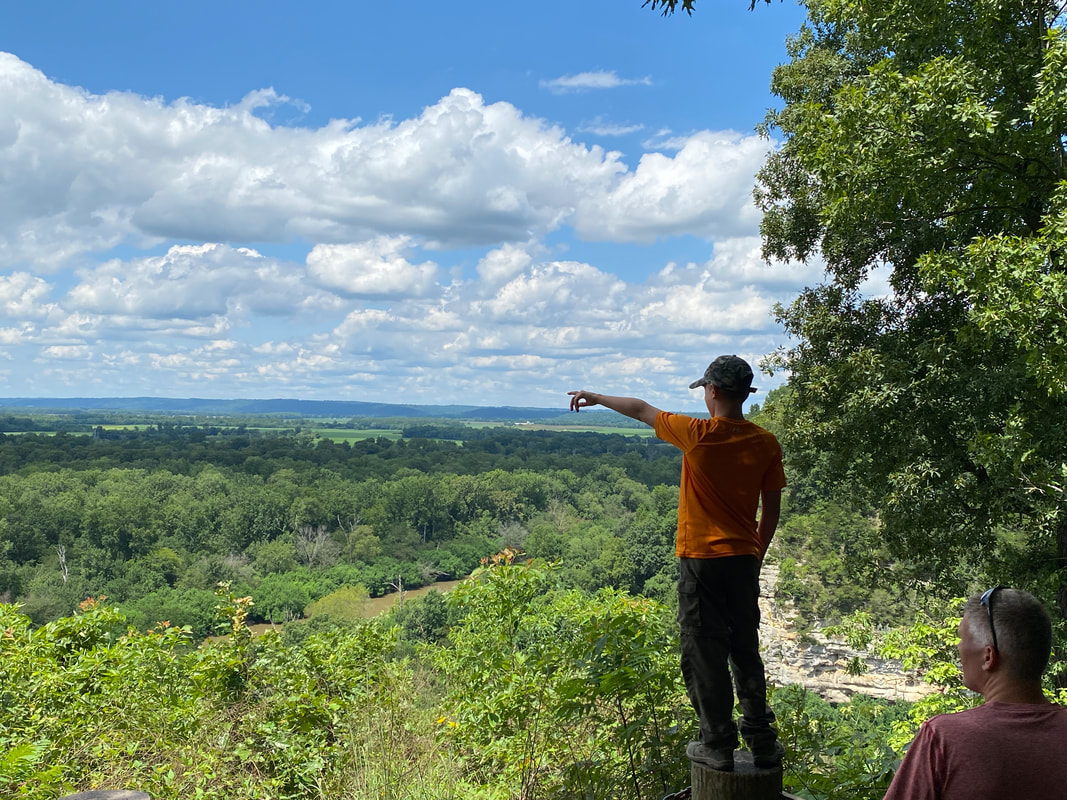
Looking over the Mud River Valley at Little Grand Canyon, Shawnee National Forest
|
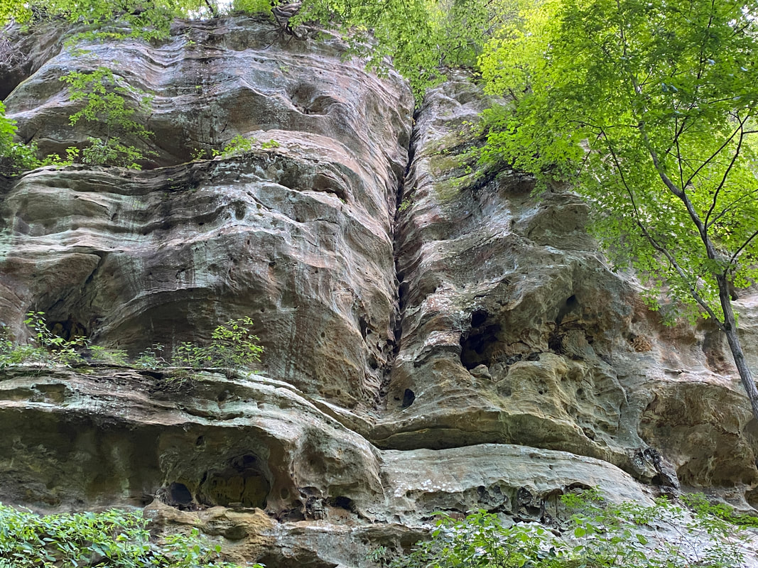
Interesting rock walls at the Little Grand Canyon, Shawnee National Forest
|
|
|
|
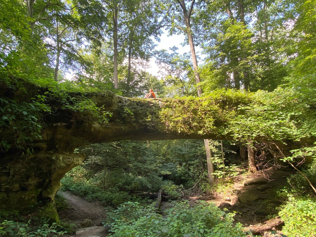
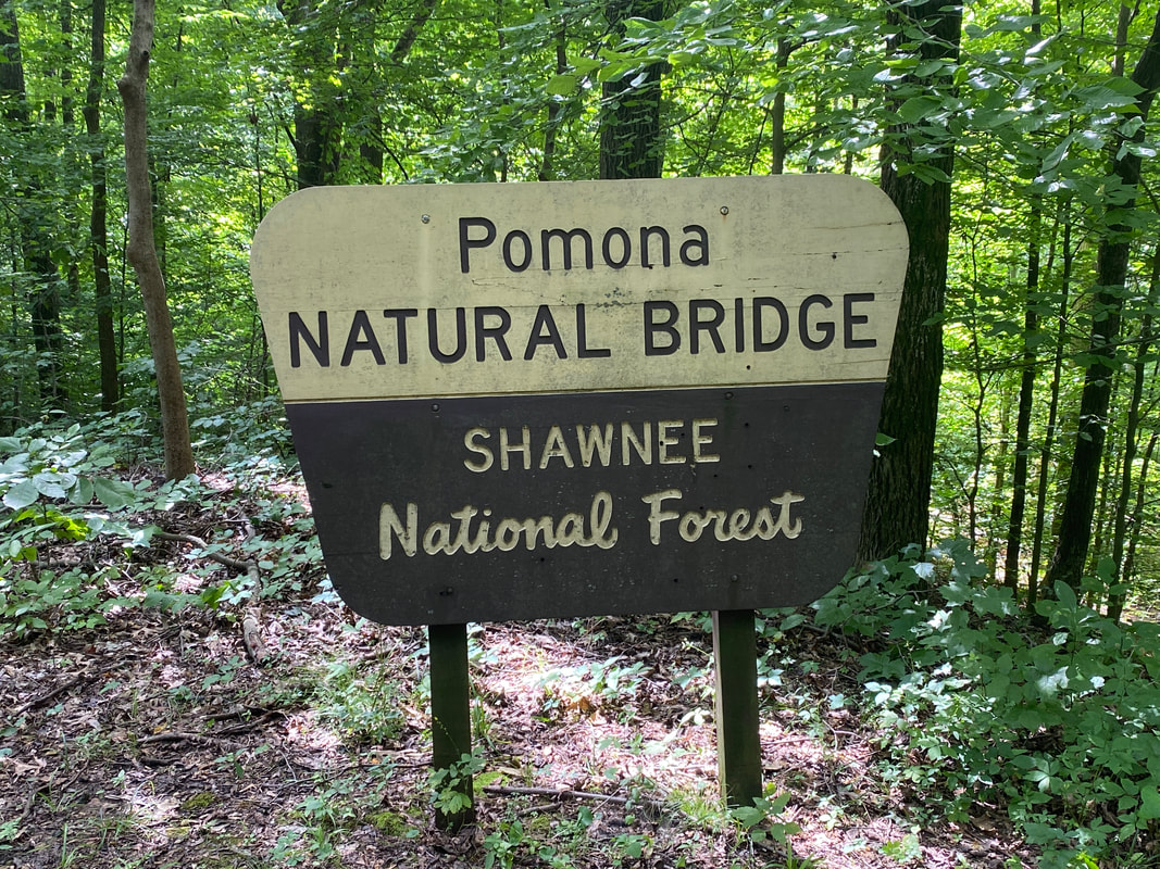
Pomona Natural Bridge
Pomona Natural Bridge, Shawnee National Forest
Pomona Natural Bridge
Key Features:
-Very short, easy hike
-longest natural bridge in the state of Illinois
-no railing or protections for kids & pets
-accessible & can walk on top
-views of above & below the arch
Key Features:
-Very short, easy hike
-longest natural bridge in the state of Illinois
-no railing or protections for kids & pets
-accessible & can walk on top
-views of above & below the arch
Pomona Natural Bridge, Shawnee National Forest
|
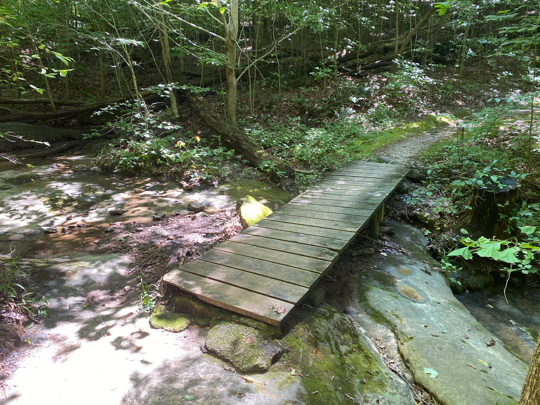
Footbridge at Pomona Natural Bridge, Shawnee National Forest
|
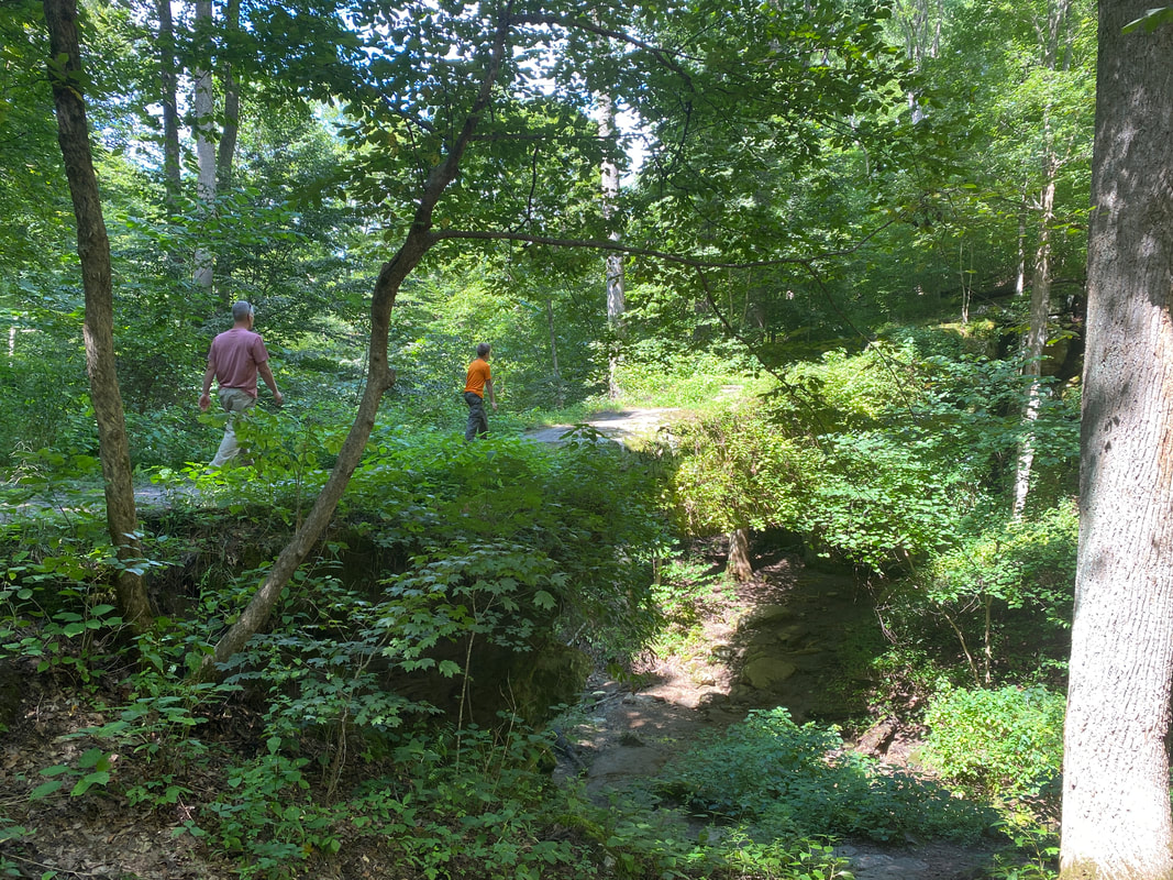
Approaching Pomona Natural Bridge, Shawnee National Forest
|

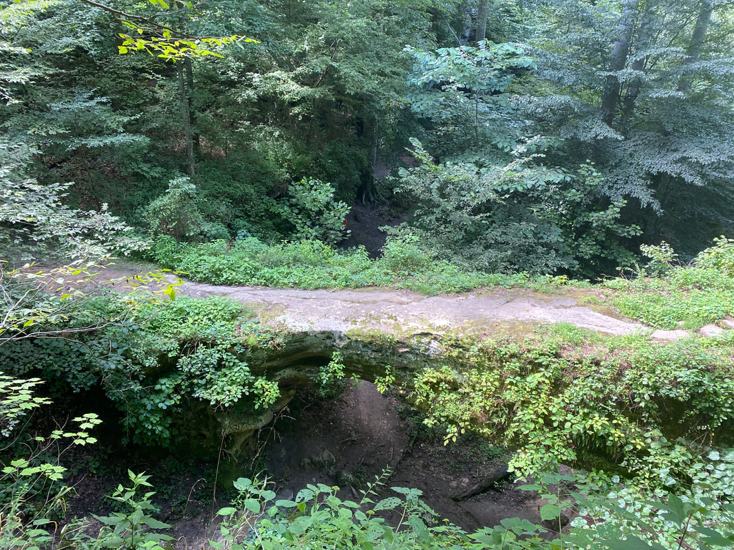
Underneath Pomona Natural Bridge, Shawnee National Forest
|
Pomona Natural Bridge, Shawnee National Forest
|
Pomona Natural Bridge
(.3 mile)
The first thing you'll want to note about this trail is that Google Maps will get you to the gravel road the bridge is on, but you'll need to travel another 3 miles to get to the actual parking lot. There you will find ample parking spots, but not a pit toilet. You shouldn't need it though, because this trail is only .3 miles long and is such a quick little hike that you won't be gone long. It would make for a nice picnic spot or a take on trip on a day when you've visited other Shawnee locales, which is what we did one cool summer day. This trail is mostly gravel and wide and clear, so it is good for most ages, so long as you keep everyone safe when walking the bridge. The only way across is to pass along the actual bridge which is very wide and stable. A fall would be about 30 feet, so keep a hold of kids and pet.... and grandma if necessary. There are side trails to explore beneath and around the naturals bridge and there is a small creek that flows along nearby. The bridge was not as large as I expected, but is is actually a quite long bridge as far as naturally occurring ones go. We saw the bridge in the summer, but I think it would be interesting to see the bridge when the underbrush and summer growth was gone and you could get a better sense of the rock formation underneath. This was a quick easy stop overall.
Easy trail at Pomona Natural Bridge, Shawnee National Forest
|
Underneath Pomona Natural Bridge, Shawnee National Forest
|
Stone stairs at Pomona Natural Bridge, Shawnee National Forest
|
|
|
|
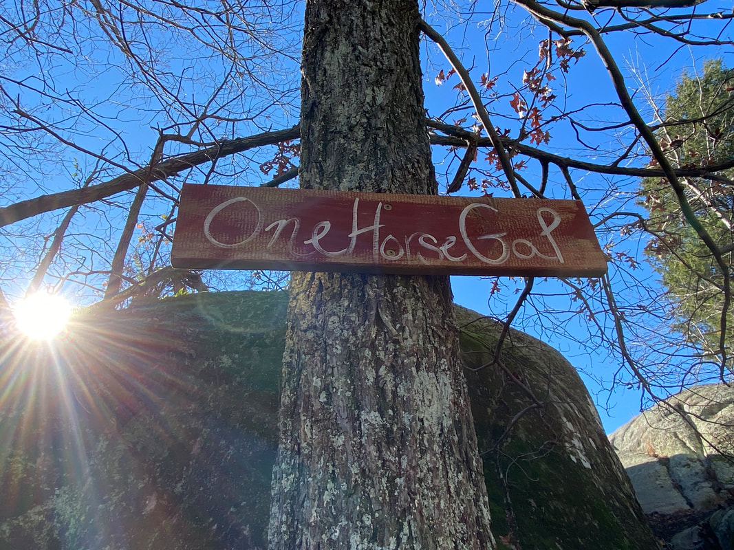
One Horse Gap Area
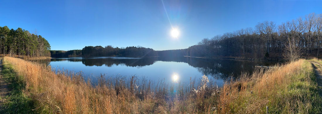
One Horse Gap Area
Key Features:
-Variety of hiking distances possible
-Beautiful 28 acre lake
-Back country camping with some drive up spots
-Interested rock formations to scramble
-Popular horse back riding destination
-Trails in good shape overall
Key Features:
-Variety of hiking distances possible
-Beautiful 28 acre lake
-Back country camping with some drive up spots
-Interested rock formations to scramble
-Popular horse back riding destination
-Trails in good shape overall
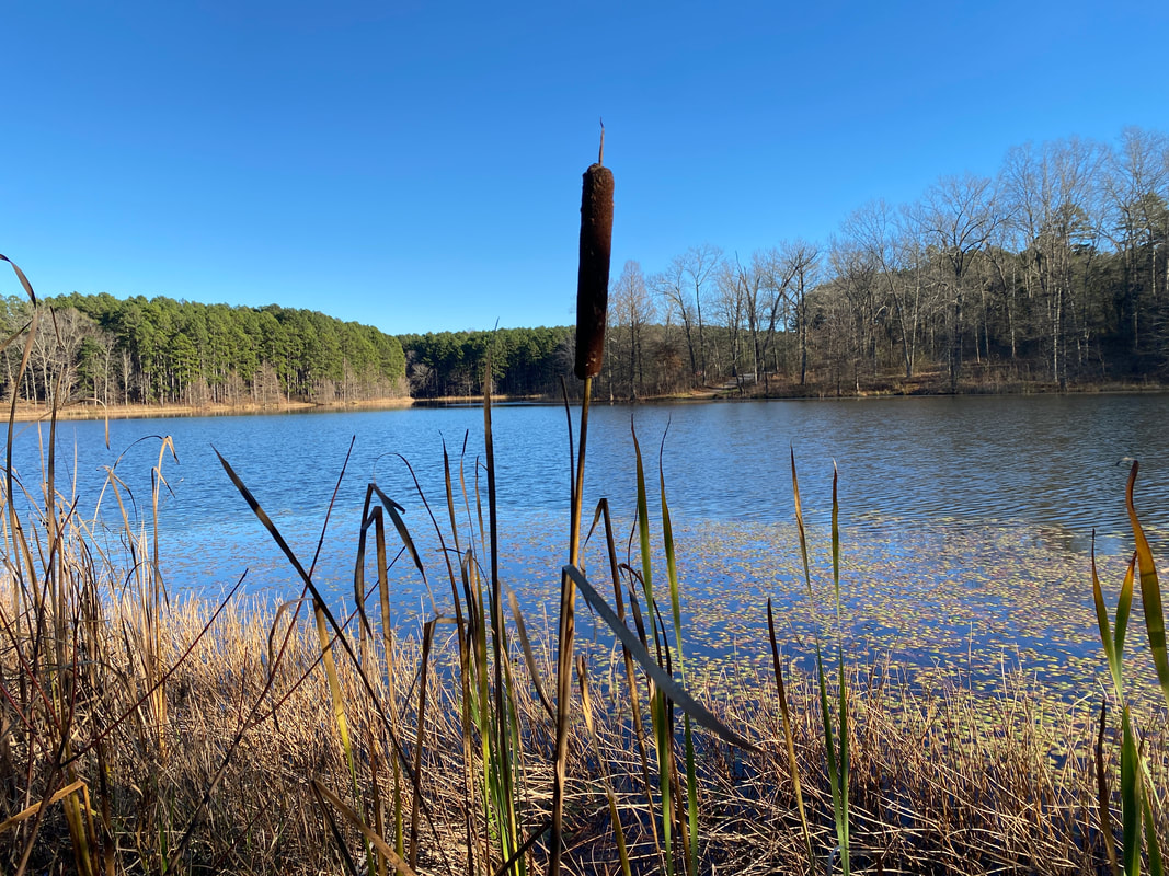
One Horse Gap Lake, Shawnee National Forest
|
Clear knobs near One Horse Gap, Shawnee National Forest
|
Atop the knobs near One horse Gap, Shawnee National Forest
|
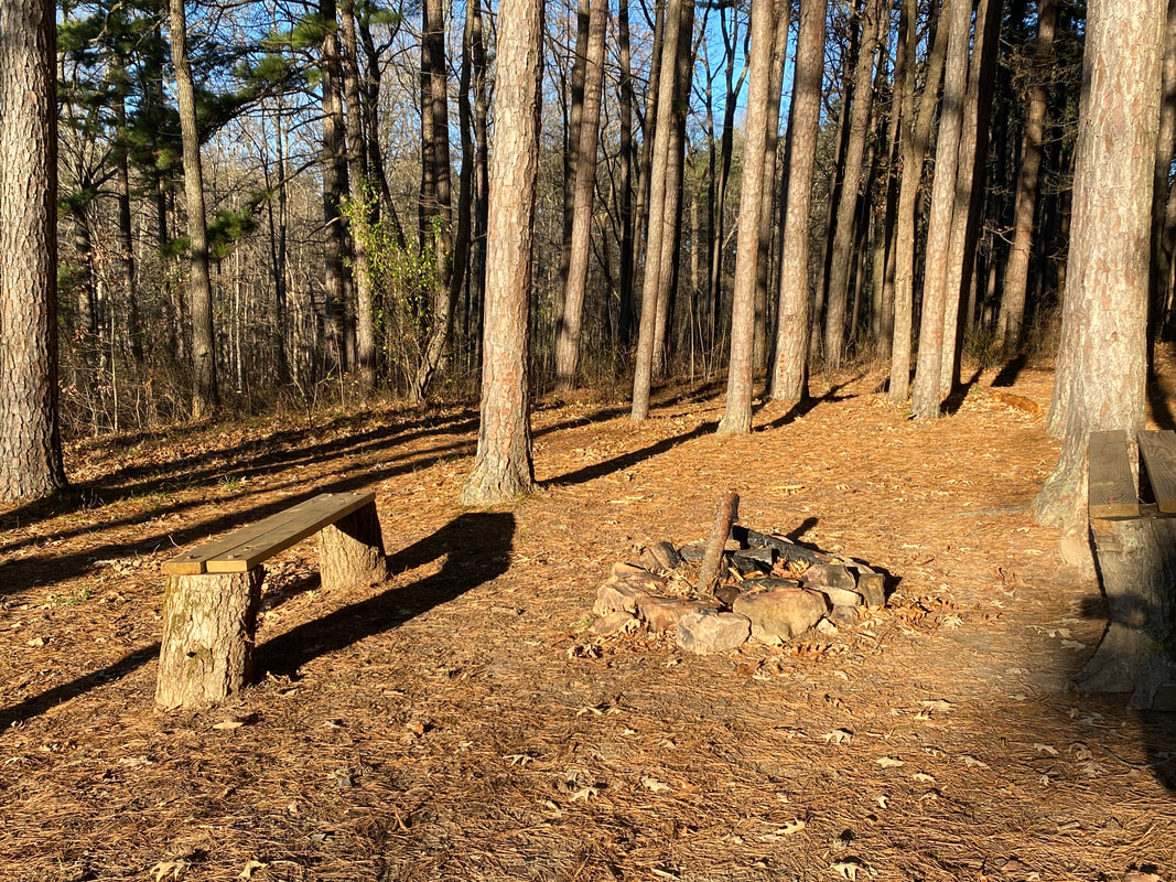
Camp site in the pines at On Horse Gap Lake, Shawnee National Forest
|
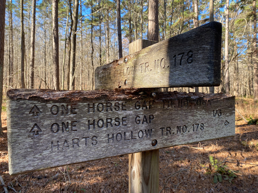
Read those trail signs One Horse Gap, Shawnee National Forest
|
One Horse Gap Area
(Many mileage options)
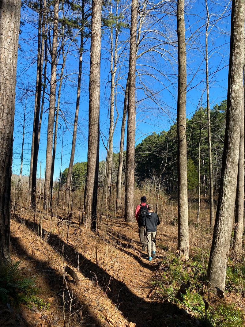
The quick trip over to Southern Illinois proved to be a very surprising day! We knew this area featured classic rock formations found in this area, but we did not expect to have so many different features to explore and knock around. There are a wide variety of options when setting out to hike this area. There is the River to River trail system that runs through this area, as well as a combination of day hiking or backcountry camping opportunities. We started our day parking at the One Horse Gap Lake put in so that we could hike the circumference of the lake in addition to the 3/4 of a mile hike to the Gap. Beyond that you can tag on any range of miles your looking for, just pay close attention to the trail markers and trail numbers as there are many points at which loops and options intersect.
The trail conditions were fairly dry, but you could see where some horse damage and erosion could make for a sloppy day of hiking in the spring or post-rain. Most of this area was comprised of either a soft bed of pine needle footing or typical light rolling leaf covered trail. As far as sharing horse trails go, this area was in surprisingly good shape. (Side note: when driving in to this area, note that the trails marked on the map as gravel are fairly reliable, but anything marked as a dirt road will require an off road vehicle, high clearance vehicle, or 4 wheel drive and extra tires on hand.)
The One Horse Lake is 28 acre lake that has a gentle U shape or a gentle Star Trek logo, with fingers extending to the east and the west off of a gently curved dam across from the put in. The pines are younger and very tall and straight, which gives the area a very inviting feel, picturesque really. We found at least 4 well-established camping sites with fire rings - some with sunset views, some with sunrise views. It was clear these sights would be busy in peak season and were perhaps, "loved to death" with most of the underbrush and firewood cleaned well around the area. (Clearly 4 wheelers and horse back riders utilize these spots adjoining from the dirt roads because there was a lot of trash and cans. It is one of the most littered trails we have hiked in the whole tri-state area, unfortunately.) We encountered a total of three other groups while out hiking that day: one group of horseback riders, one set of 4 wheelers, and a fisherman. The highlight of our hike around the lake was our encounter stirring up a bald eagle. As it took off from just around the corner from our location, its massive size and stark white head reminded us of how awe-inspiring this national symbol truly is.
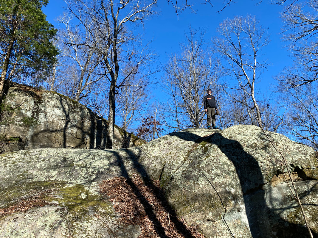
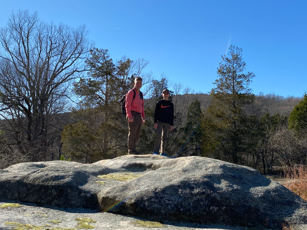
The rock formations were very accessible and not nearly as irresponsible and unsafe as Garden of Gods to the northeast of this spot. The approach to the gap seemed to jump out of nowhere. The rock formations jutted out of the forest with no warning or rhyme or reason. You can explore along the bottom of these formations and check out the nooks, crannies, and small cave like features, or pass through the actual gap up to the top where you will hike along rolling knoblike surfaces that look out into the surrounding canopy. We went when the leaves were down and had great views. I'm not sure how the summer months would compare, but it would still all be quite open and inviting. The bubble-like rounded tops were so unique and easy to hike around on without feeling in danger of plunging to your death. It was a real treat to hike around on and we highly recommend a visit.
The trail conditions were fairly dry, but you could see where some horse damage and erosion could make for a sloppy day of hiking in the spring or post-rain. Most of this area was comprised of either a soft bed of pine needle footing or typical light rolling leaf covered trail. As far as sharing horse trails go, this area was in surprisingly good shape. (Side note: when driving in to this area, note that the trails marked on the map as gravel are fairly reliable, but anything marked as a dirt road will require an off road vehicle, high clearance vehicle, or 4 wheel drive and extra tires on hand.)
The One Horse Lake is 28 acre lake that has a gentle U shape or a gentle Star Trek logo, with fingers extending to the east and the west off of a gently curved dam across from the put in. The pines are younger and very tall and straight, which gives the area a very inviting feel, picturesque really. We found at least 4 well-established camping sites with fire rings - some with sunset views, some with sunrise views. It was clear these sights would be busy in peak season and were perhaps, "loved to death" with most of the underbrush and firewood cleaned well around the area. (Clearly 4 wheelers and horse back riders utilize these spots adjoining from the dirt roads because there was a lot of trash and cans. It is one of the most littered trails we have hiked in the whole tri-state area, unfortunately.) We encountered a total of three other groups while out hiking that day: one group of horseback riders, one set of 4 wheelers, and a fisherman. The highlight of our hike around the lake was our encounter stirring up a bald eagle. As it took off from just around the corner from our location, its massive size and stark white head reminded us of how awe-inspiring this national symbol truly is.
The rock formations were very accessible and not nearly as irresponsible and unsafe as Garden of Gods to the northeast of this spot. The approach to the gap seemed to jump out of nowhere. The rock formations jutted out of the forest with no warning or rhyme or reason. You can explore along the bottom of these formations and check out the nooks, crannies, and small cave like features, or pass through the actual gap up to the top where you will hike along rolling knoblike surfaces that look out into the surrounding canopy. We went when the leaves were down and had great views. I'm not sure how the summer months would compare, but it would still all be quite open and inviting. The bubble-like rounded tops were so unique and easy to hike around on without feeling in danger of plunging to your death. It was a real treat to hike around on and we highly recommend a visit.
One Horse Gap, Shawnee National Forest
|

Trail below the cliffs near One Horse Gap, Shawnee National Forest
|
Trail conditions in the One Horse Gap area, Shawnee National Forest
|
|
|
|
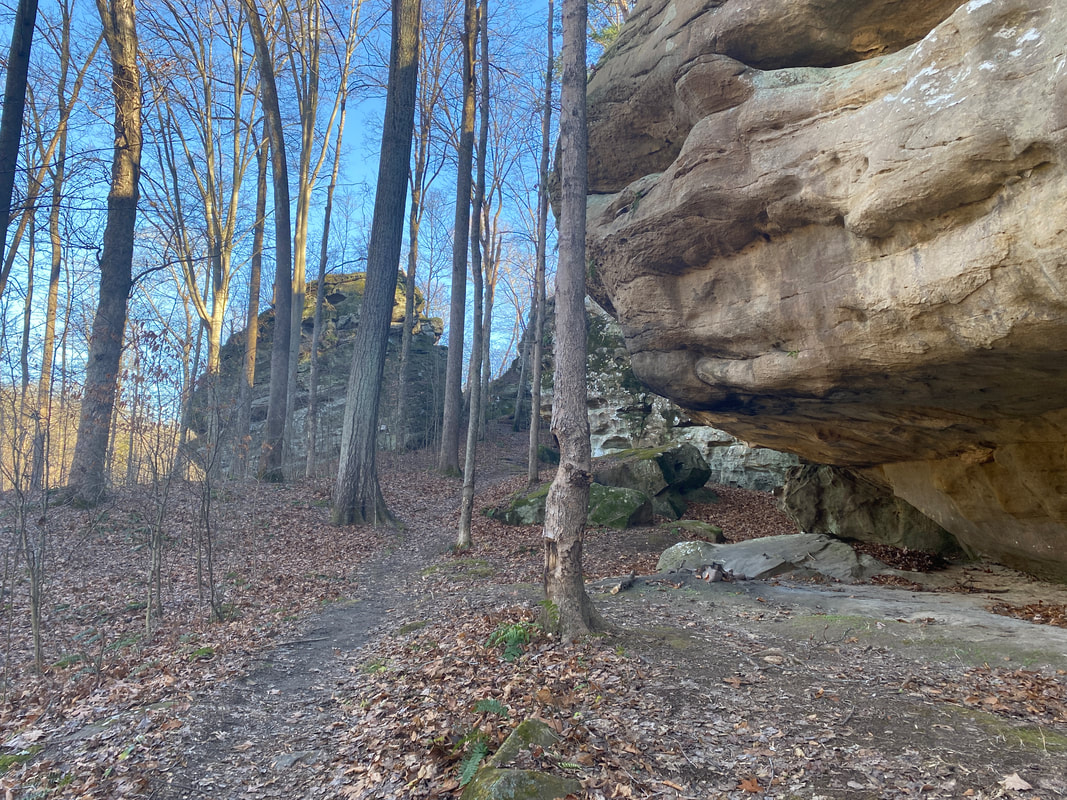
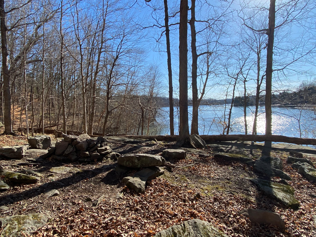
Cedar Lake Trails
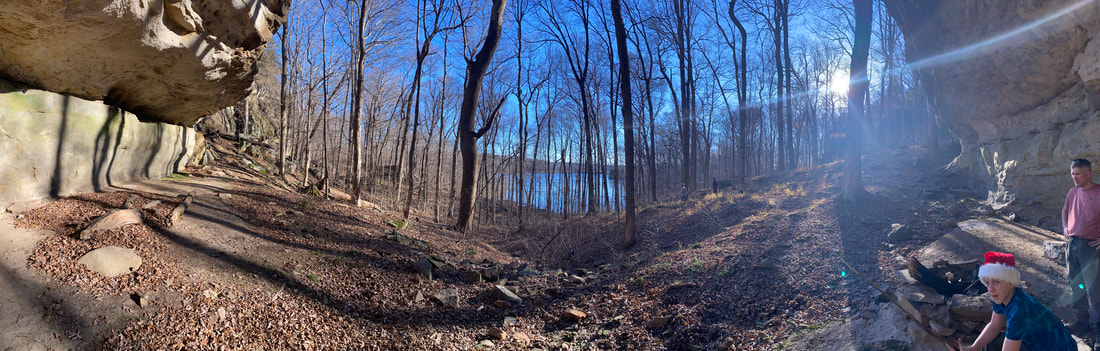
Panoramic view from our Christmas overnight at Cedar Lake, Cove Hollow, Shawnee National Forest
Cedar Lake Area
Key Features:
-Variety of hiking distances possible
-Beautiful lake
-Back country camping
-Interested rock formations to scramble
-Cliffs and rock houses
-Multiple entry points
Key Features:
-Variety of hiking distances possible
-Beautiful lake
-Back country camping
-Interested rock formations to scramble
-Cliffs and rock houses
-Multiple entry points
Cedar Lake, Cove Hollow, Shawnee National Forest
|
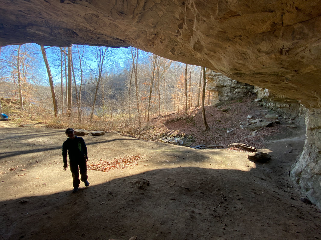
Overhangs at Cedar Lake, Cove Hollow, Shawnee National Forest
|
Fire rings lake side at Cedar Lake, Cove Hollow, Shawnee National Forest
|
Cedar Lake, Cove Hollow, Shawnee National Forest
|
Camping under the overhang at Cedar Lake, Cove Hollow, Shawnee National Forest
|
Cedar Lake Area
(Many mileage options)
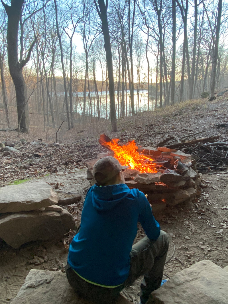
Cove Hollow Trail at Cedar Lake in Shawnee National Forest may just be our new favorite spot. With several trail head options to start from and numerous A+ fire rings lake side and/or next to unusual rock formations, this is a backpacker's dream location. We explored this area on an overnight a few days before Christmas after having kayak camped it twice before. People had mentioned a cave like feature called Cove Hollow, so we decided to check it out once the weather cooled down enough for backpacking. What a treat to discover not one, not two, not three, but numerous options for overnighting in the backcountry. Each of the spots we discovered offered great fire rings and views of the lake. Easy water access for filtering water and plenty of downed fire materials made each of these spots a great choice for an overnight adventure.
The terrain is gently rolling as the clean and wide trail works its way around the fingers of the lake. We were a little slower than normal because there was much to explore and photograph as we meandered among the rock formations, caves, and overhangs. It was hard not to feel like we were passing the perfect campsite as we journeyed on down the trail to our destination. Our goal was to hike from the Cove Hollow Trailhead to the dam between Little and Big Cedar Lakes, but there was just too much to be excited about in our new finds, so we will certainly have to come back and finish off the whole trail system.
The terrain is gently rolling as the clean and wide trail works its way around the fingers of the lake. We were a little slower than normal because there was much to explore and photograph as we meandered among the rock formations, caves, and overhangs. It was hard not to feel like we were passing the perfect campsite as we journeyed on down the trail to our destination. Our goal was to hike from the Cove Hollow Trailhead to the dam between Little and Big Cedar Lakes, but there was just too much to be excited about in our new finds, so we will certainly have to come back and finish off the whole trail system.
Typical trail conditions, Cedar Lake, Cove Hollow, Shawnee National Forest
|
Numerous lake side spots, Cedar Lake, Cove Hollow, Shawnee National Forest
|

Rock features to explore at Cedar Lake, Cove Hollow, Shawnee National Forest
|
|
|
|
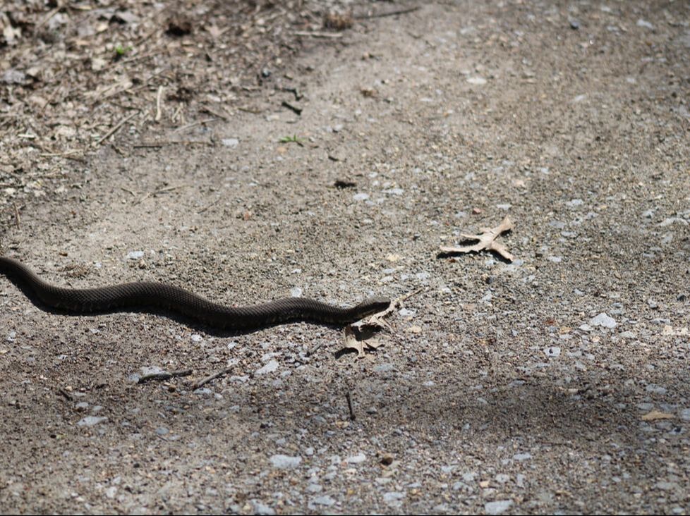
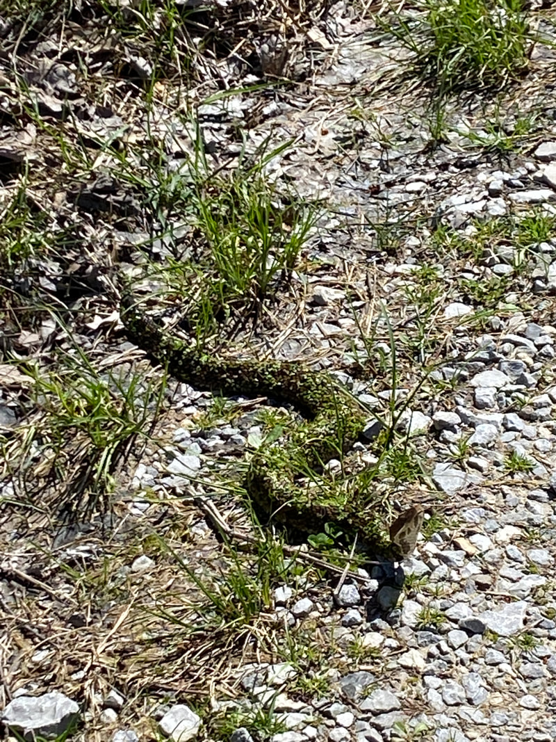
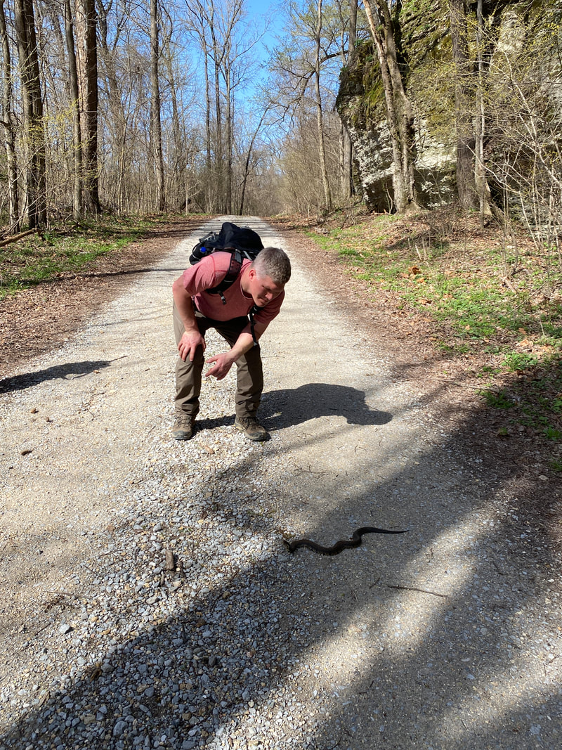
LaRue Pine Hills (Snake Road)
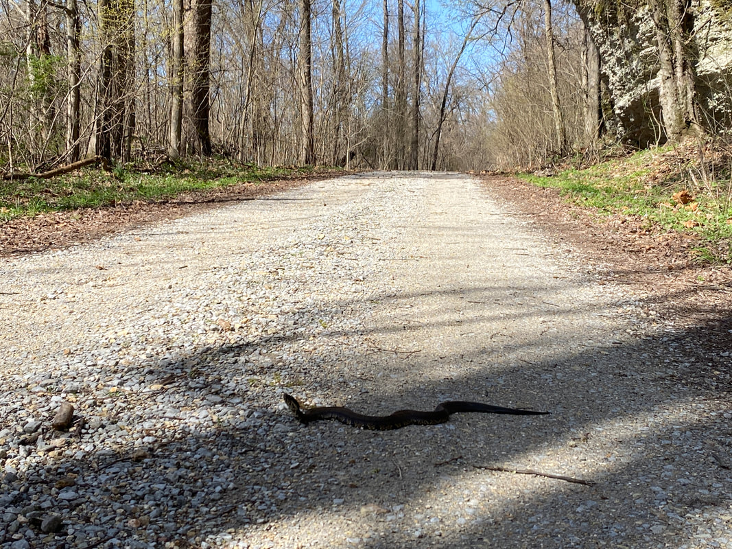
A Cotton Mouth crossing Snake Road, LaRue Pine Hills, Shawnee National Forest
LaRue Pine Hill Research Area
Key Features:
-Parking on either end of roadway
-Easy gravel trail (road bed)
-No camping near trail
-Great wildflower in spring
-Great reptile (snake viewing) at certain times of the year
Key Features:
-Parking on either end of roadway
-Easy gravel trail (road bed)
-No camping near trail
-Great wildflower in spring
-Great reptile (snake viewing) at certain times of the year
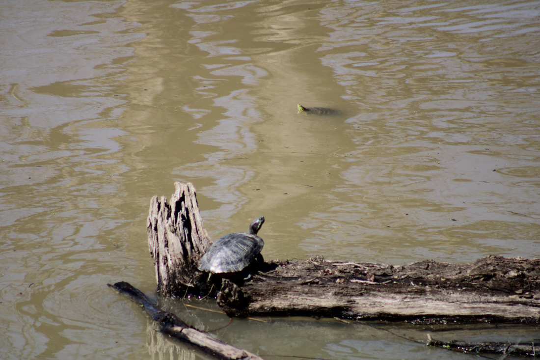
Multiple turtle species can be found in the wetlands, LaRue Pine Hills, Shawnee National Forest
|
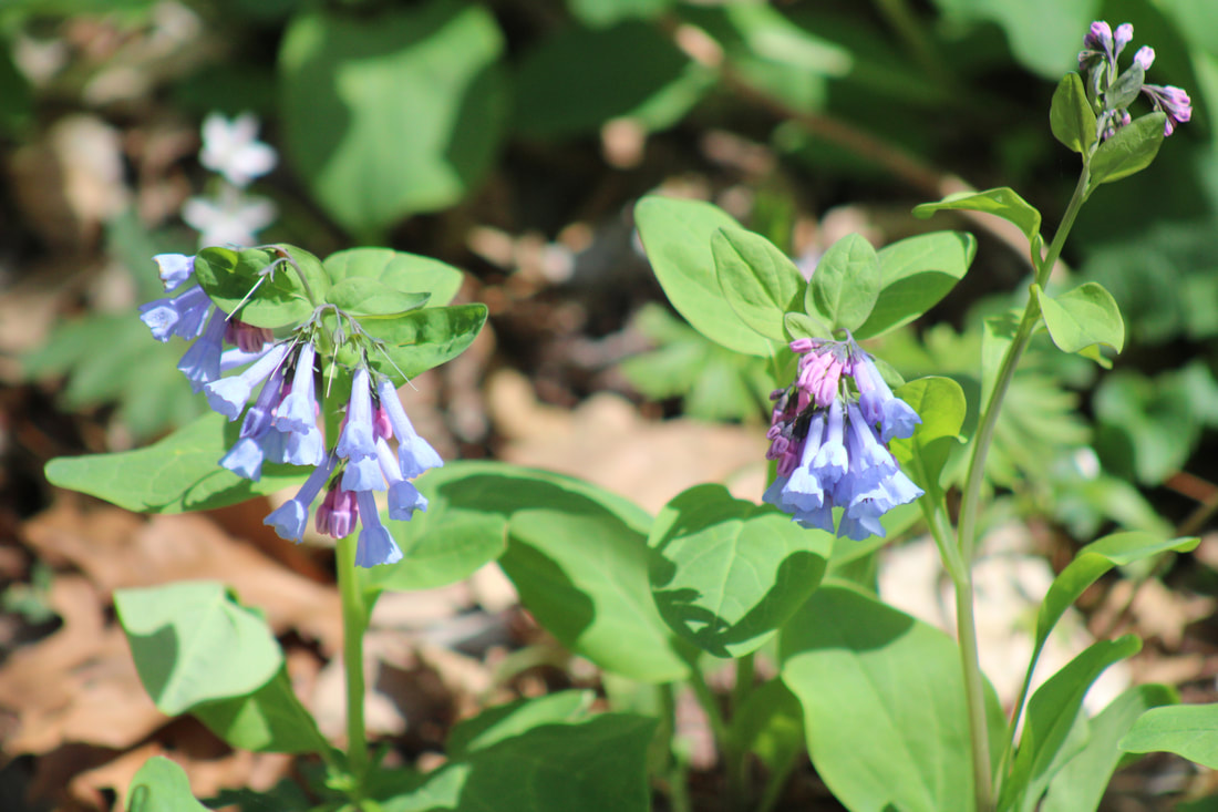
Virginia Blue Bells , LaRue Pine Hills, Shawnee National Forest
|
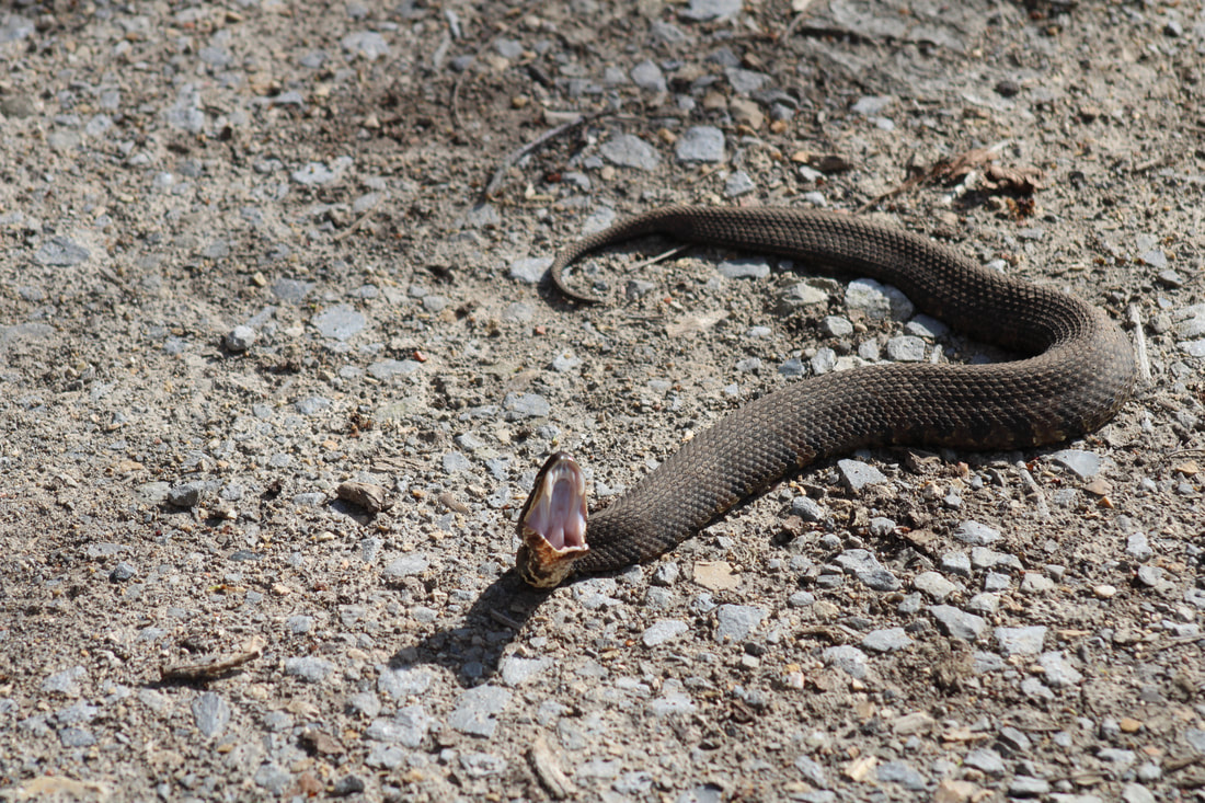
A grumpy cottonmouth, LaRue Pine Hills, Shawnee National Forest
|

Ribbon Snake, LaRue Pine Hills, Shawnee National Forest
|
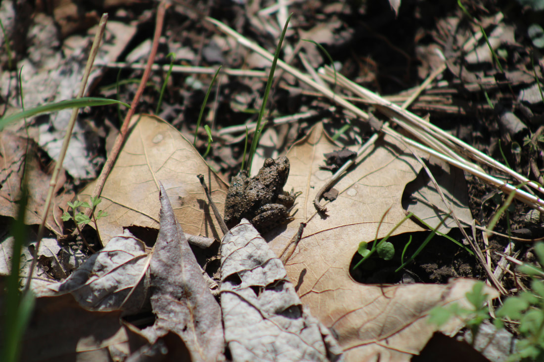
Amphibians frequent the Snake Road too, LaRue Pine Hills, Shawnee National Forest
|
LaRue Pine Hills (The Snake Road)
(5 miles out and back)
The Snake Road in LaRue Pine Hills Nature Reserve is located in the Shawnee National Forest and is an approximately 2.5 mile section of road that is closed during the spring and fall for the migration of numerous snake species as they make their way from their winter shelter in the high cliffs down to the swampy wetlands to the west. Snakes must traverse the gravel road, which makes for unprecedented sightings and up close encounters for brave souls willing to face their fears and take on the hike. It has taken on a cult following of herp fanatics from far and wide. Read more about our trip here.
The section of road has some gentle hills but is otherwise a super easy walk in the woods. You will not have to wander off the gravel at all to see snakes, in fact is can be easier to spot some of the smaller species in the gravel. Encountered several snakes crossing the gravel road right in front of us. We also found them in the leaf matter in the side ditches, and swimming in the water alongside the road. Keep your eyes peeled because there are snakes of all shapes and sizes, from 4 inch snakes that look like twigs to the big girthy cottonmouths.
The section of road has some gentle hills but is otherwise a super easy walk in the woods. You will not have to wander off the gravel at all to see snakes, in fact is can be easier to spot some of the smaller species in the gravel. Encountered several snakes crossing the gravel road right in front of us. We also found them in the leaf matter in the side ditches, and swimming in the water alongside the road. Keep your eyes peeled because there are snakes of all shapes and sizes, from 4 inch snakes that look like twigs to the big girthy cottonmouths.
Cottonmouth covered in duck weed, LaRue Pine Hills, Shawnee National Forest
|
Getting a closer look, LaRue Pine Hills, Shawnee National Forest
|
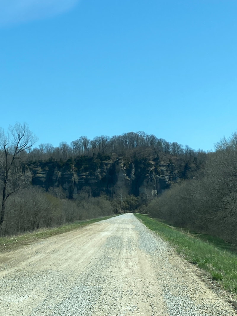
The rock bluffs the snakes hibernate in, LaRue Pine Hills, Shawnee National Forest
|
|
|
|
Lusk Creek Wilderness
Looking up at one of the many cliffs in the Lusk Creek Wilderness, Shawnee National Forest
Lusk Creek trail system
Key Features:
-Complex trail system with many intersections
- Very popular with horse back riders
- Trails are gravel covered in areas
- May have multiple creek crossings
- Some nice rcok outcropping and a natural arch
Key Features:
-Complex trail system with many intersections
- Very popular with horse back riders
- Trails are gravel covered in areas
- May have multiple creek crossings
- Some nice rcok outcropping and a natural arch
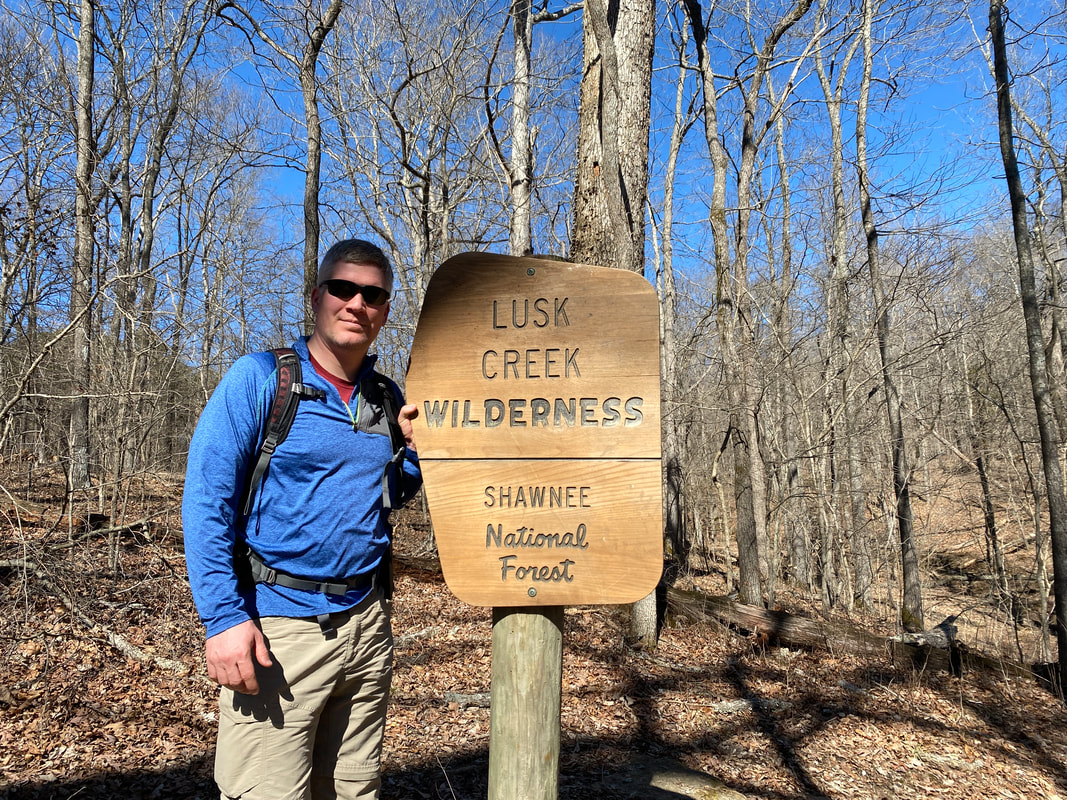
Welcome to the Lusk Creek Wilderness, Shawnee National Forest
|
One of the many creek crossing in the Lusk Creek Wilderness, Shawnee National Forest
|
The natural bridge in Lusk Creek Wilderness, Shawnee National Forest
|

Wide easy trails in the Lusk Creek Wilderness , Shawnee National Forest
|
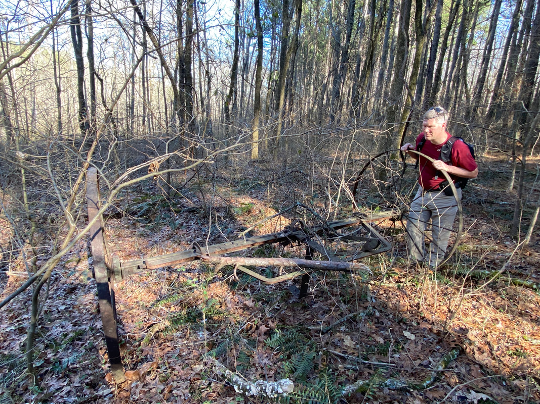
Farming relics in the Lusk Creek Wilderness, Shawnee National Forest
|
Lusk Creek Wilderness
Under construction
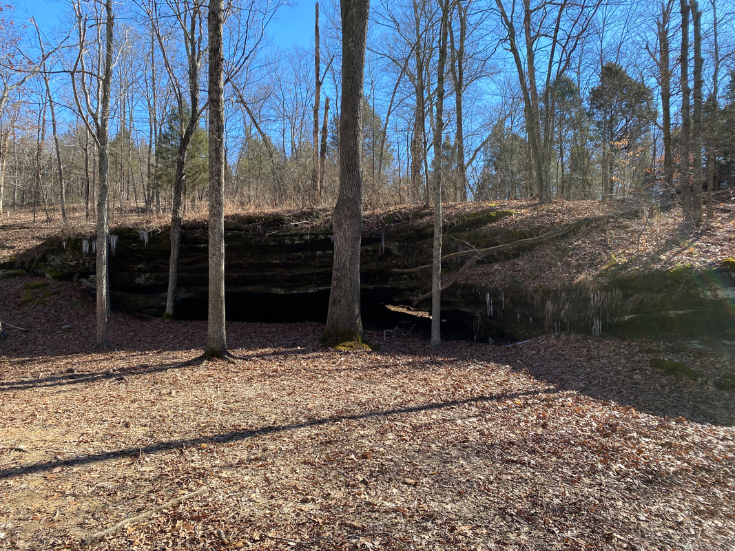
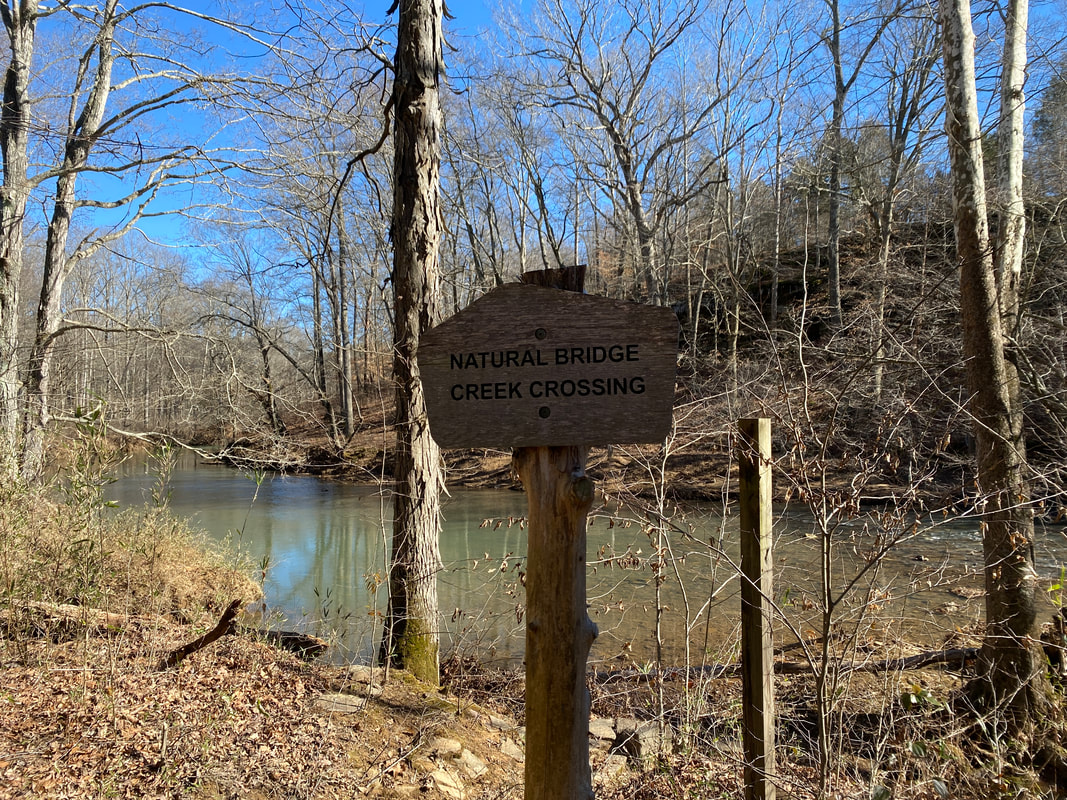
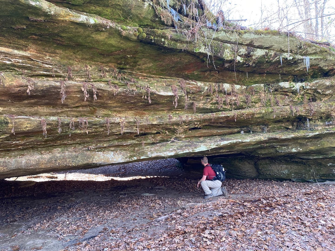
We visited the Lusk creek trail system on a cool February weekend, and we were impressed. This trail system is popular with horse back riders and we were expecting the trail to be some what sloppy but over all the trail was not too bad. Many parts of the trail have been covered with a light layer of gravel to keep the mud down. We also found the trail system to be complex with a lot of intersections to keep track of, we recommend that you study your maps before visiting and take a few minutes to check with the map at each intersection. While every intersection we found was clearly marked double check your map, it still is easy to miss trail 487A and take 481. Lusk creek itself is protected and they ask that you only cross at the designated spots. We found that the while the creek was wide at crossing 30 or more feet across the water was a little less than knee deep at its deepest, and was very cold. We are sure that the water levels would be even lower in the summer and fall. Salt peter cave and the natural bridge are two of the main attractions in this trail system. We skipped the Saltpeter cave this time to avoid a third and four crossing of Lusk creek but did visit the natural bridge. This natural bridge is much wider that some of the other we have visited in Shawnee National forest, but it was not tall and you had to duck while under the bridge. We had lunch under it as it was a dry and provided a little shelter from the breeze. We are looking forward to checking out the many mile of trails in this system we have yet to explore.
We visited the Lusk creek trail system on a cool February weekend, and we were impressed. This trail system is popular with horse back riders and we were expecting the trail to be some what sloppy but over all the trail was not too bad. Many parts of the trail have been covered with a light layer of gravel to keep the mud down. We also found the trail system to be complex with a lot of intersections to keep track of, we recommend that you study your maps before visiting and take a few minutes to check with the map at each intersection. While every intersection we found was clearly marked double check your map, it still is easy to miss trail 487A and take 481. Lusk creek itself is protected and they ask that you only cross at the designated spots. We found that the while the creek was wide at crossing 30 or more feet across the water was a little less than knee deep at its deepest, and was very cold. We are sure that the water levels would be even lower in the summer and fall. Salt peter cave and the natural bridge are two of the main attractions in this trail system. We skipped the Saltpeter cave this time to avoid a third and four crossing of Lusk creek but did visit the natural bridge. This natural bridge is much wider that some of the other we have visited in Shawnee National forest, but it was not tall and you had to duck while under the bridge. We had lunch under it as it was a dry and provided a little shelter from the breeze. We are looking forward to checking out the many mile of trails in this system we have yet to explore.
A rock staircase in the Lusk Creek Wilderness, Shawnee National Forest
|
A small creek feeding Lusk Creek, Shawnee National Forest
|
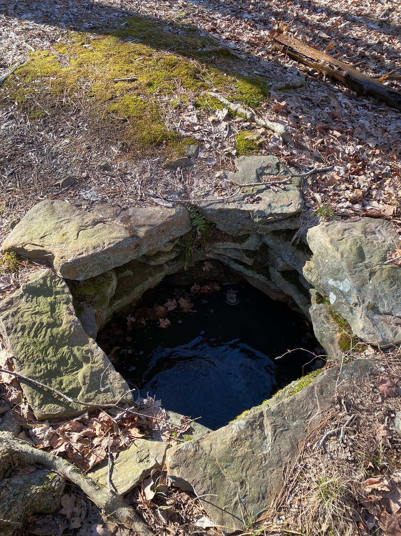
The "Wishing Well" in the Lusk Creek Wilderness, Shawnee National Forest
|
|
|
|