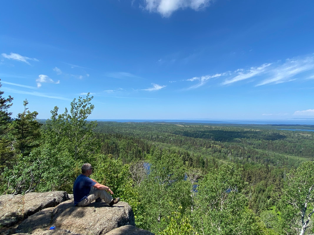
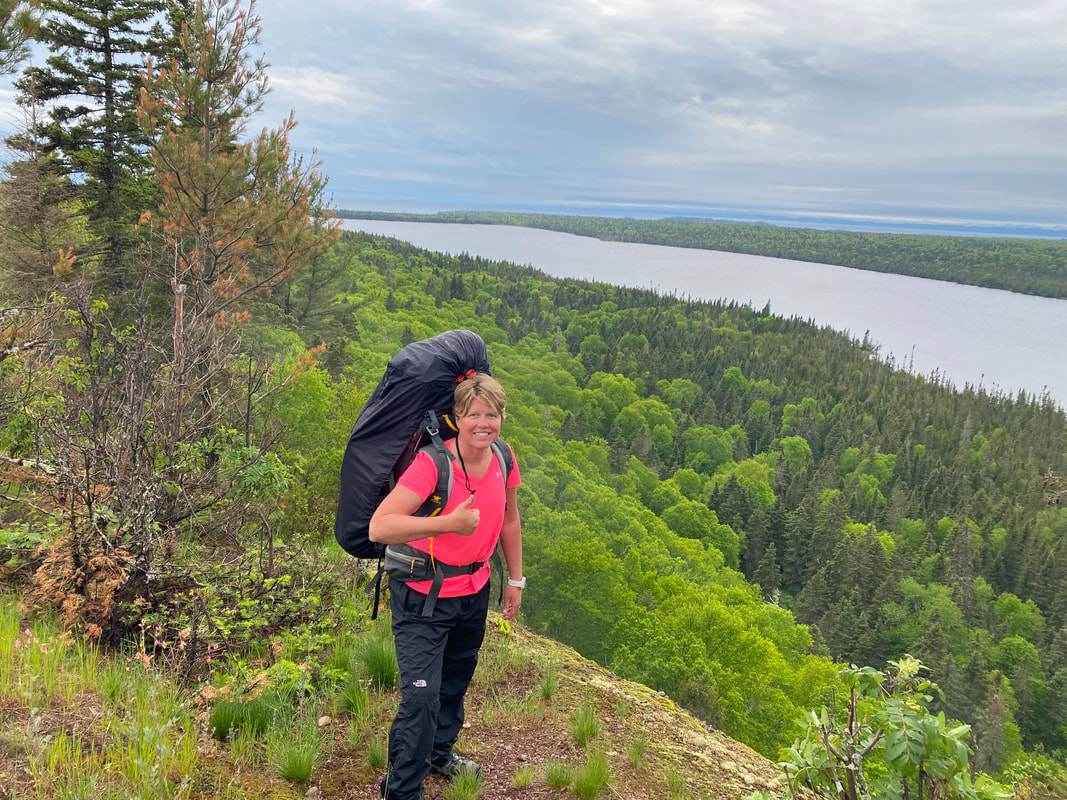
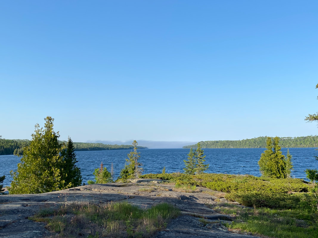
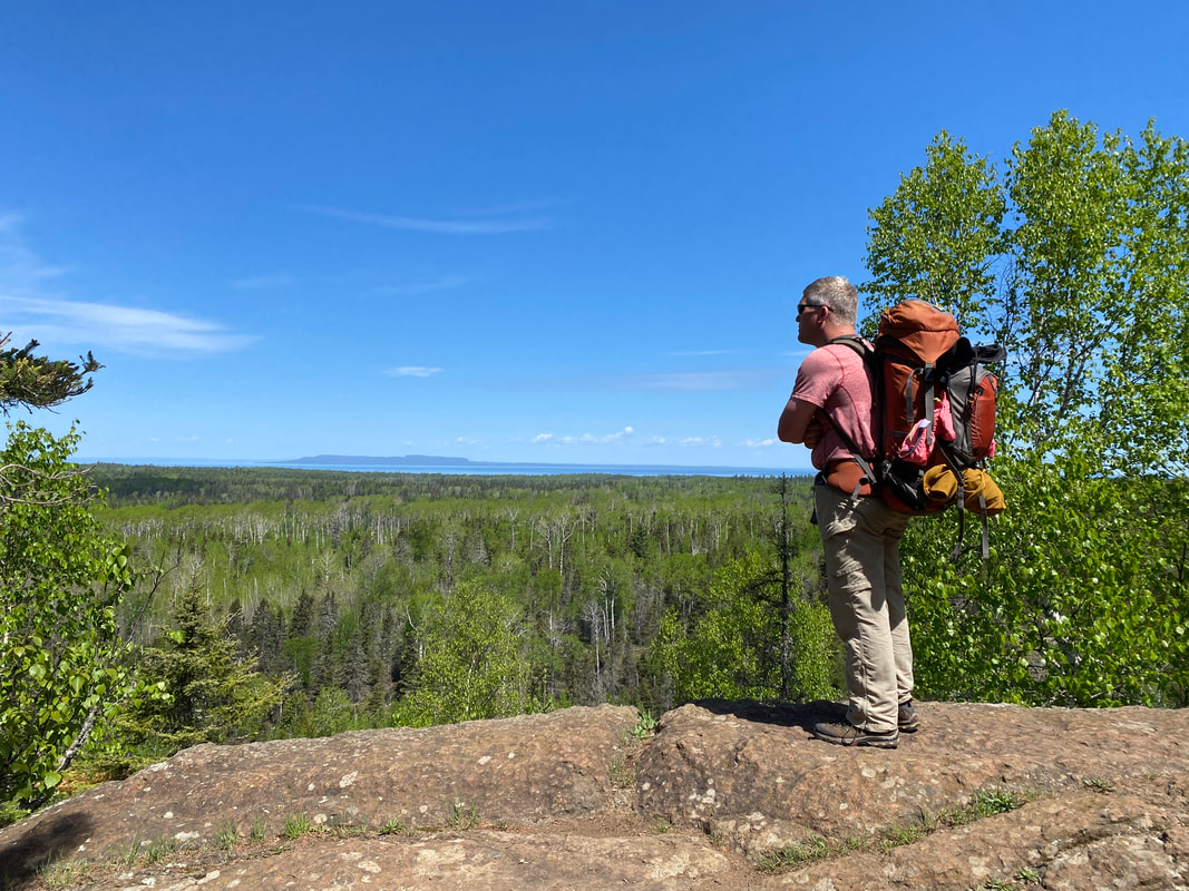
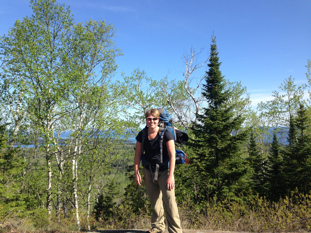
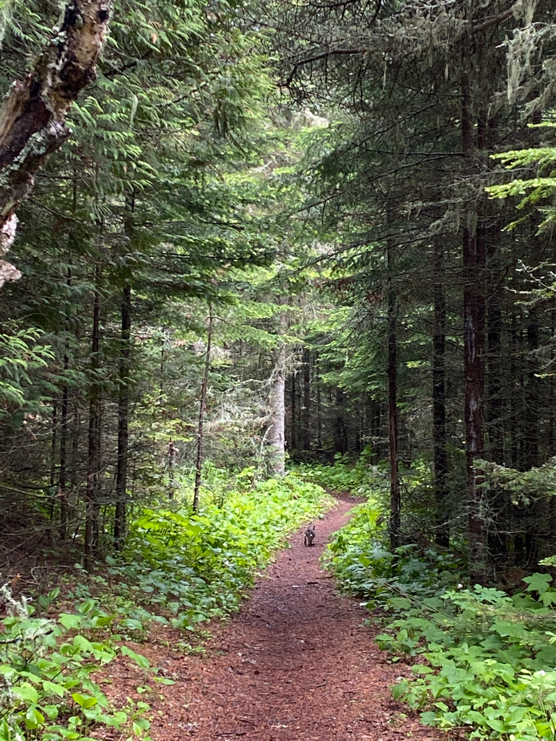
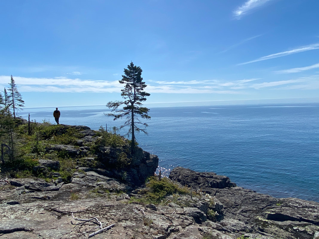
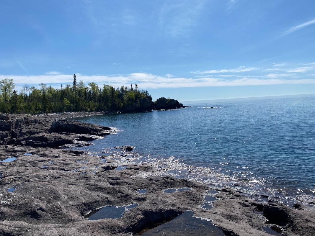
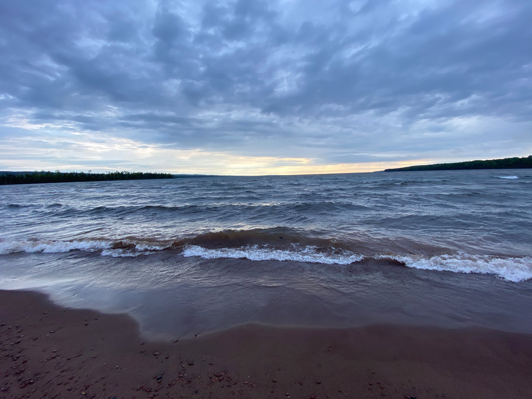
Isle Royale National Park
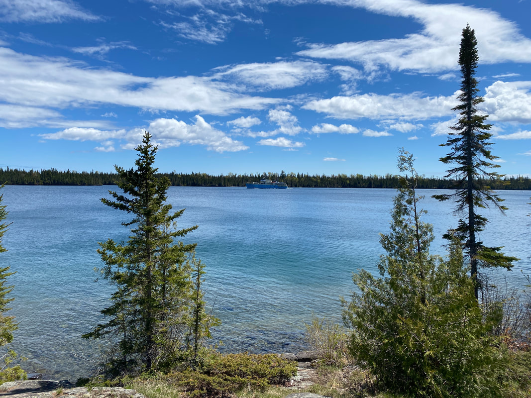
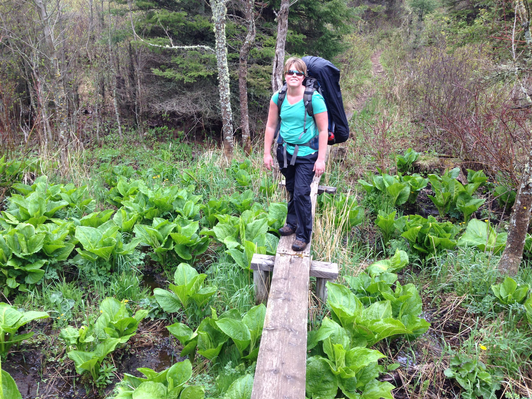
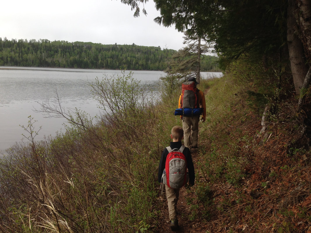
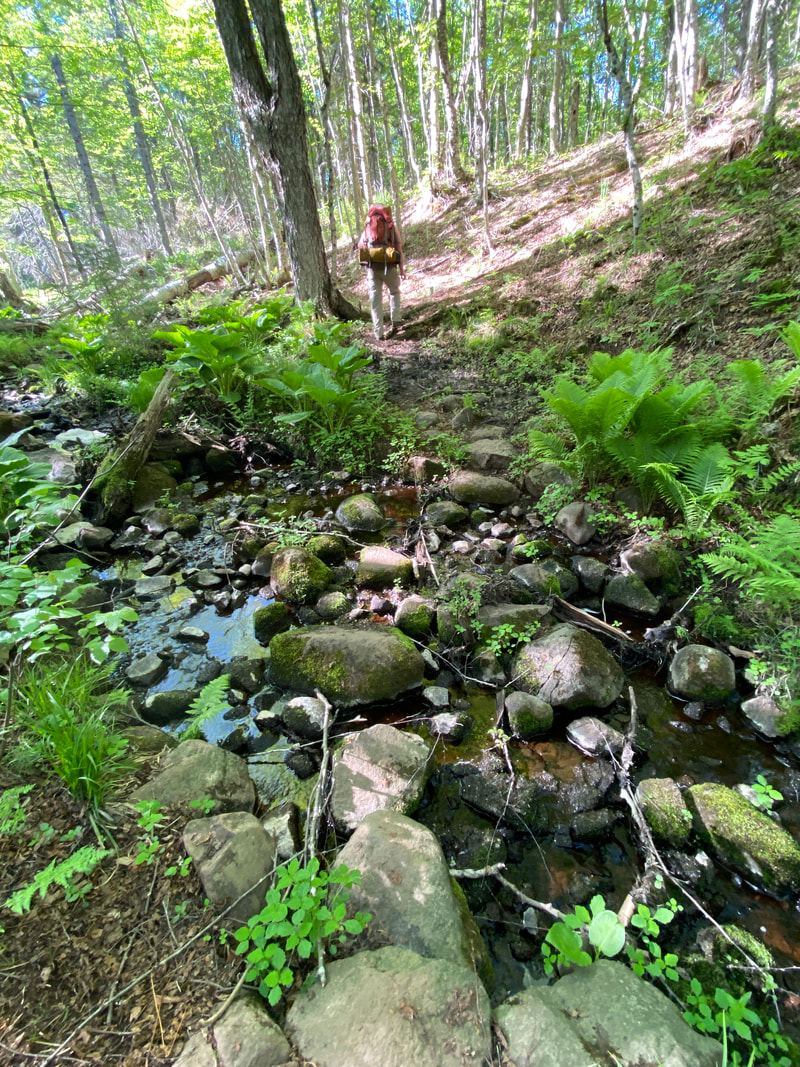
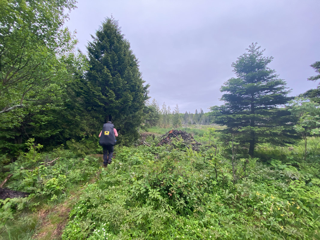
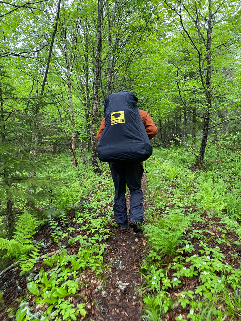
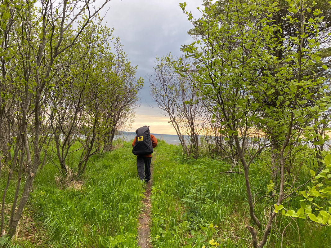
This island in north west Lake Superior is one of the least visited national parks. It measures 45 miles long by 9 miles wide and has 170 miles of hiking trails. It allows no motorized vehicles and is accessible only by ferry, plane, or boat. It is a backpacker and kayaker haven.
Getting to the Island

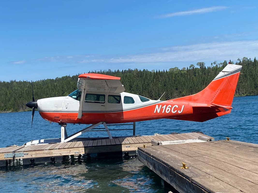
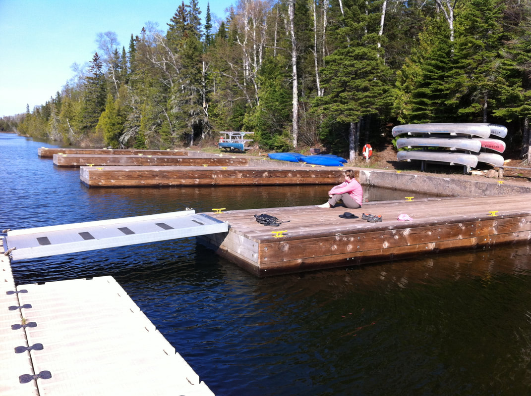
Isle Royale Sea Planes at the dock, Isle Royale National Park
Key Features:
-You are responsible for your own transportation
- Park staff will not get involved in disputes between you and your transportation service
- It is unlikely for you to get stranded when using a ferry, but it has happened
-Check your time zones, Grand Portage may not be on island time
- Getting to the island is part of the adventure
Isle Royal Air at Tobin Harbor, Isle Royale
|
The Ranger III in Rock Harbor, Isle Royale
|
The Voyager II coming in to Windigo's dock, Isle Royale
|

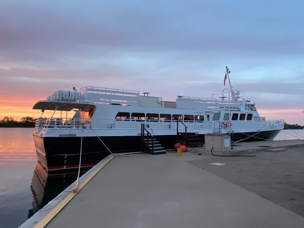
The Isle Royale Queen docked, Isle Royale
|
The Ranger at the new dock in Snug Harbor, Isle Royale
|
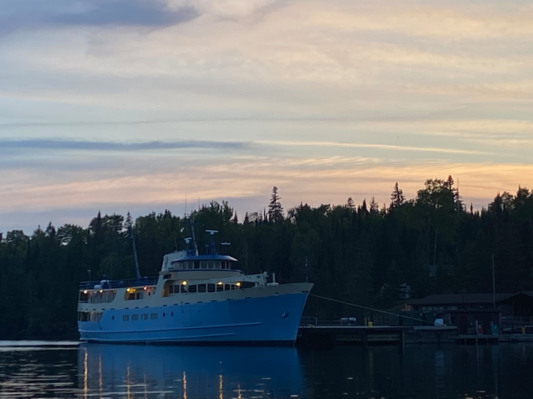
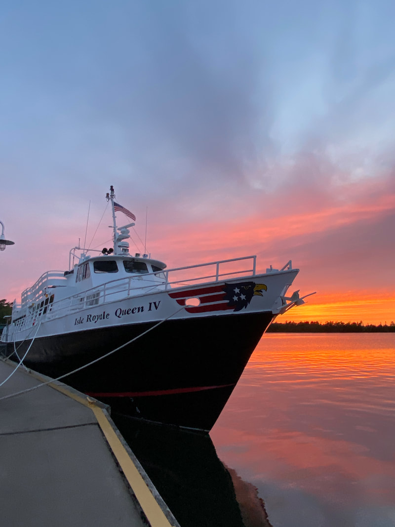
Isle Royale Queen IV
The Isle Royale Queen IV or as the locals call her "The Queen" is a popular way to get to the island. It departs from Copper Harbor at the tip of the Kennewa Peninsula. Just getting to -and staying in- Copper Harbor can be an adventure This small seasonal town is supported by Isle Royale traffic and a nationally know set of mountain bike trails. If you have extra time in town and are a mountain biker you will want to plan to stay an extra day. Loading the Queen is quick and easy, and in all of our trips, has never been a problem or hassle. The trip over takes about three hours and has away been more or less smooth. It is thrilling to see the main land fade away and get a sense of the true size of being out on the big lake. It is also very exciting to see the island slowly come into focus as you near. The Queen is a great place to spread out maps and double check your itinerary or talk with those around you to gather some insights on the Island. The chances are someone sitting near you is on their 3rd or 4th trip to the island and will be a wealth of information. The Queen also is one of the cheaper ways to get to the island. While in the off season it is not usually crowed, during the peak season you will need reservations. Taking the time to boat to the island helped me to understand how remote and isolated Isle Royale really is.
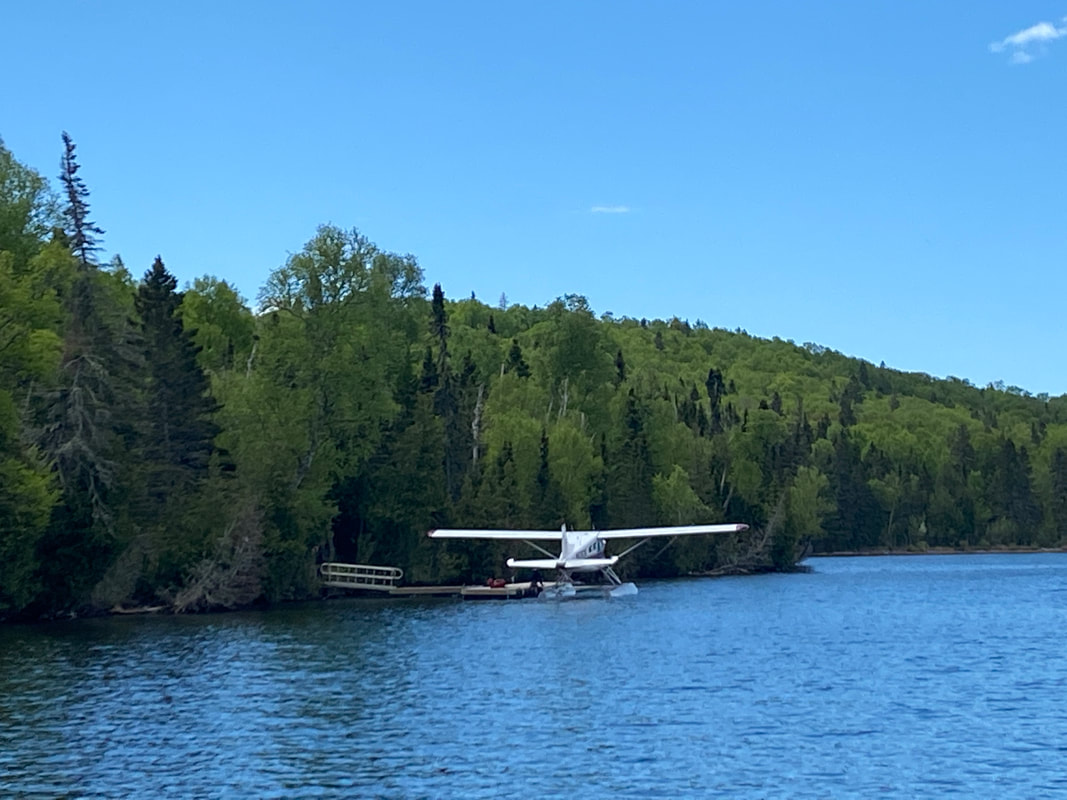
Isle Royale Sea Planes
|
Isle Royale sea planes is a quicker way to get to the island, but with greater speed comes greater cost. The last time we traveled to the island the price of one plane ticket would have bought three seats on the Queen. However, we were miles down the trail before the queen arrived in Rock Harbor that day. The float plane essentially bought us an extra day on the island instead of 7 hours of time on a round trip ferry ride. The ferry is a little more flexible with pack weights and bulky bags than the float plane. Also, the float plane will not carry any stove fuel so you must purchase it on the island. The float plane staff was friendly and fun. Our plane ride was smooth and uneventful except for the awesome view of the main land and even better views of the island. Remember air travel can be more weather dependent that sea travel. Flights to and from the island do get delayed due to fog always pack and extra day or two of food when using the float plane. Seeing the island from the air gave me a new appreciation for the layout of the island and the countless smaller islands, lakes, and coves that are associated with it that you can't possibly see backpacking due to the remote nature of the island.
|
Seaplanes in Windigo
|
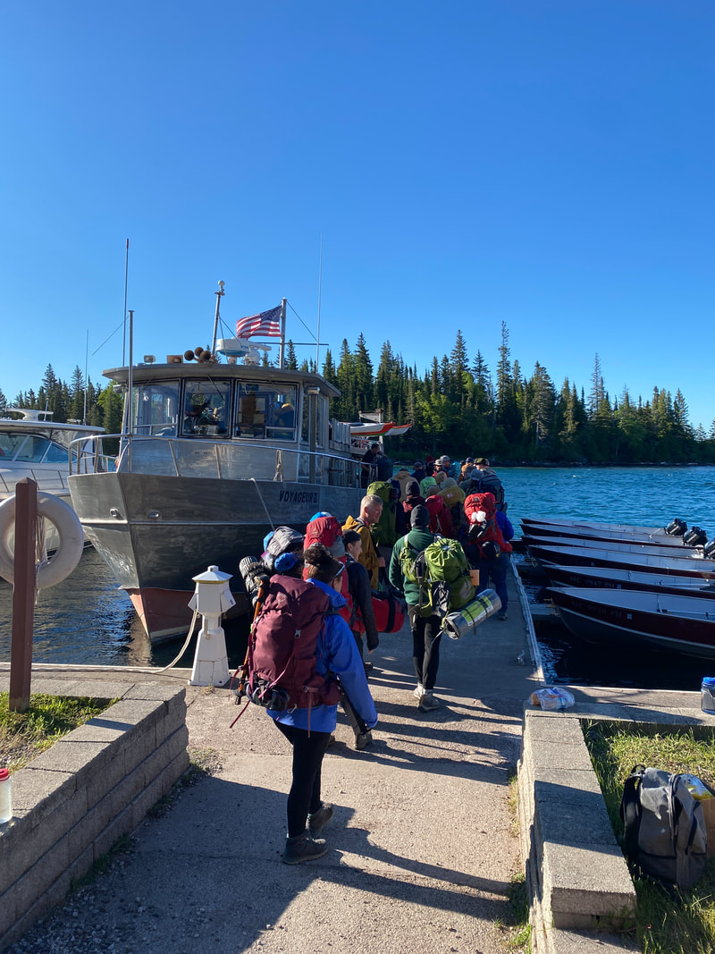
Voyager II
The Voyager II is based out of Grand Portage, MN and hold around 40 passengers, making it the smallest passenger ferries to Isle Royale. However, what it lacks in size, it makes up with in versatility and seaworthiness. (See blog). Scheduling the Voyager is a bit tricky as it leaves Grand Portage and journeys to Windigo and the North Shore, then overnights in Rock Harbor and brings passengers around the southern shore to Windigo and then on to Grand Portage in its 48 hour circuit. To add even more complexity to this circuit, the Voyager commonly stops of at a variety of docks to pick up and drop off passengers who have scheduled ferry service from these starting and ending points on their hikes. The Voyager can carry canoes and kayaks as well, for an additional fee. The flexibility of the Voyager's stops makes it a possible for creative adventurers to access all parts of the island.
Ranger III
We have seen the Ranger III Rock Harbor and unloading at Snug Harbor, but have never actually used this boat as it leaves from Houghton and is the longest of the ferries at 6 hours. It is, however, the largest vessel and offers the most flexible seating and is the most stable in the big lake. It is staffed with an interpretive ranger for programming en route. This ship also has the largest cargo capacity and even carries small passenger boats on its deck. It also resupplies the island for most of the park service, lodge, and concessions supplies at Rock Harbor and Windigo. It is not uncommon to see this impressive vessel and it's blue hull steaming down Rock Harbor.
Links to Isle Royale Transportation Services
The Queen IV in Copper Harbor, Isle Royale National Park
|
Loading the Voyager II in Rock Harbor, Isle Royale National Park
|
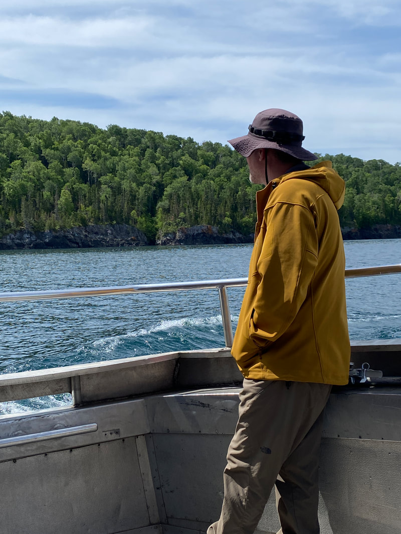
Seeing the North Shore from the Voyager II's back deck, Isle Royale National Park
|
|
|
|
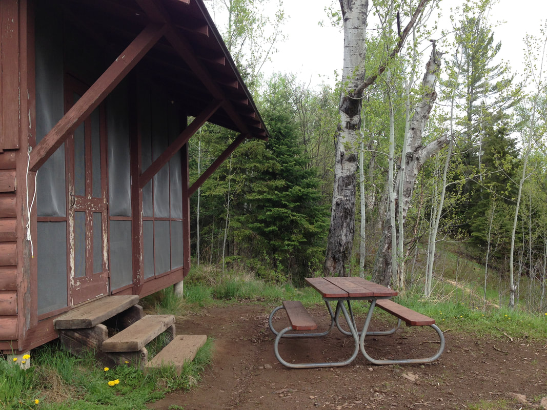
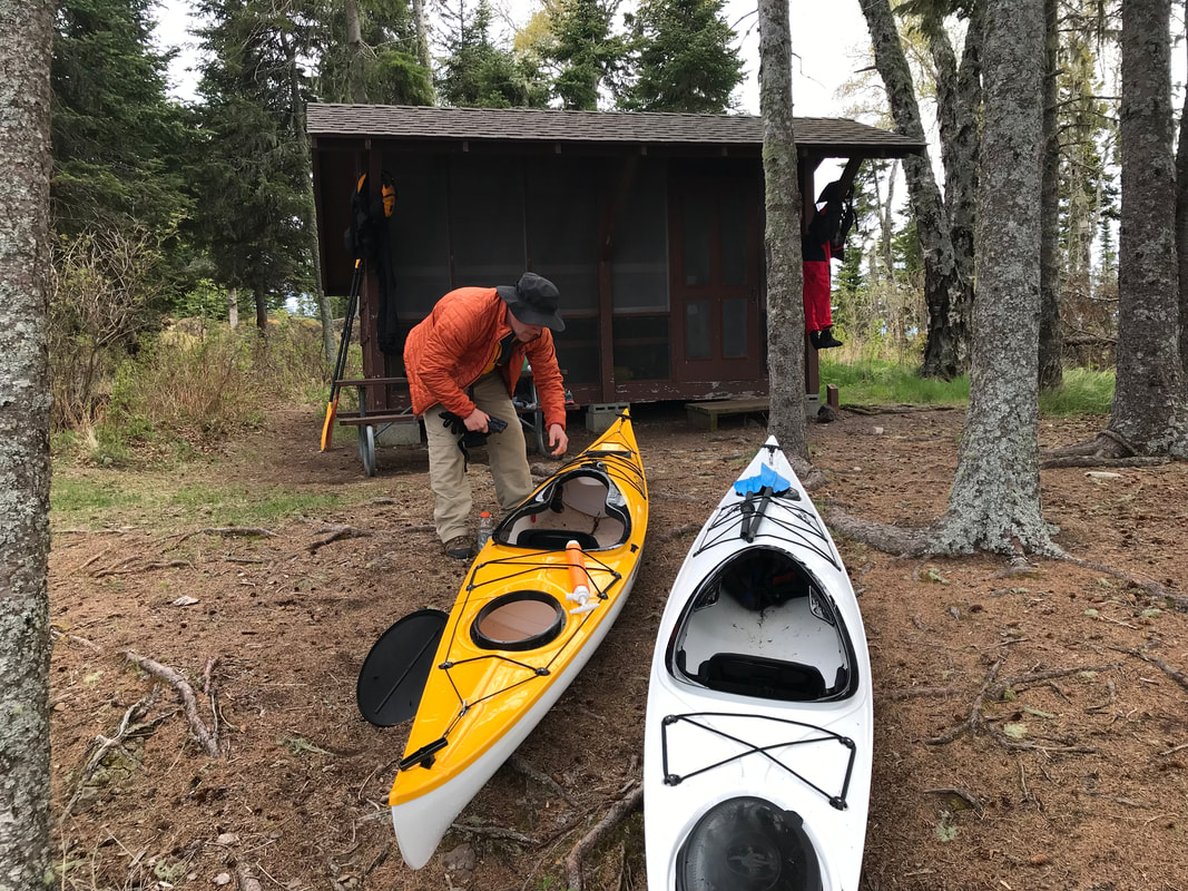
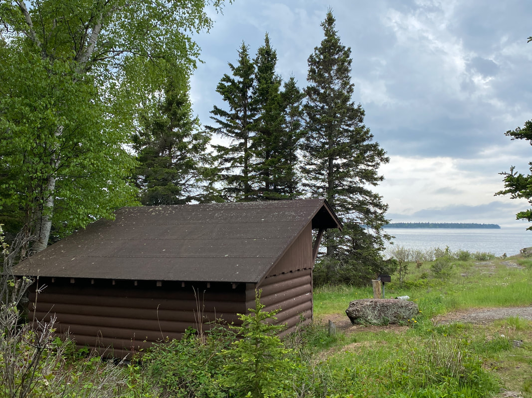
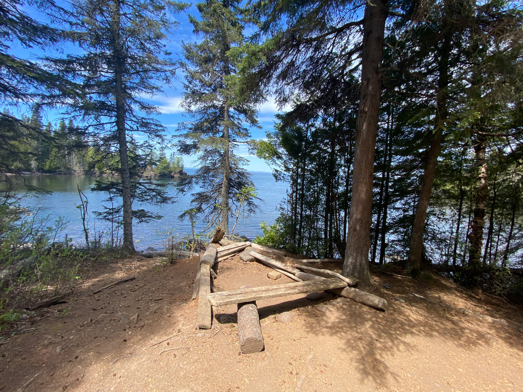
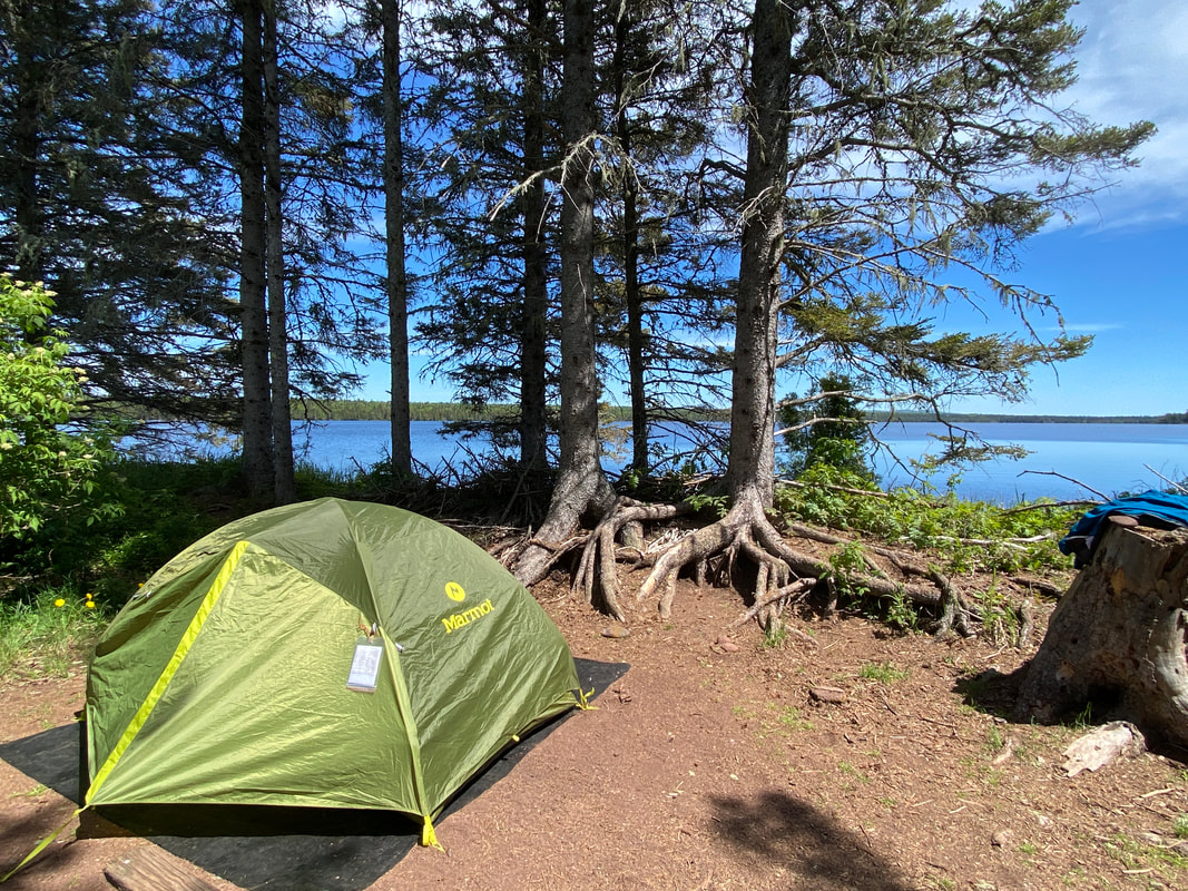
Campsites & Shelters
Duncan Bay Narrows camp site, Isle Royale National Park
Key features:
-Ample space (shelves and hooks to hang gear)
-Clean (equipped with a broom)
-Bug free zone
-Interesting graffiti
-Fog and moisture rolling in can seep through gear
-First come, first serve
-Ample space (shelves and hooks to hang gear)
-Clean (equipped with a broom)
-Bug free zone
-Interesting graffiti
-Fog and moisture rolling in can seep through gear
-First come, first serve
A shelter at McCargo Cove, Isle Royale
|
Cooking dinner at Lane Cove, Isle Royale
|
Unloading a West Caribou island, Isle Royale shelters
|
The Malone Bay shelter is setup for optimal views of the big lake, Isle Royale
|
A dry shelter at Siskiwit Bay, Isle Royale
|
General Information
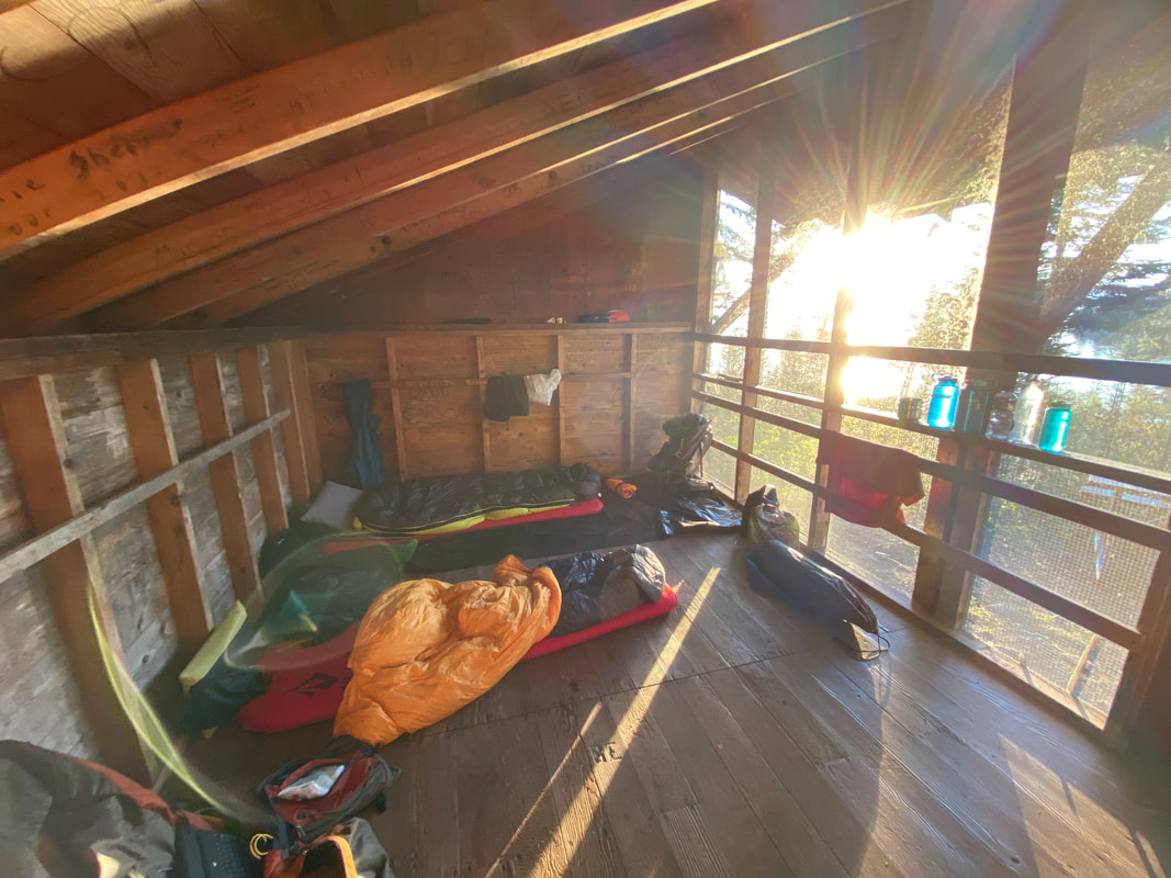
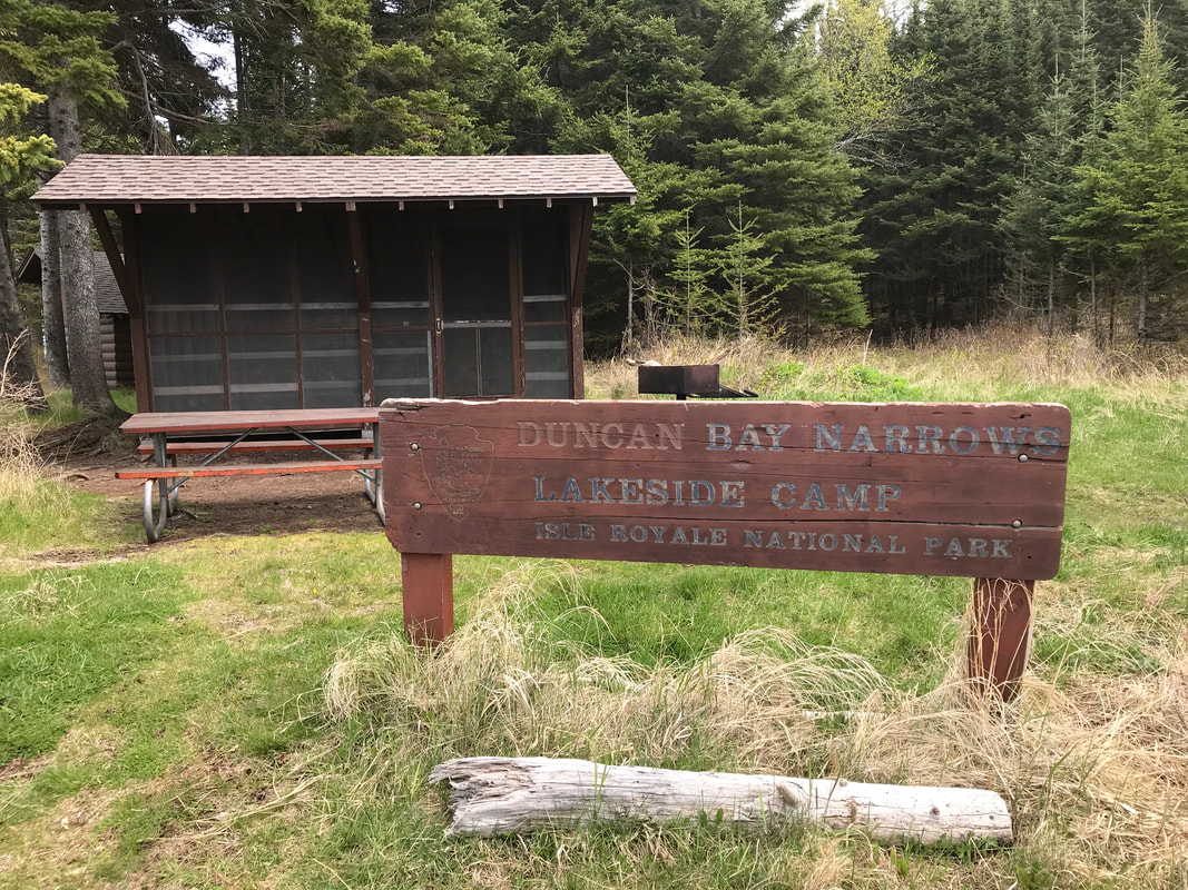
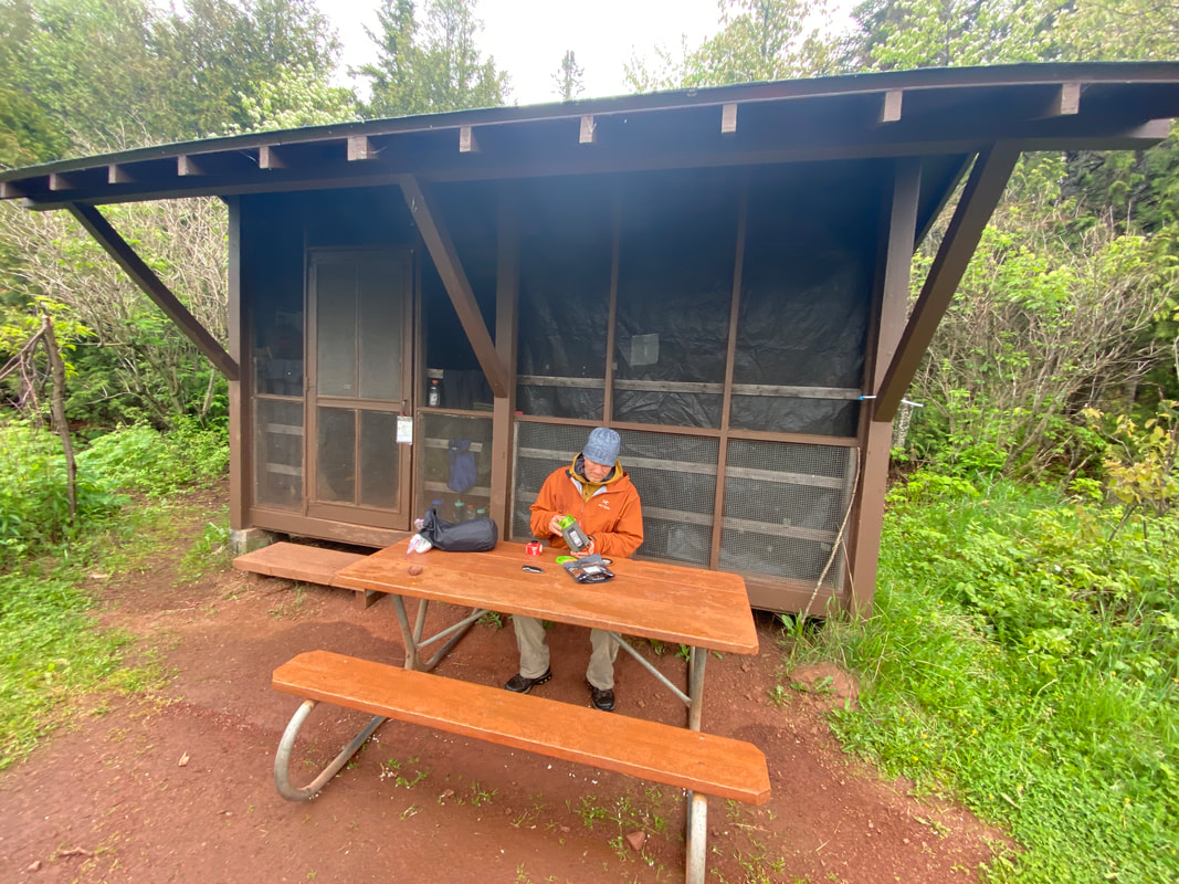
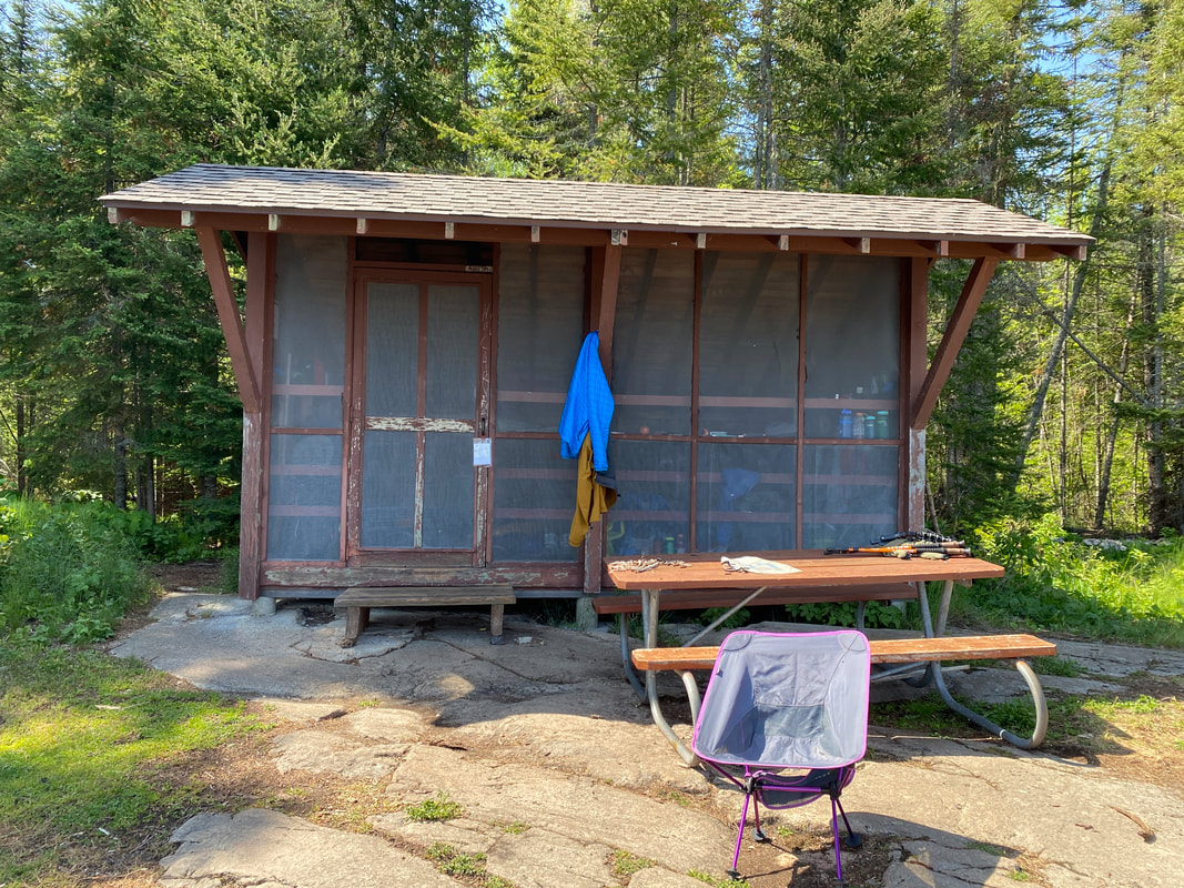
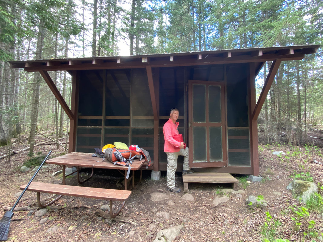
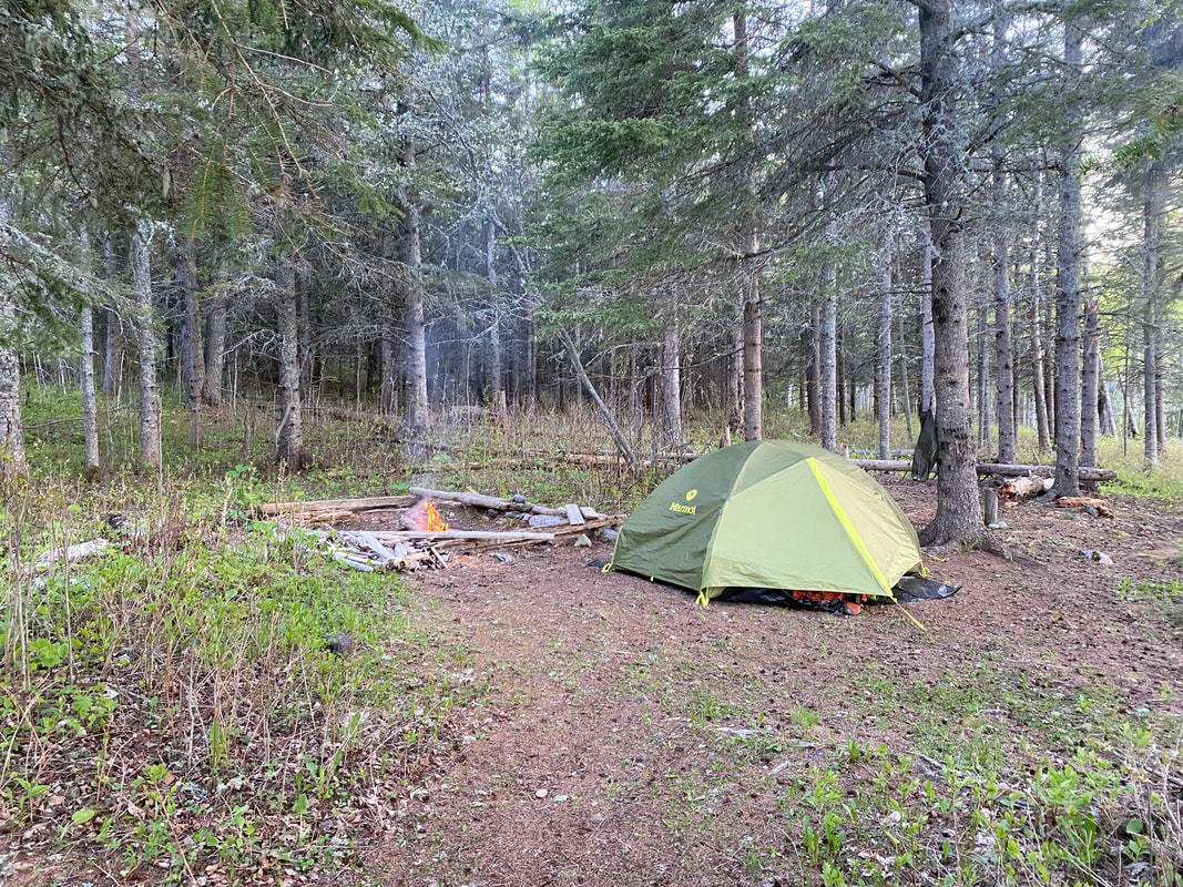
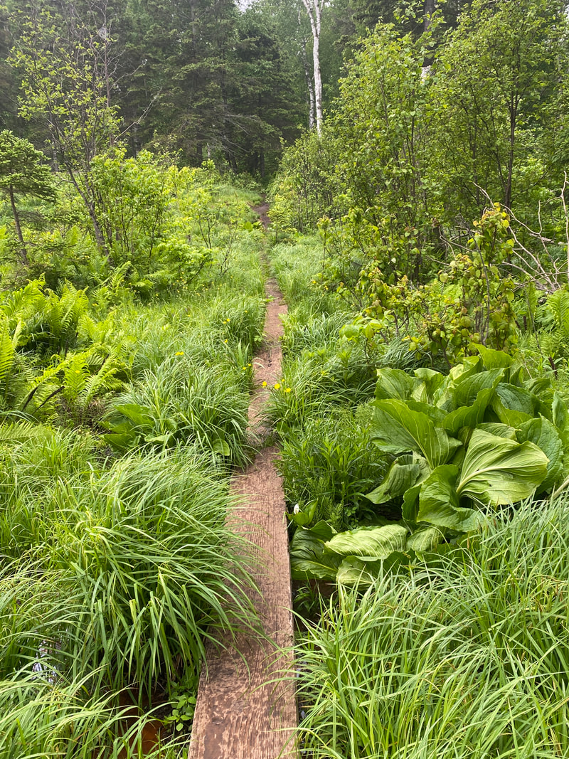
One of our favorite features on Isle Royale is the convenience and bug-free space of the camp shelters. These 3 sided screened in home away from homes offer you the ability to spread out your gear, dry out, and fully stand up to dress or pack. We have always found them to be fairly clean and stocked with a broom to brush out any dust or boot debris before laying out your sleeping pads and gear. Waking up with a view directly out of the shelter to the water is really what the experience on Isle Royale is all about.
The shelters are first come, first serve and can fill quickly in the peak season, many locations have several shelters, but not all, some are tent campgrounds are tent only. There are a few things to consider when setting up your shelter. 1. Sometimes the fog can roll right in and soak your gear in a chilly mist. 2. The open sided shelter leaves no sound barrier or privacy. 3. The squeaking, slamming doors might wake you up in the middle of the night if your shelter-mate is forgetful when using the outhouse. While I am not a fan of visitors marking up the national park, there is some interesting graffiti and art work inside most shelters. Most of the shelter locations have an outhouse, in the past they were stock with toilet paper but this is not longer the case so plan accordingly. They aren't the worst outhouses I've ever used, but it is a typical stinky experience.
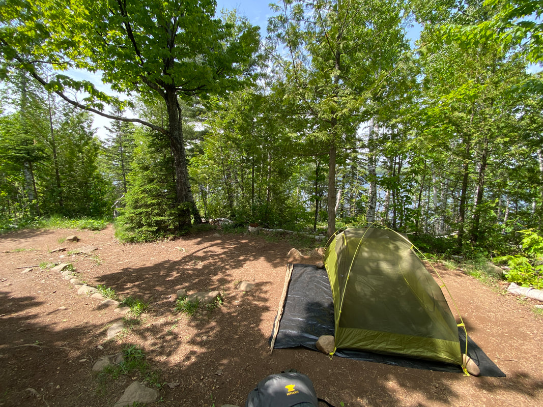
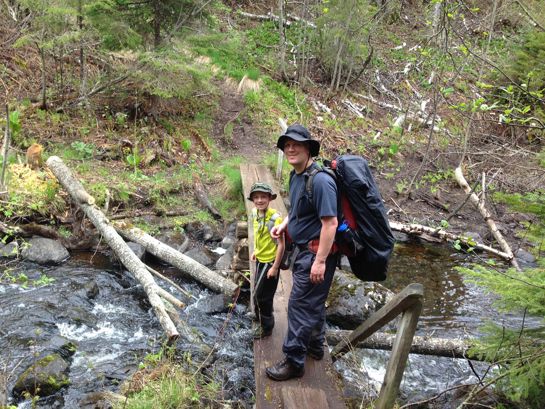
Camping is only allowed in camps sites, unless you have made arrangements with a ranger and a have a permit to camp outside a campground. The park service typically allows only one party per section or zone of the island to camp outside a camp site every day. As a result, almost everyone camps in camp sites. You may camp in a tent, or in a shelter, or in a tent inside a shelter. Inland campsites do not have shelters and some campsites only have 1 or 2 shelters, so always pack a tent on Isle Royale as the shelter is not a sure thing. Check out this blog post on our favorite campsites and shelters on the island as we have visited nearly everyone of them.
The shelters are first come, first serve and can fill quickly in the peak season, many locations have several shelters, but not all, some are tent campgrounds are tent only. There are a few things to consider when setting up your shelter. 1. Sometimes the fog can roll right in and soak your gear in a chilly mist. 2. The open sided shelter leaves no sound barrier or privacy. 3. The squeaking, slamming doors might wake you up in the middle of the night if your shelter-mate is forgetful when using the outhouse. While I am not a fan of visitors marking up the national park, there is some interesting graffiti and art work inside most shelters. Most of the shelter locations have an outhouse, in the past they were stock with toilet paper but this is not longer the case so plan accordingly. They aren't the worst outhouses I've ever used, but it is a typical stinky experience.
Camping is only allowed in camps sites, unless you have made arrangements with a ranger and a have a permit to camp outside a campground. The park service typically allows only one party per section or zone of the island to camp outside a camp site every day. As a result, almost everyone camps in camp sites. You may camp in a tent, or in a shelter, or in a tent inside a shelter. Inland campsites do not have shelters and some campsites only have 1 or 2 shelters, so always pack a tent on Isle Royale as the shelter is not a sure thing. Check out this blog post on our favorite campsites and shelters on the island as we have visited nearly everyone of them.
A campsite at South Lake Desor, Isle Royale
|
A shelter at Moskey Basin, Isle Royale
|
A shelter at Daisy Farm, Isle Royale
|
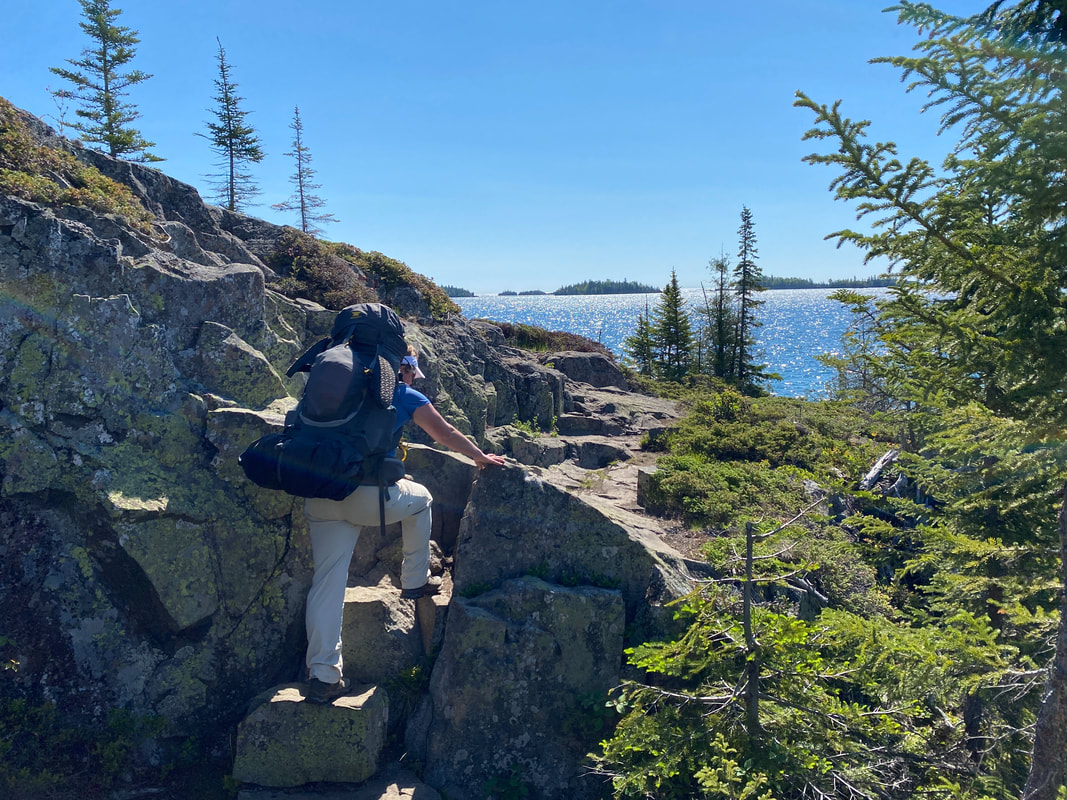
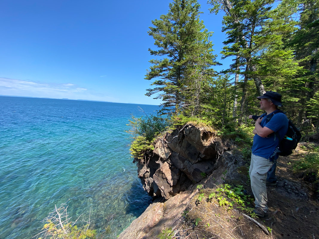
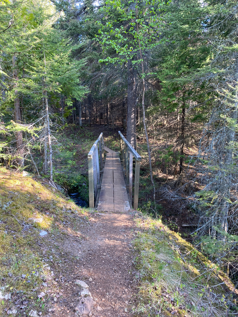
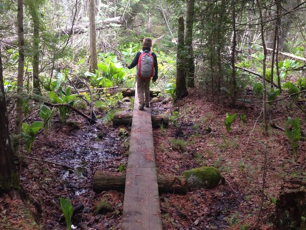
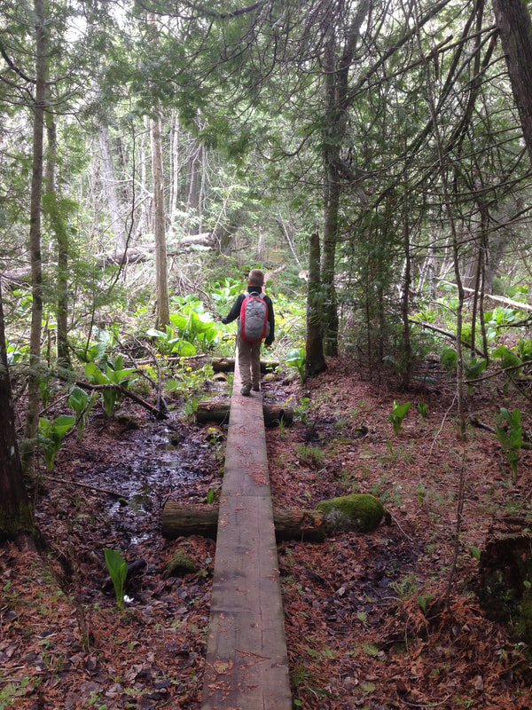
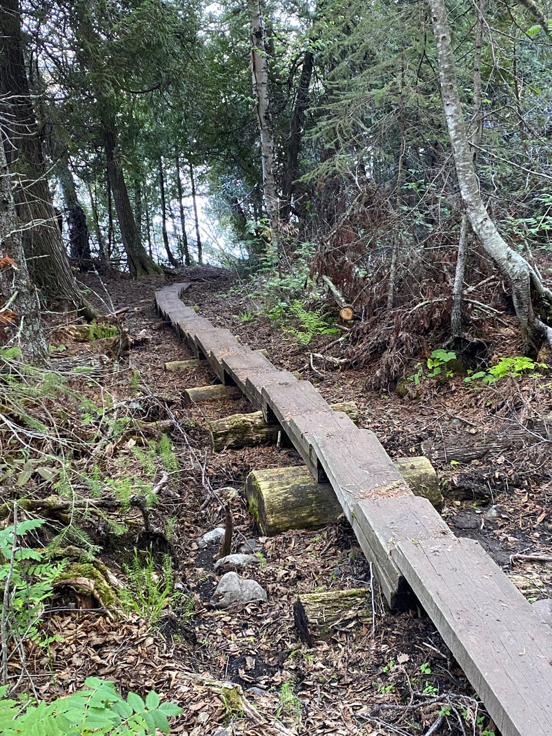
Rock Harbor Trail
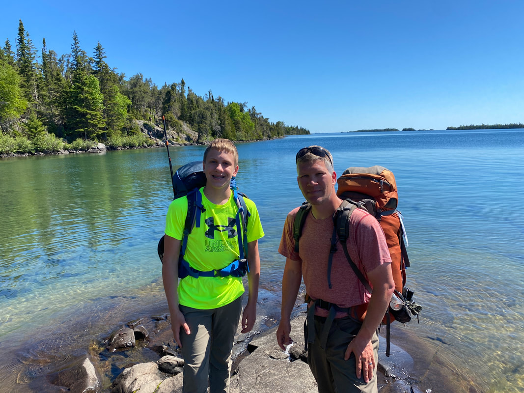
Me and my hiking buddy looking back down Rock Harbor, Isle Royale National Park
Key features:
-Some areas are wet
- Some boardwalks
-Rocky uneven surfaces on first three miles
-May be the most used trail in park
- Multiple camping options
- Views of Rock Harbor
-Some areas are wet
- Some boardwalks
-Rocky uneven surfaces on first three miles
-May be the most used trail in park
- Multiple camping options
- Views of Rock Harbor
Rock Harbor Trail between Moskey & Daisy, Isle Royale National Park
|
Rock Harbor Trail near 3 mile campground, Isle Royale National Park
|
Sussy cave between Rock Harbor and 3 mile, Isle Royale National Park
|
The view from Moskey Basin, Isle Royale National Park
|
The trail near 3 mile, Isle Royale National Park
|
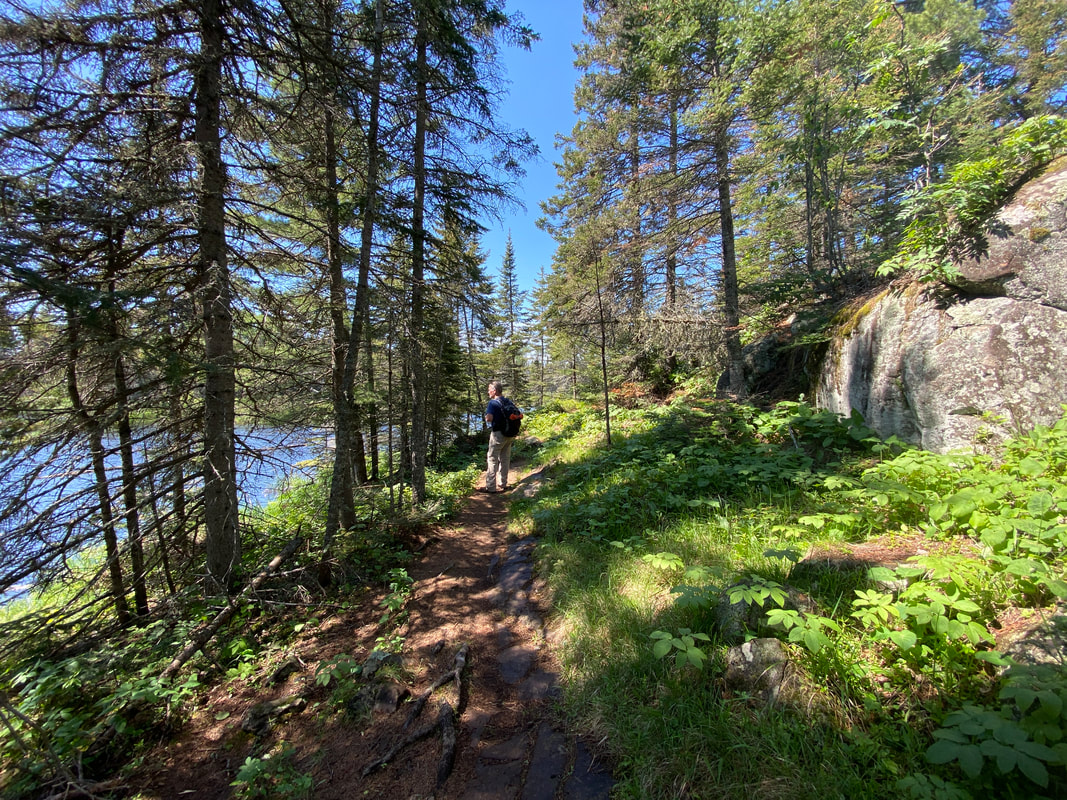
Rock Harbor Trail
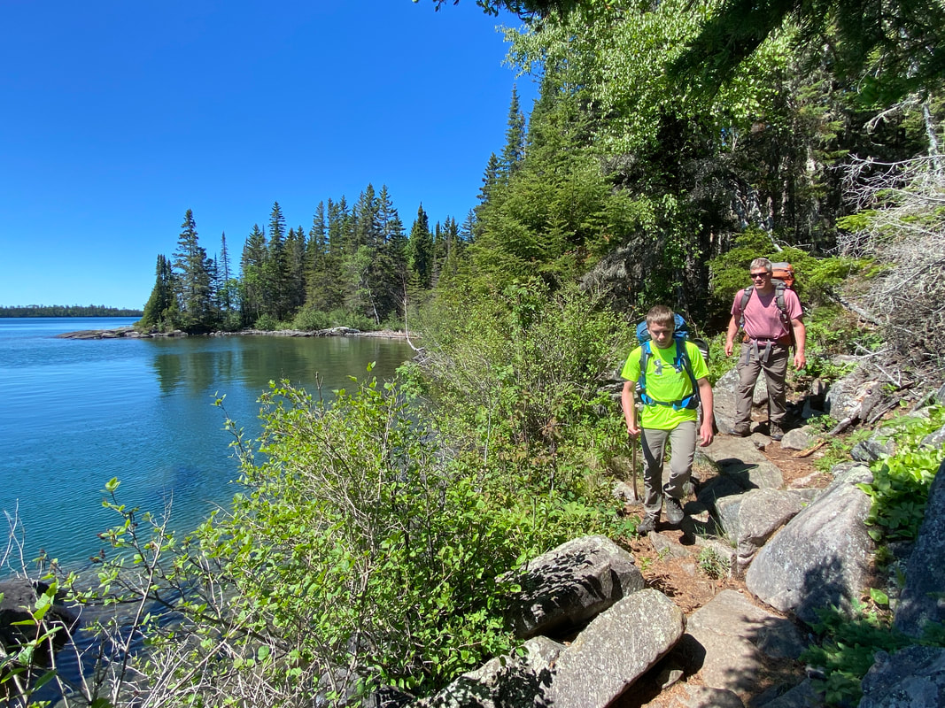
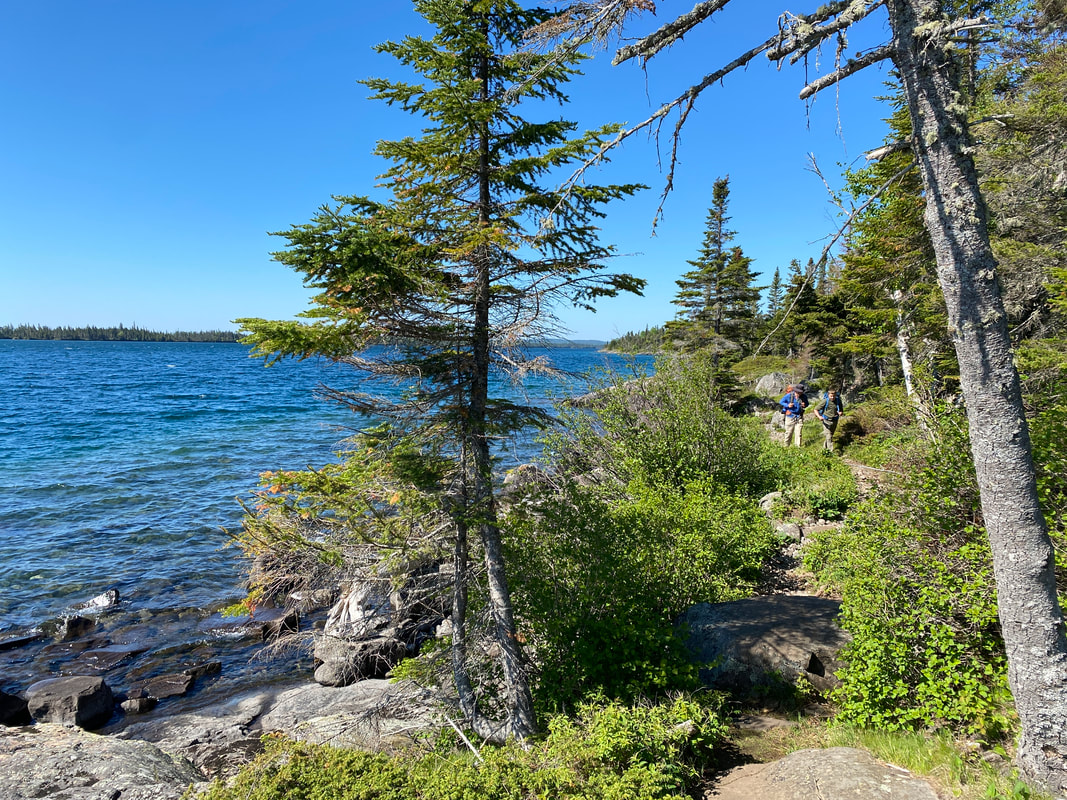
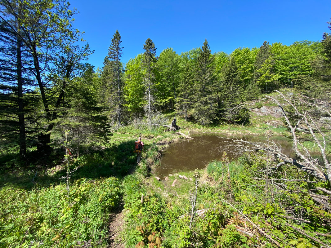
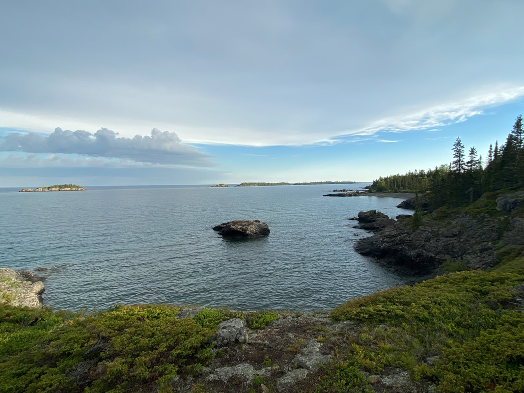
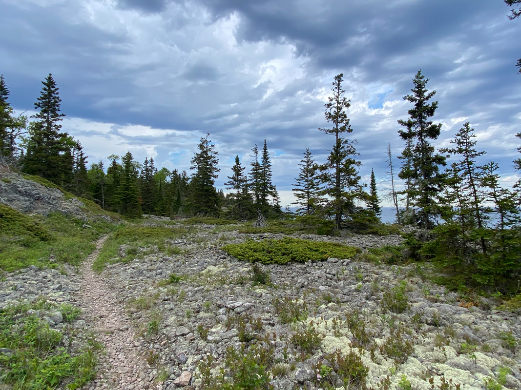
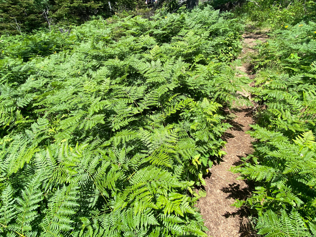
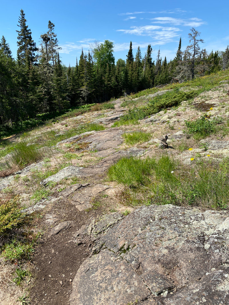
The main thoroughfare of the island, the Rock Harbor Trail is most hikers' launching point for a week of adventure. Mostly rocky, this path takes on very different personalities depending on which section you are hiking. At times, it is an easy stroll, while at others it is a rugged rock climb. Most of the trail maintains views of the harbor, but a few sections pull in and climb some rocky outcroppings and into the forest. The views are perhaps what most consider "classic" Isle Royale.
Rock Harbor Trail: Rock Harbor to Daisy Farm
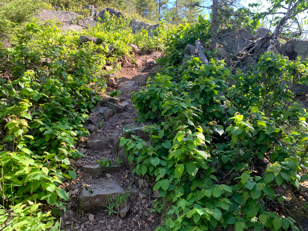
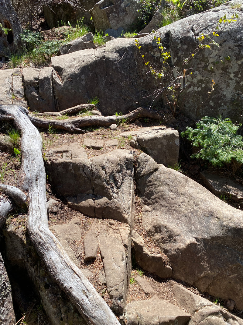
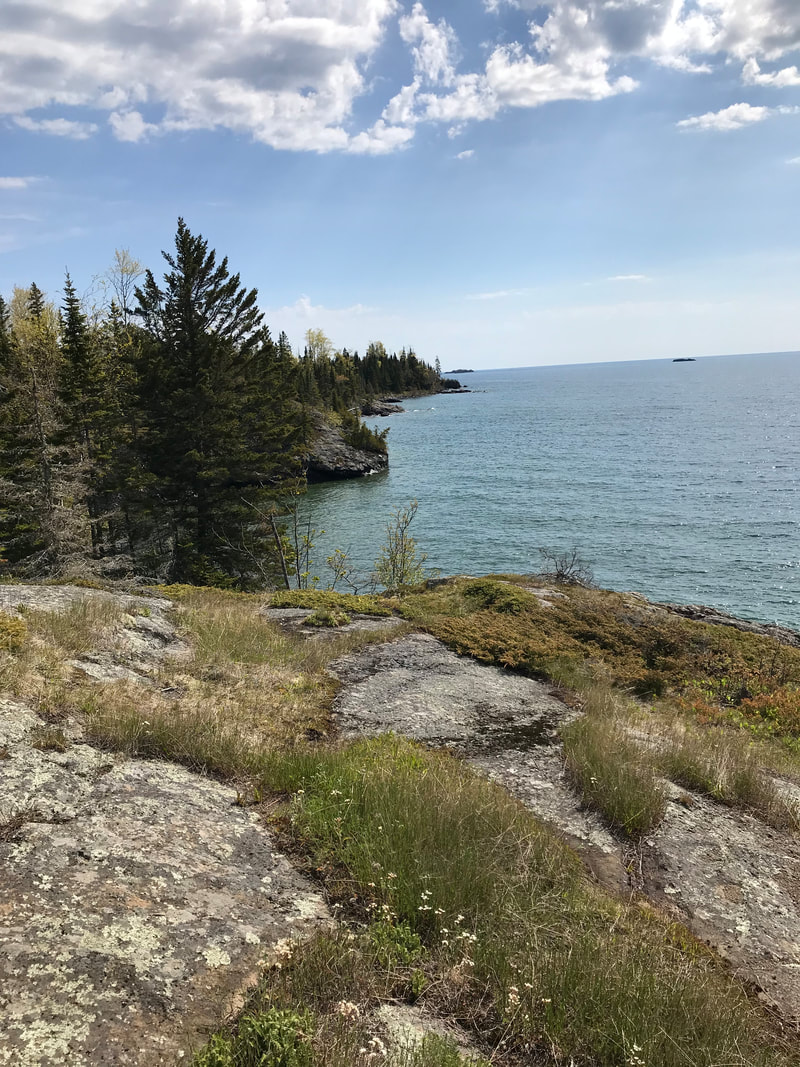
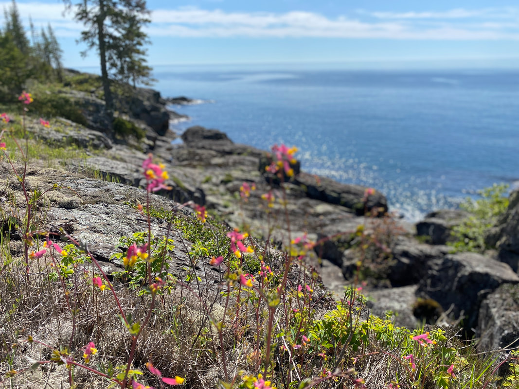
The Rock Harbor to Daisy Farm section of the Rock Harbor Trail embarks from the Rock Harbor Visitor Center and is one of the most well maintained sections of trail in the park. The trail begins as a nice walk in the woods until taking a turn leading to the rocky shores of Lake Superior. The deep blue waters churn in the wind and the craggily pines show wear and tear from the harshness of the northern winters. Rocky outcropping angle toward the waters edge and are streaked with low shrubs and lichens. In springtime, small wildflowers precariously hang to the cracks in the boulders offering hikers an occasional splash of purples, pinks, and yellows against the grayish backdrop of the basalt. Some people might find these steps angles difficult on their ankles and feet, but with fresh feet this impact is often unnoticed until the next day.
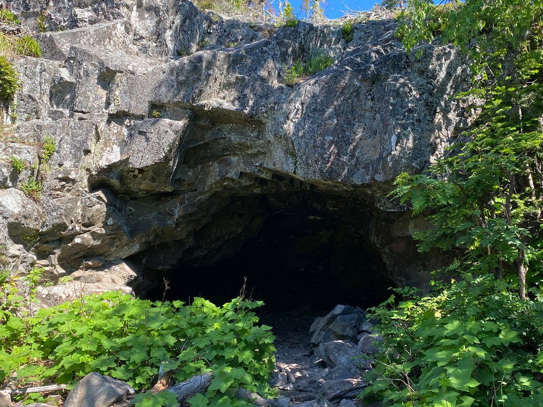
After the first mile, you will be in near constant view of the lake while navigating these rocky outcrops. About 1.8 miles from Rock Harbor, the Suzy'’s Cave turn off appears. This is a remnant of an ancient sea cave. This is worth checking out on your first visit to the island. Continuing on for another mile and a half over the rocky out crops to reach the three mile campground this trail remains fairly dry and navigable.
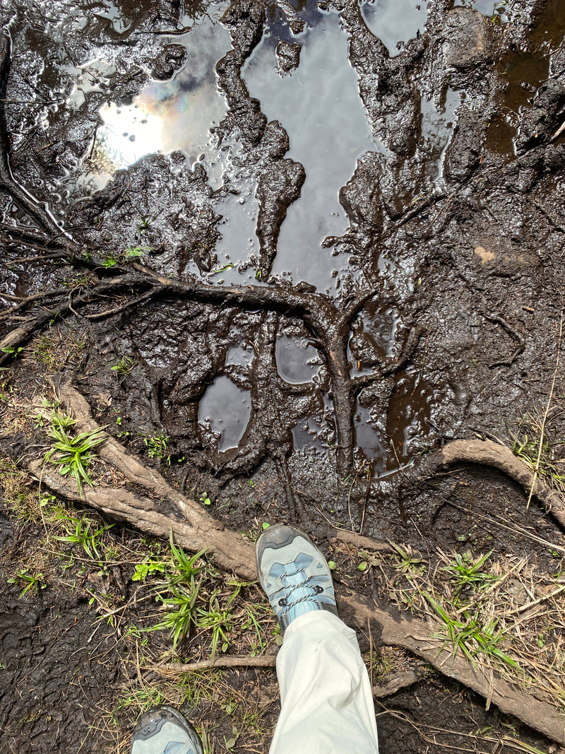
The 3 Mile campground is the first stopping off point for some backpackers after the long journey to get to the island. However, most backpackers press on to Daisy Farm for their first night. From here, the trail levels out and becomes a flat, muddy scramble in areas. The mud of Isle Royale is a deep black tar like substance, but is usually never very deep. Rock hopping and tree limb balancing acts can be required after rains or in early spring. In lucky spots, the trail crews have installed boardwalks to bypass these hazards, but there often seems to be no rhyme or reason to where these have been located. Daisy Farm is the largest campsite with 16 shelters and is a common jumping off point for many hikers. Even in the shoulder season, it can fill up quickly due to its location and proximity to starting or finishing your adventure.
Rock Harbor Trail: Daisy Farm to Moskey Basin
This section of trail is unlike the first two section of the Rock Harbor trail and is not usually combined in to a single hike like the first two sections of the Rock Harbor Trail are. A Hike from Moskey to Rock Harbor is doable but it is long. This section of the trail lacks the lake views and cool breezes found on the previous two sections. This section is rocky and has numerous small ups and downs, some of them steep and on smooth rock. This section is typically dry and water is not available anywhere on this trail. Once you reach the Intersection with the Lake Richie Trail in is only a quick bridge crossing ans short walk into the popular Moskey Basin campground.
Rock Harbor Trail: Rock Harbor to Daisy Farm
The Rock Harbor to Daisy Farm section of the Rock Harbor Trail embarks from the Rock Harbor Visitor Center and is one of the most well maintained sections of trail in the park. The trail begins as a nice walk in the woods until taking a turn leading to the rocky shores of Lake Superior. The deep blue waters churn in the wind and the craggily pines show wear and tear from the harshness of the northern winters. Rocky outcropping angle toward the waters edge and are streaked with low shrubs and lichens. In springtime, small wildflowers precariously hang to the cracks in the boulders offering hikers an occasional splash of purples, pinks, and yellows against the grayish backdrop of the basalt. Some people might find these steps angles difficult on their ankles and feet, but with fresh feet this impact is often unnoticed until the next day.
After the first mile, you will be in near constant view of the lake while navigating these rocky outcrops. About 1.8 miles from Rock Harbor, the Suzy'’s Cave turn off appears. This is a remnant of an ancient sea cave. This is worth checking out on your first visit to the island. Continuing on for another mile and a half over the rocky out crops to reach the three mile campground this trail remains fairly dry and navigable.
The 3 Mile campground is the first stopping off point for some backpackers after the long journey to get to the island. However, most backpackers press on to Daisy Farm for their first night. From here, the trail levels out and becomes a flat, muddy scramble in areas. The mud of Isle Royale is a deep black tar like substance, but is usually never very deep. Rock hopping and tree limb balancing acts can be required after rains or in early spring. In lucky spots, the trail crews have installed boardwalks to bypass these hazards, but there often seems to be no rhyme or reason to where these have been located. Daisy Farm is the largest campsite with 16 shelters and is a common jumping off point for many hikers. Even in the shoulder season, it can fill up quickly due to its location and proximity to starting or finishing your adventure.
Rock Harbor Trail: Daisy Farm to Moskey Basin
This section of trail is unlike the first two section of the Rock Harbor trail and is not usually combined in to a single hike like the first two sections of the Rock Harbor Trail are. A Hike from Moskey to Rock Harbor is doable but it is long. This section of the trail lacks the lake views and cool breezes found on the previous two sections. This section is rocky and has numerous small ups and downs, some of them steep and on smooth rock. This section is typically dry and water is not available anywhere on this trail. Once you reach the Intersection with the Lake Richie Trail in is only a quick bridge crossing ans short walk into the popular Moskey Basin campground.
The trail can be rocky and rough between Rock Harbor and 3 mile campground, Isle Royale National Park
|
The Rock Harbor Trail gets wet between 3 mile and Daisy Farm, Isle Royale National Park
|
Rock Harbor Trail West of Daisy Farm, Isle Royale National Park
|
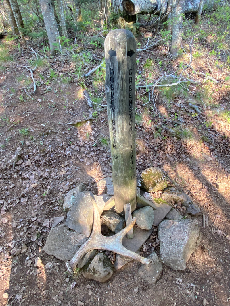
Minong Trail
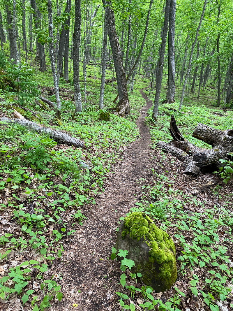
Typical views along the Minong, Isle Royale National Park
Key features:
-The hardest trail in the park
-A thirty mile multiday backpack is required to complete it
-Some sections can by doubled up by strong backpackers
-The surface ranges from knobby rock to soft dirt
-The trail is very up and down
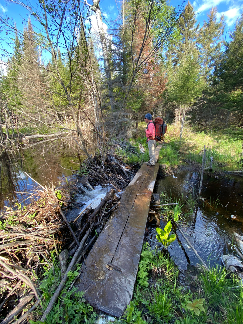
-It will require multiple beaver dam crossings
-The hardest trail in the park
-A thirty mile multiday backpack is required to complete it
-Some sections can by doubled up by strong backpackers
-The surface ranges from knobby rock to soft dirt
-The trail is very up and down
-It will require multiple beaver dam crossings
An easy section of the Minong Trail, Isle Royale National Park
|
Walking the Minong Trail looking for the next cairn, Isle Royale National Park
|
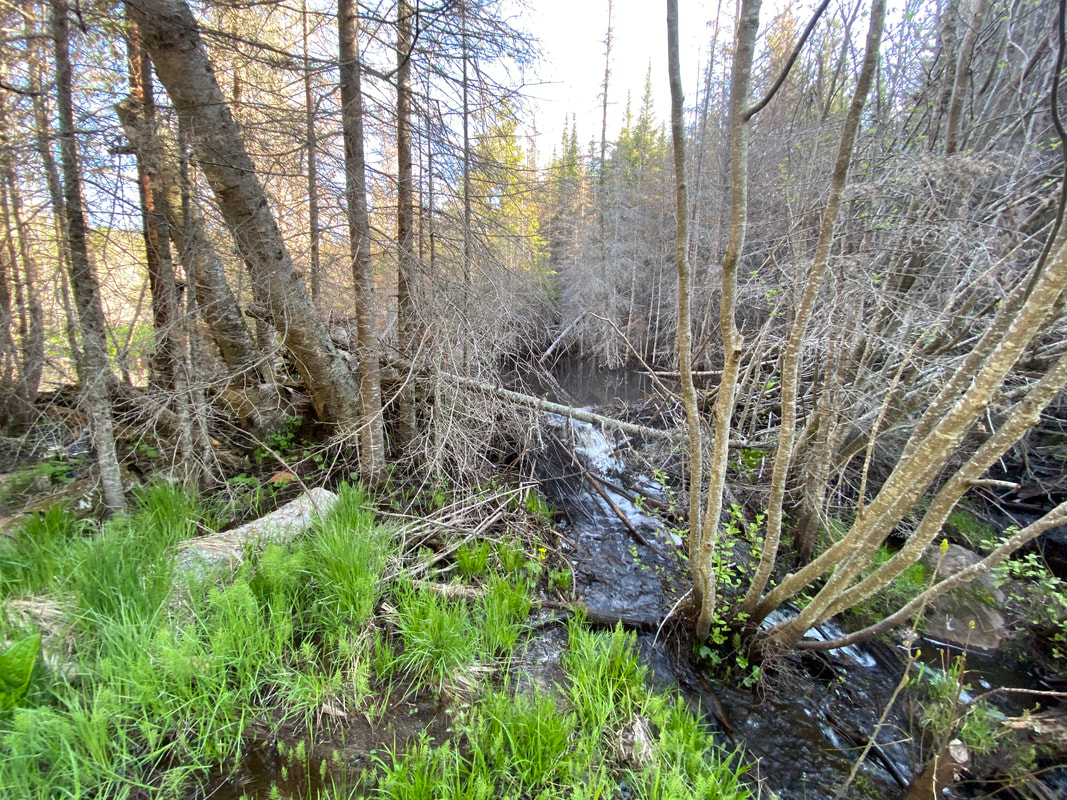
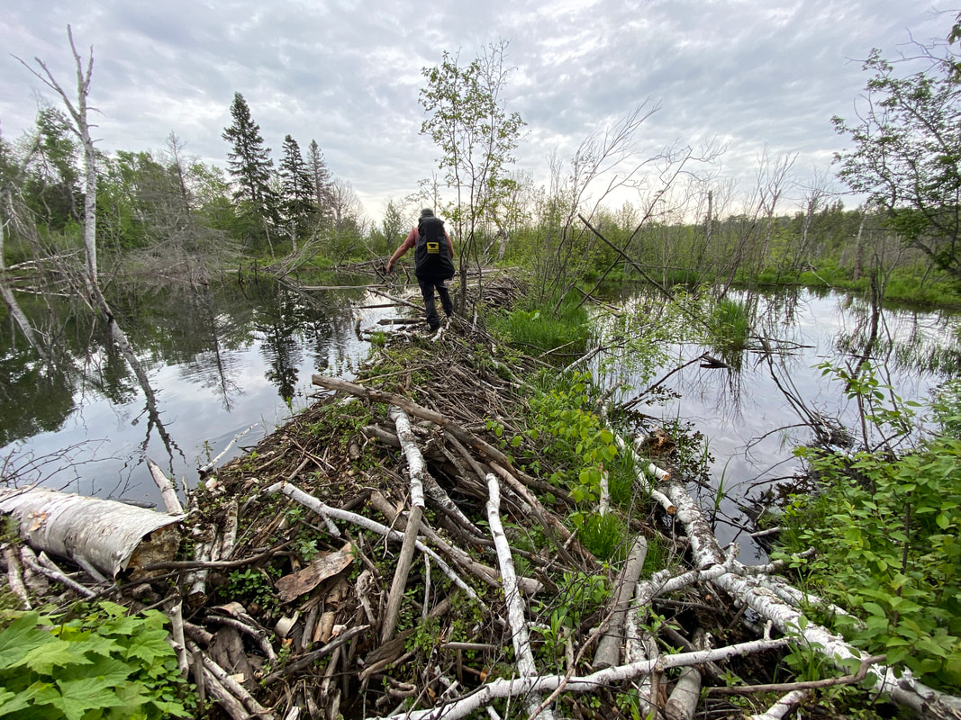
A beaver dam crossing on the Minong Trail, Isle Royale National Park
|
A little Todd Campsite along the Minong Trail, Isle Royale National Park
|
Some of the many ups and downs of the Minong Trail, Isle Royale
|
Minong Trail
The Minong Trail has been called the most challenging trail in the Midwest by some. If you talk to a park ranger on Isle Royale, they will most likely gently guide you toward an easier trail. That said, if you are in good shape, experienced and prepared, you can most likely backpack this trail. The trail is very up and down in sections, very rocky in sections, and not as maintained as other trails in the parks. On a single, 6 mile section, we crossed over 76 different trees that had fallen across the trail. Yes, trail crew will get to this, but it is last on their list of trails to maintain. If you choose to backpack the Minong, do your homework and be prepared.
Minong Trail from McCargo to Todd Harbor
The Minong Trail begins as clearly marked and wide as any trail you’d expect on Isle Royale. It continues on for .8 of a mile until it get near the sites of the old copper mines. Many visitors stop to explore this area. Just after this point, the Minong transitions into what this trail is best known for: a series of short, ups and downs along rocky ridges and deep, lush forests. While often times you are not gaining huge amounts of elevation, these changes occur very frequently. While on the rocky ridge tops, many opportunities abound to view the Canadian shore and Gitchigoomee. Occasionally rocky sections are marked with cairns, so it helps to keep a sharp lookout. As in all ridgetop trails on Isle Royale, expect hotter conditions and little to no access to water. The last mile of this trail departs the rocky ridges and descends toward Todd Harbor. During this descent, an astute hiker will notice the changes in vegetation and feel the temperature shift as you approach the cold waters of the big lake. The last obstacle hikers will encounter on the trail before reaching Todd harbor is a 4-5 foot wide deep creek that lacks a permanent structure or bridge. After crossing this creek, you are within 100 paces of the Todd Harbor campground.
Minong trail from Todd to Little Todd
This section of trail was much like McCargo to Todd Harbor. The trail was easy to follow, and for the most part a soft dirt and not too rocky. The trail did have many ups and downs, while not large the trail seemed to never be level. The most notable part of this sections was very industrious beaver family that had made several dams that resulted in several small terraced ponds. Luckily, the trail passed just behind a beaver dam; however, some hikers miss this detail and end up crossing the dam when it is unnecessary. As you near the intersection with the Little Todd campground spur, the trail drops rapidly down a few switch back and then comes to a significant creek to cross. In the spring, it looked to be 15 feet wide and 1-2 ft deep; however, later in the season it may be much smaller. The park service had a red ribbon or two showing us where the trail was on the other side. We were able to cross this obstacle and keep our feet dry by walking across two different logs. It was a shaky crossing and the logs were not too solid, but we made it. Hiking poles would be a real help crossing this creek. After crossing a marshy area and then a short uphill, we came to the Little Todd campground trail spur, This half mile spur to Little Todd was very marshy and was slow going stepping from log to log to avoid the worst of the spongy black mud. However, Little Todd was worth the effort with it's personal fire rings and North Shore views.
Minong from Little Todd to North Desor
The Minong wastes little time jumping up to rocky ridges after it passes the turn off to Little Todd. The trail crosses grayish black rock that is often on an angle. The rock is rarely gravely or loose, but instead is a solid piece that looks to be randomly cast into odd and angular shapes. At times, a square chunk is in just he right place to boost you up to the next ledge. At other times, triangular slopes makes footing unsure. During the course of this section of trail, it is estimated that we went up and over over 14 rocky outcrops. The trail atop these outcrops was marked with cairns, however, often times these cairns lacked much size or structure due to the fact that the trail is one giant rock. Downed trees are common on this trail and often require work arounds, as are large clumps of juniper which has overlapped the trail obscuring it from view in several sections. As in other section of this trail, the views of the big lake and Canada are amazing at times. AS the trail begins to move away from the pine and cedar trees and the forest transitions to sugar maples, you will approach the turn off for the North Lake Desor campground.
Minong Trail from North Lake Desor to Windigo
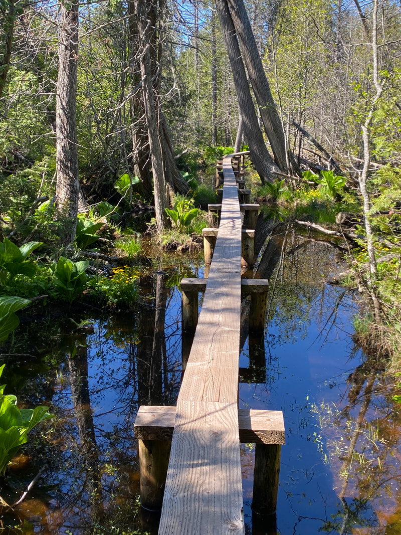
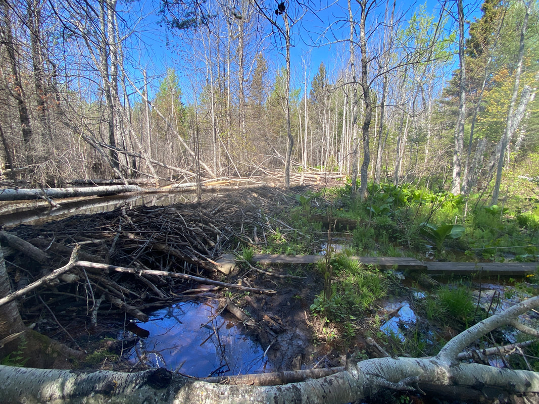
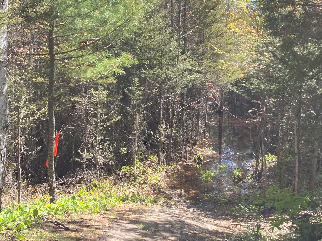
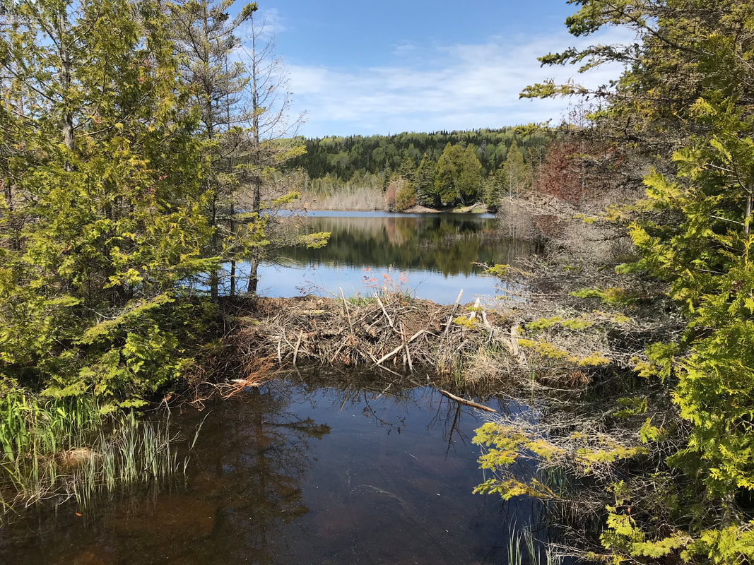
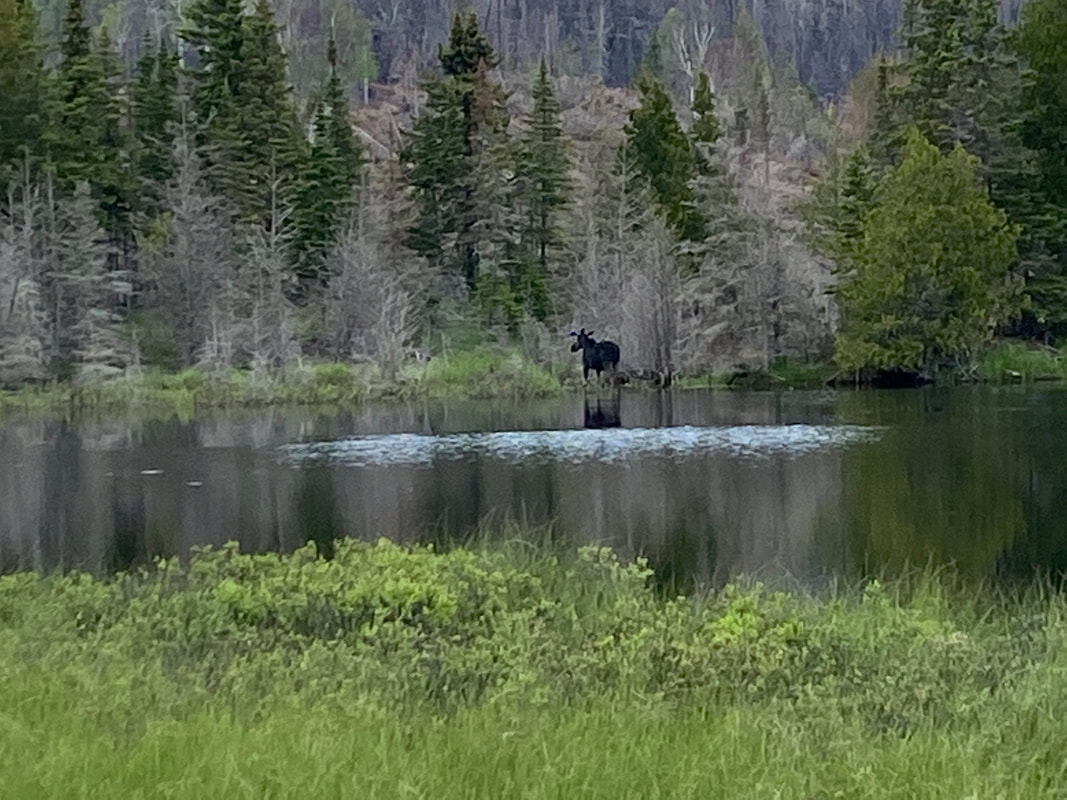
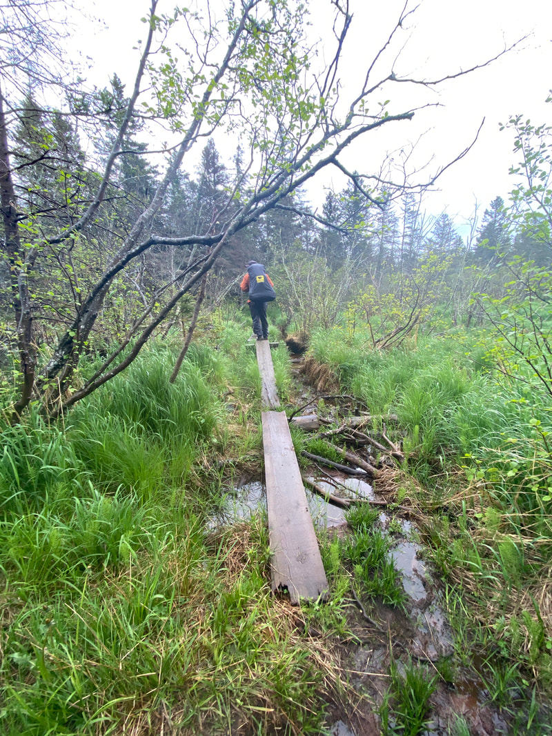
After the slightly but uphill and smooth and soft trail headed out of Lake Desor, the Greenstone once again was a series of ups and down over clunky gray basalt ridges offering uneven and uncomfortable footing. However, as expected on this ridge, the views are outstanding. This continues for slightly more than a mile, then unexpectedly dipped slightly and began a long section of trail through the birches, aspen, and maples that was cool, shady, and rock free. During this section, it was easy to make up for lost time. As the trail progress you will still encounter an occasional a rocky section or hump, but never in long continuous stretches like prior on the trail. The trail crossed two swampy sections that are clearly marked with flags of orange and red by the NPS. Eventually the trail will come to one of three beaver dams you have to cross. After reading many accounts from online, we were expecting the worst, but found the beaver dam wide enough that moose prints were found in the mud crossing it.
The trail eventually dipped to cross the large swampy area on the Minong Trail. This was the one and only boardwalk on the whole trail, but was quite new and luxurious. If it had not been there, we could see how it would be disastrous to hikers and cause them to wade through knee deep mucky waters. The trail continued to pass through 2 more drainages, each with a beaver dam to cross. Neither beaver dam was much of an obstacle and seemed anticlimactic after all of the other obstacles along this trail. Washington Creek lies ahead and the trail will follow it for several miles, leading up to an intersection with he Huginnin Trail. Further on you will connect with the campground on your way into Windigo proper. These last sections were smooth and easy walking, but felt incredibly longer than anticipated after hiking so long all day.
Minong Trail from McCargo to Todd Harbor
The Minong Trail begins as clearly marked and wide as any trail you’d expect on Isle Royale. It continues on for .8 of a mile until it get near the sites of the old copper mines. Many visitors stop to explore this area. Just after this point, the Minong transitions into what this trail is best known for: a series of short, ups and downs along rocky ridges and deep, lush forests. While often times you are not gaining huge amounts of elevation, these changes occur very frequently. While on the rocky ridge tops, many opportunities abound to view the Canadian shore and Gitchigoomee. Occasionally rocky sections are marked with cairns, so it helps to keep a sharp lookout. As in all ridgetop trails on Isle Royale, expect hotter conditions and little to no access to water. The last mile of this trail departs the rocky ridges and descends toward Todd Harbor. During this descent, an astute hiker will notice the changes in vegetation and feel the temperature shift as you approach the cold waters of the big lake. The last obstacle hikers will encounter on the trail before reaching Todd harbor is a 4-5 foot wide deep creek that lacks a permanent structure or bridge. After crossing this creek, you are within 100 paces of the Todd Harbor campground.
Minong trail from Todd to Little Todd
This section of trail was much like McCargo to Todd Harbor. The trail was easy to follow, and for the most part a soft dirt and not too rocky. The trail did have many ups and downs, while not large the trail seemed to never be level. The most notable part of this sections was very industrious beaver family that had made several dams that resulted in several small terraced ponds. Luckily, the trail passed just behind a beaver dam; however, some hikers miss this detail and end up crossing the dam when it is unnecessary. As you near the intersection with the Little Todd campground spur, the trail drops rapidly down a few switch back and then comes to a significant creek to cross. In the spring, it looked to be 15 feet wide and 1-2 ft deep; however, later in the season it may be much smaller. The park service had a red ribbon or two showing us where the trail was on the other side. We were able to cross this obstacle and keep our feet dry by walking across two different logs. It was a shaky crossing and the logs were not too solid, but we made it. Hiking poles would be a real help crossing this creek. After crossing a marshy area and then a short uphill, we came to the Little Todd campground trail spur, This half mile spur to Little Todd was very marshy and was slow going stepping from log to log to avoid the worst of the spongy black mud. However, Little Todd was worth the effort with it's personal fire rings and North Shore views.
Minong from Little Todd to North Desor
The Minong wastes little time jumping up to rocky ridges after it passes the turn off to Little Todd. The trail crosses grayish black rock that is often on an angle. The rock is rarely gravely or loose, but instead is a solid piece that looks to be randomly cast into odd and angular shapes. At times, a square chunk is in just he right place to boost you up to the next ledge. At other times, triangular slopes makes footing unsure. During the course of this section of trail, it is estimated that we went up and over over 14 rocky outcrops. The trail atop these outcrops was marked with cairns, however, often times these cairns lacked much size or structure due to the fact that the trail is one giant rock. Downed trees are common on this trail and often require work arounds, as are large clumps of juniper which has overlapped the trail obscuring it from view in several sections. As in other section of this trail, the views of the big lake and Canada are amazing at times. AS the trail begins to move away from the pine and cedar trees and the forest transitions to sugar maples, you will approach the turn off for the North Lake Desor campground.
Minong Trail from North Lake Desor to Windigo
After the slightly but uphill and smooth and soft trail headed out of Lake Desor, the Greenstone once again was a series of ups and down over clunky gray basalt ridges offering uneven and uncomfortable footing. However, as expected on this ridge, the views are outstanding. This continues for slightly more than a mile, then unexpectedly dipped slightly and began a long section of trail through the birches, aspen, and maples that was cool, shady, and rock free. During this section, it was easy to make up for lost time. As the trail progress you will still encounter an occasional a rocky section or hump, but never in long continuous stretches like prior on the trail. The trail crossed two swampy sections that are clearly marked with flags of orange and red by the NPS. Eventually the trail will come to one of three beaver dams you have to cross. After reading many accounts from online, we were expecting the worst, but found the beaver dam wide enough that moose prints were found in the mud crossing it.
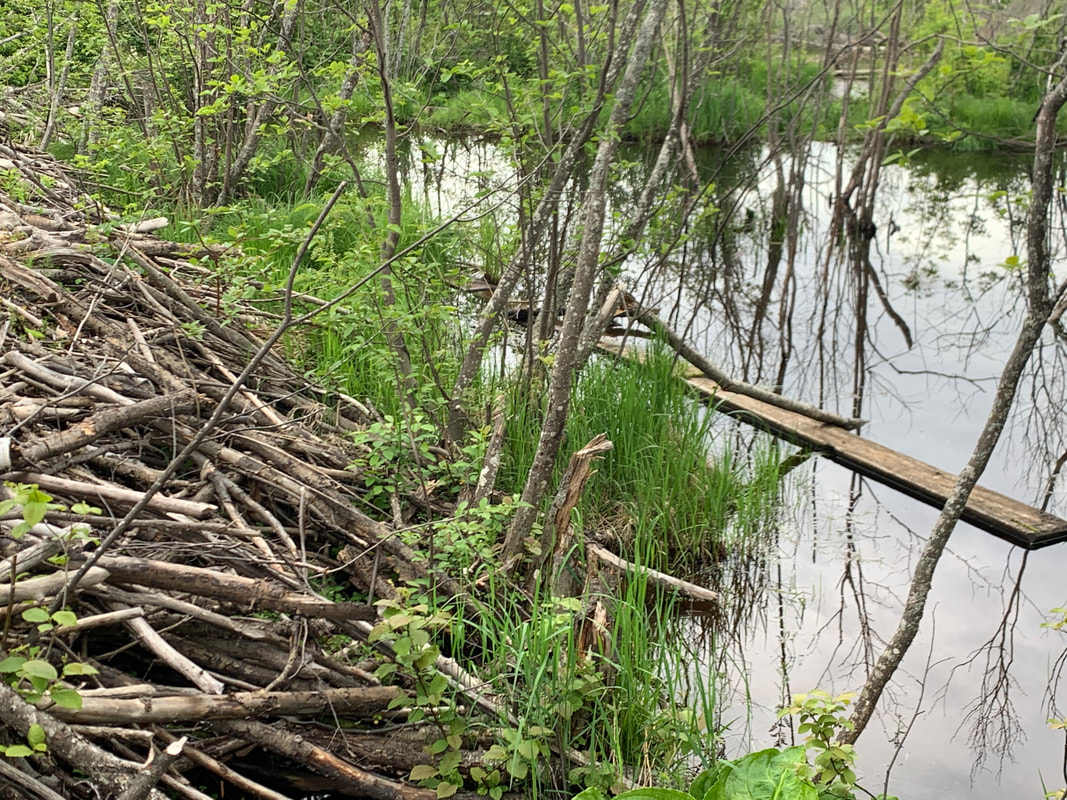
The trail eventually dipped to cross the large swampy area on the Minong Trail. This was the one and only boardwalk on the whole trail, but was quite new and luxurious. If it had not been there, we could see how it would be disastrous to hikers and cause them to wade through knee deep mucky waters. The trail continued to pass through 2 more drainages, each with a beaver dam to cross. Neither beaver dam was much of an obstacle and seemed anticlimactic after all of the other obstacles along this trail. Washington Creek lies ahead and the trail will follow it for several miles, leading up to an intersection with he Huginnin Trail. Further on you will connect with the campground on your way into Windigo proper. These last sections were smooth and easy walking, but felt incredibly longer than anticipated after hiking so long all day.

At times the Minong Trail is bare rock, Isle Royale
|

A small creek just before Todd Harbor on the Minong Trail, Isle Royale
|
The only board walk on the Minong cross a deep section swamp a few miles from Windigo, Isle Royale
|
|
|
|
Greenstone Trail
The Greenstone Ridge, Isle Royale National Park
Key features:
- Outstanding views in many locations
- One of the dryer trails
- Bring water, it many not be readily available
- Around 36 miles in length
-A multiday backpack will be required to complete it
- The main highway through the park
- Outstanding views in many locations
- One of the dryer trails
- Bring water, it many not be readily available
- Around 36 miles in length
-A multiday backpack will be required to complete it
- The main highway through the park
One of the few wet areas on the Greenstone, Isle Royale
|
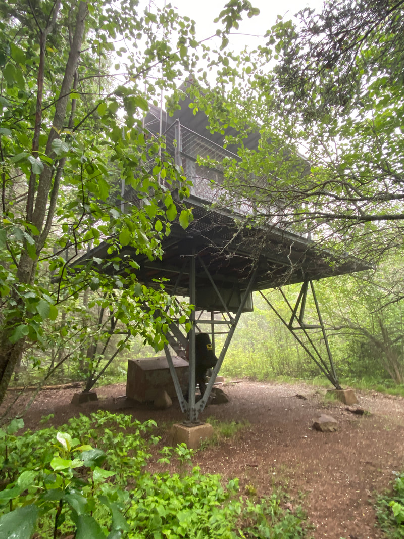
The Ishpeming Fire tower lack the great views of others, Isle Royale
|
A stone bench on the Greenstone, Isle Royale
|
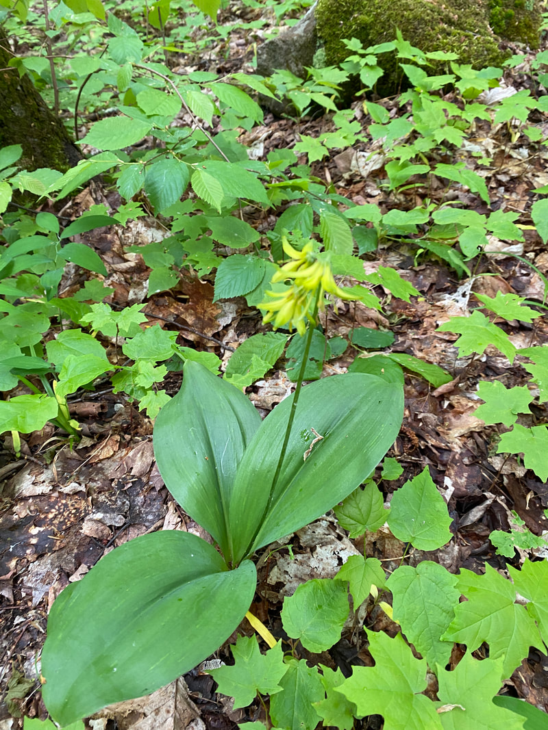
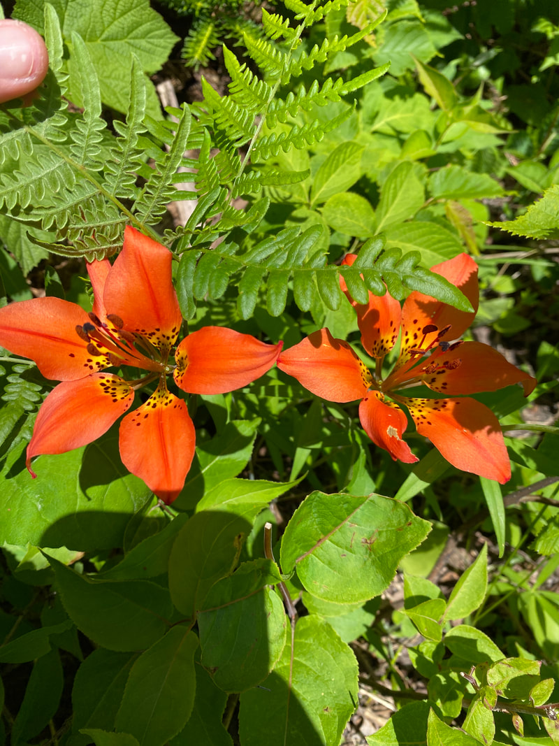
Blue bead flower along the Greenstone, Isle Royale
|
The typical Greenstone trail on the west in of the island, Isle Royale
|
Greenstone Trail
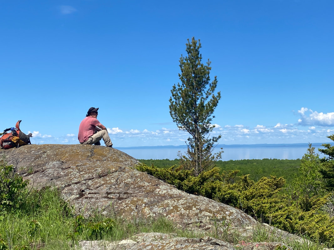
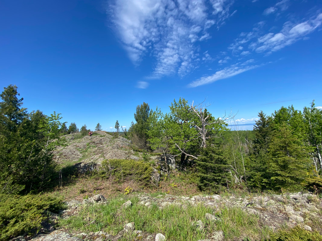
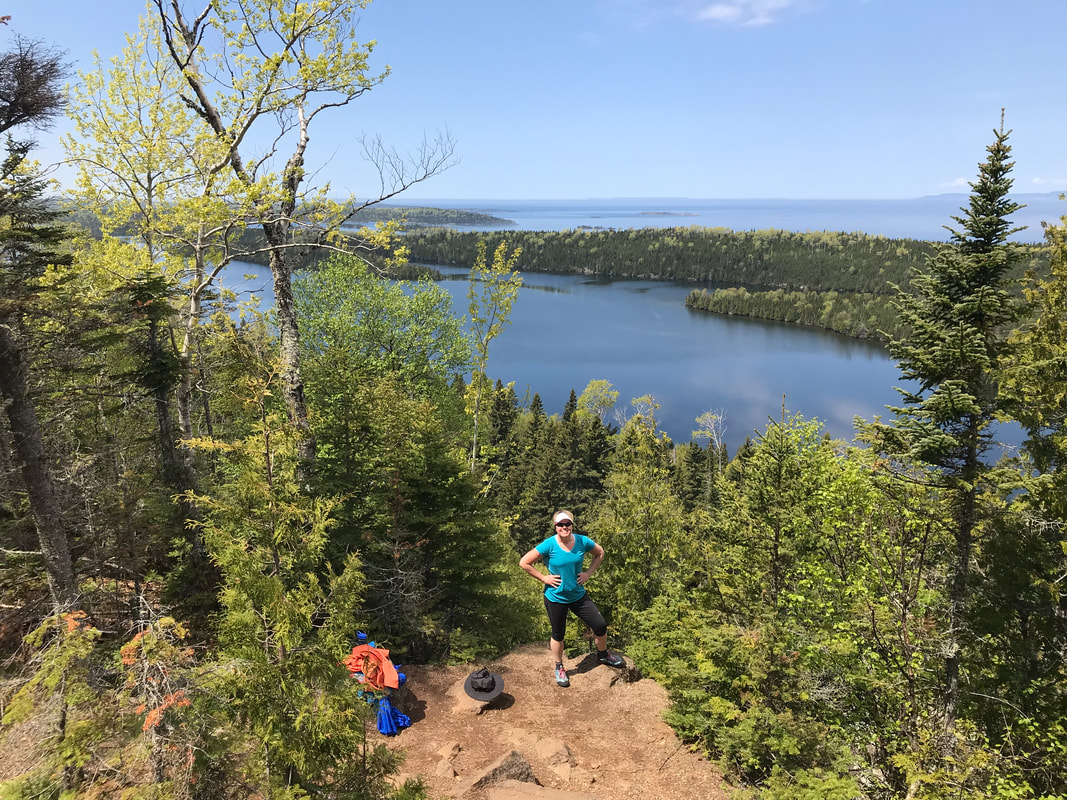
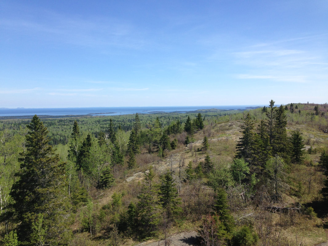
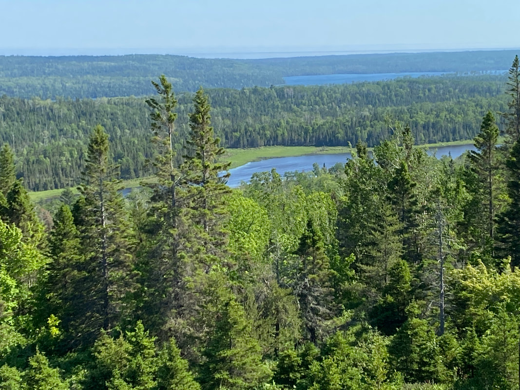
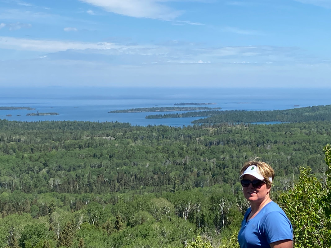
The Greenstone Trail is the premiere long distance hike on the island, covering approximately 36 miles up the backbone of the island. To truly cover the entire trail, hikers must be willing to commit sometime on the island or coordinate their entry/exit points carefully. Most hikers will use the Rock Harbor Trail to 3 Mile Campground and leave out the eastern tip- where it truly ends or begins depending upon perspective. Taking a water taxi to Lookout Louise Trail and up to the the start of the Greenstone will allow a backpacker to see the whole trail. This first section of trail is not as heavily traveled as other parts and is a good area for moose sightings.
Full disclosure... we have not hiked the Greenstone from end to end even though we have visited the island four separate times and have hiked a numerous chunks of it. Unless you plan to hike it end to end, you are frequently just utlizing chunks of the Greenstone. We have only included information on the sections we have hiked in this website. Based on what we have hiked so far, we have found the trail as a whole is well maintained and easy to follow it has a fair number of ups and downs in the sections we hiked but these are long gradual grades and not too tough compared to others on the island.
Greenstone (Daisy Farm to East Chicken Bone)
The Greenstone Trail was a smooth and easy walk compared to many other trails in the park. It acts as the main highway from one end of the park to the other. As can be expected on any highway, the travel for the most part is easy. The trail is smooth, well worn and easy to follow. However, it is high up on the ridge and offers less sun protection, warmer temperatures, and unreliable water sources at best. Much to our surprise this trip, we encountered a beaver who built a damn over one of the boardwalks in one of the lower section, causing us to have to reroute and path find through rough, wet terrain. The Greenstone Trail twists and rapidly looses elevation as it dips down toward the Chicken Bone intersection. One key feature of the Greenstone is the change in flora, with towering white birches swaying in the wind. These stark white trunks and green tops contrast the blue skies and make for a picturesque walk. Note it can be very hot and dry up on the Greenstone Trail.
Greenstone from Island Mine to Ishpeming Point Fire Tower
Compared to many of the other trails on the island, this portion of the Greenstone was a smooth, soft walk through the forest. The trail was wide and rarely muddy and free of rocks and roots that plague so many of the other trails. Only on rare occasion did it crest up onto the ridge onto bare rock. The vast majority of the time, you walked through a lush maple and birch forest with a low undergrowth. At no point was the trail brushy or hidden. While the Greenstone has many ups and downs, these elevation changes were for the most part very gradual. Even the drop down to the intersection with the turnoff with Lake Desor South was not very steep. Likewise, climbing out of this valley up out of this ridge, while a long a steady climb and somewhat more marshy, was unremarkable. Eventually, you will reach the Ishpeming fire tower. This fire tower is much short than others we have encountered on the island and lacks any view due to the trees that have grown up around it. Overall, we found this section of the Greenstone to be fast and easy backpacking and a good place to get some miles in.
A beaver build its dam right over the board walk, Greenstone trail, Isle Royale
|
The other side of the trail entering the beaver pond, Greenstone, Isle Royale
|
The Green Stone and Lane Cove Trail Intersection, Isle Royale National Park
|
Huginnin Cove East and West Trails
Looking out toward Canada from Huginnin Cove, Isle Royale National Park
Key features:
-A smooth and easy trail for the most part
-Has one rougher section along the lake Superior shore line
-Great views of the North Shore and Canada
-The campground was surprising empty not many people used it possibly because it was tent only camping
-A smooth and easy trail for the most part
-Has one rougher section along the lake Superior shore line
-Great views of the North Shore and Canada
-The campground was surprising empty not many people used it possibly because it was tent only camping
The east section of the Huginnin Cove trail provides view across the cove, Isle Royale
|
In some areas the tree roots make the trail difficult to walk on, Huginnin Cove East, Isle Royale
|
North shore cliffs along the Huginnin Cove East trail, Isle Royale
|
Huginnin Cove campsites are very close to the lake, Isle Royale
|
One of two historic log cabins along Huginnin Cove West trail, Isle Royale
|
Huginnin Cove East and West Trails
The Huginnin Cove Trail is split into an east and west section with the popular campsite by the same name near the center of the loop. Leaving Windigo, if you take the west trail, you will find it to be slightly up and down by Isle Royale standards, and relatively soft walking on a bed of leaves and pine needles. During huge first 1/3 of this trail, you may be able to see sections of Washington Harbor through the he trees before it dips back into the woods. As you approach the campground, an observant hiker will notice the change in the plant life as they approach Lake Superior, everyone will notice the change in temperature. The trail leads directly into the campground, which is tent only, and somewhat popular. Beyond the campground, you will begin Huginnin east. This trail gradually climbs along the blue green waters of Lake Superior for about a mile. At this time, you will be atop a 20-30 foot cliff tat drops into the cold water. At this point the trail turns inland and climbs a small hill before entering some excellent moose habitat. About 3/4 of the way back to Windigo you may notice a caved in log cabin and the remnants of the Windigo Mine. Overall, Huginnin east is a more level trail than the west, however, it seemed to be more rooty and rocky. This loop, while a little long, makes a great day trip for someone in the Windigo area.
The Huginnin Cove East trail is narrow and rocky at places, Isle Royale
|
Board walks sections help to keep your feet dry, Huginnin Cove, Isle Royale
|

Canadian dog woods bloom along the Huginnin Cove trails. Isle Royale
|
|
|
|
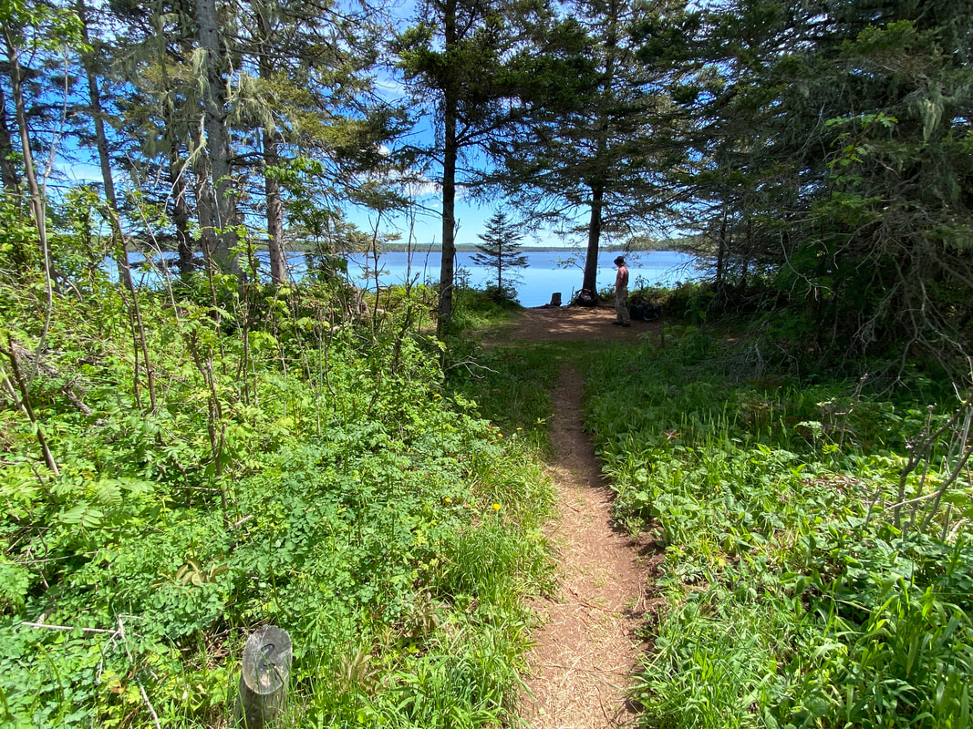
Tobin Harbor Trail
Tobin Harbor Trail, Isle Royale National Park
Key features:
-Not as wet
- Some boardwalks
- Slightly uphill
-Tends to be soft and pine needle covered
- Alternative to rocky uneven Rock Harbor Trail
- Lacks views of big lake
-Not as wet
- Some boardwalks
- Slightly uphill
-Tends to be soft and pine needle covered
- Alternative to rocky uneven Rock Harbor Trail
- Lacks views of big lake
The Tobin HarborTrail is not as rocky as most, Isle Royale National Park
|
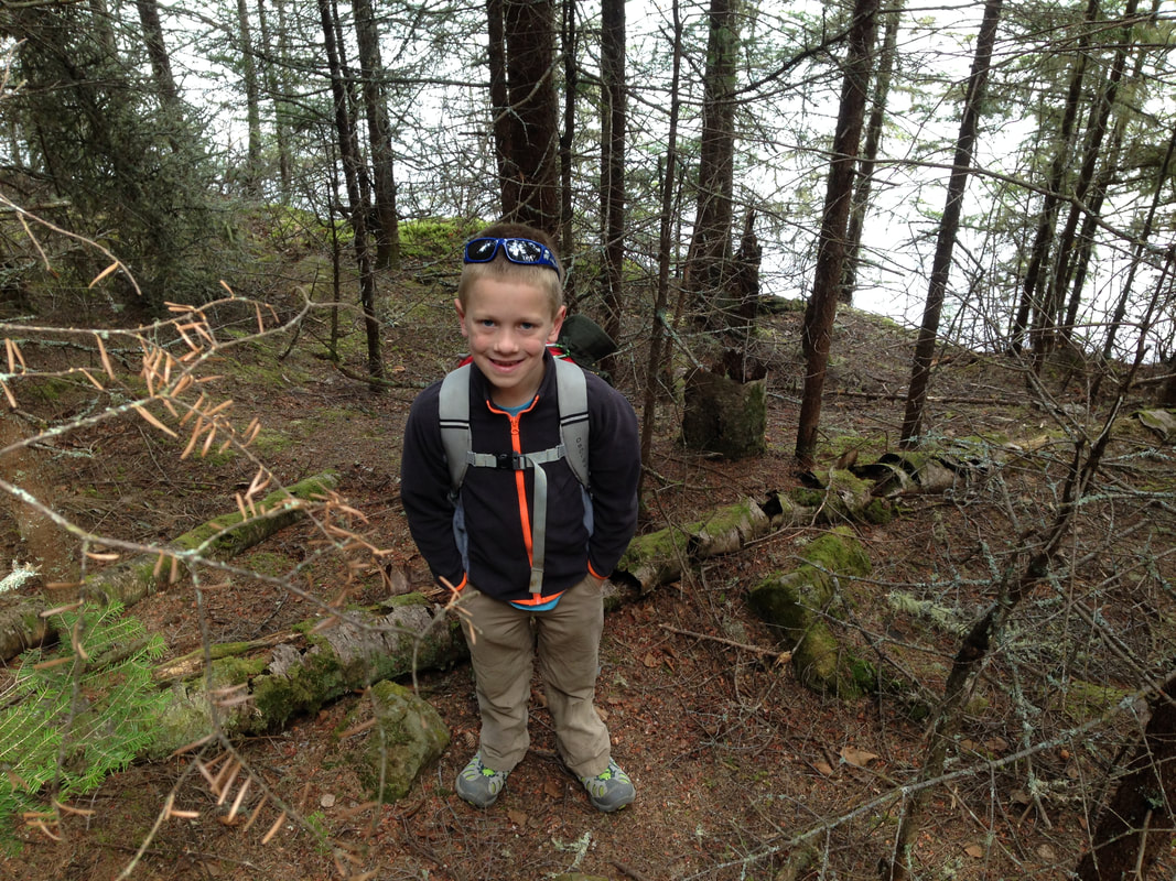
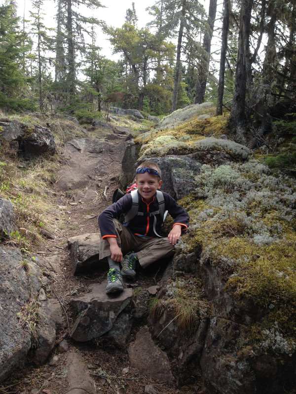
Our little hiker on Tobin Harbor Trail, Isle Royale National Park
|
Tobin Harbor trail starts near the sea plane dock, Isle Royale National Park
|
Views of Tobin Harbor, Isle Royale National Park
|
A rocky section of the Tobin Harbor Trail, Isle Royale
|
Tobin Harbor Trail
Tobin Harbor Trail is a nice alternative to the rocky path to 3 mile campground. This trail has some gentle rolls, but avoids the rocky, uneven path like Rock Harbor's trail. The pines soften the hike and the harbor views are peaceful and serene. Often times you will witness fishermen fishing the warmer waters of the harbor and hear the hum of the float plane rotors as the sea plane makes its pick up and drop offs. It is a relatively flat and well-maintained trail, and you will make quick time as you start or finish your adventure. Perhaps the best part of this trail is getting to see and hear the loons on the water. There are usually several loon pairs that you can hear tremolo and call. This trail begins at the Tobin Harbor sea plane dock, which is one of our favorite places to sit and enjoy the island. It is fairly peaceful, without all the hustle and bustle of Rock Harbor traffic, but has enough wildlife, paddlers, and fishermen to have something better than tv to watch. The trail travels about 3 miles toward the split offs to Suzie Cave, Mount Franklin, and the 3 mile campground. We enjoy starting our adventures on this lesser traveled paths.

Suzy's cave can be reached from the Tobin Harbor Trail, Isle Royale
|
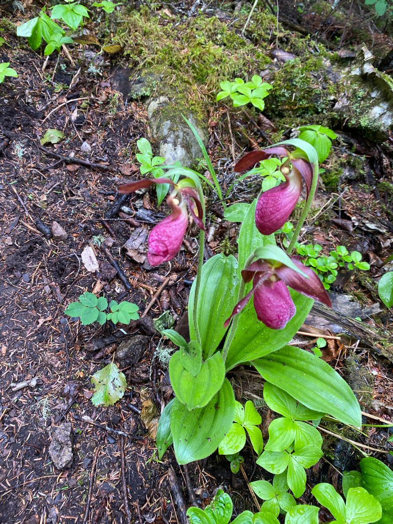
Pink lady slippers along the Tobin Harbor Trail, Isle Royale
|
The Tobin Harbor Trail cuts through a spruce forest, Isle Royale National Park
|
|
|
|
Stoll Memorial Trail
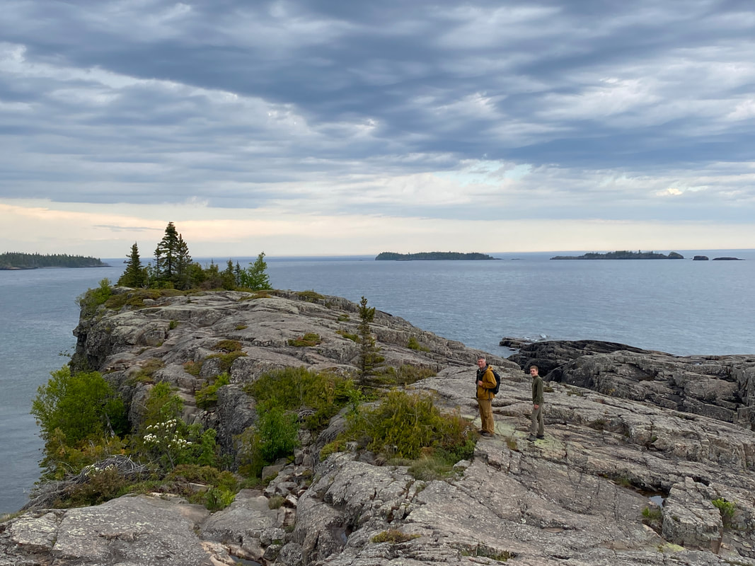
Scoville Point at the end of the Stoll Trail, Isle Royale National Park
Key features:
-Some areas are wet
- Some boardwalks
-Rocky uneven surfaces new the end
-Broken in several shorter loops
-Interpretative signage on the first loop
-Some areas are wet
- Some boardwalks
-Rocky uneven surfaces new the end
-Broken in several shorter loops
-Interpretative signage on the first loop
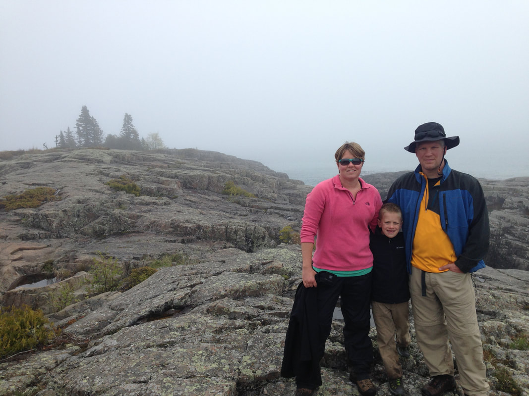
Scoville Point in the fog, Isle Royale National Park
|
Tobin Harbor from the Stoll Trail, Isle Royale National Park
|

Watching the waves on Scoville Point, Isle Royale National Park
|
Looking back toward Rock Harbor from the Stoll Trail, Isle Royale
|
A chunky rock section of the Stoll Trail, Isle Royale
|
Stoll Memorial Trail
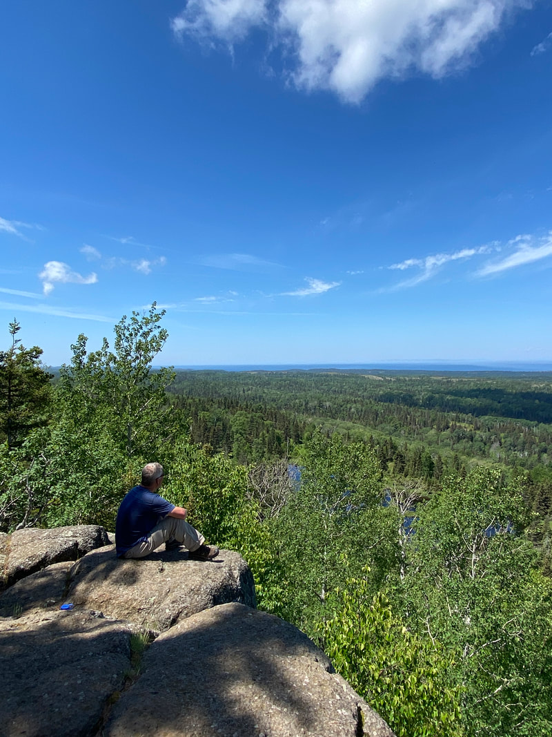
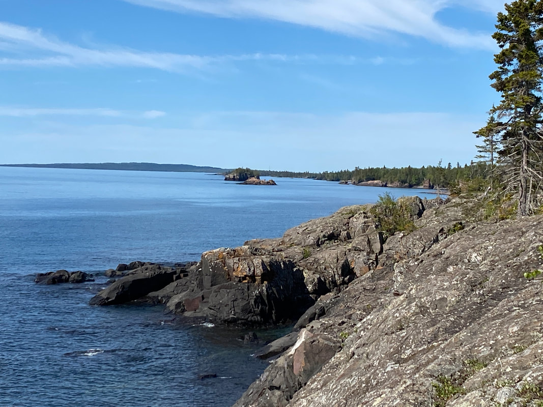
This short loop trail will take you right past the lodge and some of the support areas on the island before moving out toward the Point. This is a four mile trail at its longest, but has several loops and connectors that can be used to make a shorter hike if you are crunched for time before your departure. The trail has become a ritual for us as it is always the last hike we do on the day we leave the island. It exposes the hiker to dense forests, bogs, rocky shore lines and peaceful coves. We find the trail peaceful and the views on Stoll Point to be outstanding.
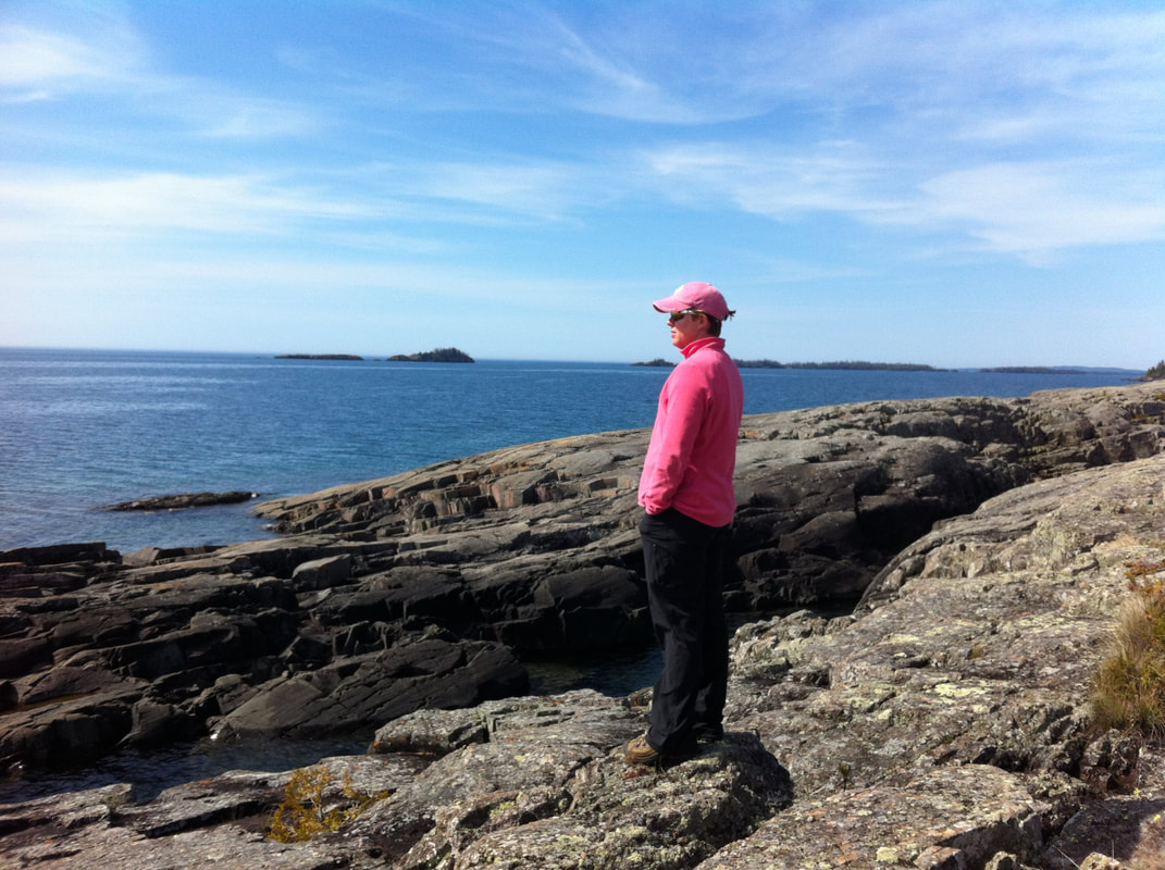
The absolutely rugged landscape and power of Lake Superior make this Point a destination to plan in some additional time to enjoy. Watching the waves crash the shore and looking out into the expanse of Lake Superior is a great way to wrap up and reflect on your time away from society and all the stressors of daily life. This is the best place for epic photos while on the island- as long as you don't have fog.
The wind and waves will really pick up on Stoll Point and we recommend that if you plan to hike to the very end of the trail, take an extra layer. Near the end of the trail, a monument is set for the Detroit newspaper editor who was key advocate for making Isle Royale the national park we now all enjoy.
Looking back into Tobin Harbor from Scoville Point, Isle Royale National Park
|
The last section of the Stoll Memorial Trail is all rock, Isle Royale National Park
|
Looking along the shore toward Scoville Point, Isle Royale National Park
|
|
|
|
Daisy Farm Trail
The views on the Daisy Farm trail improve as you enter clearing near the Greenstone Ridge, Isle Royale National Park
Key features:
- Trail is generally up hill when heading northwest or inland
- Section near Daisy Farm are impacted by beaver dams
- Sections near Daisy Farm tend to be wet
-Popular connecting trail providing access to Greenstone Trail
- Trail is generally up hill when heading northwest or inland
- Section near Daisy Farm are impacted by beaver dams
- Sections near Daisy Farm tend to be wet
-Popular connecting trail providing access to Greenstone Trail
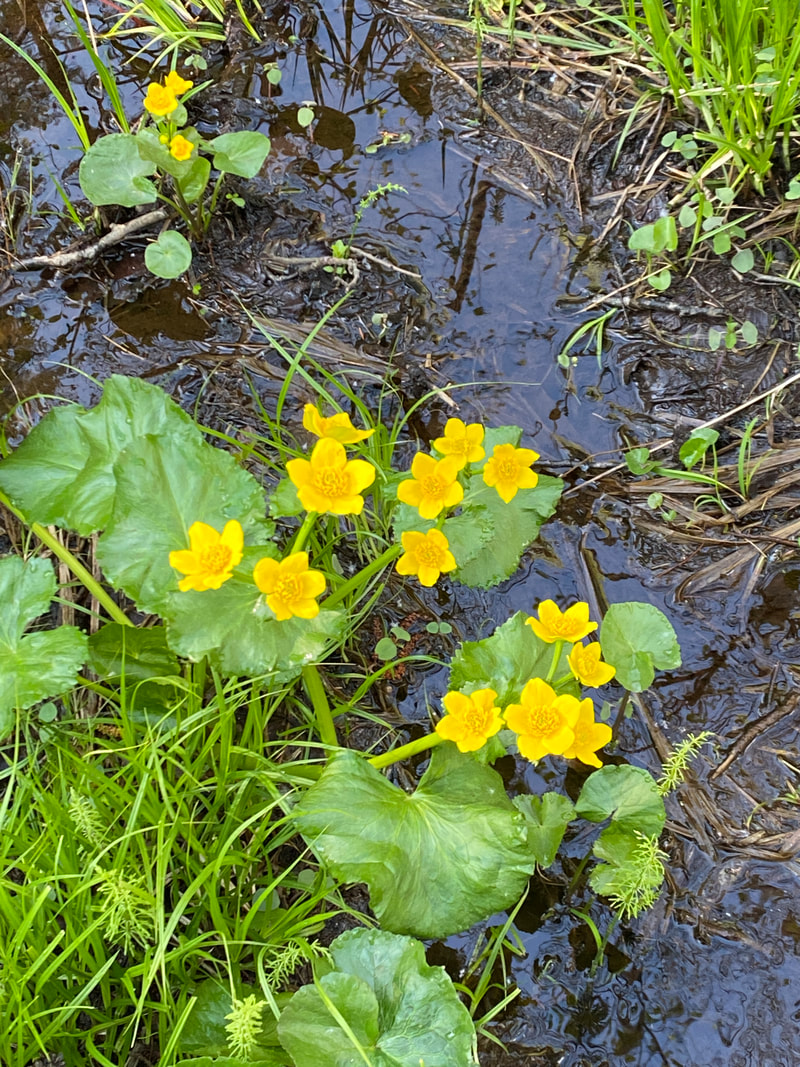
Marsh marigolds along the Daisy Farm Trail, Isle Royale
|
Most sections of trail are smooth and easy, Daisy Farm Trail, Isle Royale
|
Crossing Benson Creek on the Daisy Farm Trail, Isle Royale
|
There are several intersections in the Daisy Farm area, check those markers, Isle Royale
|
The beavers are working on flooding another boardwalk, Daisy Farm Trail, Isle Royale
|
Daisy Farm Trail
This short trail connects Daisy Farm to the Greenstone Trail and is popular with people heading to the Greenstone to cross the island or those headed to McCargo Cove. This trail begins following a small creek outside of Daisy Farm. The bubbling and gurgling of the creek can be heard for the first ten or so minutes before the action of the beavers damns up the creek. Some twisting and turning of board walks helps hikers navigate around these industrious little rodents. Beaver dams are ridges of mud and criss-crossed sticks holding back large smooth pools of flat brown waters. These areas have the work of the beaver fallen into them and quickly become their own micro environment with plant life, fish, and ambitions. Skunk cabbage plants unfold into large green jungles of crisp, lush foliage.
The trail continues to climb as a dry, rocky trail rising up and down through a series of valleys. Numerous long boardwalk sections through this area bypass the marshy lowlands and challenge hikers to remain balanced and focused as they traverse their way up to the Greenstone Trail. Most hikers can complete this section in tow hours or less as their day 2 legs loosen up. Keep your eyes peeled for moose throughout this section.
The trail continues to climb as a dry, rocky trail rising up and down through a series of valleys. Numerous long boardwalk sections through this area bypass the marshy lowlands and challenge hikers to remain balanced and focused as they traverse their way up to the Greenstone Trail. Most hikers can complete this section in tow hours or less as their day 2 legs loosen up. Keep your eyes peeled for moose throughout this section.
The beavers have altered the forest and trail since the last time we hiked the Daisy Farm Trail, Isle Royale
|
Boardwalks help the hiker get around some beaver ponds, Daisy Farm Trail, Isle Royale
|
Looking for a moose in a beaver pond along the Daisy Farm Trail, Isle Royale
|
Lookout Louise Trail
The Five Fingers area from Lookout Louise, Isle Royal National Park
Key features:
-Only view for many of the Five Finger area of the park
- Some boardwalks
- Must paddle to trail head or take the ferry
-Short trail but will gain a fair amount of elevation
- Picnic area near trail head
- Great wild flower hike in spring
-Only view for many of the Five Finger area of the park
- Some boardwalks
- Must paddle to trail head or take the ferry
-Short trail but will gain a fair amount of elevation
- Picnic area near trail head
- Great wild flower hike in spring
Boat dock at Lookout Louise Trail head, Isle Royale National Park
|
Monument Rock is now easy to spot along the Lookout Louise Trail, Isle Royale
|
A boardwalk around Hidden Lake on the Lookout Louise Trail, Isle Royale
|
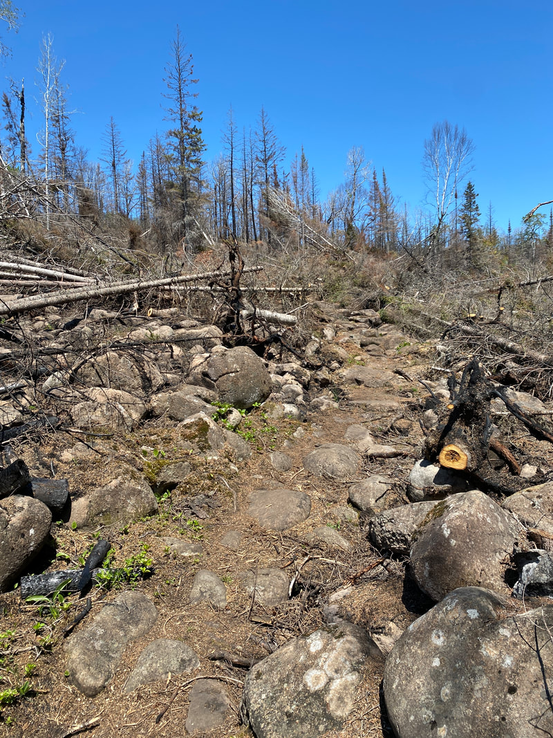
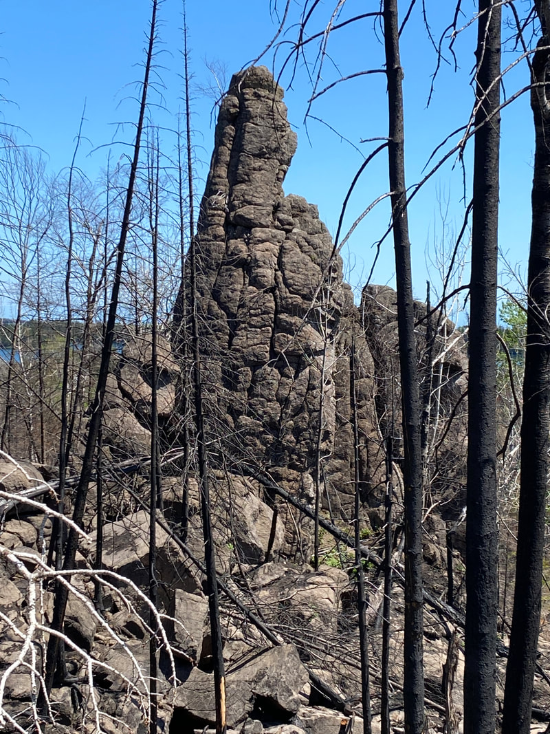
The first spring after the Horne Fire, Lookout Louise Trail, Isle Royale
|
The start or end of the Greenstone Trail, Isle Royale National Park
|
Lookout Louise Trail
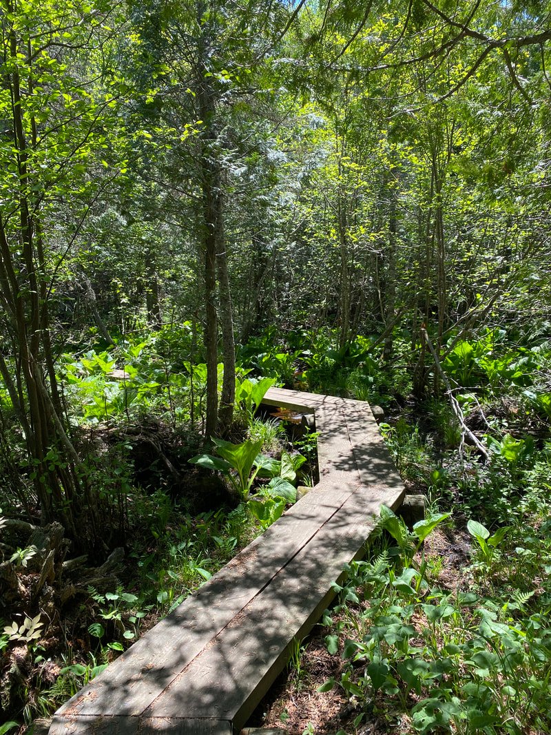
This is a wonderful little day hike, but it takes a little extra effort to get to the trail head. The trail begins across Tobin Harbor roughly 2 miles toward the big lake. You'll have to cross the harbor to the north side and dock. You can rent a canoe and paddle, or tag it onto a kayak trip like we did. The other option is to board the ferry, the "Sandy," for around $20 and be part of the daily excursion group. This ferry will round Stoll Point from Snug Harbor. After docking, there will be a pit toilet and a picnic area and you will immediately see Hidden Lake that is a really good spot to see moose and beaver dams. You will walk right alongside this lovely, little lake. This is not a difficult hike, but you will go straight up to reach the top and gain some elevations. This trail has the classic boardwalks that Isle Royale is known for and passes by a sea stack (a chimney/pillar of rock created by old wave action). Eventually the trail comes to an intersection with the Green Stone Trail. this point is the official start of the Green Stone trail, and those purists wishing to hike it in its entirety will need to start here. Just a little past this point you will find the actual lookout point. It has grown up quite a bit, but we found it still quite an impressive view. This looks out over the north side of the island and into the 5 Fingers area, which most visitors never get to. We had just kayaked this whole area and getting the perspective from above over what we had just paddled all week was really unique. From here you can see Duncan Bay, Grass Point, Locke Point, 5 Finger Bay, Hill Point, and out into Canada. This hike is roughly 1 mile up and 1 mile down, but budget plenty of time to stay up top and scout out the island.
The beaver dam creating Hidden lake, Isle Royale National Park
|
The view from Lookout Louise, Isle Royale National Park
|
A moose in Hidden Lake along the Lookout Louise Trail, Isle Royale
|
|
|
|
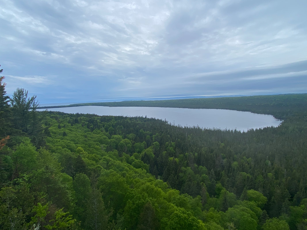
Mount Ojibway Trail
The view west from the Mount Ojibway fire tower, Isle Royale National Park
Key features:
-Clear, easy to follow trail
- Will require thee different up hill climbs the last being the longest
-A popular spot in the park, expect to see others on the trail
-Awesome views in all directions
-Clear, easy to follow trail
- Will require thee different up hill climbs the last being the longest
-A popular spot in the park, expect to see others on the trail
-Awesome views in all directions
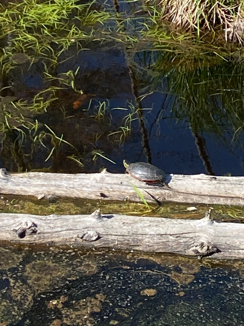
Turtles came out to sun in the warm June afternoon, Mt Ojibway Trail, Isle Royale
|
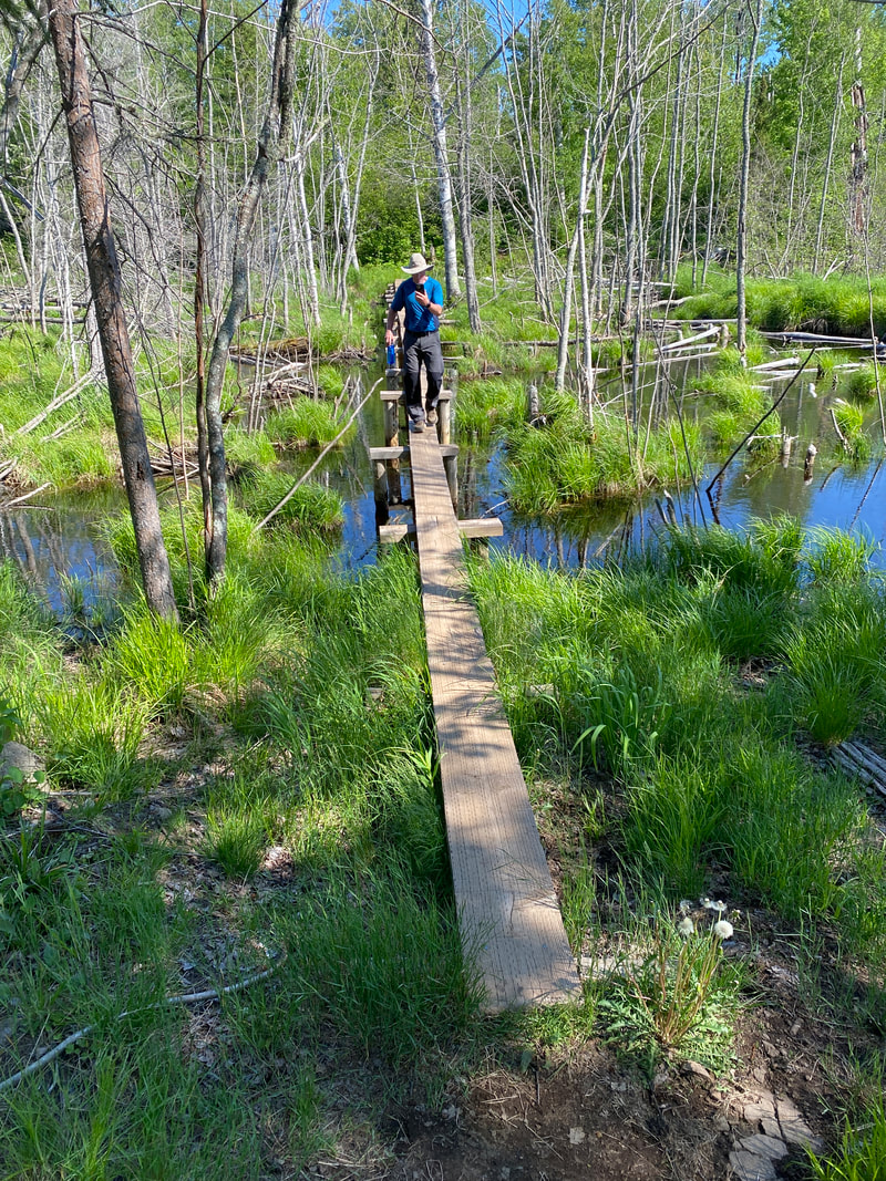
The big boardwalk right before the climb up to the fire tower, Mt Ojibway Trail, Isle Royale
|
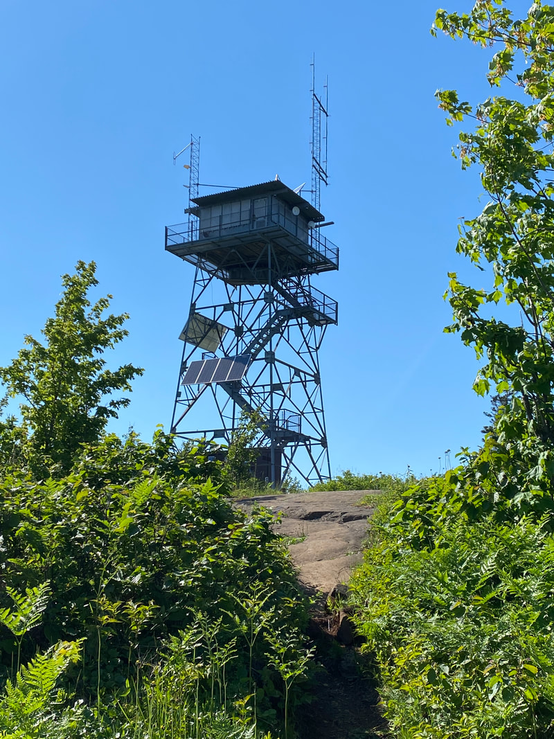
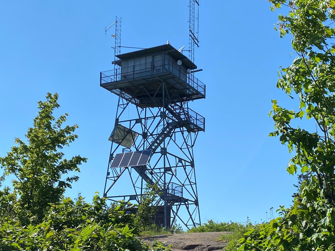
The Mount Ojibway fire tower, Isle Royale
|
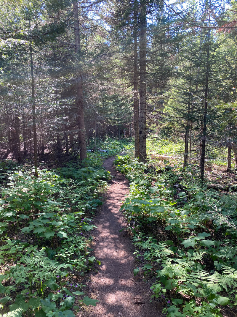
The popular Mount Ojibway Trail was clear and dry, Isle Royale
|
Mount Ojibway Trail
First, it is important to identify the correct trail, as four different trails leave the Daisy Farm campground and two of them lead toward the Greenstone Ridge and fire tower. Only the Mount Ojibway Trail leads directly to the fire tower.
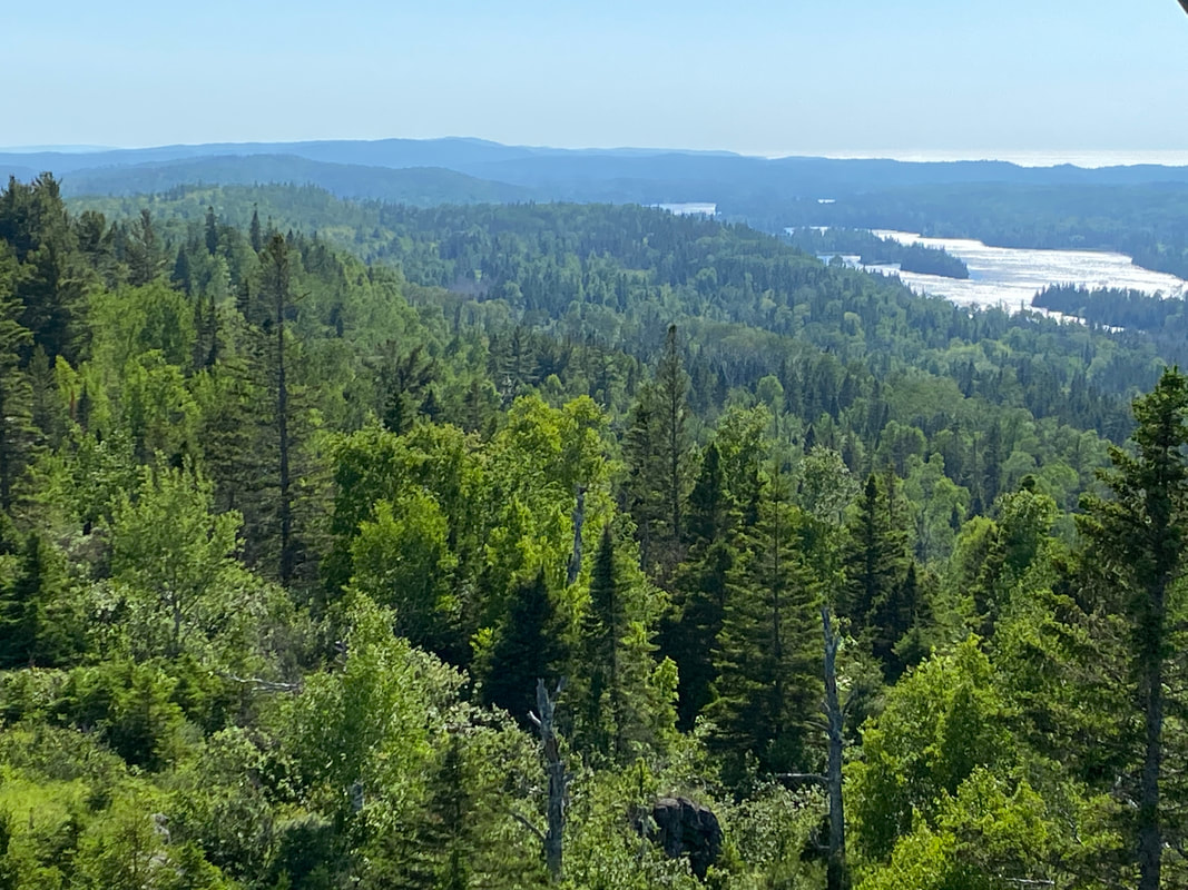
This trail begins in the Daisy Farm campground with a slight rocky climb that mellows into soft dirt. After you climb this first ridge, you will drop down into a valley, while hiking downhill you may get a view of the fire tower, but don't get too excited, you still have a ways to go. Climb another hill and then quickly drop back down in to another swampy area with a long boardwalk. After crossing this area, you will begin the long climb up to the fire tower. The trail is never steep, but it will require 20 minutes of constant uphill walking for most hikers to make it to the top. Once up top, enjoy the views; you have earned them. Like all Isle Royale fire towers, you can climb up a fee flight of stairs, but the top is lock up and inaccessible. On a clear day, you can see the Rock Harbor light house, Moskey Basin, Canada, few inland lakes, and ridges that make up the west end of the island. This is a popular break, lunch spot so expect to see other hikers around the tower.
This trail begins in the Daisy Farm campground with a slight rocky climb that mellows into soft dirt. After you climb this first ridge, you will drop down into a valley, while hiking downhill you may get a view of the fire tower, but don't get too excited, you still have a ways to go. Climb another hill and then quickly drop back down in to another swampy area with a long boardwalk. After crossing this area, you will begin the long climb up to the fire tower. The trail is never steep, but it will require 20 minutes of constant uphill walking for most hikers to make it to the top. Once up top, enjoy the views; you have earned them. Like all Isle Royale fire towers, you can climb up a fee flight of stairs, but the top is lock up and inaccessible. On a clear day, you can see the Rock Harbor light house, Moskey Basin, Canada, few inland lakes, and ridges that make up the west end of the island. This is a popular break, lunch spot so expect to see other hikers around the tower.
Looking east from the Ojibway fire tower, Isle Royale
|
Looking south west toward Moskey Basin from the Ojibway fire tower, Isle Royale
|
Mount Franklin Trail
Looking out at the Five Fingers from Mount Franklin, Isle Royale National Park
Key features:
-Mainly an uphill trail from the 3 mile campground
- Crosses a large area of bare rock, look for cairns to stay on the trail
-Great views from the top
-Can be done as a longer day hike from Rock Harbor Lodge
-Mainly an uphill trail from the 3 mile campground
- Crosses a large area of bare rock, look for cairns to stay on the trail
-Great views from the top
-Can be done as a longer day hike from Rock Harbor Lodge
Crossing Tobin Creek on the Mount Franklin Trail, Isle Royale
|
The Mount Franklin Trail passing a beaver pond, Isle Royale
|
The Mount Franklin Trail, near the top, Isle Royale
|
Looking out from Mount Franklin, Isle Royale
|
The Mount Franklin overlook, Isle Royale
|
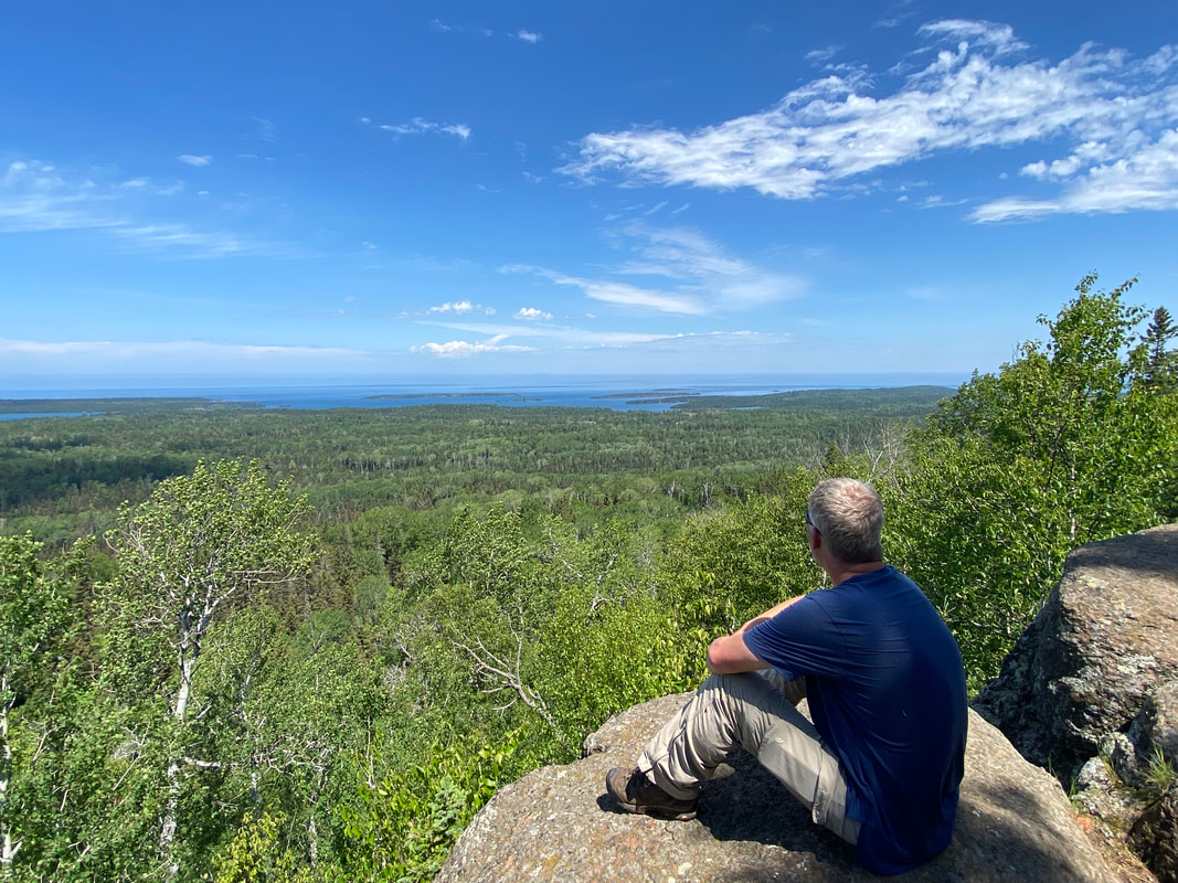
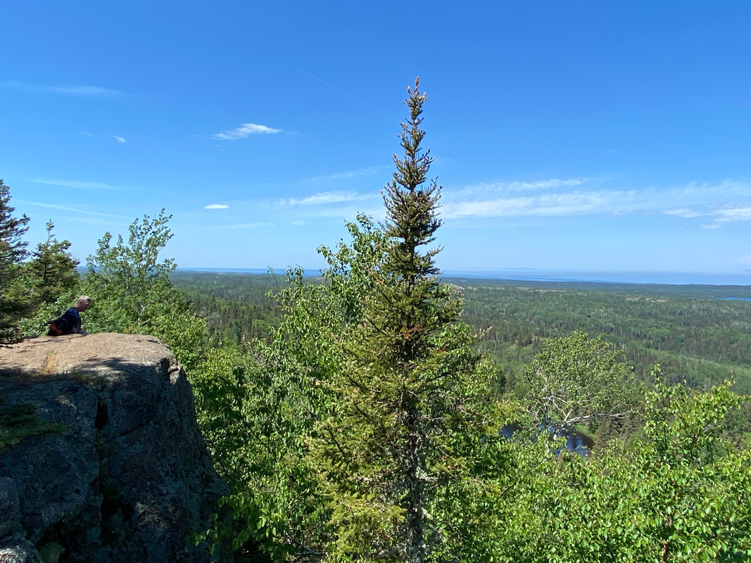
Mount Franklin Trail
The Mt. Franklin trail begins near the 3 Mile campground and crosses (more or less) north and south on the island until it reaches the top of the Greenstone Ridge. From here, another .3 of a mile on the Greenstone will get you to the actual summit of Mt. Franklin, and some of the best views on the island. From the 3 Mile campground, the trail ascends a ridge and drops down into the valley of Tobin Harbor. Here it intersects with the Tobin Harbor Trail. The trail will cross a bridge and boardwalks around the swampy, westernmost end of Tobin Harbor. Next it climbs a large, relatively smooth rock hillside. We have heard reports of hikers losing the trail at this point, and have encountered one party that missed the trail, but if you avoid looking at the harbor and assuming you head toward it, and rather look for the cairns, you will have no trouble. From here the trail has a slight downhill section before passing behind a beaver dam and skirting the edge of a very large beaver pond. Moose are frequently seen by hikers in this pond, so keep your eyes and ears peeled. after turning northward from the pond, the trail begins a long and steady climb. It is at no point too steep or too difficult. Upon reaching a bridge, you will encounter a four way intersection with the Greenstone going both east and west, and the Lane Cove Trail traveling north.
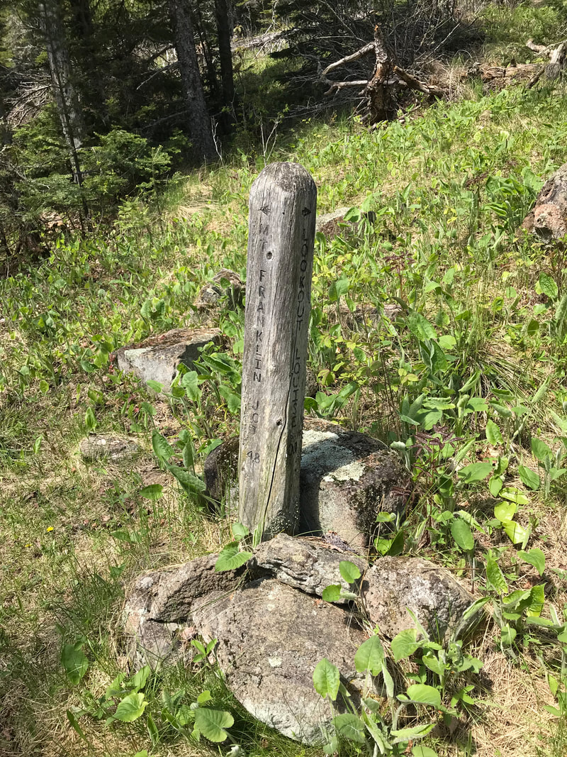
Heading west on the Greenstone .3 of a mile will take you to the Mt. Franklin overlook and some epic views of Canada, and the Five Fingers area. This area is simply a rocky outcropping with views. Don't be confused that you've arrived, it is clearly marked with a wooden sign post.
Heading west on the Greenstone .3 of a mile will take you to the Mt. Franklin overlook and some epic views of Canada, and the Five Fingers area. This area is simply a rocky outcropping with views. Don't be confused that you've arrived, it is clearly marked with a wooden sign post.
A bare rock section of trail on the way up to Mount Franklin, Isle Royale
|
Wood Lilies along Mount Franklin Trail, Isle Royale
|
Looking west from Mount Franklin, Isle Royale
|
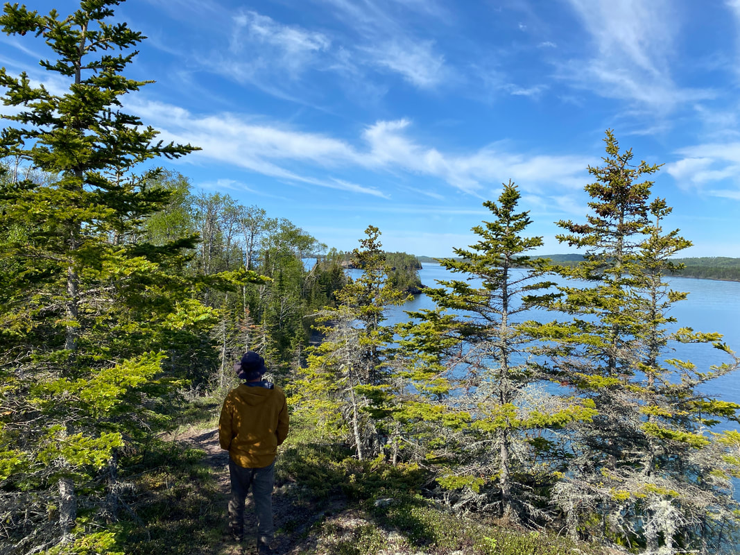
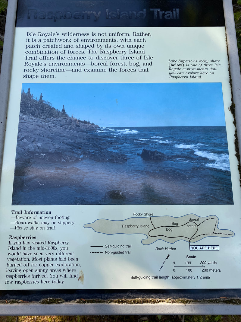
Raspberry Island Trail
Looking toward Smithwick and the outer islands from Raspberry Island, Isle Royale National Park
Key features:
-Short easy trail with interpretive signage
- Some boardwalks
- Great views of supperior
-Have to boat across Rock Harbor to access the trail
- The lodge does charter day trips on the Sandy over tp Raspberry island multiple times a week
-Short easy trail with interpretive signage
- Some boardwalks
- Great views of supperior
-Have to boat across Rock Harbor to access the trail
- The lodge does charter day trips on the Sandy over tp Raspberry island multiple times a week
Exploring the Lake Superior side of Raspberry Island, Isle Royale
|
Rock Harlequin blooming along shore of Raspberry Island, Isle Royale
|
Wave battered basalt on Raspberry Island, Isle Royale
|
The Raspberry Island dock, Isle Royale
|
Walking Raspberry Island, Isle Royale
|
Raspberry Island Trail
Half the fun of this short 1 mile hike is getting there. Raspberry Island is located approximately 1/4 mile across Rock Harbor straight across from the loge. This 1mile interpretive trail is wide and easy to follow through the bog and boreal forest sections. However, it is a little bit rocky and hilly for some crowds on the Lake Superior sections. This trail gives you access to the rocks on the Lake Superior side and offers a particularly good view of the Smithwick Channel, which the Queen IV travels through. You can see up close what a treacherous journey it can be with the large rocks just under the surface of the water that boats might run aground on if unaware. There are three main ways to get to the dock on Raspberry Island to start the trail. The first is through the Sandy through the Rock Harbor Lodge, the second is by renting a small boat from the marina, the third would be via personal watercraft. If you choose to paddle to the island, remember that this section of Rock Harbor has limited protection from the main lake, so lan accordingly.
A rocky section of trail on Raspberry Island, Isle Royale
|
Interpretive signage along the Raspberry Island Trail, Isle Royale National Park
|
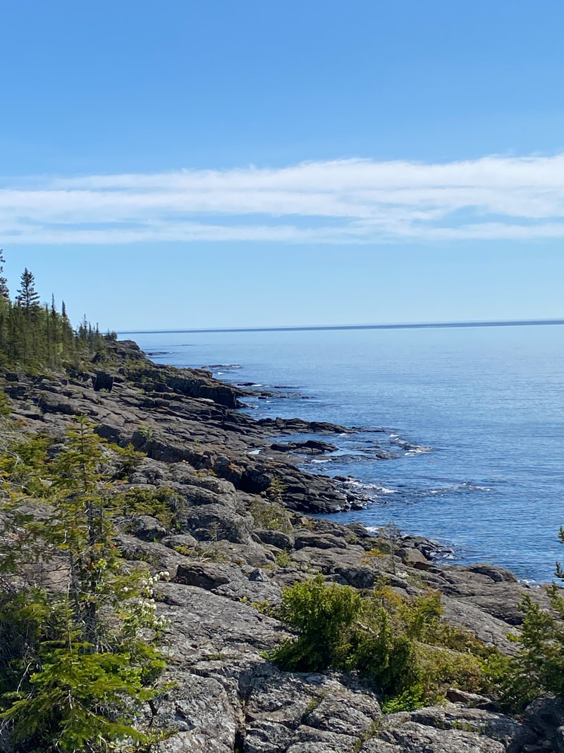
Raspberry Island's rocky shore, Isle Royale
|
Indian Portage Trail
Indian Portage trail crossing a patch of Skunk cabbage, Isle Royale National Park
Key features:
-Some areas are wet
- Some boardwalks
- North/South Trail tend to be more hilly
-May encounter people carrying canoes
- Multiple camping options
- Views of inland lakes, Richie, Chickenbone, LeSage, and Livermore
-Some areas are wet
- Some boardwalks
- North/South Trail tend to be more hilly
-May encounter people carrying canoes
- Multiple camping options
- Views of inland lakes, Richie, Chickenbone, LeSage, and Livermore
Indian Portage Trail, Isle Royale National Park
|
Creek Crossing near McCargo Cove, Indian Portage Trail, Isle Royale National Park
|
Lake Richie, on the Indian Portage Trail, Isle Royale National Park
|
Board walks are common on the Indian Portage Trail, Isle Royale National Park
|
Passing Chicken Bone Lake, Isle Royale National Park
|
Indian Portage Trail
The Indian Portage Trail crosses the island from North to South which would normally indicate a hilly trail; however, this trail did not seem to be as hilly or steep as other north South trail in the park. That may be why this trail has been used for hundreds of years as a way to portage boats across the island. The trail follow the inland lakes, Richie, Chicken Bone, LeSage, and Livermore. If you walk the trail all way from McCargo Cove to Chippewa Harbor, you will get to see all four lakes. The official portage does not follow the trail exactly, but don't be surprised to see paddlers, fishermen, and backpackers all on this trail. Overall, the trail is not rocky or particularly rooty, and surprisingly, it is not too muddy either. while the trail is easy it lacks the big lake feel and views of some of the other trail.
Birch forest along the Indian Portage Trail, on way to Chippiwa Harbor, Isle Royale National Park
|
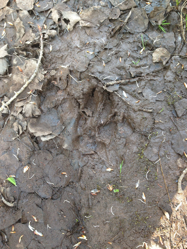
Wolf prints, on Indian Portage Trail, near Lake Ritchie, Isle Royale National Park
|
Indian Portage Trail, Isle Royale National Park
|
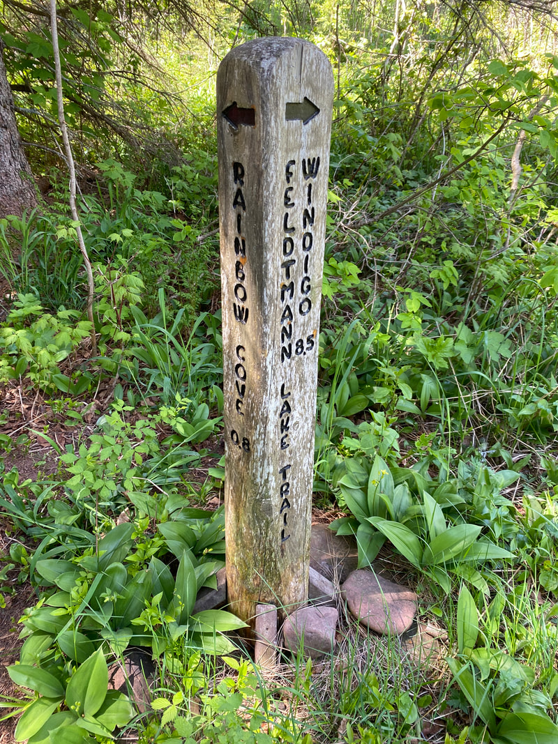
Feldtmann Lake Trail
Our campsite, just a few feet from Feldtmann Lake, Isle Royale
Key features:
-Some nice views of Washington Harbor
-Grace overlook lets you see more of the interior of the island
-Not very hilly after the first climb
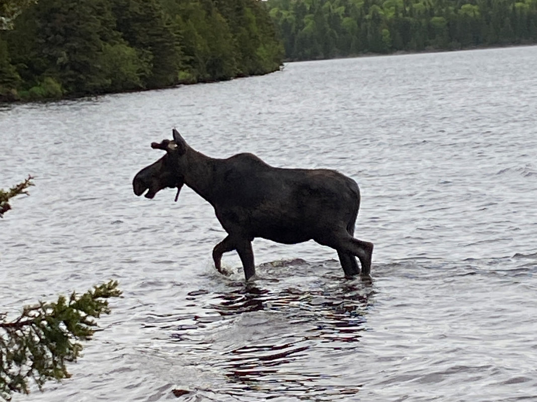
- Feldtmann Lake has some great moose viewing
-Not a particularly hard trail
-Some nice views of Washington Harbor
-Grace overlook lets you see more of the interior of the island
-Not very hilly after the first climb
- Feldtmann Lake has some great moose viewing
-Not a particularly hard trail
Beaver Island from the Feldtmann Lake Trail, Isle Royale
|
The start on the only significant climb on the Feldtmann Lake Trail, Isle Royale
|

Large gravely rocks make up sections of the Feldtmann Lake Trail, Isle Royale
|
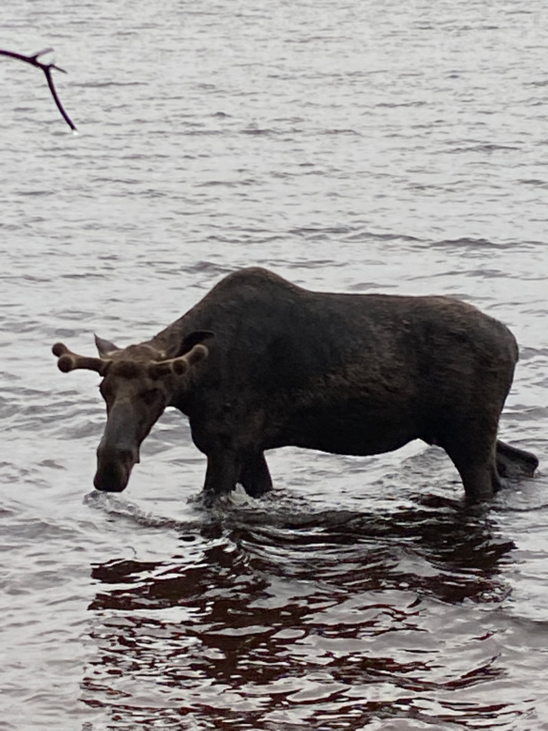
A young bull wading in Feldtmann Lake, Isle Royale
|
Hopping a stream on the Feldtmann Lake Trail, Isle Royale
|
Feltmann Lake Trail
dtThis trail begins in Windigo near the seaplane dock. Be careful to check the signs and your views of Washington Harbor don't make you miss the turn off. If you do, no worries, you haven’t gone to far out of your way before you will figure out your mistake. This trail continues along Washington Harbor and is fairly level. Eventually, affording the hiker views of the Beaver Island dock before beginning a long yet gentle climb to the Grace Creek Overlook. The Grace Creek Overlook is on a rock outcropping with many bright yellow flowers pushing up through the cracks in the ancient lava rock. Continuing on with the Feldtmann Trail, you will drop down into the valley crossing a marshy area or two eventually crossing Grace Creek. From here the trail climbs slightly and begins a long level stretch on an ancient shoreline. The trail is level and has occasional gravely sections. As the trail moves nearer Feldtmann Lake, the forest begins to open into a slightly more park like setting. We are unsure if this is the result of a fire many years ago or just the moose grazing down all of the young trees. The park rangers commonly recommend this hike to visitors because hikers frequently encounter moose. We, too, spotted 3 moose on our day on the Feldtmann Lake Trail. The trail ends in a popular Feldtmann Lake campground which has a brick red sandy beach and around 5 tent sites.
The Grace Creek Overlook on the Feldtmann Lake Trail, Isle Royale
|
Crossing Grace Creek on the Feltmann Lake Trail, Isle Royale
|
The trail into the Feltmann Lake campground, Isle Royale
|
Feldtmann Ridge Trail
Looking over Feldtmann Lake from Feldtmann Ridge, Isle Royale National Park
Key features:
-A significant climb to reach Feldtmann Ridge
-Awesome views from the ridge
-Fire tower is cool to check out and even more great views
-A long section of trail on a old logging road with swamps on either side
-A significant climb to reach Feldtmann Ridge
-Awesome views from the ridge
-Fire tower is cool to check out and even more great views
-A long section of trail on a old logging road with swamps on either side
The last 1/2 mile of the Feldtmann Ridge Trail is in a meadow, Isle Royale
|
A dry shelter awaited us after a wet day on the Feldtmann Ridge Trail, Isle Royale
|
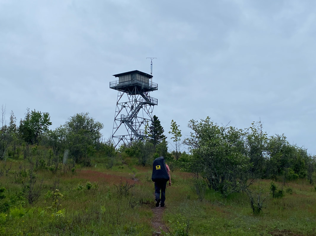
The Feldtmann fire tower would have great views on a clear day, Isle Royale
|
Walking the old logging road that makes up 1/2 of the Feldtmann Ridge Trail, Isle Royale
|

Beaver slides along the Feldtmann Ridge Trail, Isle Royale
|
Feldtmann Ridge Trail
The Feldman Ridge Trail begins on the south side of the Feldtmann Lake campground and quickly crosses a particularly ambitious beaver dam that attempts to block the outlet of Feldman Lake. The trail will continue with a gradual incline for most of the length of Feldtmann Lake before turning southward and starting a very steep climb to Feldtmann Ridge.
Once on the ridge, you will be rewarded with several natural vistas that allow one to get a much better feel of the western end of Isle Royale. If you pay attention, you can noticed a dip in the sea of green treetops for Washington Harbor and the Rock of the Ages Lighthouse. The trail will continue on a much more smooth conglomerate rock before it returns to the Forrest for a very slow and long climb to the Feldtmann firepower. It is recommended that you climb up this fire tower and take another look around. The views are amazing and you can clearly see Siskiwit Bay from here.
A short while on from here, the trail will turn north and proceed downhill through a swampy area until it intersects with what was an old logging road. From here the trail follows this slight ridge for miles with great marshy moose habitat on either side. Even in early June, the grass and shrubs along this section were knee to thigh high. Late season hikers need to be aware that this trail, while passable, may be very overgrown. Quiet hikers may hear the loons on Lake Halloran to your right, which means you are within 2 miles of Siskiwit Bay. The trail continues along this grassy ridge until you notice a reddish dirt/gravel beneath your feet, meaning you are minutes away from the Bay. Once you reach the bay, hikers can turn north toward Island Mine and the Greenstone Ridge or continue a tenth further to the Siskiwit Bay campground, which many guides refer to as a warm, and inviting place, but on our stormy day, it was blustery and furiously turned up significant surf.
Boardwalks help to keep us out of the beaver muck on the Feltmann Ridge Trail, Isle Royale
|
Many parts of the Feltmann Ridge Trail are in the forest, Isle Royale
|
A small water fall on the eastern end of Feltmann Ridge, Isle Royale
|
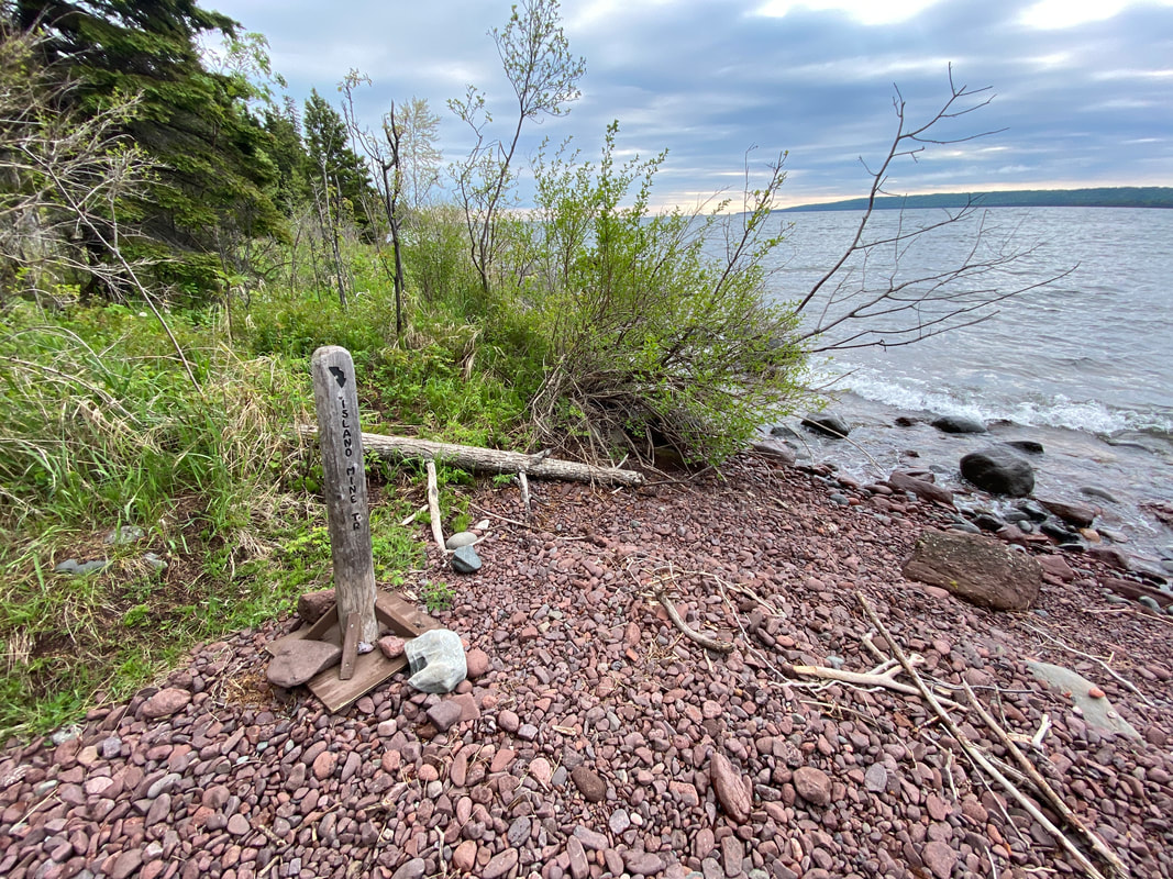
Island Mine Trail

A cold wind drives the water into Carnilian Beach, Isle Royale National Park
Key features:
-About a 1/3 of the trail follows the beach
- Some boardwalks
-The bridge over the Siskiwit River looks bad, but felt very solid
-Historic mining artifacts if your willing to get off the tail and look
- Access to Island Mine campground
-About a 1/3 of the trail follows the beach
- Some boardwalks
-The bridge over the Siskiwit River looks bad, but felt very solid
-Historic mining artifacts if your willing to get off the tail and look
- Access to Island Mine campground
Waves pounding the beach in Siskiwit Bay, Isle Royale
|
Exoting the forest on to Carnialian Beach, Isle Royale
|
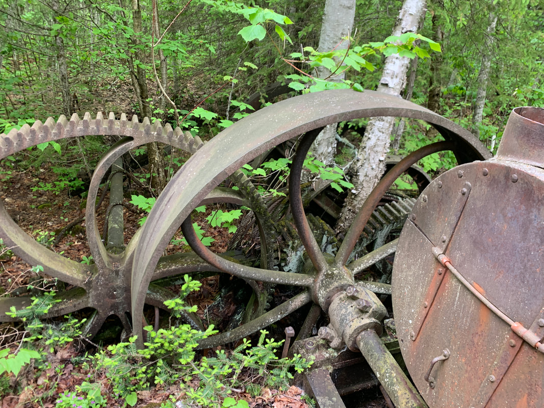
Remains of the steam powered hoist from the Island Mine, Isle Royale
|
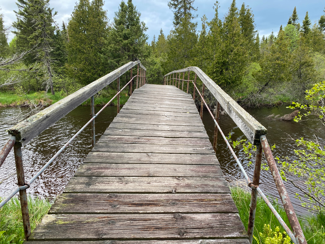
The bridge over the Big Siskiwit River, Island Mine Trail, Isle Royale
|
Leaving the beach and entering the forest on the Island Mine Trail, Isle Royale
|
Island Mine Trail
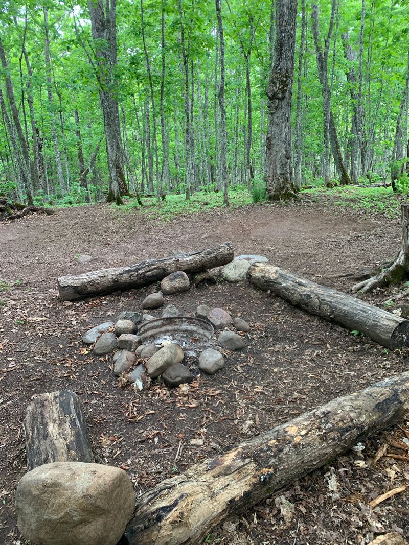
The Island Mine Trail starts just outside Siskiwit Bay campground and proceeds in the forest along the edge of the beach. However, most hikers and even the park rangers recommend walking along the beach because the trail inland is wet and marshy and blocked by many beaver dams. Walking along this section of beach is slow going, but totally worth it. In many places the reddish rock has broken down into a red sand called carnelian. The only obstacle you will encounter is the Big Siskiwit River draining into the bay. If you backtrack a few steps and cut into the woods, you can find the trail that leads to the bridge over the river. This bridge was one of the more sketchy bridges on Isle Royale.While it had an iron base, it literally curved and pitched sideways across the river. After crossing this, you will hike across the Senter Point and do another section of beach walking. We noted fox and moose footprints common in the sand. At the end of the beach, the trail turns into the forest and begins a long slow climb toward the Greenstone Ridge, passing over many smaller ridges along the way. One notable ridge was Red Oak Ridge, and an observant hiker will not the sugar maples give way to red oak trees in this area.
Along this trail, you will encounter the Island Mine site. If one climbs over the spoil piles and does a little searching, many mining artifacts can be observed, including a large steam engine hoist. Eventually this trail will cross into the Island Mine Campground. This is a tent only site, but has the added bonus of fire rings in each campsite. However, you have to filter water from the nearby creek. Another four tenths of a mile mainly uphilll will lead to the northern end of this trail where it intersects with the Greenstone Trail. Overall, this trail is very typical of north/south trails on the island, with several dry ups and marshy down sections.
Along this trail, you will encounter the Island Mine site. If one climbs over the spoil piles and does a little searching, many mining artifacts can be observed, including a large steam engine hoist. Eventually this trail will cross into the Island Mine Campground. This is a tent only site, but has the added bonus of fire rings in each campsite. However, you have to filter water from the nearby creek. Another four tenths of a mile mainly uphilll will lead to the northern end of this trail where it intersects with the Greenstone Trail. Overall, this trail is very typical of north/south trails on the island, with several dry ups and marshy down sections.
A smooth section of the Island Mine Trail, Isle royale
|
A campsite in the Island Mine Campground, Isle Royale
|
Boardwalks as you approch the Island Mine campground from the south, Island Mine Trail, Isle Royale
|
Rainbow Cove Trail

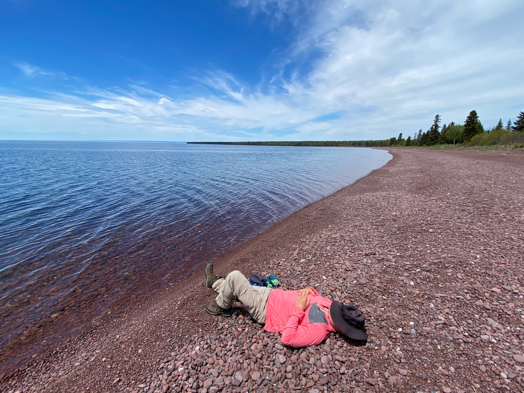
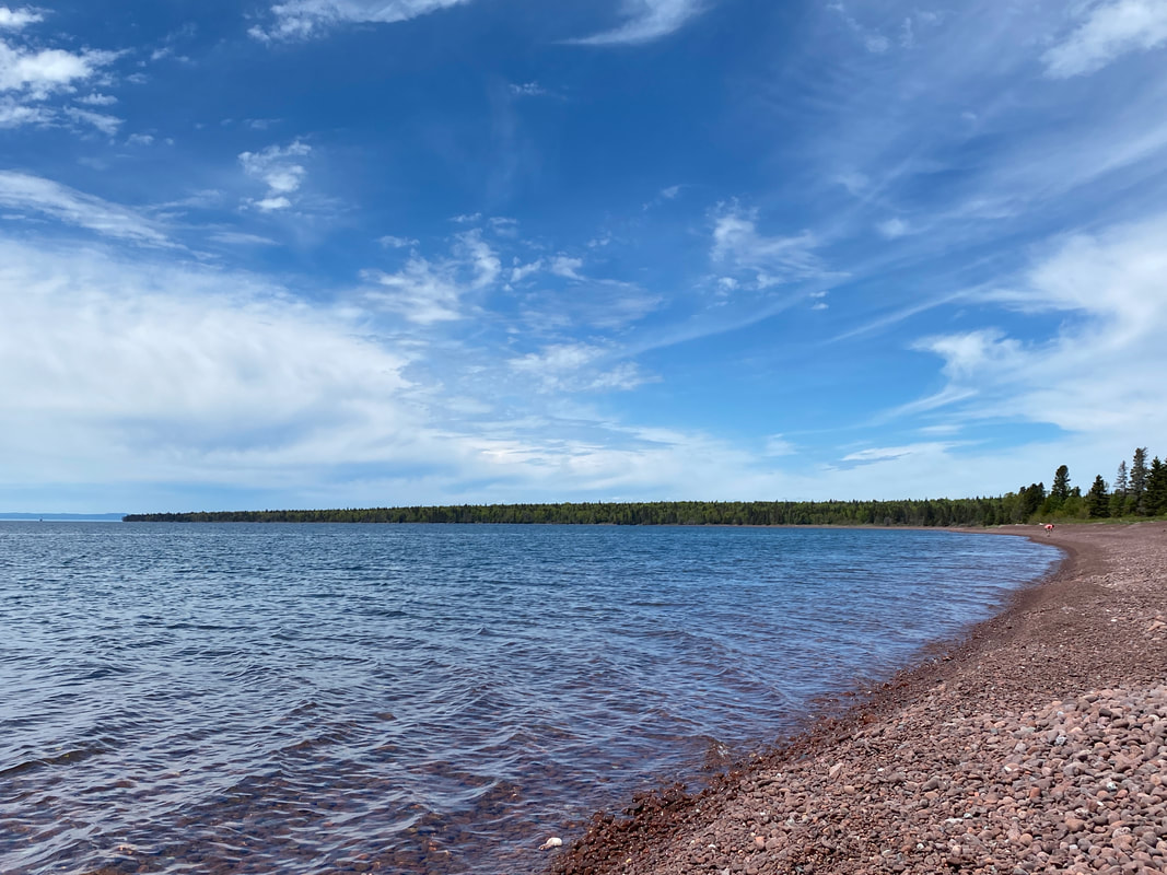
Small reddish pebbles make up the beach in Rainbow Cove, Isle Royale National Park
Key features:
-Short easy trail from Feldtmann Lake campground
- Dry and more or less level
-A mile and half of reddish gravel beach
-A great place to nap, warm yourself on the rocks or ice your feet in the lake
-Short easy trail from Feldtmann Lake campground
- Dry and more or less level
-A mile and half of reddish gravel beach
-A great place to nap, warm yourself on the rocks or ice your feet in the lake
Rainbow Cove is easy to find from the Feldtmann Lake campground, Isle Royale
|
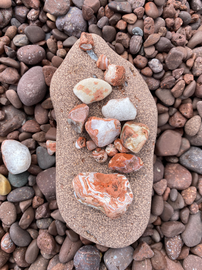
We found several Lake Superior agates on the Rainbow Cove beach, Isle Royale
|
The Rainbow Cove Trail, Isle Royale
|
Nodding or drooping trillium along the Rainbow Cove Trail, Isle Royale
|
Rainbow Cove Trail
If you are lucky enough to make it to Feldman Lake, you have to visit Rainbow Cove. This is a short out and back hike that starts at the Feldtmann Lake Camp ground. It is only 8 tenths of a mile long and ends on a large rainbow shaped beach. This beach is impressive for it huge size and the many different sizes and colors of gravel. On a clear day you can see the Rock of the Ages light house from this location. This is a great place to take a break, ice your feet in the chilled lake water, and warm yourself on the beach gravel. The best part is the trail is that it is more or less level, grassy, and short.
Taking a nap at Rainbow Cove, Isle Royale
|
Over a mile of beach to explore, Rainbow Cove, Isle Royale
|
Ishpeming Trail
Sun, clouds, and waves in Malone Bay, Isle Royale National Park
Key features:
-Faint or overgrown trail at time
-Least used trail in park, per the ranger we spoke with
- The longest board walk in the park crosses the Siskiwit swamp
- A beaver has recently modified the trail with his dam
-It is the only land access to the Malone Bay campground
-Faint or overgrown trail at time
-Least used trail in park, per the ranger we spoke with
- The longest board walk in the park crosses the Siskiwit swamp
- A beaver has recently modified the trail with his dam
-It is the only land access to the Malone Bay campground
Our first views of Siskiwit Lake, Ishpeming Trail, Isle Royale
|
Crossing a beaver dam on the Ishpeming Trail, Isle Royale
|
Not much remains of the original boardwalk, Ishpeming Trail, Isle Royale
|
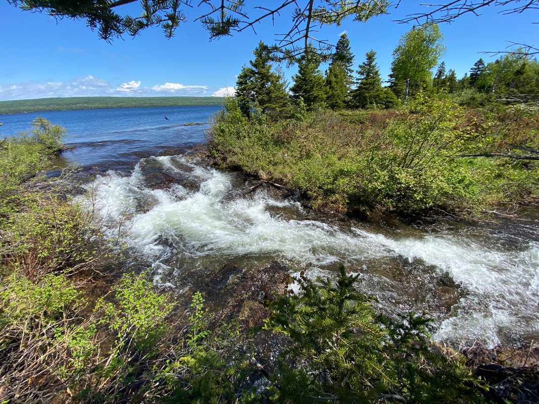
Siskiwit Lake draining down small waterfalls, or large rapids into Lake Superior, Isle Royale
|
The rocky shore / beach at Malone Bay, Isle Royale
|
Ishpeming Trail
This trail connects the Greenstone Ridge Trail to the Malone Bay campground. This 7 mile trail is not nearly as frequently traveled as some of the other trails in the park because it does not readily make a loop. It requires a serious investment of miles out and back or with a pick up at Malone Bay dock. We found the Minong Trail more heavily used and more clear than this trail. In mid June, the trail near the Greenstone was overgrown and partially obstructed by maple saplings. As you moved closer to Malone, the alders and thimbleberry bushes completely grow into the rail, requiring the hiker to push through an d bushwhacked. One great hint about this trail is that it is virtually all downhill. Even though it was harder to follow, we made great time. About halfway down this trail, you may encounter a beaver dam. This beaver has completely cut off the trail, and hikers will need to walk across the dam to get back on track. Once Siskiwit Lake pops into view through the trees after the beaver dam, you will walk one of the longest boardwalks in the park. This boardwalk will cross the Big Siskiwit River and loop you around the far western finger of the lake. Many hikers probably feel like Malone Bay is right around the corner at this point, but they are mistaken. You’ll have around 2.5 miles of hiking through dense undergrowth to reach the Malone Bay campground. Thankfully this is a fairly level stretch that occasionally has views of Isle Royale’s largest inland lake.

By mid June the Ishpeming trail is get hard to follow in spots, Isle Royale
|
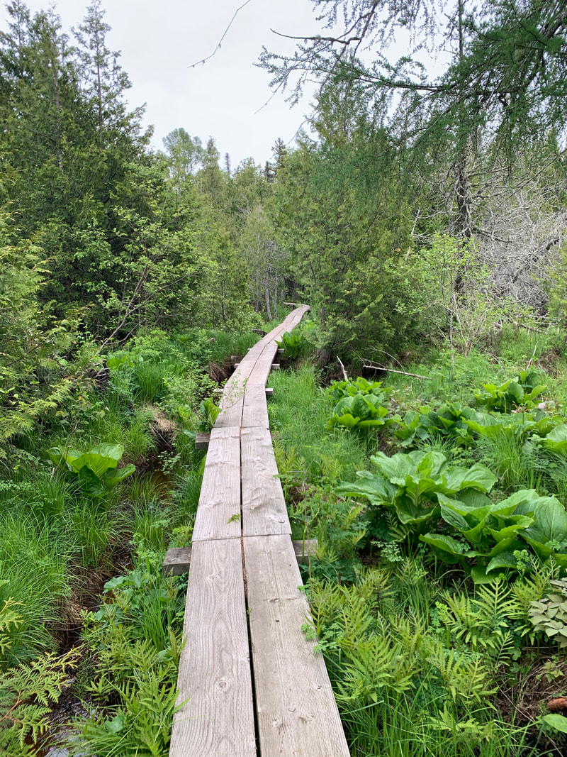
The last section of board walk connecting Superior and Siskiwit lake is extra wide for portages, Isle Royale
|
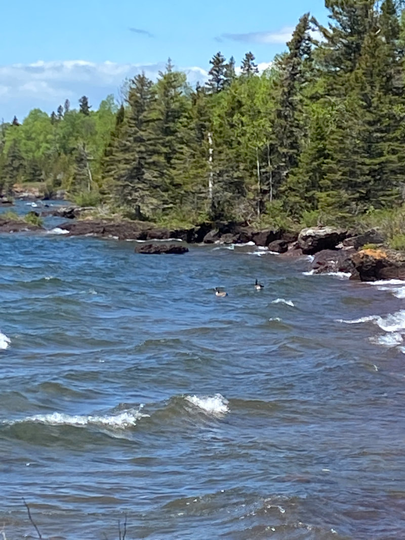
Waves hitting the rocks in Malone Bay, Isle Royale
|